


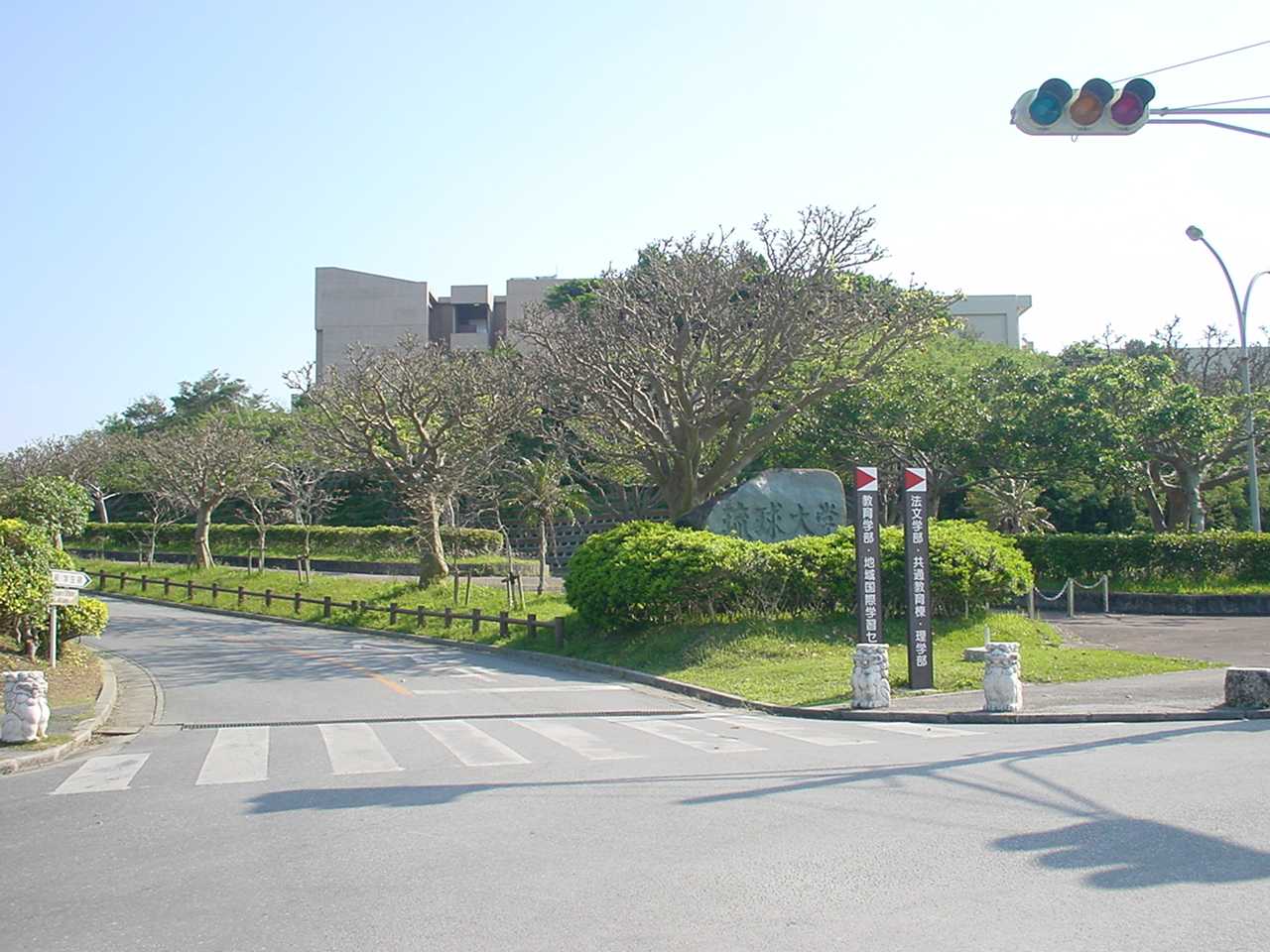


Urasoe, Japan
浦添市
Urasoe is a town of 115,690 people in Okinawa, Japan, founded in July 1, 1970.
Why visit Urasoe
Townapedia lists 78 museums and landmarks, 51 parks and trails, 207 places to eat, 12 places to stay and 8 attractions in and around town.
Highlights include Okinawa International University, Okinawa Christian University, Ginowan City Museum and Urasoe city museum.
Weather in Urasoe
Forecast from MET Norway (CC BY 4.0). Full forecast
About Urasoe
Urasoe (浦添市, Urasoe-shi) Japanese pronunciation: [ɯ̈̀.ɾä́.só̞.é̞(.ɕì)]; Okinawan: Urashii is a city located in Okinawa Prefecture, Japan. The neighboring municipalities are Naha to the south, Ginowan to the north, and Nishihara to the east. As of February 2024, the city has an estimated population of 115,518 and a population density of 6,051.2 persons per km2. The total area is 19.09 km2.
From the Wikipedia article Urasoe, Okinawa (this version), under CC BY-SA 4.0.
Things to do8

Okinawa International University
School · 2.4 km
Higher education institution in Okinawa Prefecture, Japan
宜野湾2-6-1

Okinawa Christian University
School · 3.4 km
Higher education institution in Okinawa Prefecture, Japan
Okinawa Prefectural College of Nursing
School · 6.9 km
Higher education institution in Okinawa Prefecture, Japan

Okinawa Prefectural University of Arts
School · 4.5 km
Higher education institution in Okinawa Prefecture, Japan
Okinawa University
School · 7.2 km
Higher education institution in Okinawa Prefecture, Japan
University of the Ryukyus
School · 3.6 km
Higher education institution in Okinawa Prefecture, Japan

Museums and landmarks78


Mekaru Tomb Cluster
Monument and historic site · 4.5 km
Historic cemetery in Okinawa Prefecture, Japan

Naha City Museum of History
Museum · 7.1 km
Museum in Naha, Okinawa Prefecture, Japan

Okinawa Prefectural Museum & Art Museum
Museum · 5.1 km
Museum in Naha City

Ōyama Shell Mound
Monument and historic site · 2.2 km
Early Kaizuka Period shellmound in Ginowan, Okinawa

Ryukyu University Museum (Fūjukan)
Museum · 3.6 km
Museum in Nishihara, Okinawa, Japan


Tamaudun
Monument and historic site · 4.8 km
Building in Naha, Okinawa Prefecture, Japan

Tsushima-maru Memorial Museum
Museum · 7.2 km
Museum in Naha, Okinawa Prefecture, Japan
66 more on the map.
Parks, trails and playgrounds51






39 more on the map.
Restaurants and cafes207

CoCo ICHIBANYA
Restaurant · Curry, Japanese · 1.9 km
8 国道58号 宜野湾バイパス, 宜野湾市
11:00-23:00 open "悪天候、店舗の事情によりやむなく営業時間終了前に閉店する場合もございます"

KushiKatsu Tanaka
Restaurant · Japanese · 1.0 km
1 県道241号宜野湾南風原線, 浦添市
Sa-Su 12:00-00:00; Mo-Tu, Th-Fr 15:00-00:00

195 more on the map.
History
Urasoe was the original capital of the Okinawan kingdom of Chūzan for several centuries until it was supplanted by Shuri in the late 14th or early 15th century. Shunten (1166–1237), the first known king of the Chuzan Kingdom, located in the central region of the island of Okinawa, ruled from Urasoe, as did his son and grandson. For much of the 14th century, Urasoe Castle was the largest on the island of Okinawa. The castle now contains the remains of several kings of the Ryukyu Kingdom.
Urasoe was completely razed during the Battle of Okinawa in 1945 at the end of World War II. 45% of the population, 4,117 residents, died during the battle. The village office of Urasoe was re-established in 1946 to conduct basic administrative functions, settle refugees returning to the village, and restore agricultural land. The village saw a significant increase in U.S. military presence in 1950 in the western coast of the village, which eventually became Camp Kinser. The population of Urasoe grew rapidly from 1956, and the city became a bedroom community of Naha in this period. Urasoe was elevated to city status on July 1, 1970.
From the History section of Urasoe, Okinawa on Wikipedia, under CC BY-SA 4.0.
Where to stay12
Churches and places of worship25
Shopping58
Gas and EV charging20
Schools, colleges and libraries75
Healthcare48
Map of Urasoe
250 places. The map loads OpenStreetMap tiles when you open it.
Getting there and nearby towns
Kadena Air Base (DNA) is the nearest airport with scheduled flights listed in OpenStreetMap, 11 km away.
- Nishihara 1 km southeast, about 1 min by car
- Ginowan 3 km east, about 3 min by car
- Nakagusuku 5 km east, about 5 min by car
- Yonabaru 6 km south, about 6 min by car
- Kanegusuku 7 km south, about 7 min by car
- Chatan 7 km northeast, about 7 min by car
- Naha 7 km southwest, about 7 min by car
- Kishaba 8 km northeast, about 8 min by car
- Tomigusuku 9 km southwest, about 9 min by car
- Uruma 18 km northeast, about 18 min by car
Drive times are estimates from straight-line distance, not routes.
Local news
Headlines from INDB.
Reviews, tips and questions
Loading what members have shared...
Sources and licences
- GeoNames (CC BY 4.0): population, coordinates, regions and time zone
- OpenStreetMap contributors (ODbL 1.0): places, airports, map data
- Wikidata (CC0 1.0): elevation, founding date, time zone, website, landmarks and historic places
- Wikimedia Commons (see each image): photos
- Wikipedia (CC BY-SA 4.0): overview and history text
Photo credits
- Okinawakentitsukangouniv, Original uploader was Hykw-a4 at ja.wikipedia, CC BY-SA 3.0
- Okinawa Prefectural University of Arts Naha Japan02bs5, 663highland, CC BY 2.5
- Okinawauniv, Hykw-a4 at ja.Wikipedia, CC BY-SA 3.0
- Ryuukyuudaigaku, Hykw-a4 at ja.Wikipedia, CC BY-SA 3.0
- Izena Dunchi Tomb6, やちむん, CC BY-SA 3.0
- Pallet Kumoji Naha Okinawa03s3s4500, 663highland, CC BY 2.5
- Okinawa Prefectural Museum & Art Museum02bss3200, 663highland, CC BY 2.5
- Ōyama Shellmound (entrance stele), Bérangère444, CC BY-SA 4.0
- 琉球大学博物館(風樹館), Kiken68, CC0
- Sakima Art Museum03n3000, 663highland, CC BY 2.5
- Naha Shuri Castle51s3s4200, 663highland, CC BY 2.5
- Tamaudun01s3s4592, 663highland, CC BY 2.5
- Tsushima-maru Memorial Museum03n, 663highland, CC BY 2.5
- Urasoe Art Museum04s4s2940, 663highland, CC BY 2.5
- Ginowan Tropical Beach, Abasaa, Public domain
- Lagunagarden, しんかわな, CC BY 3.0
- Ginowan City Museum03n3104, 663highland, CC BY 2.5
- ロンドンチャレンジ沖縄ツアー (6887994662), norio nakayama from saitama, japan, CC BY-SA 2.0
- Ginowan High School, Abasaa, Public domain
- ANA Field Urasoe, 国土地理院, CC BY 4.0
- Okikiri, Hykw-a4 at ja.Wikipedia, CC BY-SA 3.0
- Urasoetec hs, Kattin, CC BY-SA 3.0
- Urasoe City Urasoe Elementary schools, Bio06940, CC BY 4.0
- Urasoe City Urasoe Junior high school, Bio06940, CC BY 4.0
- JP 日本 Japan 沖繩 OKINAWA Naha shuttle bus view from Chatan city to 那霸機場 Naha Airport via 國道58號 National Route 1208pm January 2025 R12S 05, Naha Mama Pavilionz, CC0
- JP 日本 Japan 沖繩 OKINAWA Naha shuttle bus view from Chatan city to 那霸機場 Naha Airport via 國道58號 National Route 1208pm January 2025 R12S 06, Naha Mama Pavilionz, CC0
- Seen from the KAKAZU height park observatory, Nogiwan, Okinawa, Superkumaji, CC0
- Futenma airport runway, さかおり ( talk ), CC BY-SA 3.0
- JP 日本 Japan 沖繩 OKINAWA shuttle bus view from 那霸機場 Naha Airport to city via 國道58號 National Route evening 1716pm January 2025 N13P 823, TOALLE MOA FITBOYZ Soemw, CC0
- JP 日本 Japan 沖繩 OKINAWA shuttle bus view from 那霸機場 Naha Airport to city via 國道58號 National Route evening 1716pm January 2025 N13P 825, TOALLE MOA FITBOYZ Soemw, CC0
- JP 日本 Japan 沖繩 OKINAWA shuttle bus view from 那霸機場 Naha Airport to city via 國道58號 National Route evening 1716pm January 2025 N13P 824, TOALLE MOA FITBOYZ Soemw, CC0
- JP 日本 Japan 沖繩 OKINAWA shuttle bus view from 那霸機場 Naha Airport to city via 國道58號 National Route evening 1716pm January 2025 N13P 821, TOALLE MOA FITBOYZ Soemw, CC0
- JP 日本 Japan 沖繩 OKINAWA shuttle bus view from 那霸機場 Naha Airport to city via 國道58號 National Route evening 1716pm January 2025 N13P 822, TOALLE MOA FITBOYZ Soemw, CC0
- JP 日本 Japan 沖繩 OKINAWA shuttle bus view from 那霸機場 Naha Airport to city via 國道58號 National Route evening 1716pm January 2025 N13P 817, TOALLE MOA FITBOYZ Soemw, CC0
- JP 日本 Japan 沖繩 OKINAWA shuttle bus view from 那霸機場 Naha Airport to city via 國道58號 National Route evening 1716pm January 2025 N13P 819, TOALLE MOA FITBOYZ Soemw, CC0
- JP 日本 Japan 沖繩 OKINAWA shuttle bus view from 那霸機場 Naha Airport to city via 國道58號 National Route evening 1716pm January 2025 N13P 820, TOALLE MOA FITBOYZ Soemw, CC0
- JP 日本 Japan 沖繩 OKINAWA shuttle bus view from 那霸機場 Naha Airport to city via 國道58號 National Route evening 1716pm January 2025 N13P 818, TOALLE MOA FITBOYZ Soemw, CC0
- View of south side near Makiminato Crossroads, そらみみ, CC BY-SA 4.0
- PCA2335BAW Lavie, CatseyeTaku, CC BY-SA 4.0
- Makiminato Gawa, Syced, CC0


Page built November 4, 2026. Spotted a mistake? Tell us or suggest a place.