




Yoshitomi, Japan
吉富町
Yoshitomi is a town of 6,875 people in Fukuoka, Japan, founded in April 1, 1889.
Why visit Yoshitomi
Townapedia lists 50 museums and landmarks, 5 parks and trails, 14 places to eat, 6 places to stay and 1 attraction in and around town.
Highlights include Chōja Yashiki Government Office Site and Dainose Kanga ruins.
Weather in Yoshitomi
Forecast from MET Norway (CC BY 4.0). Full forecast
About Yoshitomi
Yoshitomi (吉富町, Yoshitomi-machi) is a town located in Chikujō District, Fukuoka Prefecture, Japan. As of 2 December 2023, the town had an estimated population of 6,617 in 3075 households, and a population density of 1200 persons per km². The total area of the town is 5.72 km2 (2.21 sq mi).
From the Wikipedia article Yoshitomi, Fukuoka (this version), under CC BY-SA 4.0.
Things to do1

Museums and landmarks50

Chōja Yashiki Government Office Site
Monument and historic site · 4.7 km
Archaeological site
Dainose Kanga ruins
Monument and historic site · 2.6 km
Archaeological site in Japan

Tomoeda Tile Kiln Site
Monument and historic site · 4.9 km
Archaeological site in Japan


38 more on the map.
Parks, trails and playgrounds5

Restaurants and cafes14



2 more on the map.
History
The area of Yoshitomi was part of ancient Buzen Province. During the Edo period it was under control of Nakatsu Domain. The village of Higashi-Yoshiomi within Kōgei District, Fukuoka was established on May 1, 1889 with the creation of the modern municipalities system. Kōgei District became Chikujō District in 1896. Higashi-Yoshitomi was raised to town status on May 19, 1942, changing its name to Yoshitomi. Efforts to merge with the town of Buzen have failed to secure popular support.
From the History section of Yoshitomi, Fukuoka on Wikipedia, under CC BY-SA 4.0.
Where to stay6
Churches and places of worship14
Shopping3
Gas and EV charging3
Schools, colleges and libraries17
Healthcare5
Map of Yoshitomi
118 places. The map loads OpenStreetMap tiles when you open it.
Getting there and nearby towns
Kitakyushu Airport (KKJ) is the nearest airport with scheduled flights listed in OpenStreetMap, 29 km away.
- Nakatsu 1 km southeast, about 1 min by car
- Buzen 4 km west, about 4 min by car
- Yokkaichi 16 km southeast, about 16 min by car
- Yukuhashi 23 km northwest, about 23 min by car
- Bungo-Takada-shi 25 km east, about 25 min by car
- Soeda 30 km west, about 30 min by car
- Kawara 32 km west, about 32 min by car
- Ube 39 km north, about 39 min by car
- Hita 38 km southwest, about 38 min by car
- Kitakyushu 41 km northwest, about 41 min by car
Drive times are estimates from straight-line distance, not routes.
Local news
Headlines from INDB.
Reviews, tips and questions
Loading what members have shared...
Sources and licences
- GeoNames (CC BY 4.0): population, coordinates, regions and time zone
- OpenStreetMap contributors (ODbL 1.0): places, airports, map data
- Wikidata (CC0 1.0): elevation, founding date, time zone, website, landmarks and historic places
- Wikimedia Commons (see each image): photos
- Wikipedia (CC BY-SA 4.0): overview and history text
Photo credits
- Yoshitomi town hall, アラツク, CC BY-SA 4.0
- Nakatu Castle 4, Mukai, CC BY-SA 3.0
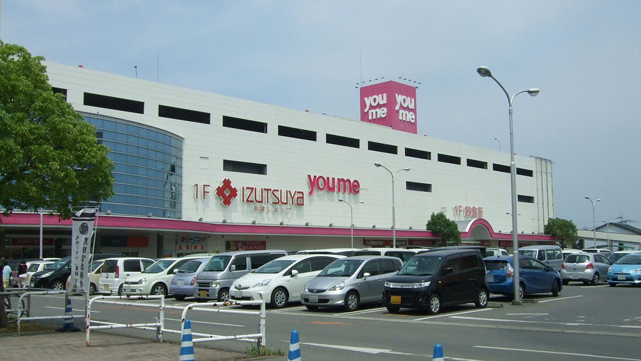
- Youmetown Nakatsu, Muyo, CC BY-SA 3.0
- Nakatsu Obata Commemoration Library, Wiiii, CC BY-SA 3.0
- Former Residence of Fukuzawa Yukichi, STA3816, CC BY-SA 3.0
- Nakatsu Toyoda Elementary school, Noukei314, CC BY-SA 4.0
- Yamakunigawa River from bridge of Nippo Main Line, そらみみ (Soramimi), CC BY-SA 4.0
- 山国橋 - panoramio, sk01, CC BY-SA 3.0
- Moat of Nakatsu Castle, そらみみ, CC BY-SA 4.0
- Nakatsu City History & Folklore Museum, そらみみ, CC BY-SA 4.0
- Nakatsu City Obata Memorial Library 2, そらみみ, CC BY-SA 4.0
- Nakatsu City History & Folklore Museum 20170430, そらみみ, CC BY-SA 4.0
- Nakatsu City Obata Memorial Library 1, そらみみ, CC BY-SA 4.0
- 中津市 2011年12月 - panoramio (4), Masashi Taomoto, CC BY 3.0
- Nakatsu Historical Museum, Muyo, CC BY-SA 4.0
- 中津市 2011年12月 - panoramio (2), Masashi Taomoto, CC BY 3.0
- Nakatu Castle 3, Mukai, CC BY-SA 3.0
- Shoda Gate of Nambu Elementary School in Nakatsu, Oita, そらみみ, CC BY-SA 4.0
- Nakatu Castle 2, Mukai, CC BY-SA 3.0
- View of grand torii of Nakatsu Grand Shrine, そらみみ, CC BY-SA 4.0
- 中津市 2011年12月 - panoramio (1), Masashi Taomoto, CC BY 3.0
- Oita Prefectural Road No.108 near Nakatsu City History & Folklore Museum, そらみみ, CC BY-SA 4.0
- South entrance of Shin-Hakatamachi Shopping Street, そらみみ, CC BY-SA 4.0
- Niwa Café in Nakatsu, Oita, そらみみ, CC BY-SA 4.0
- Grand torii of Nakatsu Grand Shrine, そらみみ, CC BY-SA 4.0
- South moat of Nakatsu Castle, そらみみ, CC BY-SA 4.0
- South moat and stone wall of Nakatsu Castle, そらみみ, CC BY-SA 4.0
- 中津市 2011年12月(博多町) - panoramio (1), Masashi Taomoto, CC BY 3.0
- 中津市 2011年12月(博多町) - panoramio, Masashi Taomoto, CC BY 3.0
- Stele of Independence and Self‐respect in Nakatsu Castle 2, そらみみ, CC BY-SA 4.0
- Stele of Independence and Self‐respect in Nakatsu Castle, そらみみ, CC BY-SA 4.0
- Nakatsu Grand Shrine in Nakatsu Castle, そらみみ, CC BY-SA 4.0
- Nakatu Castle 1, Mukai, CC BY-SA 3.0
- Nakatsu Shrine in Nakatsu Castle, そらみみ, CC BY-SA 4.0
- Sansaiike Pond and Tenshu of Nakatsu Castle, そらみみ, CC BY-SA 4.0
- Sansaiike Pond in Nakatsu Castle 2, そらみみ, CC BY-SA 4.0
- Nakatsu castle1, Vanquish0, CC BY-SA 3.0
- Haiden of Okudaira Shrine and Tenshu of Nakatsu Castle, そらみみ, CC BY-SA 4.0
- Nakatu Castle 5, Mukai, CC BY-SA 3.0
- Sansaiike Pond in Nakatsu Castle, そらみみ, CC BY-SA 4.0


Page built November 5, 2026. Spotted a mistake? Tell us or suggest a place.