



Keego Harbor, Michigan
Keego Harbor is a city of 2,747 people in Oakland County, Michigan, founded in 1900.
Why visit Keego Harbor
Townapedia lists 20 museums and landmarks, 29 parks and trails and 30 places to eat in and around town.
Highlights include Apple Island, Casa del Rey Apartments, Dodge #4 State Park and Baxter-Morgan Park.
July is the warmest month, with average highs of 82°F; January lows average 17°F, and about 36 inches of snow fall in a normal year.
Weather in Keego Harbor
Forecast from the National Weather Service. Full forecast
About Keego Harbor
Keego Harbor is a city in Oakland County in the U.S. state of Michigan. A northern suburb of Detroit, Keego Harbor is located roughly 27 miles (43.5 km) from downtown Detroit, and about 3 miles (4.8 km) southwest of Pontiac. As of the 2020 census, Keego Harbor had a population of 2,764. With a land area of 0.50 square miles (1.29 km2), Keego Harbor is the third-smallest city by land area in the state of Michigan, after Petersburg and Clarkston.
From the Wikipedia article Keego Harbor, Michigan (this version), under CC BY-SA 4.0.
Museums and landmarks20

Apple Island
Monument and historic site · National Register of Historic Places · 1.9 mi
Island in the United States of America

Casa del Rey Apartments
Monument and historic site · National Register of Historic Places · 2.4 mi
Multifamily residential in Pontiac, United States of America
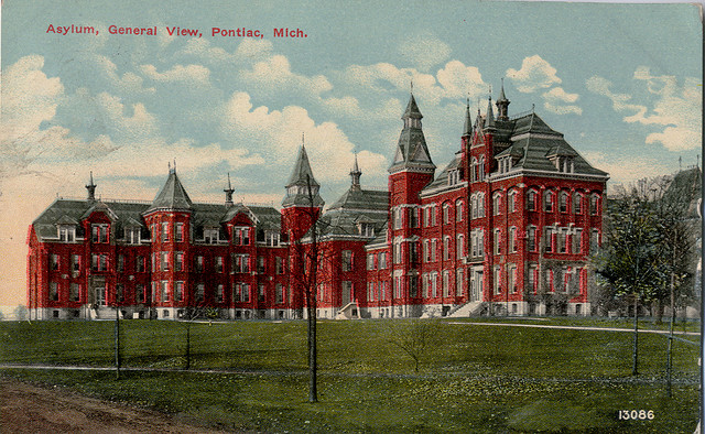
Clinton Valley Center
Monument and historic site · National Register of Historic Places · 2.8 mi
Psychiatric hospital located in Michigan

Eagle Theatre
Monument and historic site · National Register of Historic Places · 3.4 mi
Movie theater in Pontiac, Michigan, United States

Franklin Boulevard Historic District
Monument and historic site · National Register of Historic Places · 2.9 mi
Historic district in Pontiac, Michigan

Gillespie Street-Clinton River Bridge
Bridge · National Register of Historic Places · 2.7 mi
Road bridge in Pontiac, United States of America
Michigan Military Academy
Monument and historic site · National Register of Historic Places · 1.2 mi
Defunct military prep school in Orchard Lake Village, Oakland County, Michigan USA

Myrick-Palmer House
Monument and historic site · National Register of Historic Places · 3.0 mi
House in Pontiac, United States of America

Pontiac Commercial Historic District
Monument and historic site · National Register of Historic Places · 3.3 mi
Historic district in Michigan, USA

Grinnell Brothers Music House
Monument and historic site · National Register of Historic Places · 3.3 mi

8 more on the map.
Parks, trails and playgrounds29


Club Royale @ Cass Lake Dry Dock Marina
Marina and boat launch · 1.5 mi
4157 Chenlot Street, Waterford

17 more on the map.
Restaurants and cafes30


The Lodge
Restaurant
2812 Orchard Lake Road, Keego Harbor
Mo-Th 11:00-23:00; Fr-Sa 11:00-24:00; Su 11:00-23:00

Ellen's Bakery and Cafe
Cafe · 0.6 mi
Fresh baked bread and serving breakfast, lunch, and dinner
2495 Orchard Lake Road, Sylvan Lake
Gino's Pizzeria & Restaurant
Restaurant · Italian
1999 Cass Lake Road, Keego Harbor
Mo-Fr 15:00-21:00; Sa,Su 14:00-21:00
Filo Fresh
Restaurant · Mediterranean, Gyros · 0.6 mi
3375 Orchard Lake Road, Keego Harbor
Harbor Steak House
Restaurant · Steak House · 0.4 mi
3251 Orchard Lake Road, Keego Harbor

18 more on the map.
Churches and places of worship7

St. Vincent DePaul Catholic Church, Convent, and School
Church · National Register of Historic Places · 3.4 mi
Church building in Michigan, United States of America
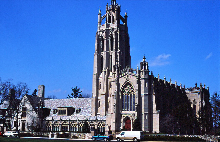




Sri Balaji Temple of Great Lakes
Place of worship · 1.5 mi
3325 Middlebelt Road, West Bloomfield
The Muslim Unity Center
Place of worship · 1.5 mi
1830 West Square Lake Road, Bloomfield Hills
History
The first non-native settlers to the area arrived between 1825 and 1830. Cass Lake drew many wealthy residents to purchase land along the lake for vacationing. In 1890, a railway line was built through Keego Harbor to connect to Detroit and Pontiac, making the area much more accessible. At the turn of the century, a prominent Pontiac lawyer, Joseph E. Sawyer, purchased and platted land just to the southwest along Orchard Lake. He built a canal to connect the smaller Dollar Lake to Cass Lake and declared the area to be a harbor on the eastern edge of Cass Lake. He named the area Keego, which was a phonetic spelling of the Anishinaabemowin word "giigoonh" meaning "fish." The spelling Keego comes from the Henry Wadsworth Longfellow poem, The Song of Hiawatha. The community was originally part of West Bloomfield Township before incorporating as an independent city in 1955.
From the History section of Keego Harbor, Michigan on Wikipedia, under CC BY-SA 4.0.
Shopping3
Gas and EV charging4
Schools, colleges and libraries46
St. Mary's Preparatory School
School · 1.1 mi
3535 Commerce Road, Orchard Lake
Arts And Technology Academy of Pontiac
School · 4.9 mi
888 Enterprise Dr, Pontiac
Clifford H Smart Middle School
School · 5.5 mi
8500 Commerce Rd, Commerce Township
Healthcare1
Map of Keego Harbor
140 places. The map loads OpenStreetMap tiles when you open it.
Climate by month
Monthly table
| Month | High | Low | Rain | Snow |
|---|---|---|---|---|
| Jan | 31°F | 17°F | 2.2 in | 12.1 in |
| Feb | 34°F | 18°F | 1.9 in | 9.0 in |
| Mar | 44°F | 26°F | 2.2 in | 4.1 in |
| Apr | 58°F | 36°F | 2.9 in | 0.9 in |
| May | 69°F | 49°F | 3.8 in | 0.0 in |
| Jun | 78°F | 59°F | 3.3 in | 0.0 in |
| Jul | 82°F | 63°F | 3.1 in | 0.0 in |
| Aug | 81°F | 62°F | 3.2 in | 0.0 in |
| Sep | 74°F | 54°F | 2.9 in | 0.0 in |
| Oct | 60°F | 42°F | 2.9 in | 0.1 in |
| Nov | 47°F | 32°F | 3.1 in | 1.7 in |
| Dec | 36°F | 24°F | 2.2 in | 8.1 in |
U.S. Climate Normals 1991-2020 for Pontiac Wwtp (5 mi away), NOAA NCEI.
People and cost of living
American Community Survey 5-year estimates, 2020-2024, U.S. Census Bureau. Estimates have margins of error, larger for small towns.
Disaster history
Oakland County has had 10 federal disaster declarations since 2000, most often for severe storms.
- 2024-02-08: Severe Storms, Tornadoes, And Flooding (Flood)
- 2021-07-15: Severe Storms, Flooding, And Tornadoes (Severe Storm)
- 2020-03-27: Covid-19 Pandemic (Biological)
- 2020-03-13: Covid-19 (Biological)
- 2014-09-25: Severe Storms And Flooding (Flood)
- 2005-09-07: Hurricane Katrina Evacuation (Hurricane)
OpenFEMA disaster declarations summaries.
Getting there and nearby towns
Oakland County International Airport (PTK) is the nearest airport with scheduled flights listed in OpenStreetMap, 6 miles away.
- Pontiac 4 mi northeast, about 7 min by car
- Auburn Hills 7 mi northeast, about 11 min by car
- Franklin 7 mi south, about 11 min by car
- Bingham Farms 7 mi southeast, about 12 min by car
- Birmingham 8 mi southeast, about 13 min by car
- Beverly Hills 8 mi southeast, about 13 min by car
- Farmington Hills 9 mi south, about 14 min by car
- Rochester Hills 10 mi east, about 16 min by car
- Southfield 10 mi southeast, about 16 min by car
- Troy 10 mi east, about 17 min by car
Drive times are estimates from straight-line distance, not routes.
Local news
Headlines from INDB, the NEMICO news database.
Reviews, tips and questions
Loading what members have shared...
Sources and licences
- NCES EDGE (Public domain): public schools
- NOAA NCEI U.S. Climate Normals 1991-2020 (Public domain): climate by month
- OpenFEMA (Public domain): disaster declarations
- OpenStreetMap contributors (ODbL 1.0): places, airports, map data
- U.S. Census Bureau (Public domain): population, income, housing, education, commute
- Wikidata (CC0 1.0): elevation, founding date, time zone, website, landmarks and historic places
- Wikimedia Commons (see each image): photos
- Wikipedia (CC BY-SA 4.0): overview and history text
Photo credits
- St Vincent DePaul Catholic Church Pontiac MI, Andrew Jameson, CC BY-SA 3.0
- Casa del Rey Apartments Pontiac MI, Andrew Jameson, CC BY-SA 3.0
- Gillespie Street-Clinton River Bridge Pontiac MI, Andrew Jameson, CC BY-SA 3.0
- StMarysprepbuilding, Gsgeorge, Public domain
- Pontiac Asylum c 1912, Unknown author Unknown author, Public domain
- Eagle Theater Pontiac MI, Andrew Jameson, CC BY-SA 3.0
- Franklin Boulevard Historic District Pontiac MI C, Andrew Jameson, CC BY-SA 3.0
- Myrick-Palmer House Pontiac MI, Andrew Jameson, CC BY-SA 3.0
- Pontiac Commercial Historic District A, Andrew Jameson, CC BY-SA 3.0
- Grinnell Brothers Music House Pontiac MI, Andrew Jameson, CC BY-SA 3.0
- KirkInTheHills, Unknown author, CC BY-SA 3.0
Page built October 30, 2026. Spotted a mistake? Tell us or suggest a place.