



Keller, Texas
Keller is a city of 45,976 people in Tarrant County, Texas, founded in 1881.
Why visit Keller
Townapedia lists 11 museums and landmarks, 53 parks and trails, 153 places to eat, 1 place to stay and 3 attractions in and around town.
Highlights include Alamo Drafthouse Cinema North Richland Hills, Moviehouse and Eatery, Green Valley Raceway Historic Plaza and Cross Timbers Park.
July is the warmest month, with average highs of 97°F; January lows average 36°F.
Weather in Keller
Forecast from the National Weather Service. Full forecast
About Keller
Keller is a city in Tarrant County, Texas, United States, in the Dallas–Fort Worth metroplex. According to the 2020 census, the city's population is 45,776, making Keller the 78th-most populated city in Texas. The most recent population estimate, as of July 1, 2021, is 45,397.
From the Wikipedia article Keller, Texas (this version), under CC BY-SA 4.0.
Things to do3

Alamo Drafthouse Cinema North Richland Hills
Cinema and theater · 2.8 mi
8380 Davis Boulevard, North Richland Hills

Museums and landmarks11




Parks, trails and playgrounds53

Green Valley Raceway Historic Plaza
Park · 2.4 mi
Small park commemorating the site of the former Green Valley Raceway, of which pavement remains can still be seen
7904 North Tarrant Parkway, North Richland Hills

41 more on the map.
Restaurants and cafes153

Baskin-Robbins
Ice cream · Ice Cream · 2.4 mi
2063 West Southlake Boulevard, Southlake
Mo-Tu 11:00-22:00; We 11:00-21:30; Th-Su 11:00-22:00

Blue Goose Cantita
Restaurant · Mexican · 2.7 mi
9005 North Tarrant Parkway, North Richland Hills
Mo-Fr 11:00-22:30; Sa-Su 10:00-22:30
Chili's
Restaurant · Tex-Mex · 2.6 mi
8485 Davis Boulevard, North Richland Hills
Mo-Th 10:45-22:00; Fr-Sa 10:45-23:30; Su 10:45-22:00
Elote Mexican Kitchen
Restaurant · Mexican · 3.5 mi
12584 N Beach St
Sa,Su 09:00-21:00; Mo-Th 11:00-21:00; Fr 11:00-22:00
IHOP
Restaurant · Breakfast, Pancake · 2.5 mi
700 North Tarrant Parkway, Keller
Mo-Th,Su 06:00-22:00; Fr 06:00-24:00; Sa 00:00-24:00
Jet's Pizza
Restaurant · Pizza · 2.6 mi
8509 Davis Boulevard, North Richland Hills
Mo-Th 10:00-21:00; Fr-Sa 10:00-23:00; Su 11:00-22:00

Kindred Coffee Co
Cafe · Coffee Shop · 2.6 mi
8700 North Tarrant Parkway, North Richland Hills
Mo 06:30-20:00; Tu-Fr 06:00-20:00; Sa-Su 06:00-19:00
Mi Pueblo
Restaurant · Mexican · 2.7 mi
8412 Davis Boulevard, North Richland Hills
Mo-Th 11:00-21:30; Fr-Sa 11:00-22:00
Mikoto Ramen Bar & Sushi
Restaurant · Noodle · 2.2 mi
2310 West Southlake Boulevard, Southlake
11:00-20:30
Starbucks
Cafe · Coffee Shop · 2.6 mi
8536 Davis Boulevard, North Richland Hills
Mo-Fr 05:30-19:30; Sa-Su 06:00-18:30
141 more on the map.
Where to stay1
Churches and places of worship19
The Church of Jesus Christ of Latter-day Saints
Church · Mormon · 3.5 mi
500 West McDonwell School Road
St. Elizabeth Ann Seton Catholic Church
Church · Catholic · 2.7 mi
2016 Willis Lane, Keller
St. Martin-in-the-Fields Episcopal Church
Church · Episcopal · 1.3 mi
223 South Pearson Lane, Keller
Shopping31
Gas and EV charging19
Schools, colleges and libraries68
Academy At Carrie F Thomas
School · 5.9 mi
8200 O Brian Way, North Richland Hills
Healthcare31
Methodist Legacy ER & Urgent Care
Clinic and pharmacy · 2.7 mi
8950 North Tarrant Parkway, North Richland Hills
Southlake Neurology & Sleep Wellness Clinic
Clinic and pharmacy · 2.2 mi
175 Stonebridge Lane, Southlake
Walgreens
Clinic and pharmacy · 2.7 mi
8955 North Tarrant Parkway, North Richland Hills
Map of Keller
250 places. The map loads OpenStreetMap tiles when you open it.
Climate by month
Monthly table
| Month | High | Low | Rain |
|---|---|---|---|
| Jan | 57°F | 36°F | 1.9 in |
| Feb | 62°F | 40°F | 2.2 in |
| Mar | 69°F | 48°F | 2.9 in |
| Apr | 76°F | 55°F | 4.0 in |
| May | 84°F | 64°F | 4.1 in |
| Jun | 93°F | 73°F | 4.0 in |
| Jul | 97°F | 76°F | 2.4 in |
| Aug | 97°F | 76°F | 2.8 in |
| Sep | 89°F | 68°F | 3.2 in |
| Oct | 79°F | 56°F | 4.1 in |
| Nov | 67°F | 46°F | 2.5 in |
| Dec | 58°F | 38°F | 2.5 in |
U.S. Climate Normals 1991-2020 for Ft Worth Alliance Ap (6 mi away), NOAA NCEI.
People and cost of living
American Community Survey 5-year estimates, 2020-2024, U.S. Census Bureau. Estimates have margins of error, larger for small towns.
Disaster history
Tarrant County has had 19 federal disaster declarations since 2000, most often for hurricanes.
- 2021-02-19: Severe Winter Storms (Severe Ice Storm)
- 2021-02-14: Severe Winter Storm (Severe Ice Storm)
- 2020-08-24: Tropical Storms Marco And Laura (Hurricane)
- 2020-03-25: Covid-19 Pandemic (Biological)
- 2020-03-13: Covid-19 (Biological)
- 2017-08-25: Hurricane Harvey (Hurricane)
OpenFEMA disaster declarations summaries.
Getting there and nearby towns
Fort Worth Alliance Airport (AFW) is the nearest airport with scheduled flights listed in OpenStreetMap, 7 miles away.
- Colleyville 5 mi southeast, about 8 min by car
- Hurst 7 mi south, about 11 min by car
- Bedford 8 mi southeast, about 13 min by car
- Haltom City 8 mi south, about 14 min by car
- Grapevine 9 mi east, about 14 min by car
- Flower Mound 10 mi northeast, about 16 min by car
- Euless 10 mi southeast, about 16 min by car
- Fort Worth 13 mi southwest, about 20 min by car
- Coppell 14 mi east, about 22 min by car
- Irving 16 mi east, about 25 min by car
Drive times are estimates from straight-line distance, not routes.
Local news
Headlines from INDB, the NEMICO news database.
Reviews, tips and questions
Loading what members have shared...
Sources and licences
- NCES EDGE (Public domain): public schools
- NOAA NCEI U.S. Climate Normals 1991-2020 (Public domain): climate by month
- OpenFEMA (Public domain): disaster declarations
- OpenStreetMap contributors (ODbL 1.0): places, airports, map data
- U.S. Census Bureau (Public domain): population, income, housing, education, commute
- Wikidata (CC0 1.0): elevation, founding date, time zone, website
- Wikimedia Commons (see each image): photos
- Wikipedia (CC BY-SA 4.0): overview and history text
Photo credits
- Keller Recreation Center, Larry D. Moore, CC BY 4.0
- Keller Tower - panoramio, Corey Coyle, CC BY 3.0
- ExxonGasKellerTX, Smarty9108, CC BY-SA 4.0
- Bourland Cemetery Gateway, Larry D. Moore, CC BY 4.0
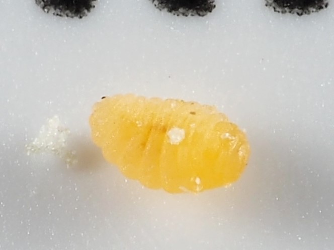
- Celticecis pubescens, Kimberlie Sasan, CC0
- K Scott Griffith - office photo a, Farhin Ali, CC BY-SA 4.0
- K Scott Griffith - office photo, Farhin Ali, CC BY-SA 4.0
- ISS065-E-158620 - View of Earth, Earth Science and Remote Sensing Unit , Lyndon B. Johnson Space Center, Public domain
- ISS065-E-158623 - View of Earth, Earth Science and Remote Sensing Unit , Lyndon B. Johnson Space Center, Public domain
- ISS055-E-86445 - View of Earth, Earth Science and Remote Sensing Unit, NASA Johnson Space Center, Public domain
- ISS058-E-7730 - View of Earth, Earth Science and Remote Sensing Unit, NASA Johnson Space Center, Public domain
- ISS065-E-158621 - View of Earth, Earth Science and Remote Sensing Unit , Lyndon B. Johnson Space Center, Public domain
- ISS040-E-102269 - View of Earth, Earth Science and Remote Sensing Unit , Lyndon B. Johnson Space Center, Public domain
- ISS058-E-7731 - View of Earth, Earth Science and Remote Sensing Unit, NASA Johnson Space Center, Public domain
- ISS065-E-158622 - View of Earth, Earth Science and Remote Sensing Unit , Lyndon B. Johnson Space Center, Public domain
- Sahil Mehta, Sahilmehta97, CC BY-SA 4.0
- CVS N Tarrant Davis, Smarty9108, CC BY-SA 4.0
- Agrostis hyemalis plant (03), Sam Kieschnick, CC BY 4.0
- Agrostis hyemalis plant (04), Sam Kieschnick, CC BY 4.0
- Agrostis hyemalis flower (06), Sam Kieschnick, CC BY 4.0
- Agrostis hyemalis plant (05), Sam Kieschnick, CC BY 4.0
- Agrostis hyemalis leaf (01), Sam Kieschnick, CC BY 4.0
- Découpe des côtes 01, cote, CC BY 2.0
- Gateway NRH Lobby, Jared Stump, CC BY-SA 3.0
- Gateway Church NRH, Jared Stump, CC BY-SA 3.0
- Deloitte university, Lahti213, CC BY-SA 4.0
- M3 Salon - panoramio, Dameon Hudson, CC BY 3.0


Page built October 30, 2026. Spotted a mistake? Tell us or suggest a place.