


Kennett Square, Pennsylvania
Kennett Square is a borough of 6,243 people in Chester County, Pennsylvania, founded in 1682.
Why visit Kennett Square
Townapedia lists 12 museums and landmarks, 3 parks and trails, 37 places to eat, 2 places to stay and 2 attractions in and around town.
Highlights include Chandler Mill Bridge, Kenneth Flash, Auburn Mills Historic District and Cedarcroft.
July is the warmest month, with average highs of 84°F; January lows average 23°F.
Weather in Kennett Square
Forecast from the National Weather Service. Full forecast
About Kennett Square
Kennett Square is a borough in Chester County, Pennsylvania, United States. As of the 2020 U.S. census, Kennett Square had a population of 5,943.
From the Wikipedia article Kennett Square, Pennsylvania (this version), under CC BY-SA 4.0.
Things to do2

Chandler Mill Bridge
Bridge · National Register of Historic Places · 2.1 mi
Bridge in United States of America

Museums and landmarks12

Auburn Mills Historic District
Monument and historic site · National Register of Historic Places · 3.0 mi
National historic district near Yorklyn, New Castle County, Delaware, United States

Cedarcroft
Monument and historic site · National Register of Historic Places · 1.2 mi
Historic house in Pennsylvania, United States

Cloud-Reese House
Monument and historic site · National Register of Historic Places · 3.2 mi
Historic house in Delaware, United States
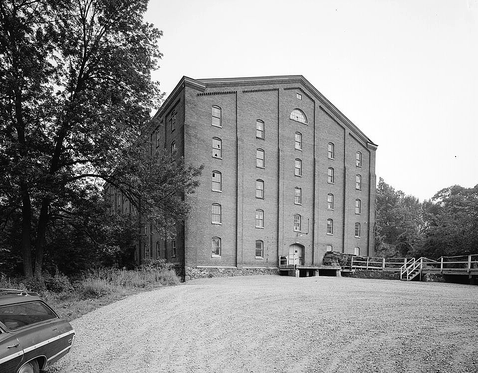
Garrett Snuff Mills Historic District
Monument and historic site · National Register of Historic Places · 3.1 mi
Historic district in Delaware, United States

Gideon Wickersham Farmstead
Monument and historic site · National Register of Historic Places · 3.3 mi
Building in Pennsylvania, United States

Joseph Gregg House
Monument and historic site · National Register of Historic Places · 1.8 mi
Kennett Square, Pennsylvania, listed on the National Register of Historic Places in Centre County
Kennett Square Historic District
Monument and historic site · National Register of Historic Places
Historic district in Pennsylvania, United States

Longwood Gardens
Monument and historic site · National Register of Historic Places · 2.7 mi
Botanical garden in Kennett Square, Pennsylvania, United States

South Brook Farm
Monument and historic site · National Register of Historic Places · 2.7 mi
Building in Pennsylvania, United States

Wiley-Cloud House
Monument and historic site · National Register of Historic Places · 2.3 mi
House in Kennett Township, Pennsylvania

Garrett Snuff Mill
Monument and historic site · National Register of Historic Places · 3.1 mi

Square Pear Fine Art Gallery
Museum
200 East State Street, Kennett Square
Mo off; Tu 16:00-19:00; We-Sa 11:00-18:00; Su 12:00-16:00
Parks, trails and playgrounds3




Restaurants and cafes37

The Creamery
Diner · American
360 Birch Street, Kennett Square
Mo-We closed, Th 16:00-20:00, Fr 16:00-23:00, Sa 12:00-23:00, Su...

Cafe Emis
Cafe · Mediterranean, Coffee Shop
115 West State Street, Kennett Square
Mo-Sa 07:00-19:00; Su 08:00-18:00

Ji-In Korean Eatery
Restaurant · Korean
148 West State Street, Kennett Square
Tu-Sa 11:00-21:00; Su 11:00-19:00
Kabo Burritos
Restaurant · Mexican, Mediterranean
148 West State Street, Kennett Square
Tu-Sa 11:00-21:00; Su-Mo 11:00-20:00
Kennett Chicken
Restaurant · Chicken
148 West State Street, Kennett Square
Tu-Sa 11:00-21:00; Su-Mo 11:00-20:00
La Verona
Restaurant · Italian
114 East State Street, Kennett Square
Mo-Su 11:45-21:00; Fr,Sa 12:00-22:00
Lily's Asian Cuisine
Restaurant · Asian
104 West State Street, Kennett Square
Mo-Th 10:30-21:30; Fr,Sa 10:30-22:30; Su 11:30-21:30
Mary Pat's Provisions
Restaurant · Breakfast
148 West State Street, Kennett Square
Mo-Fr 07:00-15:00; Sa-Su 08:00-15:00
Portobello's
Diner · American
108 East State Street, Kennett Square
We-Th 16:00-20:00; Fr-Sa 12:00-21:00; Su 12:00-20:00
Talula's Table
Cafe
Marketplace during the day, exclusive, reservation-only dinner spot at 7pm
102 West State Street, Kennett Square
07:00-18:00
25 more on the map.
History
The area that became known as Kennett Square was originally inhabited by the Lenape Native American tribe. Once colonized, the town was named Kennett Square, a reference to Kennett, Wiltshire, England, with "Square" referring to the original land grant from William Penn, which was one square mile. In 1777, during the American Revolutionary War, Sir William Howe, a British Army general, led troops through Kennett Square on their way to the Battle of Brandywine.
In the 19th century, the borough played an instrumental role in the Underground Railroad, which helped slaves escape the South for freedom. In 1853, a group asked for Kennett Square to be incorporated, and by 1855, it held elections.
Kennett Square's founder is credited with introducing mushroom growing to the area. He grew carnations, a popular local commodity beginning in 1885, and wanted to make use of the wasted space under the elevated beds. He imported spawn from Europe and started experimenting with mushroom cultivation.
From the History section of Kennett Square, Pennsylvania on Wikipedia, under CC BY-SA 4.0.
Where to stay2
Fairfield by Marriott Inn & Suites Kennett Square Brandywine Valley
Motel and hotel · 1.3 mi
719 East Baltimore Pike, Kennett Square
Churches and places of worship14
Bethel African Methodist Episcopal Church
Church · African Methodist Episcopal
301 East Linden Street, Kennett Square
Kennett Square Hispanic Seventh-day Adventist Church
Church · Seventh Day Adventist
500 East Cypress Street, Kennett Square
New Garden Memorial Union American Methodist Episcopal Church
Church · Union American Methodist Episcopal Church · 0.4 mi
309 East Linden Street, Kennett Square
Full Gospel Apostolic Church
Church · 0.4 mi
430 East South Street, Kennett Square
Iglesia Menonita Palabra de Vida
Church · Anabaptist · 1.1 mi
486 North Mill Road, Kennett Square
Kennett Friends Meeting
Church · Quaker · 0.4 mi
125 West Sickle Street, Kennett Square
Shopping7
Gas and EV charging3
Schools, colleges and libraries18
Healthcare4
Map of Kennett Square
102 places. The map loads OpenStreetMap tiles when you open it.
Climate by month
Monthly table
| Month | High | Low | Rain |
|---|---|---|---|
| Jan | 39°F | 23°F | 3.6 in |
| Feb | 41°F | 24°F | 3.1 in |
| Mar | 50°F | 31°F | 4.4 in |
| Apr | 62°F | 40°F | 3.8 in |
| May | 71°F | 50°F | 3.6 in |
| Jun | 80°F | 59°F | 4.4 in |
| Jul | 84°F | 64°F | 4.2 in |
| Aug | 82°F | 62°F | 4.3 in |
| Sep | 75°F | 55°F | 4.5 in |
| Oct | 64°F | 44°F | 4.0 in |
| Nov | 53°F | 34°F | 3.2 in |
| Dec | 43°F | 28°F | 4.0 in |
U.S. Climate Normals 1991-2020 for Avondale 2 N 72516 (4 mi away), NOAA NCEI.
People and cost of living
American Community Survey 5-year estimates, 2020-2024, U.S. Census Bureau. Estimates have margins of error, larger for small towns.
Disaster history
Chester County has had 17 federal disaster declarations since 2000, most often for hurricanes.
- 2021-09-10: Remnants Of Hurricane Ida (Hurricane)
- 2020-03-30: Covid-19 Pandemic (Biological)
- 2020-03-13: Covid-19 (Biological)
- 2016-03-23: Severe Winter Storm And Snowstorm (Snowstorm)
- 2014-02-06: Severe Winter Storm (Severe Ice Storm)
- 2012-10-29: Hurricane Sandy (Hurricane)
OpenFEMA disaster declarations summaries.
Getting there and nearby towns
Chester County G. O. Carlson Airport (CTH) is the nearest airport with scheduled flights listed in OpenStreetMap, 12 miles away.
- Avondale 4 mi west, about 6 min by car
- Hockessin 5 mi southeast, about 7 min by car
- North Star 6 mi south, about 10 min by car
- Chadds Ford 6 mi east, about 9 min by car
- Pike Creek 7 mi south, about 11 min by car
- Greenville 7 mi southeast, about 11 min by car
- Pike Creek Valley 8 mi south, about 13 min by car
- Dilworthtown 8 mi northeast, about 14 min by car
- West Chester 10 mi northeast, about 16 min by car
- Elsmere 10 mi southeast, about 15 min by car
Drive times are estimates from straight-line distance, not routes.
Local news
Headlines from INDB, the NEMICO news database.
Reviews, tips and questions
Loading what members have shared...
Sources and licences
- NCES EDGE (Public domain): public schools
- NOAA NCEI U.S. Climate Normals 1991-2020 (Public domain): climate by month
- OpenFEMA (Public domain): disaster declarations
- OpenStreetMap contributors (ODbL 1.0): places, airports, map data
- U.S. Census Bureau (Public domain): population, income, housing, education, commute
- Wikidata (CC0 1.0): elevation, founding date, time zone, website, landmarks and historic places
- Wikimedia Commons (see each image): photos
- Wikipedia (CC BY-SA 4.0): overview and history text
Photo credits
- Kennett Square, Coemgenus at en.wikipedia, CC BY-SA 3.0
- 2022-09-06 15 31 07 View south along Pennsylvania State Route 82 (South Union Street) just south of Cypress Street in Kennett Square, Chester County, Pennsylvania, Famartin, CC BY-SA 4.0
- 2026 Mushroom Festival in Kennett Square PA, Dough4872, CC BY-SA 4.0
- PA 82 NB past South Street Kennett Square, Dough4872, CC BY-SA 4.0
- 2022-09-06 15 59 49 View north along Pennsylvania State Route 82 (South Union Street) just north of South Street in Kennett Square, Chester County, Pennsylvania, Famartin, CC BY-SA 4.0
- 2022-09-06 15 35 17 View south along Pennsylvania State Route 82 (South Street) just south of South Union Street in Kennett Square, Chester County, Pennsylvania, Famartin, CC BY-SA 4.0
- 2022-09-06 15 58 11 View north along Pennsylvania State Route 82 (South Street) just south of South Union Street in Kennett Square, Chester County, Pennsylvania, Famartin, CC BY-SA 4.0
- Chalfant Kennett Square PA front doors 2, Smallbones, CC0
- Chalfant Kennett Square PA front doors, Smallbones, CC0
- House in Kennett Square Historic District, Ceeb47, CC BY-SA 4.0
- 2022-09-03 12 23 38 View south along U.S. Route 1 (Kennett-Oxford Bypass) at the exit for Pennsylvania State Route 82 (Unionville, Kennett Square) in East Marlborough Township, Chester County..., Famartin, CC BY-SA 4.0
- 2022-09-03 13 54 06 View north along U.S. Route 1 (Kennett-Oxford Bypass) at the exit for Pennsylvania State Route 82 (Unionville, Kennett Square) in East Marlborough Township, Chester County..., Famartin, CC BY-SA 4.0
- St Patrick Kennett Square, Kyle Wagaman, CC BY-SA 3.0
- Auburn Mill DE, Smallbones, CC0
- SOUTH BROOK FARM, JERRYE & ROY KLOTZ MD, CC BY-SA 3.0
- Chandler Mill Bridge, Smallbones, Public domain
- Wickersham Farmstead, Smallbones, CC0
- Cloud Reese 1, Smallbones, CC0
- JOSEPH GREGG HOUSE, JERRYE & ROY KLOTZ JR, CC BY-SA 3.0
- Longwood Gardens - Exterior view of Conservatory, P. Hughes, CC BY-SA 4.0
- WILEY-CLOUD HOUSE, JERRYE & ROY KLOTZ MD, CC BY-SA 3.0
- Garrett Snuff Mill HAER DE1, George Rineer, HABS photographer, Public domain
- Yorklyn Snuff Mill Warehouses, Choess, CC BY-SA 3.0
- Chalfant Kennett Sq PA Carriagehouse, Smallbones, CC0
- Chalfant Kennett Sq PA front, Smallbones, CC0
- Chalfant Kennett SQ house from NE, Smallbones, CC0
- Chalfant Kennett SQ himneys from N, Smallbones, CC0
- Chalfant Kennett SQ chimneys from NE, Smallbones, CC0
- Chalfant Kennett SQ datestone 1884, Smallbones, CC0
- Chalfant Kennett Sq PA stairway, Smallbones, CC0
- Chalfant Kennett SQ chimneys from NW, Smallbones, CC0
- PA 82 NB at West Sickle Street, Dough4872, CC BY-SA 4.0
- 2022-09-06 16 04 35 View north along Pennsylvania State Route 82 (North Union Street) just north of Leslie Road in Kennett Township, Chester County, Pennsylvania, Famartin, CC BY-SA 4.0
- 2022-09-06 15 22 49 View south along Pennsylvania State Route 82 (North Union Street) just north of Leslie Road in Kennett Township, Chester County, Pennsylvania, Famartin, CC BY-SA 4.0
- 2022-09-06 15 55 34 View north along Pennsylvania State Route 82 (Creek Road) just north of Hillendale Road in Kennett Township, Chester County, Pennsylvania, Famartin, CC BY-SA 4.0
- 2022-09-06 15 39 51 View south along Pennsylvania State Route 82 (Creek Road) just south of Hillendale Road in Kennett Township, Chester County, Pennsylvania, Famartin, CC BY-SA 4.0
- 2022-09-03 13 56 13 View north along U.S. Route 1 (Kennett-Oxford Bypass) just north of the exit for Pennsylvania State Route 82 in Kennett Township, Chester County, Pennsylvania, Famartin, CC BY-SA 4.0
- 2022-09-15 11 39 32 View north along the northbound lanes of U.S. Route 1 (Kennett-Oxford Bypass) from the overpass for Pennsylvania State Route 82 (Unionville Road) in East Marlborough Township..., Famartin, CC BY-SA 4.0
- 2022-09-15 11 38 57 View south along the northbound lanes of U.S. Route 1 (Kennett-Oxford Bypass) from the overpass for Pennsylvania State Route 82 (Unionville Road) in East Marlborough Township..., Famartin, CC BY-SA 4.0
- 2022-09-15 11 38 37 View south along the southbound lanes of U.S. Route 1 (Kennett-Oxford Bypass) from the overpass for Pennsylvania State Route 82 (Unionville Road) in East Marlborough Township..., Famartin, CC BY-SA 4.0


Page built October 30, 2026. Spotted a mistake? Tell us or suggest a place.