




Kettering, Maryland
Kettering is a community of 14,014 people in Prince George's County, Maryland.
Why visit Kettering
Townapedia lists 7 museums and landmarks, 9 parks and trails, 21 places to eat, 1 place to stay and 3 attractions in and around town.
Highlights include Six Flags America, Bowieville, Concord and Watkins Regional Park.
July is the warmest month, with average highs of 88°F; January lows average 25°F.
Weather in Kettering
Forecast from the National Weather Service. Full forecast
About Kettering
Kettering is an unincorporated area and census-designated place in Prince George's County, Maryland, United States. At the 2020 United States census, the population was 14,424. Kettering is adjacent to Prince George's Community College, the upscale gated community of Woodmore, Six Flags America, Evangel Temple megachurch, and the community of Largo at the end of the Washington Metro’s Blue and Silver Lines. Watkins Regional Park in Kettering offers a large playground, a colorful carousel, miniature golf, a miniature train ride, and various animals.
From the Wikipedia article Kettering, Maryland (this version), under CC BY-SA 4.0.
Things to do3

Six Flags America
Monument and historic site · 1.5 mi
Former amusement park in Woodmore, Maryland

Museums and landmarks7
Bowieville
Monument and historic site · National Register of Historic Places · 2.1 mi
Historic house in Prince George's County, Maryland, United States
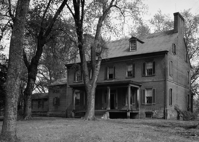
Concord
Monument and historic site · National Register of Historic Places · 4.2 mi
Historic house in District Heights, Maryland, United States

Mount Lubentia
Monument and historic site · National Register of Historic Places · 1.5 mi
Human settlement in Maryland, United States of America

Pleasant Prospect
Monument and historic site · National Register of Historic Places · 3.1 mi
Building in Maryland, United States

Ridgeley School
Monument and historic site · National Register of Historic Places · 3.8 mi
Historic school in Capitol Heights, Maryland, United States

National Capitol Radio & Television Museum
Museum · 4.0 mi
Museum of radio and television
Wellspring Manor & Spa
Monument and historic site · 1.1 mi
11311 Drumsheugh Lane, Upper Marlboro
Parks, trails and playgrounds9



Belt Woods
Park · 1.8 mi
Nature reserve in the U.S. state of Maryland


Oak Creek Golf Club
Golf course · 1.9 mi
600 Bowieville Manor Lane, Upper Marlboro
Restaurants and cafes21


Spiced Black
Restaurant · Salad, African, American · 1.8 mi
10420 Campus Way South, Upper Marlboro
Mo-Su 11:00-21:00

Domino's
Fast food · Pizza · 2.1 mi
796 Harry S Truman Drive, Upper Marlboro
Mo-Th 10:00-24:00; Fr-Sa 10:00-01:00; Su 10:00-24:00
Dunkin'
Fast food · Donut, Coffee Shop · 0.8 mi
12172 Central Avenue, Mitchellville
Mo-Sa 05:00-22:00; Su 06:00-22:00
Popeyes
Fast food · Chicken · 0.8 mi
12120 Central Avenue, Mitchellville
Mo-Th 10:00-23:00; Fr-Sa 10:00-24:00; Su 10:00-23:00
Subway
Fast food · Sandwich · 1.8 mi
10428 Campus Way, Largo
Mo-Fr 08:00-22:00; Sa 09:00-21:00; Su 08:00-21:00
9 more on the map.
Where to stay1
Churches and places of worship12
Ridgley Methodist Episcopal Church
Church · National Register of Historic Places · 3.3 mi
Shopping4
Gas and EV charging2
Schools, colleges and libraries52
Healthcare1
Map of Kettering
112 places. The map loads OpenStreetMap tiles when you open it.
Climate by month
Monthly table
| Month | High | Low | Rain | Snow |
|---|---|---|---|---|
| Jan | 44°F | 25°F | 3.0 in | 5.7 in |
| Feb | 47°F | 26°F | 2.7 in | 6.3 in |
| Mar | 55°F | 33°F | 3.9 in | 1.7 in |
| Apr | 66°F | 44°F | 3.4 in | 0.0 in |
| May | 75°F | 54°F | 4.1 in | 0.0 in |
| Jun | 84°F | 63°F | 4.2 in | 0.0 in |
| Jul | 88°F | 67°F | 4.2 in | 0.0 in |
| Aug | 86°F | 65°F | 4.1 in | 0.0 in |
| Sep | 80°F | 58°F | 4.5 in | 0.0 in |
| Oct | 69°F | 46°F | 4.1 in | 0.0 in |
| Nov | 58°F | 36°F | 3.2 in | 0.0 in |
| Dec | 48°F | 29°F | 3.5 in | 2.2 in |
U.S. Climate Normals 1991-2020 for Upper Marlboro 3 Nnw (3 mi away), NOAA NCEI.
People and cost of living
American Community Survey 5-year estimates, 2020-2024, U.S. Census Bureau. Estimates have margins of error, larger for small towns.
Disaster history
Prince George's County has had 13 federal disaster declarations since 2000, most often for hurricanes.
- 2026-01-24: Severe Winter Storm (Winter Storm)
- 2020-03-26: Covid-19 Pandemic (Biological)
- 2020-03-13: Covid-19 (Biological)
- 2016-03-04: Severe Winter Storm And Snowstorm (Snowstorm)
- 2012-11-20: Hurricane Sandy (Hurricane)
- 2012-10-28: Hurricane Sandy (Hurricane)
OpenFEMA disaster declarations summaries.
Getting there and nearby towns
Joint Base Andrews (ADW) is the nearest airport with scheduled flights listed in OpenStreetMap, 7 miles away.
- Brock Hall 3 mi southeast, about 6 min by car
- Bowie 5 mi northeast, about 8 min by car
- Forestville 5 mi southwest, about 8 min by car
- Glenn Dale 7 mi north, about 11 min by car
- East Riverdale 8 mi northwest, about 13 min by car
- Greenbelt 9 mi northwest, about 14 min by car
- Camp Springs 9 mi southwest, about 15 min by car
- Hyattsville 10 mi northwest, about 16 min by car
- Crofton 10 mi northeast, about 17 min by car
- Washington 12 mi west, about 20 min by car
Drive times are estimates from straight-line distance, not routes.
Local news
Headlines from INDB, the NEMICO news database.
Reviews, tips and questions
Loading what members have shared...
Sources and licences
- NCES EDGE (Public domain): public schools
- NOAA NCEI U.S. Climate Normals 1991-2020 (Public domain): climate by month
- OpenFEMA (Public domain): disaster declarations
- OpenStreetMap contributors (ODbL 1.0): places, airports, map data
- U.S. Census Bureau (Public domain): population, income, housing, education, commute
- Wikidata (CC0 1.0): elevation, founding date, time zone, website, landmarks and historic places
- Wikimedia Commons (see each image): photos
- Wikipedia (CC BY-SA 4.0): overview and history text
Photo credits
- Kettering (1), SlipperyDude, CC BY-SA 3.0
- Mt Lubentia Jan 09, Pubdog at en.wikipedia, Public domain
- Ridgley Methodist Episcopal Church Dec 08, Pubdog ( talk ), Public domain
- Concord 1936, Historic American Buildings Survey / Historic American Engineering Record, Public domain
- Bowieville 1936, Historic American Buildings Survey / Historic American Engineering Record, Public domain
- Ridgeley Rosenwald School, exterior (21636807881), Preservation Maryland, CC BY-SA 2.0
- St Barnabas 1936, John O. Brostrup, Public domain
- BeltWoods1a, Valerius Tygart, CC BY-SA 3.0
- Metropolitan Baptist Church, SlipperyDude, CC BY-SA 3.0
- SFA-Joker's Jinx, Chris Hagerman, CC BY-SA 3.0
- FBC Glenarden (cropped), Gravada, CC BY 4.0


Page built October 30, 2026. Spotted a mistake? Tell us or suggest a place.