


King City, California
King City is a city of 13,604 people in Monterey County, California, founded in 1886.
Why visit King City
Townapedia lists 19 museums and landmarks, 25 parks and trails, 39 places to eat, 9 places to stay and 2 attractions in and around town.
Highlights include King City Cinemas, King City High School Auditorium, King City Station (Southern Pacific Railroad) and King City Golf Course.
August is the warmest month, with average highs of 85°F; December lows average 37°F.
Weather in King City
Forecast from the National Weather Service. Full forecast
About King City
King City (variants: Kings City, City of King) is a city in Monterey County, California, United States. It is located on the Salinas River 51 miles (82 km) southeast of Salinas, at an elevation of 335 feet (102 m). It lies along U.S. Route 101 in the Salinas Valley of California's Central Coast. King City is a member of the Association of Monterey Bay Area Governments.
From the Wikipedia article King City, California (this version), under CC BY-SA 4.0.
Things to do2

Robert Stanton Theater
Cinema and theater · 0.4 mi
720 Broadway Street, King City
Museums and landmarks19

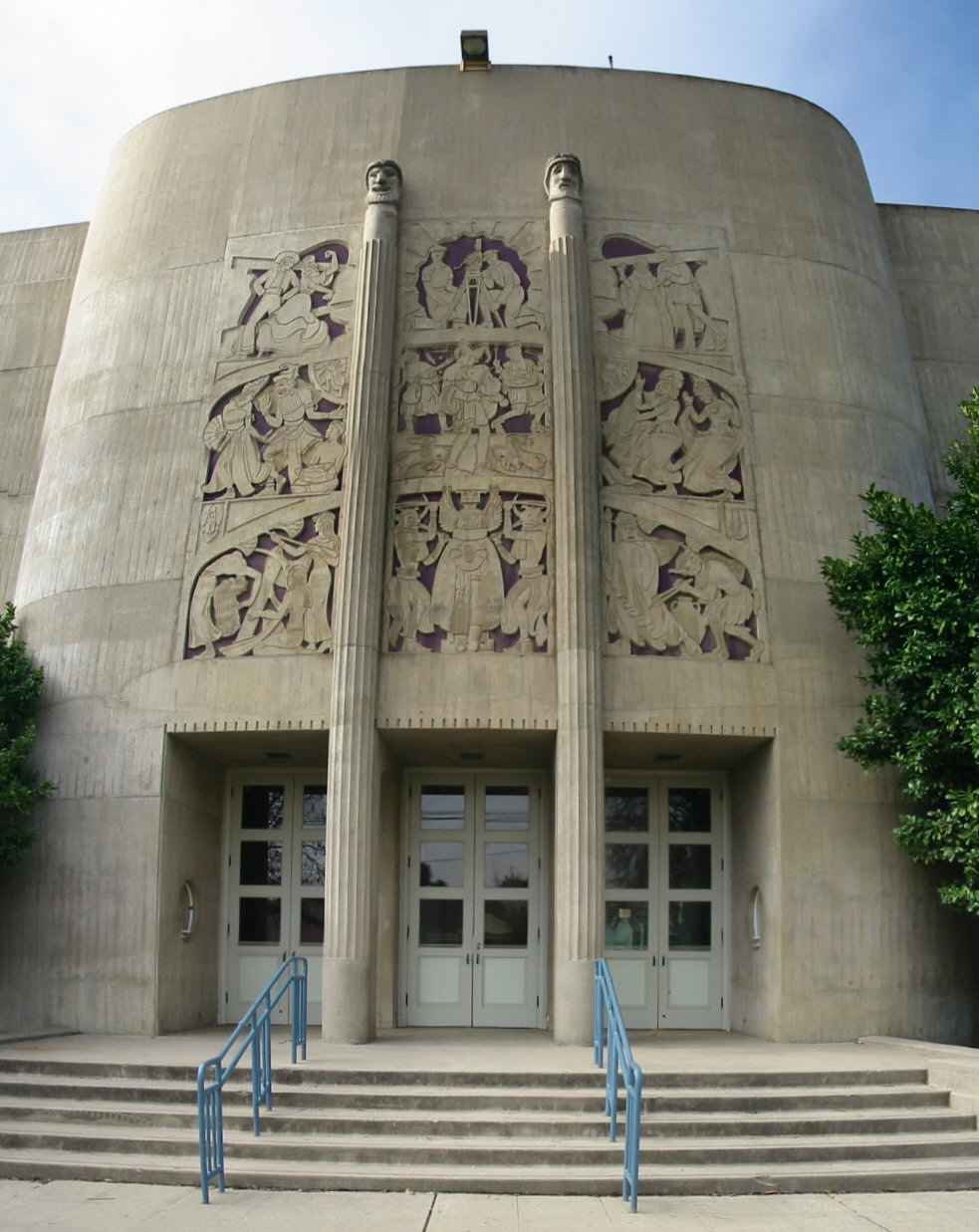
King City High School Auditorium
Monument and historic site · National Register of Historic Places · 0.4 mi
Auditorium in King City, United States of America
King City Station (Southern Pacific Railroad)
Monument and historic site · 1.1 mi
Historic King City train depot originally located alongside the Southern Pacific Railroad at First Street and Broadway
Old Salinas River Bridge Ruins
Monument and historic site · 1.2 mi
Four concrete bridge support pillars remaining from the 1919 U.S. Route 101 highway bridge
Historic Downtown
Monument and historic site
Historic commercial area of Downtown King City bounded by businesses along First Street, San Lorenzo Avenue, Bassett Street, Lynn...
La Gloria Schoolhouse
Monument and historic site · 1.1 mi
A one-room schoolhouse originally situated southeast of Gonzales, California
Spreckels Sugar Company Farmhouse
Monument and historic site · 1.0 mi
Historic house originally situated on Spreckels Sugar Company's "Ranch Number One", in Spreckels, California
Vendome Hotel Building
Monument and historic site · 0.4 mi
320 Broadway Street, King City

7 more on the map.
Parks, trails and playgrounds25



Forden War Memorial Stadium
Sports field and stadium · 0.5 mi
720 Broadway Street, King City
13 more on the map.
Restaurants and cafes39

California Gourmet Pizza
Restaurant · Pizza · 0.4 mi
232 Broadway Street, King City
Mo-Th,Su 11:00-21:00; Fr-Sa 11:00-22:00

Starbucks
Cafe · Coffee Shop · 0.9 mi
1301 Broadway Circle, King City
Mo-Fr 05:00-21:00; Sa-Su 05:30-22:00
Bloom Coffee Shop
Cafe · Coffee Shop, Tea, Dessert · 0.4 mi
200 Broadway Street, King City
Tu,Th 10:00-14:00; We,Fr,Su 10:00-18:00
Guadalajara Restaurant
Restaurant · Mexican · 0.4 mi
211 Broadway Street, King City
10:00-20:30
Lorena's Taqueria
Restaurant · Mexican · 0.4 mi
132 Broadway Street, King City
Mo-Su 05:00-20:00; PH off
Mariscos El Camarón Estilo Nayarit
Restaurant · Mexican · 0.4 mi
223 Broadway Street, King City
09:00-20:00
Restaurante El Sinaloense
Restaurant · Mexican · 0.4 mi
231 Broadway Street, King City
Th-Tu 10:00-20:00

The Cork & Plough
Diner · American · 0.4 mi
200 Broadway Street, King City
Tu-Su 11:00-21:00
La Patrona Restaurant And Cafe
Restaurant · Mexican · 0.5 mi
103 South First Street, King City
Mo 10:00-22:30

Martinez Tortilleria Y Bakery #2
Bakery · 0.4 mi
209 Broadway Street, King City
06:00-20:00

Pozzi's Stampede
Bar and pub · 0.4 mi
207 Broadway Street, King City
Mo-Fr 15:00-22:00
27 more on the map.
History
The first European land exploration of Alta California, Don Gaspar de Portolá's Spanish expedition, camped on the Salinas River just south of today's King City on September 26, 1769, having followed the route of today's Jolon Road from the south. The land they camped on would later become part of King City.
The Dutton Hotel, Stagecoach Station, was located on Jolon Road in King City. What remains are ruins of an adobe inn that was established in 1849. The Dutton Hotel was a major stagecoach stop on El Camino Real in the late 1880s. The landmark was listed on the National Register of Historic Places on October 14, 1971.
King City was originally known as "Kings City" for its founder, Charles King. In 1884 Charles King acquired 13,000 acres (53 km2) of the Mexican land grant Rancho San Lorenzo, originally given to Mariano and Feliciano Soberanes in the early 1840s during Mexican rule of California. King began growing 6,000 acres (2,400 ha) of wheat. In an effort to get his crop to market, King allowed the Southern Pacific Railroad to lay tracks across King Ranch land. The terminus was a station known as King's.
In 1886, the Southern Pacific Railroad completed service to King City station to serve the farms and ranches in the south Salinas Valley and to transport the goods to San Francisco and Los Angeles.
From the History section of King City, California on Wikipedia, under CC BY-SA 4.0.
Where to stay9
Quality Inn Near Fort Hunter Liggett
Motel and hotel · 0.9 mi
1190 Broadway Street, King City
Churches and places of worship11
Asemblea Apostolica
Church · New Apostolic · 0.5 mi
209 South Vanderhurst Avenue, King City
Shopping12
Gas and EV charging9
Schools, colleges and libraries17
Special Education Preschool
School · 0.4 mi
104 South Vanderhurst Ave., King City
Healthcare7
Map of King City
150 places. The map loads OpenStreetMap tiles when you open it.
Climate by month
Monthly table
| Month | High | Low | Rain | Snow |
|---|---|---|---|---|
| Jan | 63°F | 38°F | 2.4 in | 0.0 in |
| Feb | 65°F | 40°F | 2.5 in | 0.0 in |
| Mar | 70°F | 42°F | 2.0 in | 0.0 in |
| Apr | 74°F | 44°F | 0.8 in | 0.0 in |
| May | 78°F | 48°F | 0.3 in | 0.0 in |
| Jun | 83°F | 51°F | 0.0 in | 0.0 in |
| Jul | 85°F | 54°F | 0.0 in | 0.0 in |
| Aug | 85°F | 54°F | 0.0 in | 0.0 in |
| Sep | 85°F | 52°F | 0.1 in | 0.0 in |
| Oct | 80°F | 46°F | 0.5 in | 0.0 in |
| Nov | 70°F | 41°F | 1.0 in | 0.0 in |
| Dec | 62°F | 37°F | 2.0 in | 0.0 in |
U.S. Climate Normals 1991-2020 for King City (1 mi away), NOAA NCEI.
People and cost of living
American Community Survey 5-year estimates, 2020-2024, U.S. Census Bureau. Estimates have margins of error, larger for small towns.
Disaster history
Monterey County has had 19 federal disaster declarations since 2000, most often for fires.
- 2024-04-13: Severe Winter Storms, Tornadoes, Flooding, Landslides, And Mudslides (Severe Storm)
- 2023-04-03: Severe Winter Storms, Straight-Line Winds, Flooding, Landslides, And Mudslides (Severe Storm)
- 2023-03-10: Severe Winter Storms, Flooding, Landslides, And Mudslides (Flood)
- 2023-01-14: Severe Winter Storms, Flooding, Landslides, And Mudslides (Flood)
- 2023-01-09: Severe Winter Storms, Flooding, And Mudslides (Flood)
- 2020-08-22: Wildfires (Fire)
OpenFEMA disaster declarations summaries.
Getting there and nearby towns
Mesa Del Rey Airport (KIC) is the nearest airport with scheduled flights listed in OpenStreetMap, 1 miles away.
- Greenfield 10 mi northwest, about 16 min by car
- Soledad 18 mi northwest, about 29 min by car
- Salinas 43 mi northwest, about 1 h 15 min by car
- Coalinga 44 mi east, about 1 h 15 min by car
- Hollister 47 mi north, about 1 h 15 min by car
- Seaside 47 mi northwest, about 1 h 15 min by car
- El Paso de Robles (Paso Robles) 49 mi southeast, about 1 h 15 min by car
- Marina 49 mi northwest, about 1 h 15 min by car
- Monterey 50 mi northwest, about 1 h 15 min by car
- Prunedale 50 mi northwest, about 1 h 15 min by car
Drive times are estimates from straight-line distance, not routes.
Local news
Headlines from INDB, the NEMICO news database.
Reviews, tips and questions
Loading what members have shared...
Sources and licences
- NCES EDGE (Public domain): public schools
- NOAA NCEI U.S. Climate Normals 1991-2020 (Public domain): climate by month
- OpenFEMA (Public domain): disaster declarations
- OpenStreetMap contributors (ODbL 1.0): places, airports, map data
- U.S. Census Bureau (Public domain): population, income, housing, education, commute
- Wikidata (CC0 1.0): elevation, founding date, time zone, website, landmarks and historic places
- Wikimedia Commons (see each image): photos
- Wikipedia (CC BY-SA 4.0): overview and history text
Photo credits
- KingCityHS-RobertStantonTheater, Binksternet, Public domain
- Sunweb Lexus team car with Giant bikes in King City (40952049230), Ray Rogers from Novato, United States, CC BY-SA 2.0
- Ian Boswell before the start in King City (42763090591), Ray Rogers from Novato, United States, CC BY-SA 2.0
- Tom Stamsnijder at the start in King City (42763069331), Ray Rogers from Novato, United States, CC BY-SA 2.0
- Dan McLay before the start of Stage 3 in King City (42713336192), Ray Rogers from Novato, United States, CC BY-SA 2.0
- Lukasz Wisniowski before the start in King City (40951998460), Ray Rogers from Novato, United States, CC BY-SA 2.0
- Holowesko-Citadel's BMC bikes in King City (40952038420), Ray Rogers from Novato, United States, CC BY-SA 2.0
- Alexander Kristoff before the start in King City (42713337632), Ray Rogers from Novato, United States, CC BY-SA 2.0
- BMC team car leaving King City (40951989090), Ray Rogers from Novato, United States, CC BY-SA 2.0
- Julien Vermote before the start in King City (40952006230), Ray Rogers from Novato, United States, CC BY-SA 2.0
- The peloton heading out of King City (40951993370), Ray Rogers from Novato, United States, CC BY-SA 2.0
- SRAM neutral service car leaving King City (41862636045), Ray Rogers from Novato, United States, CC BY-SA 2.0
- Lotto NL - Jumbo team cars with bikes in King City (27893777237), Ray Rogers from Novato, United States, CC BY-SA 2.0
- Sebastian Henao before the start in King City (40952003410), Ray Rogers from Novato, United States, CC BY-SA 2.0
- Alexander Kristoff before the start in King City (42763088211), Ray Rogers from Novato, United States, CC BY-SA 2.0
- Ian Stannard before the start in King City (42713333152), Ray Rogers from Novato, United States, CC BY-SA 2.0
- Mark Renshaw before the start in King City (41862638135), Ray Rogers from Novato, United States, CC BY-SA 2.0
- Jhonatan Narvaez before the start in King City (28889252368), Ray Rogers from Novato, United States, CC BY-SA 2.0
- Michael Schar before the start in King City (42713338492), Ray Rogers from Novato, United States, CC BY-SA 2.0
- Mathew Hayman before the start in King City (28889250508), Ray Rogers from Novato, United States, CC BY-SA 2.0
- Brandon McNulty (L) and teammate in King City (40951998150), Ray Rogers from Novato, United States, CC BY-SA 2.0
- Sunweb's Giant team bike in King City (27893782887), Ray Rogers from Novato, United States, CC BY-SA 2.0
- Nathan Van Hooydonck before the start in King City (40951997590), Ray Rogers from Novato, United States, CC BY-SA 2.0
- (L-R) Daniel Oss and Peter Sagan in King City (41862662095), Ray Rogers from Novato, United States, CC BY-SA 2.0
- (L-R) Michael Kolar and Rob Britton in King City (27893740427), Ray Rogers from Novato, United States, CC BY-SA 2.0
- Lawson Craddock before the start in King City (42713333572), Ray Rogers from Novato, United States, CC BY-SA 2.0
- The Broom Wagon at the start in King City (41862672245), Ray Rogers from Novato, United States, CC BY-SA 2.0
- Matteo Fabbro before the start in King City (41862643415), Ray Rogers from Novato, United States, CC BY-SA 2.0
- The peloton leaving King City for Laguna Seca (41862634195), Ray Rogers from Novato, United States, CC BY-SA 2.0
- Hagen Bermans Axeon team car leaving King City (40951990990), Ray Rogers from Novato, United States, CC BY-SA 2.0
- Juraj Sagan before the start in King City (41862659465), Ray Rogers from Novato, United States, CC BY-SA 2.0
- Marcel Kittel before the start in King City (28889257278), Ray Rogers from Novato, United States, CC BY-SA 2.0
- Ian Boswell before the start in King City (28889277808), Ray Rogers from Novato, United States, CC BY-SA 2.0
- Holowesko Citadel team car leaving King City (40951990040), Ray Rogers from Novato, United States, CC BY-SA 2.0
- Steijn Vandenbergh before the start in King City (41862652905), Ray Rogers from Novato, United States, CC BY-SA 2.0
- EF-Education First Drapac team car in King City (40952035850), Ray Rogers from Novato, United States, CC BY-SA 2.0
- Maciej Bodnar (40952009070), Ray Rogers from Novato, United States, CC BY-SA 2.0
- Unicycle rider (41862670725), Ray Rogers from Novato, United States, CC BY-SA 2.0
- Trek Segafredo team car and bikes (41862632485), Ray Rogers from Novato, United States, CC BY-SA 2.0
- Luke Rowe (28889271208), Ray Rogers from Novato, United States, CC BY-SA 2.0


Page built October 30, 2026. Spotted a mistake? Tell us or suggest a place.