


Konterra, Maryland
Konterra is a community of 3,641 people in Prince George's County, Maryland.
Why visit Konterra
Townapedia lists 7 museums and landmarks, 36 parks and trails, 39 places to eat, 4 places to stay and 2 attractions in and around town.
Highlights include Capitol Technology University, Regal's Cinema 12, Ammendale Normal Institute and Abraham Hall.
July is the warmest month, with average highs of 89°F; January lows average 26°F.
Weather in Konterra
Forecast from the National Weather Service. Full forecast
About Konterra
Konterra is an unincorporated area and census-designated place (CDP) in Prince George's County, Maryland, United States. The population was 3,158 at the 2020 census.
From the Wikipedia article Konterra, Maryland (this version), under CC BY-SA 4.0.
Things to do2

Capitol Technology University
School · 3.5 mi
University near Washington, DC, United States

Museums and landmarks7
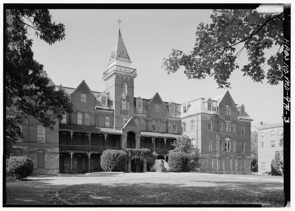
Ammendale Normal Institute
Monument and historic site · National Register of Historic Places · 1.9 mi
Historical Catholic novitiate and school, operated by the Christian Brothers in Beltsville, Maryland, United States

Abraham Hall
Museum · National Register of Historic Places · 2.0 mi
Historic African American benevolent society lodge in Prince George's County, Maryland, United States

Avondale Mill
Monument and historic site · National Register of Historic Places · 3.4 mi
United States historic place

Laurel station
Monument and historic site · National Register of Historic Places · 3.4 mi
Train station in Laurel, Maryland, US
Montpelier Mansion
Monument and historic site · National Register of Historic Places · 3.1 mi
Human settlement in Maryland, United States of America

Snow Hill
Monument and historic site · National Register of Historic Places · 3.1 mi
Building in Maryland, United States

Old Laurel High School
Monument and historic site · National Register of Historic Places · 3.0 mi
Parks, trails and playgrounds36


Dinosaur Park
Park · 1.8 mi
Park at the approximate site of the discovery of Astrodon dinosaur fossils, encompassing the Muirkirk Deposit which was once an iron...
13100 Mid Atlantic Boulevard, Laurel

National Capital Curling Center
Sports field and stadium · 1.2 mi
13810 Old Gunpowder Road, West Laurel


The Gardens Ice House
Sports field and stadium · 1.2 mi
13810 Old Gunpowder Road
24 more on the map.
Restaurants and cafes39

Chido's Tex-Mex Grill
Restaurant · Mexican · 2.2 mi
14600 Laurel Place
Mo-We 11:00-22:00; Th 11:00-23:00; Fr 11:00-00:00; Sa 10:30-00:00;...
La Curva Tex-Mex Bar & Grill
Restaurant · Grill, Mexican, Peruvian · 1.2 mi
15107 Sweitzer Lane
Su-Th 11:00-23:00; Fr-Sa 11:00-00:00
Mango's Grill
Restaurant · Mexican · 2.3 mi
14605 Baltimore Avenue
Su-Th 11:00-10:00; Fr-Sa 11:00-23:00
Bella Indian and Italian Cuisine
Restaurant · Italian · 1.3 mi
7423 Van Dusen Road
Fr-Sa 11:00-22:00; Su-Th 11:00-21:00
Blaze Pizza
Restaurant · Pizza · 2.4 mi
14708 Baltimore Avenue, Laurel
Mo-Th 11:00-22:00; Fr-Sa 11:00-23:00; Su 11:00-22:00

27 more on the map.
Where to stay4
Churches and places of worship24
Trinity Reformed Presbyterian Church
Church · Presbyterian · 2.0 mi
4515 Sandy Spring Road, Burtonsville
Beltsville Seventh-day Adventist Church
Church · Seventh Day Adventist · 2.2 mi
4200 Ammendale Road, Beltsville
Filipino American Capital Seventh-day Adventist Church
Church · Seventh Day Adventist · 2.4 mi
4216 Powder Mill Road, Beltsville
First Baptist Church of Laurel
Church · Baptist · 1.8 mi
15000 First Baptist Lane, Laurel
Lifehouse Church
Place of worship · Assemblies Of God · 1.6 mi
12304 Baltimore Avenue, Beltsville
BAPS Shri Swaminarayan Mandir
Place of worship · 1.9 mi
4320 Ammendale Road, Beltsville
Shopping6
Gas and EV charging7
Schools, colleges and libraries51
Healthcare4
Map of Konterra
180 places. The map loads OpenStreetMap tiles when you open it.
Climate by month
Monthly table
| Month | High | Low | Rain |
|---|---|---|---|
| Jan | 43°F | 26°F | 3.5 in |
| Feb | 46°F | 28°F | 2.7 in |
| Mar | 55°F | 35°F | 4.2 in |
| Apr | 67°F | 45°F | 3.8 in |
| May | 76°F | 55°F | 4.4 in |
| Jun | 84°F | 64°F | 4.4 in |
| Jul | 89°F | 69°F | 4.2 in |
| Aug | 87°F | 68°F | 3.8 in |
| Sep | 80°F | 61°F | 4.7 in |
| Oct | 68°F | 50°F | 4.4 in |
| Nov | 57°F | 39°F | 3.5 in |
| Dec | 47°F | 31°F | 3.9 in |
U.S. Climate Normals 1991-2020 for Laurel 3 W Hcn (0 mi away), NOAA NCEI.
People and cost of living
American Community Survey 5-year estimates, 2020-2024, U.S. Census Bureau. Estimates have margins of error, larger for small towns.
Disaster history
Prince George's County has had 13 federal disaster declarations since 2000, most often for hurricanes.
- 2026-01-24: Severe Winter Storm (Winter Storm)
- 2020-03-26: Covid-19 Pandemic (Biological)
- 2020-03-13: Covid-19 (Biological)
- 2016-03-04: Severe Winter Storm And Snowstorm (Snowstorm)
- 2012-11-20: Hurricane Sandy (Hurricane)
- 2012-10-28: Hurricane Sandy (Hurricane)
OpenFEMA disaster declarations summaries.
Getting there and nearby towns
College Park Airport (CGS) is the nearest airport with scheduled flights listed in OpenStreetMap, 7 miles away.
- Laurel 2 mi northeast, about 4 min by car
- Fairland 3 mi west, about 5 min by car
- Beltsville 3 mi south, about 5 min by car
- South Laurel 3 mi southeast, about 5 min by car
- Calverton 3 mi southwest, about 5 min by car
- Burtonsville 3 mi northwest, about 6 min by car
- North Laurel 4 mi northeast, about 7 min by car
- Scaggsville 4 mi north, about 7 min by car
- Maryland City 5 mi east, about 8 min by car
- White Oak 5 mi southwest, about 9 min by car
Drive times are estimates from straight-line distance, not routes.
Local news
Headlines from INDB, the NEMICO news database.
Reviews, tips and questions
Loading what members have shared...
Sources and licences
- NCES EDGE (Public domain): public schools
- NOAA NCEI U.S. Climate Normals 1991-2020 (Public domain): climate by month
- OpenFEMA (Public domain): disaster declarations
- OpenStreetMap contributors (ODbL 1.0): places, airports, map data
- U.S. Census Bureau (Public domain): population, income, housing, education, commute
- Wikidata (CC0 1.0): elevation, founding date, time zone, website, landmarks and historic places
- Wikimedia Commons (see each image): photos
- Wikipedia (CC BY-SA 4.0): overview and history text
Photo credits
- Ammendale SE 1990, Jack Boucher, Public domain
- Montpellier Maryland 2, The original uploader was Quarterczar at English Wikipedia ., Public domain
- Abraham Hall Dec 08, Pubdog ( talk ), Public domain
- Laurel Maryland Railroad Station Dec 08, Pubdog ( talk ), Public domain
- Snow Hill East Dec 08, Pubdog ( talk ), Public domain
- Avondale Mill Site Laurel MD Jan 11, Pubdog, Public domain
- Dinosaur Park Laurel, Paul, CC BY-SA 2.0
- Laurel High School Dec 08, Pubdog ( talk ), Public domain
- First United Methodist Church Laurel Maryland, FlugKerl2, CC BY-SA 4.0
- Saint John's Episcopal Church (Beltsville, Maryland), Farragutful, CC BY-SA 3.0


Page built October 30, 2026. Spotted a mistake? Tell us or suggest a place.