


Beverly, New Jersey
Beverly is a city of 2,514 people in Burlington County, New Jersey, founded in March 5, 1850.
Why visit Beverly
Townapedia lists 7 museums and landmarks, 5 parks and trails, 4 places to eat, 1 place to stay and 3 attractions in and around town.
Highlights include Burlington–Bristol Bridge, Riverside–Delanco Bridge, Andalusia and Beverly National Cemetery.
July is the warmest month, with average highs of 88°F; January lows average 27°F.
Weather in Beverly
Forecast from the National Weather Service. Full forecast
About Beverly
Beverly is a city in Burlington County in the U.S. state of New Jersey. As of the 2020 United States census, the city's population was 2,499, a decrease of 78 (−3.0%) from the 2010 census count of 2,577, which in turn had reflected a decline of 84 (−3.2%) from the 2,661 counted in the 2000 census. The city and all of Burlington County constitute a part of the Philadelphia metropolitan area.
From the Wikipedia article Beverly, New Jersey (this version), under CC BY-SA 4.0.
Things to do3

Burlington–Bristol Bridge
Bridge · 3.0 mi
Truss Bridge Connecting New Jersey & Pennsylvannia

Riverside–Delanco Bridge
Bridge · 2.4 mi
Bridge in United States of America

Museums and landmarks7

Andalusia
Museum · National Register of Historic Places · 1.9 mi
Historic mansion

Beverly National Cemetery
Monument and historic site · National Register of Historic Places · 0.7 mi
Historic veterans cemetery in Burlington County, New Jersey
Bristol College
Monument and historic site · National Register of Historic Places · 1.5 mi
Defunct college in Bucks County, Pennsylvania
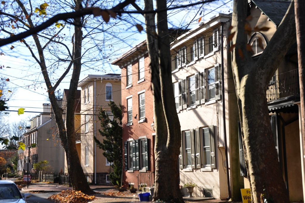
Burlington Historic District
Monument and historic site · National Register of Historic Places · 3.2 mi
Listed on the National Register of Historic Places in Burlington County, New Jersey

Philadelphia Watch Case Company Building
Monument and historic site · National Register of Historic Places · 2.6 mi
Historic building in Riverside Township, New Jersey


Willingboro School House
Monument and historic site · National Register of Historic Places · 2.7 mi
Historic schoolhouse in Burlington County, New Jersey

Poquessing Creek
Monument and historic site · National Register of Historic Places · 3.1 mi
Parks, trails and playgrounds5


Restaurants and cafes4

45th Street Pub
Bar and pub · 1.5 mi
4303 Route 130, Edgewater Park
Mo-Tu,Th,Su 11:00-23:00; We,Fr-Sa 11:00-24:00


Where to stay1
Churches and places of worship11
Coopertown Meetinghouse
Church · National Register of Historic Places · 1.5 mi
St. Stephen's Episcopal Church
Church · National Register of Historic Places
Little Jerusalem AME Church
Church · National Register of Historic Places · 2.4 mi
St. Elizabeth's Convent
Church · National Register of Historic Places · 2.0 mi
St. Mary's Episcopal Church
Church · National Register of Historic Places · 3.3 mi
Shopping2
Schools, colleges and libraries47
Benjamin Banneker Preparatory Charter School
School · 1.9 mi
11 South Sunset Road, Willingboro
Burlington Township Middle School At Springside
School · 4.3 mi
1600 Burlington By Pass, Burlington
Captain James Lawrence Elementary School
School · 3.8 mi
315 Barclay St, Burlington
Map of Beverly
80 places. The map loads OpenStreetMap tiles when you open it.
Climate by month
Monthly table
| Month | High | Low | Rain |
|---|---|---|---|
| Jan | 42°F | 27°F | 3.3 in |
| Feb | 45°F | 28°F | 2.6 in |
| Mar | 53°F | 35°F | 4.0 in |
| Apr | 65°F | 44°F | 3.8 in |
| May | 74°F | 54°F | 3.6 in |
| Jun | 83°F | 64°F | 3.9 in |
| Jul | 88°F | 69°F | 4.3 in |
| Aug | 86°F | 68°F | 4.2 in |
| Sep | 79°F | 60°F | 4.5 in |
| Oct | 68°F | 48°F | 3.6 in |
| Nov | 57°F | 38°F | 3.2 in |
| Dec | 47°F | 31°F | 4.0 in |
U.S. Climate Normals 1991-2020 for Philadelphia Ne Ap (5 mi away), NOAA NCEI.
People and cost of living
American Community Survey 5-year estimates, 2020-2024, U.S. Census Bureau. Estimates have margins of error, larger for small towns.
Disaster history
Burlington County has had 23 federal disaster declarations since 2000, most often for hurricanes.
- 2021-09-05: Remnants Of Hurricane Ida (Hurricane)
- 2021-09-02: Remnants Of Hurricane Ida (Hurricane)
- 2020-12-11: Tropical Storm Isaias (Hurricane)
- 2020-03-25: Covid-19 Pandemic (Biological)
- 2020-03-13: Covid-19 (Biological)
- 2018-06-08: Severe Winter Storm And Snowstorm (Severe Storm)
OpenFEMA disaster declarations summaries.
Getting there and nearby towns
Northeast Philadelphia Airport (PNE) is the nearest airport with scheduled flights listed in OpenStreetMap, 5 miles away.
- Levittown 7 mi northeast, about 11 min by car
- Moorestown-Lenola 7 mi south, about 11 min by car
- Cherry Hill Mall 10 mi southwest, about 16 min by car
- Marlton 11 mi south, about 18 min by car
- Philadelphia 12 mi west, about 19 min by car
- Willow Grove 12 mi northwest, about 19 min by car
- Greentree 12 mi south, about 19 min by car
- Roslyn 12 mi west, about 20 min by car
- Camden 13 mi southwest, about 21 min by car
- Trenton 14 mi northeast, about 22 min by car
Drive times are estimates from straight-line distance, not routes.
Local news
Headlines from INDB, the NEMICO news database.
Reviews, tips and questions
Loading what members have shared...
Sources and licences
- NCES EDGE (Public domain): public schools
- NOAA NCEI U.S. Climate Normals 1991-2020 (Public domain): climate by month
- OpenFEMA (Public domain): disaster declarations
- OpenStreetMap contributors (ODbL 1.0): places, airports, map data
- U.S. Census Bureau (Public domain): population, income, housing, education, commute
- Wikidata (CC0 1.0): elevation, founding date, time zone, website, landmarks and historic places
- Wikimedia Commons (see each image): photos
- Wikipedia (CC BY-SA 4.0): overview and history text
Photo credits
- St. Stephen's Beverly Exterior, Philly2boston, CC BY 3.0
- COOPERTOWN MEETING HOUSE, BURLINGTON COUNTY, NJ, JERRYE AND ROY KLOTZ MD, CC BY-SA 3.0
- BurlingtonNJ NewStMarysChurch 03, User:Magicpiano, CC BY-SA 4.0
- SCHOOLHOUSE, WILLINGBORO, BURLINGTON COUNTY, NJ, JERRYE AND ROY KLOTZ MD, CC BY-SA 3.0
- Bristol College 1919, John Thomson Faris, Public domain
- Andalusia, State Road vicinity (Bensalem Township), Andalusia (Bucks County, Pennsylvania), Jack Boucher, Public domain
- BensalemPA JerusalemAMEChurch, User:Magicpiano, CC BY-SA 4.0
- BurlingtonNJ WoodStreet, User:Magicpiano, CC BY-SA 4.0
- PHILADELPHIA WATCH CASE COMPANY BUILDING - RIVERSIDE, BURLINGTON COUNTY, JERRYE AND ROY KLOTZ MD, CC BY-SA 3.0
- BensalemPA DrexelShrineHousing, User:Magicpiano, CC BY-SA 4.0
- BEVERLY NATIONAL CEMETERY, BURLINGTON COUNTY, JERRYE AND ROY KLOTZ MD, CC BY-SA 3.0
- Burlington-Bristol Bridge heading south, User:Dough4872, CC BY-SA 3.0
- Riverside-Delanco Bridge, April 2022, Mr. Matté (if there is an issue with this image, contact me using this image's Commons talk page , my Commons user talk page , or my English Wikipedia user talk page ; I'll know about it a lot faster), CC BY-SA 4.0


Page built October 30, 2026. Spotted a mistake? Tell us or suggest a place.