



Lansdowne, Maryland
Lansdowne is a community of 7,876 people in Baltimore County, Maryland, founded in 1892.
Why visit Lansdowne
Townapedia lists 23 museums and landmarks, 14 parks and trails, 47 places to eat, 3 places to stay and 3 attractions in and around town.
Highlights include R/C Hollywood Cinema 4, Hanover Street Bridge, Baltimore National Cemetery and Benson–Hammond House.
July is the warmest month, with average highs of 90°F; January lows average 30°F.
Weather in Lansdowne
Forecast from the National Weather Service. Full forecast
About Lansdowne
Lansdowne is a census-designated place in southern Baltimore County, Maryland, United States, located just south of Baltimore. As of the 2010 census, it had a population of 8,409. At the 2000 census and earlier, the area was delineated as part of the Lansdowne-Baltimore Highlands CDP.
From the Wikipedia article Lansdowne, Maryland (this version), under CC BY-SA 4.0.
Things to do3



University of Maryland, Baltimore County
School · 2.9 mi
Public university in Maryland
Museums and landmarks23

Baltimore National Cemetery
Monument and historic site · National Register of Historic Places · 3.5 mi
United States national cemetery in Baltimore and Baltimore County, Maryland

Benson–Hammond House
Monument and historic site · National Register of Historic Places · 3.2 mi
Historic house in Maryland

Carrollton Viaduct
Bridge · National Register of Historic Places · 2.8 mi
Bridge in United States of America

Elkridge Furnace Complex
Monument and historic site · National Register of Historic Places · 2.6 mi
Building in Maryland, United States

Linthicum Heights Historic District
Monument and historic site · National Register of Historic Places · 2.1 mi
Historic district in Maryland, United States

Loudon Park National Cemetery
Monument and historic site · National Register of Historic Places · 3.1 mi
U.S. national cemetery in Baltimore, Maryland
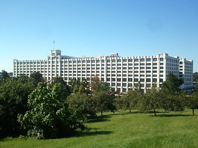
Montgomery Park
Monument and historic site · National Register of Historic Places · 3.0 mi
State government office building across from Carroll Park in southwest Baltimore, Maryland, United States

Mount Auburn Cemetery
Monument and historic site · National Register of Historic Places · 2.1 mi
Cemetery in Baltimore, oldest black owned and operated cemetery in the United States

Mount Clare
Monument and historic site · National Register of Historic Places · 3.2 mi
Historic locality in Baltimore, Maryland, United States of America

Parker Metal Decoration Company Plant
Monument and historic site · National Register of Historic Places · 3.6 mi
Historic factory building located at Baltimore, Maryland, United States

Pigtown
Monument and historic site · National Register of Historic Places · 3.5 mi
Neighborhood in Baltimore, Maryland, United States

Schwartze Mansion
Monument and historic site · National Register of Historic Places · 3.5 mi
Building in Maryland, United States
11 more on the map.
Parks, trails and playgrounds14


Carroll Park
Park · 3.1 mi
Urban park and statistical area in Baltimore, Maryland, United States


Patapsco Valley State Park Belle Grove Area
Hiking and trails · 1.6 mi
Sub-unit of the larger Patapsco Valley State Park.
Patapsco Valley State Park Halethorpe Ponds Area
Hiking and trails · 1.0 mi
Sub-unit of the larger Patapsco Valley State Park.

2 more on the map.
Restaurants and cafes47

Happy Garden
Restaurant · Chinese · 0.7 mi
810 Nursery Road, Linthicum Heights
Mo-Th 10:30-22:00; Fr 10:30-22:30; Sa 11:00-22:30; Su 12:00-22:30

Royal Spice
Restaurant · Indian, Nepalese · 0.7 mi
810 Nursery Road, Linthicum Heights
Mo off; Tu-Th 11:00-15:00,16:00-21:30; Fr 11:00-15:00,...

Heavy Seas Beer
Bar and pub · 0.6 mi
4615 Hollins Ferry Road
We-Fr 15:00-22:00; Sa 12:00-22:00; Su 11:00-17:00
Martha's Cafe
Restaurant · 1.7 mi
5507 Oregon Avenue, Halethorpe
Tu-Th 08:00-20:00; Fr 08:00-19:00; Sa 08:00-20:00
Three Brothers
Restaurant · Italian · 0.9 mi
3611 Washington Boulevard, Halethorpe
Sa-Th 11:00-21:00; Fr 11:00-22:00
Bonfire
Restaurant · 0.9 mi
4122 Washington Boulevard, Halethorpe
Mo-Th 11:00-20:00;Fr-Sa 11:00-21:00
The Border Line Bar & Grill
Bar and pub · 1.5 mi
3306 Washington Boulevard, Halethorpe
Mo-Su 11:00-02:00
35 more on the map.
History
In the late 1800s, the Whitaker Iron Company mined for ore in Lansdowne. Abandoned pits from the mining were filled up by underground springs creating small ponds and lakes. Lansdowne was mostly farmland, including the Kessler farm, MacLeod farm and Wades farm.
When the railroad came, Lansdowne became known as a B&O town. Most people worked for the B&O, commuting by train into Baltimore. The first station was named Coursey Station. The Coursey Station senior housing center takes its name from this.
The two main roads were Hammonds Ferry Road and Hollins Ferry Road, both of which led to the Patapsco River where there was once a ferry in operation.
Early churches included the Lutheran Church of Our Savior, St. Clements Catholic Church, Lansdowne United Methodist Church, Lansdowne Christian Church and the First Baptist Church. The Hull Memorial Christian Church was listed on the National Register of Historic Places in 1977. The site of the original wooden school house was on the property that is now St. Clements.
In the 1950s housing developments sprang up in the Riverview area, and new schools were built for these neighborhoods. The Lansdowne Elementary School, Lansdowne Middle School and Lansdowne Senior High were known as the "Golden Education Triangle."
From the History section of Lansdowne, Maryland on Wikipedia, under CC BY-SA 4.0.
Where to stay3
Churches and places of worship13
Lansdowne Christian Church
Church · National Register of Historic Places · 0.6 mi
Halethorpe United Methodist Church
Church · Methodist · 1.3 mi
4513 Ridge Avenue, Halethorpe
First Mount Olive Church Rehoboth Campus
Church · 1.2 mi
618 North Hammonds Ferry Road, Linthicum Heights
Shopping7
Gas and EV charging18
Schools, colleges and libraries57
Benjamin Franklin High School At Masonville Cove
School · 3.8 mi
1201 Cambria Street, Baltimore
Healthcare4
Kaiser Permanente Medical Center
Clinic and pharmacy · 1.6 mi
1701 Twin Springs Road, Halethorpe
Map of Lansdowne
189 places. The map loads OpenStreetMap tiles when you open it.
Climate by month
Monthly table
| Month | High | Low | Rain |
|---|---|---|---|
| Jan | 44°F | 30°F | 3.1 in |
| Feb | 47°F | 32°F | 2.8 in |
| Mar | 55°F | 39°F | 3.9 in |
| Apr | 67°F | 48°F | 3.5 in |
| May | 76°F | 58°F | 3.4 in |
| Jun | 85°F | 68°F | 3.4 in |
| Jul | 90°F | 73°F | 4.7 in |
| Aug | 87°F | 71°F | 4.3 in |
| Sep | 80°F | 64°F | 4.5 in |
| Oct | 69°F | 53°F | 3.5 in |
| Nov | 58°F | 43°F | 3.0 in |
| Dec | 48°F | 35°F | 3.7 in |
U.S. Climate Normals 1991-2020 for Md Sci Ctr Baltimore Hcn (4 mi away), NOAA NCEI.
People and cost of living
American Community Survey 5-year estimates, 2020-2024, U.S. Census Bureau. Estimates have margins of error, larger for small towns.
Disaster history
Baltimore County has had 17 federal disaster declarations since 2000, most often for hurricanes.
- 2026-01-24: Severe Winter Storm (Winter Storm)
- 2020-03-26: Covid-19 Pandemic (Biological)
- 2020-03-13: Covid-19 (Biological)
- 2018-07-02: Severe Storm And Flooding (Flood)
- 2016-03-04: Severe Winter Storm And Snowstorm (Snowstorm)
- 2014-04-10: Snowstorm (Severe Storm)
OpenFEMA disaster declarations summaries.
Getting there and nearby towns
Baltimore-Washington International/Thurgood Marshall Airport (BWI) is the nearest airport with scheduled flights listed in OpenStreetMap, 4 miles away.
- Baltimore Highlands 1 mi east, about 2 min by car
- Arbutus 2 mi west, about 2 min by car
- Linthicum 2 mi south, about 3 min by car
- Brooklyn Park 3 mi southeast, about 4 min by car
- Ferndale 4 mi southeast, about 6 min by car
- Catonsville 5 mi northwest, about 7 min by car
- Baltimore 5 mi northeast, about 9 min by car
- Elkridge 5 mi southwest, about 8 min by car
- Ilchester 5 mi west, about 9 min by car
- Glen Burnie 6 mi southeast, about 10 min by car
Drive times are estimates from straight-line distance, not routes.
Local news
Headlines from INDB, the NEMICO news database.
Reviews, tips and questions
Loading what members have shared...
Sources and licences
- NCES EDGE (Public domain): public schools
- NOAA NCEI U.S. Climate Normals 1991-2020 (Public domain): climate by month
- OpenFEMA (Public domain): disaster declarations
- OpenStreetMap contributors (ODbL 1.0): places, airports, map data
- U.S. Census Bureau (Public domain): population, income, housing, education, commute
- Wikidata (CC0 1.0): landmarks and historic places
- Wikimedia Commons (see each image): photos
- Wikipedia (CC BY-SA 4.0): overview and history text
Photo credits
- 2016-07-27 08 08 31 View south along Maryland State Route 648 (Annapolis Road) entering Baltimore Highlands, Baltimore County, Maryland from Baltimore City, Maryland, Famartin, CC BY-SA 4.0
- Turkey Hill Dec 09, Pubdog ( talk ), Public domain
- Linthicum Heights Historic District View 2 Dec 09, Pubdog ( talk ), Public domain
- Elkridge Furnace Sept 09, Pubdog ( talk ), Public domain
- Montgomery Ward Warehouse and Retail Store, Phaneros, CC BY-SA 3.0
- SCHWARTZE MANSION, WEST & SOUTHWEST BALTIMORE, MARYLAND, Jerrye & Roy Klotz, MD, CC BY-SA 4.0
- Weiskittel-Roehle Burial Vault MD1, Acroterion, CC BY-SA 4.0
- The Lawn, Zrmachuga, CC BY-SA 4.0
- St. Charles College Historic District Dec 09, Pubdog ( talk ), Public domain
- Baltimore Parker Metal, Smallbones, CC0
- Carrollton-viaduct, William Edmund Barrett, Historic American Engineering Record, Public domain
- Benson-Hammond House Dec 09, Pubdog ( talk ), Public domain
- Thomas Viaduct LOC 082103pu, Jack Boucher, Public domain
- Hull Memorial Christian Church Dec 09, Pubdog ( talk ), Public domain
- Mount Clare Baltimore MD Dec 11, Pubdog, Public domain
- Mount Auburn Cemetery Baltimore, Maryland Dec 11, Pubdog, Public domain
- Sunnyfields Dec 09, Pubdog ( talk ), Public domain
- Pigtown Historic District Baltimore MD Dec 11, Pubdog, Public domain
- Baltimore National Cemetery 1, Eminonuk, CC BY-SA 4.0
- Maryland Sons monument, Loudoun Park National Cemetery (Baltimore), Don Woods, CC BY-SA 3.0
- Twin Oaks Dec 09, Pubdog ( talk ), Public domain
- Equitable gas Baltimore, Smallbones, CC0
- Electronics Museum front enterance, NatElecMuseum, CC BY-SA 3.0
- Hanover street bridge baltimore, Patorjk, CC BY-SA 4.0
- Mount Clare Museum House, rear (21592230272), Preservation Maryland, CC BY-SA 2.0


Page built October 30, 2026. Spotted a mistake? Tell us or suggest a place.