




Why visit Lewiston
Townapedia lists 12 museums and landmarks, 6 parks and trails, 11 places to eat, 3 places to stay and 5 attractions in and around town.
Highlights include Lewiston–Queenston Bridge, Niagara Parks Butterfly Conservatory, Frontier House and Brock's Monument.
July is the warmest month, with average highs of 83°F; January lows average 19°F, and about 55 inches of snow fall in a normal year.
Weather in Lewiston
Forecast from the National Weather Service. Full forecast
About Lewiston
Lewiston is a village in Niagara County, New York, United States. The population was 2,701 at the 2010 census. The village is named after Morgan Lewis, an early 19th-century governor of New York. It is part of the Buffalo–Niagara Falls Metropolitan Statistical Area.
From the Wikipedia article Lewiston (village), New York (this version), under CC BY-SA 4.0.
Things to do5
Lewiston–Queenston Bridge
Bridge · 1.3 mi
Bridge in Ontario and Lewiston, New York

Niagara Parks Butterfly Conservatory
Zoo and aquarium · 2.5 mi
Butterfly house in Niagara Falls, Ontario, Canada

Niagara University
School · 2.4 mi
Private Catholic university in Lewiston, New York, USA

Museums and landmarks12

Frontier House
Monument and historic site · National Register of Historic Places
Historic building in Lewiston, New York, United States

Brock's Monument
Monument and historic site · 1.0 mi
Monument dedicated to Major General Sir Isaac Brock
Castellani Art Museum
Museum · 2.2 mi
Art museum in Lewiston, New York


Queenston Heights National Historic Site of Canada
Monument and historic site · 1.1 mi
Urban park and heritage site in Niagara-on-the-Lake, Ontario, Canada


Parks, trails and playgrounds6


Restaurants and cafes11

Orange Cat Coffee Co
Cafe · Coffee Shop
703 Center Street, Lewiston
Mo-Fr 06:00-18:00; Sa 07:00-18:00; Su 08:00-03:00

The Silo
Restaurant · Burger, American, Sandwich, Ice Cream · 0.5 mi
115 North Water Street, Lewiston
May 01-Sep 30: Mo-Su,PH 11:00-21:00
Spicy Pickle
Restaurant · Burritos, Burrito Bowl
463 Center Street, Lewiston
Mo-Su 12:00-19:00




History
Various cultures of Native American tribes inhabited the Lewiston area for thousands of years, with the earliest known artifacts dating to 5000 B.C. By the 14th century, Iroquoian-speaking peoples inhabited the area. Before the mid-17th century, they had coalesced into the Five Nations, the historic Iroquois tribes of the Haudenosaunee based in present-day New York. In the early 18th century, they were joined by the Iroquoian Tuscarora from the South, who centuries before had migrated from the Great Lakes area to North Carolina. In 1722, the Iroquois accepted the Tuscarora as the Sixth Nation of the confederacy. The Tuscarora had a village here before the American Revolutionary War called Yehęwakwáʼthaʼ.
During the war, Tuscarora and Oneida Iroquois bands allied individually with the colonists or the British. Those who allied with the British went north with Joseph Brant before the end of the war and are part of the Six Nations of the Grand River First Nation in Ontario. Those allied with the American colonists stayed in New York. The Tuscarora Nation of New York is federally recognized and has occupied a reservation at Lewiston since the early 19th century, although in the 1950s state and federal authorities took 22% of their reservation by eminent domain to construct what is now the Robert Moses Power Plant reservoir.
From the History section of Lewiston (village), New York on Wikipedia, under CC BY-SA 4.0.
Where to stay3
Churches and places of worship2
Shopping1
Gas and EV charging3
Schools, colleges and libraries15
Colonial Village Elementary School
School · 3.9 mi
1456 Saunders Stlmnt Rd, Niagara Falls
Healthcare3
Map of Lewiston
61 places. The map loads OpenStreetMap tiles when you open it.
Climate by month
Monthly table
| Month | High | Low | Rain | Snow |
|---|---|---|---|---|
| Jan | 34°F | 19°F | 2.4 in | 12.8 in |
| Feb | 36°F | 19°F | 2.2 in | 20.8 in |
| Mar | 43°F | 25°F | 2.7 in | 8.1 in |
| Apr | 55°F | 35°F | 4.1 in | 1.7 in |
| May | 68°F | 46°F | 2.9 in | 0.0 in |
| Jun | 77°F | 57°F | 3.2 in | 0.0 in |
| Jul | 83°F | 62°F | 3.2 in | 0.0 in |
| Aug | 81°F | 61°F | 2.2 in | 0.0 in |
| Sep | 74°F | 54°F | 3.2 in | 0.0 in |
| Oct | 62°F | 44°F | 2.9 in | 0.0 in |
| Nov | 50°F | 34°F | 2.7 in | 2.0 in |
| Dec | 38°F | 26°F | 2.7 in | 9.8 in |
U.S. Climate Normals 1991-2020 for Youngstown 2 E (6 mi away), NOAA NCEI.
People and cost of living
American Community Survey 5-year estimates, 2020-2024, U.S. Census Bureau. Estimates have margins of error, larger for small towns.
Disaster history
Niagara County has had 19 federal disaster declarations since 2000, most often for severe storms.
- 2023-03-15: Severe Winter Storm And Snowstorm (Snowstorm)
- 2022-11-20: Severe Winter Storm And Snowstorm (Winter Storm)
- 2020-03-20: Covid-19 Pandemic (Biological)
- 2020-03-13: Covid-19 (Biological)
- 2017-11-14: Flooding (Flood)
- 2013-07-12: Severe Storms And Flooding (Flood)
OpenFEMA disaster declarations summaries.
Getting there and nearby towns
Niagara Falls International Airport (IAG) is the nearest airport with scheduled flights listed in OpenStreetMap, 6 miles away.
- Youngstown 5 mi north, about 9 min by car
- Niagara Falls 6 mi south, about 9 min by car
- Ransomville 8 mi northeast, about 13 min by car
- Sanborn 8 mi east, about 14 min by car
- North Tonawanda 12 mi southeast, about 19 min by car
- Grandyle Village 13 mi south, about 22 min by car
- Tonawanda 14 mi southeast, about 22 min by car
- Tonawanda Town 15 mi southeast, about 25 min by car
- Wilson 15 mi northeast, about 23 min by car
- Kenmore 17 mi southeast, about 27 min by car
Drive times are estimates from straight-line distance, not routes.
Local news
Headlines from INDB, the NEMICO news database.
Reviews, tips and questions
Loading what members have shared...
Sources and licences
- NCES EDGE (Public domain): public schools
- NOAA NCEI U.S. Climate Normals 1991-2020 (Public domain): climate by month
- OpenFEMA (Public domain): disaster declarations
- OpenStreetMap contributors (ODbL 1.0): places, airports, map data
- U.S. Census Bureau (Public domain): population, income, housing, education, commute
- Wikidata (CC0 1.0): elevation, founding date, time zone, website, landmarks and historic places
- Wikimedia Commons (see each image): photos
- Wikipedia (CC BY-SA 4.0): overview and history text
Photo credits
- FrontierHouse, Kdm85 ( talk ), CC BY-SA 3.0
- Brock's Monument- Queenston Heights-Niagara-on-the-Lake-Ontario- HPC7677-20220205, Mhsheikholeslami, CC BY-SA 4.0
- Butterfly Conservatory (37486356821), Jeff Hitchcock from Seattle, WA, USA, CC BY 2.0
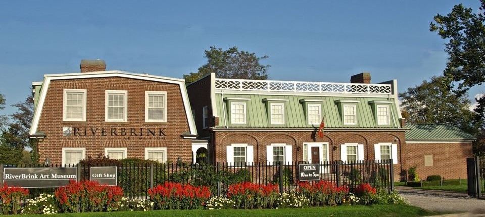
- RiverBrink Art Museum, Diane Pellicone, CC BY-SA 3.0
- Lewiston-Queenston Bridge, TwinsMetsFan, CC BY-SA 2.5
- CAM-exterior, Ewright76, CC BY-SA 4.0
- Brock’s Monument, Jesse Davis, CC BY-SA 3.0
Page built October 30, 2026. Spotted a mistake? Tell us or suggest a place.