




Lincoln Village, Ohio
Lincoln Village is a community of 8,928 people in Franklin County, Ohio.
Why visit Lincoln Village
Townapedia lists 4 museums and landmarks, 7 parks and trails, 48 places to eat and 2 places to stay in and around town.
Highlights include Camp Chase, Confederate Soldier Memorial and Georgesville Green Parkland.
July is the warmest month, with average highs of 85°F; January lows average 21°F.
Weather in Lincoln Village
Forecast from the National Weather Service. Full forecast
About Lincoln Village
Lincoln Village is a census-designated place (CDP) in Prairie Township, Franklin County, Ohio, United States. It is centered near the intersection of US 40 and I-270 on the west side of Columbus. As of the 2020 census, the population was 9,702.
From the Wikipedia article Lincoln Village, Ohio (this version), under CC BY-SA 4.0.
Museums and landmarks4
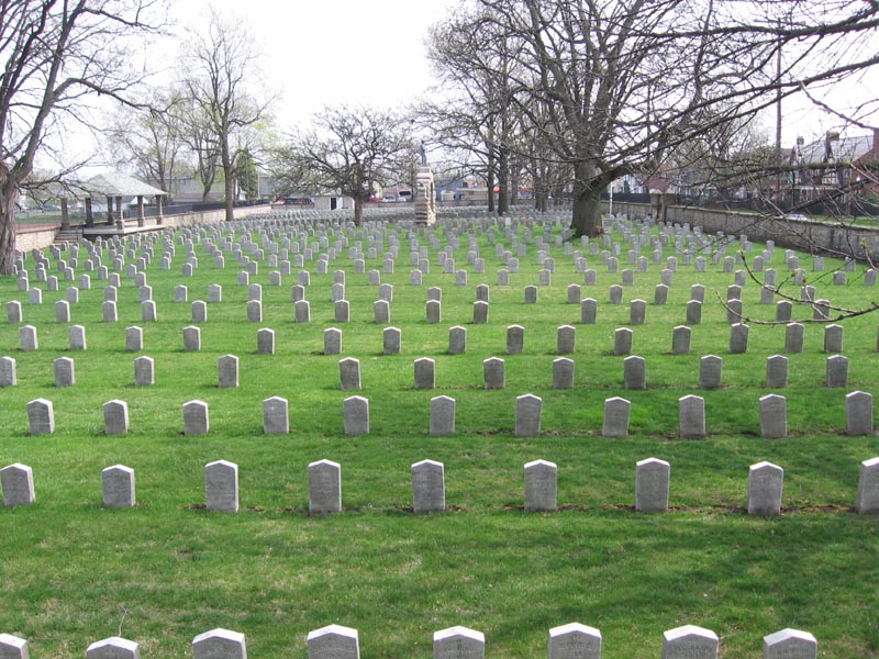
Camp Chase
Monument and historic site · National Register of Historic Places · 3.0 mi
Military camp in Columbus, Ohio, USA
Confederate Soldier Memorial
Monument and historic site · 3.0 mi
Monument in Columbus, Ohio, U.S.

Parks, trails and playgrounds7

Georgesville Green Parkland
Hiking and trails · 1.6 mi
945 Georgesville Road, Columbus
Mo-Su 07:00-23:00


Restaurants and cafes48


Tim Hortons
Cafe · Coffee Shop
4765 West Broad Street, Columbus
Mo-We 07:00-15:00; Fr-Sa 07:00-15:00; Su 06:00-16:00
Bubble & Crepe House
Cafe · Bubble Tea · 1.6 mi
5500 Hall Road, Columbus
11:00-24:00

3 Amigos Mexican Grill
Restaurant · Mexican · 1.0 mi
4182 West Broad Street, Columbus
Tu-Su 11:00-21:00

Mugsy's Pub And Patio
Bar and pub · 1.6 mi
1040 Hilliard-Rome Road, Columbus
Mo-Su 12:00-02:30
36 more on the map.
Where to stay2

History
Ohio Farm Bureau Federation President and CEO Murray Lincoln had aspired to create a suburban "village" since the early 1940s. Lincoln, as the head of what would become Nationwide Insurance from 1920 to 1948, initiated work on the Lincoln Village project in the early 1950s with the support of the U.S. Cooperative Movement. Lincoln was able to "sell" the Cooperative ideology to Ohio individual farmers, and viewed co-ops as "an answer to Communism in Europe and Asia, and as a balance wheel against unfettered private enterprise in the U.S." After founding several co-op and non co-op enterprises, Lincoln was able to fund the development of Lincoln Village with assets made from these corporations (which totaled $133,510,000). Lincoln's People's Development Corporation was formed to build Lincoln Village. The price of this project was about $30,000,000 USD.
From the History section of Lincoln Village, Ohio on Wikipedia, under CC BY-SA 4.0.
Churches and places of worship11
Shopping11
Gas and EV charging8
Schools, colleges and libraries48
Healthcare6
Fresenius Kidney Care Columbus Medical Partners
Clinic and pharmacy · 0.6 mi
4500 West Broad Street, Columbus
Map of Lincoln Village
145 places. The map loads OpenStreetMap tiles when you open it.
Climate by month
Monthly table
| Month | High | Low | Rain |
|---|---|---|---|
| Jan | 36°F | 21°F | 3.1 in |
| Feb | 40°F | 23°F | 2.6 in |
| Mar | 51°F | 31°F | 3.9 in |
| Apr | 64°F | 41°F | 4.0 in |
| May | 74°F | 51°F | 4.8 in |
| Jun | 82°F | 61°F | 4.7 in |
| Jul | 85°F | 65°F | 4.3 in |
| Aug | 84°F | 62°F | 3.8 in |
| Sep | 78°F | 55°F | 3.8 in |
| Oct | 66°F | 43°F | 3.2 in |
| Nov | 52°F | 33°F | 3.0 in |
| Dec | 41°F | 27°F | 3.4 in |
U.S. Climate Normals 1991-2020 for Columbus Wcmh (7 mi away), NOAA NCEI.
People and cost of living
American Community Survey 5-year estimates, 2020-2024, U.S. Census Bureau. Estimates have margins of error, larger for small towns.
Disaster history
Franklin County has had 15 federal disaster declarations since 2000, most often for severe storms.
- 2026-10-02: Severe Storms, Straight-Line Winds, Tornadoes, Flooding, And Landslides (Flood)
- 2020-03-31: Covid-19 Pandemic (Biological)
- 2020-03-13: Covid-19 (Biological)
- 2012-08-20: Severe Storms And Straight-Line Winds (Severe Storm)
- 2012-06-30: Severe Storms (Severe Storm)
- 2008-10-24: Severe Wind Storm Associated With Tropical Depression Ike (Severe Storm)
OpenFEMA disaster declarations summaries.
Getting there and nearby towns
Ohio State University Airport (OSU) is the nearest airport with scheduled flights listed in OpenStreetMap, 9 miles away.
- Urbancrest 4 mi southeast, about 7 min by car
- Lake Darby 5 mi west, about 8 min by car
- Grandview Heights 5 mi east, about 8 min by car
- Hilliard 6 mi north, about 9 min by car
- Upper Arlington 6 mi northeast, about 10 min by car
- Grove City 7 mi southeast, about 11 min by car
- Columbus 8 mi east, about 13 min by car
- West Jefferson 10 mi west, about 16 min by car
- Bexley 10 mi east, about 17 min by car
- Dublin 11 mi north, about 18 min by car
Drive times are estimates from straight-line distance, not routes.
Local news
Headlines from INDB, the NEMICO news database.
Reviews, tips and questions
Loading what members have shared...
Sources and licences
- NCES EDGE (Public domain): public schools
- NOAA NCEI U.S. Climate Normals 1991-2020 (Public domain): climate by month
- OpenFEMA (Public domain): disaster declarations
- OpenStreetMap contributors (ODbL 1.0): places, airports, map data
- U.S. Census Bureau (Public domain): population, income, housing, education, commute
- Wikidata (CC0 1.0): elevation, founding date, time zone, website, landmarks and historic places
- Wikimedia Commons (see each image): photos
- Wikipedia (CC BY-SA 4.0): overview and history text
Photo credits
- Doctors Hospital, Lincoln Village, Nyttend, Public domain
- Camp chase 1, User Georgeccampbell on en.wikipedia, Public domain
- Camp chase 2, The original uploader was Georgeccampbell at English Wikipedia ., Public domain
- Columbus Ohio Temple (cropped), Trödel, CC BY-SA 2.5
- Doctors Hospital from the Southwest 1, Sixflashphoto, CC BY-SA 4.0
- OhioHealth - Doctors Hospital 1, Sixflashphoto, CC BY-SA 4.0
- Broad Street in New Rome, Nyttend, Public domain
- Prairie Township Administrative Center 1, Sixflashphoto, CC BY-SA 4.0
- New Rome houses on West Street, Nyttend, Public domain
- Westland Mall Columbus, OH March 2017 (33612313596), Mike Kalasnik from Charlotte, USA, CC BY-SA 2.0
- York Steakhouse, Mike Kalasnik, CC BY-SA 2.0
- Hollywood Casino Columbus Front 1, Sixflashphoto, CC BY-SA 4.0
- Hollywood Casino Columbus Front 2, Sixflashphoto, CC BY-SA 4.0
- Hollywood Casino Columbus Garage 1, Sixflashphoto, CC BY-SA 4.0
- MarkWahlbergChevrolet, Jgera5, CC0


Page built October 30, 2026. Spotted a mistake? Tell us or suggest a place.