

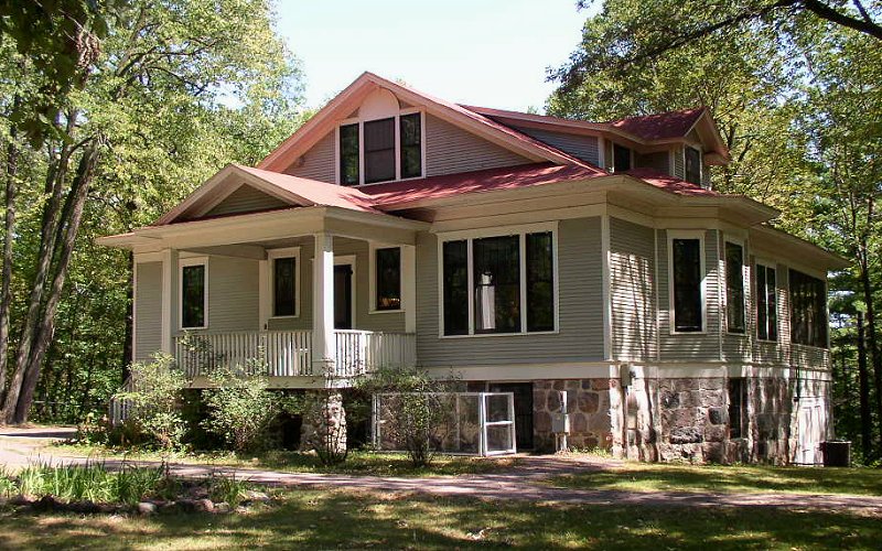


Little Falls, Minnesota
Little Falls is a city of 9,121 people in Morrison County, Minnesota, founded in 1848.
Why visit Little Falls
Townapedia lists 12 museums and landmarks, 6 parks and trails, 9 places to eat, 4 places to stay and 3 attractions in and around town.
Highlights include Broadway Bridge, Falls Cinema, Charles A. Lindbergh State Park and Burton-Rosenmeier House.
July is the warmest month, with average highs of 85°F; January lows average 4°F, and about 53 inches of snow fall in a normal year.
Weather in Little Falls
Forecast from the National Weather Service. Full forecast
About Little Falls
Little Falls is a city and the county seat of Morrison County, Minnesota, United States, near the geographic center of the state. The population was 9,140 as of the 2020 census, and was estimated at 9,277 in 2025. Little Falls was the boyhood home of noted aviator Charles Lindbergh. Just across from his former home is Charles A.
From the Wikipedia article Little Falls, Minnesota (this version), under CC BY-SA 4.0.
Things to do3



Museums and landmarks12
Charles A. Lindbergh State Park
Monument and historic site · National Register of Historic Places · 2.8 mi
State park in Morrison County, Minnesota, United States
1615 Lindbergh Drive Southwest, Little Falls

Burton-Rosenmeier House
Monument and historic site · National Register of Historic Places · 1.3 mi
Historic house in Little Falls, Minnesota

Charles A. Weyerhaeuser and Musser Houses
Monument and historic site · National Register of Historic Places · 1.3 mi
Historic houses in Minnesota, United States

Little Falls Commercial Historic District
Monument and historic site · National Register of Historic Places · 0.9 mi
Historic district in Minnesota, United States

Little Falls Public Library
Monument and historic site · National Register of Historic Places · 0.8 mi
Public library in Little Falls, Minnesota, USA

Morrison County Courthouse
Monument and historic site · National Register of Historic Places · 0.9 mi
County courthouse in Little Falls, United States of America

Northern Pacific Railway Depot (Little Falls, Minnesota)
Monument and historic site · National Register of Historic Places · 1.0 mi
Railway station in Little Falls, the United States of America

Our Lady of the Angels Academy
Monument and historic site · National Register of Historic Places · 3.3 mi
Historic building in Little Falls, Minnesota, United States

Pine Tree Lumber Company Office Building
Monument and historic site · National Register of Historic Places
Office building in Little Falls, United States of America


Charles A. Weyerhaeuser Memorial Museum
Museum · 2.9 mi
Museum in Little Falls, Minnesota

Parks, trails and playgrounds6

Restaurants and cafes9




Burger King
Fast food · Burger · 1.0 mi
1112 1st Avenue Northeast, Little Falls
Mo-Sa 06:00-22:00; Su 07:00-22:00
Taco Bell
Fast food · Tex-Mex · 1.2 mi
105 Lemieur Street, Little Falls
Mo-Th 07:00-01:00; Fr-Sa 07:00-02:00; Su 07:00-01:00
History
The town developed at falls on the Mississippi River and was named after them. Several different dams have been built over the falls during the town's history, some of which powered sawmills in the 19th century. Today, the Little Falls Dam is a hydroelectric station that generates power for the surrounding area.
According to the obituary of the Ojibwe war chief Mou-zoo-mau-nee, the people of Little Falls asked the Ojibwe for protection in 1862 during the Sioux Uprising. The Ojibwe sent 150 warriors.
From the History section of Little Falls, Minnesota on Wikipedia, under CC BY-SA 4.0.
Where to stay4
Country Inn & Suites, Little Falls, MN
Motel and hotel · 1.1 mi
209 16th Street Northeast, Little Falls
Churches and places of worship3
Church of Our Savior-Episcopal
Church · National Register of Historic Places · 0.8 mi
First Lutheran Church
Church · Lutheran · 0.7 mi
2100 Riverview Drive, Little Falls
Shopping3
Gas and EV charging3
Schools, colleges and libraries13
Little Falls Continuing Education
School · 1.0 mi
14800 Riverwood Drive, Little Falls
Mid State Ed Dist Steps Trans. Prog
School · 1.1 mi
15770 18Th Street Ne, Little Falls
Healthcare1
Map of Little Falls
57 places. The map loads OpenStreetMap tiles when you open it.
Climate by month
Monthly table
| Month | High | Low | Rain | Snow |
|---|---|---|---|---|
| Jan | 24°F | 4°F | 0.8 in | 9.5 in |
| Feb | 29°F | 7°F | 0.7 in | 9.7 in |
| Mar | 42°F | 20°F | 1.3 in | 8.5 in |
| Apr | 58°F | 33°F | 2.3 in | 4.1 in |
| May | 71°F | 45°F | 3.3 in | 0.0 in |
| Jun | 80°F | 55°F | 4.3 in | 0.0 in |
| Jul | 85°F | 60°F | 3.7 in | 0.0 in |
| Aug | 82°F | 58°F | 3.2 in | 0.0 in |
| Sep | 74°F | 50°F | 3.0 in | 0.0 in |
| Oct | 59°F | 37°F | 2.5 in | 0.9 in |
| Nov | 42°F | 23°F | 1.3 in | 8.2 in |
| Dec | 28°F | 10°F | 0.9 in | 11.9 in |
U.S. Climate Normals 1991-2020 for Little Falls 2Nne (1 mi away), NOAA NCEI.
People and cost of living
American Community Survey 5-year estimates, 2020-2024, U.S. Census Bureau. Estimates have margins of error, larger for small towns.
Disaster history
Morrison County has had 8 federal disaster declarations since 2000, most often for floods.
- 2023-07-19: Severe Storms And Flooding (Flood)
- 2022-07-08: Severe Storms, Straight-Line Winds, Tornadoes, And Flooding (Severe Storm)
- 2020-04-07: Covid-19 Pandemic (Biological)
- 2020-03-13: Covid-19 (Biological)
- 2013-07-25: Severe Storms, Straight-Line Winds, And Flooding (Severe Storm)
- 2005-09-13: Hurricane Katrina Evacuation (Hurricane)
OpenFEMA disaster declarations summaries.
Getting there and nearby towns
Brainerd Lakes Regional Airport (BRD) is the nearest airport with scheduled flights listed in OpenStreetMap, 30 miles away.
- Baxter 25 mi north, about 40 min by car
- Sartell 26 mi south, about 43 min by car
- Brainerd 26 mi north, about 43 min by car
- Albany 27 mi south, about 43 min by car
- Sauk Rapids 29 mi south, about 46 min by car
- Foley 31 mi southeast, about 50 min by car
- St. Cloud 33 mi south, about 53 min by car
- Cold Spring 37 mi south, about 59 min by car
- Crosby 40 mi northeast, about 1 h by car
- Breezy Point 44 mi north, about 1 h 15 min by car
Drive times are estimates from straight-line distance, not routes.
Local news
Headlines from INDB, the NEMICO news database.
Reviews, tips and questions
Loading what members have shared...
Sources and licences
- NCES EDGE (Public domain): public schools
- NOAA NCEI U.S. Climate Normals 1991-2020 (Public domain): climate by month
- OpenFEMA (Public domain): disaster declarations
- OpenStreetMap contributors (ODbL 1.0): places, airports, map data
- U.S. Census Bureau (Public domain): population, income, housing, education, commute
- Wikidata (CC0 1.0): elevation, founding date, time zone, website, landmarks and historic places
- Wikimedia Commons (see each image): photos
- Wikipedia (CC BY-SA 4.0): overview and history text
Photo credits
- Downtownacrossriver008, Dustin Simmonds at English Wikipedia, CC BY-SA 3.0
- CharlesLindberghHouse, McGhiever, CC BY-SA 3.0
- Burton-Rosenmeier House, McGhiever, CC BY-SA 3.0
- Church of Our Savior, Little Falls, McGhiever, CC BY-SA 4.0
- Our Lady of the Angels Academy, McGhiever, CC BY-SA 3.0
- Little Falls Commercial HD, McGhiever, CC BY-SA 4.0
- Little Falls Carnegie Library original building, Tom Reedy, CC BY-SA 3.0
- Linden Hill Historic Estate, McGhiever, CC BY-SA 4.0
- Morrison Co Courthouse 1, Elkman, CC BY-SA 3.0
- Little Falls Depot, McGhiever, CC BY-SA 4.0
- Pine Tree Lumber Company Office Building, McGhiever, CC BY-SA 3.0
- Charles A. Weyerhaeuser Memorial Museum, McGhiever, CC BY-SA 4.0
Page built October 30, 2026. Spotted a mistake? Tell us or suggest a place.