




Lomita, California
Lomita is a city of 20,225 people in Los Angeles County, California, founded in 1964.
Why visit Lomita
Townapedia lists 11 museums and landmarks, 13 parks and trails, 144 places to eat, 4 places to stay and 2 attractions in and around town.
Highlights include AMC Rolling Hills 20, Auditorium (Torrance High School), Banning House and Ken Malloy Harbor Regional Park.
August is the warmest month, with average highs of 78°F; December lows average 46°F.
Weather in Lomita
Forecast from the National Weather Service. Full forecast
About Lomita
Lomita (Spanish for "Little hill") is a city in Los Angeles County, California, United States. The population was 20,921 at the 2020 census, up slightly from 20,256 at the 2010 census.
From the Wikipedia article Lomita, California (this version), under CC BY-SA 4.0.
Things to do2

Museums and landmarks11

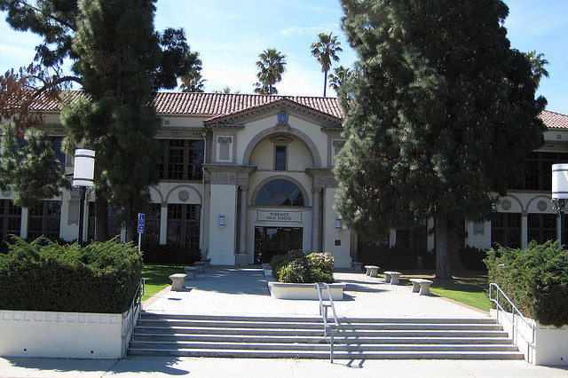
Auditorium (Torrance High School)
Monument and historic site · National Register of Historic Places · 2.5 mi
Event venue in Torrance, United States of America

Banning House
Monument and historic site · National Register of Historic Places · 3.5 mi
Historic house in Los Angeles, California

Fern Elementary School
Monument and historic site · National Register of Historic Places · 3.0 mi
Public elementary school in Torrance, California, United States

Home Economics Building
Monument and historic site · National Register of Historic Places · 2.6 mi
Torrance, California, listed on the NRHP in Los Angeles County, California
Main Building
Monument and historic site · National Register of Historic Places · 2.6 mi
Building in California, United States


Pacific Electric Railroad Bridge
Bridge · National Register of Historic Places · 3.1 mi
Railway bridge in Torrance, California, United States
Torrance School
Monument and historic site · National Register of Historic Places · 2.4 mi
School building in California, United States of America

Wilmington Branch
Monument and historic site · National Register of Historic Places · 3.1 mi
Former public library in Wilmington, Los Angeles, built in 1927

Lomita Railroad Museum
Museum · 0.4 mi
Railroad museum in Lomita, California
2137 250th Street
Fr-Su 10:00-17:00; Mo-Th off; PH off
George F. Canyon Nature Center
Museum · 1.6 mi
Fr 13:00-16:00; Sa,Su 10:00-15:30; Mo-Th off
Parks, trails and playgrounds13

Ken Malloy Harbor Regional Park
Park · 1.4 mi
Park in Los Angeles County, California, United States of America

Rolling Hills Country Club
Golf course · 1.1 mi
18 hole Par 70
27000 Palos Verdes Drive East, Rolling Hills Estates

1 more on the map.
Restaurants and cafes144

Hof's Hut
Restaurant · American, Burger, Breakfast, Bakery, Cake, Ice Cream, Pancake, Chicken, Fried Chicken, Pizza, Sandwich, Mexican, Wings, Fries, Salad, Soup, Chili, Seafood, Pasta, Steak · 1.3 mi
Family-owned chain restaurant serving a variety of dishes, baked goods, and drinks.
23635 Crenshaw Boulevard, Torrance
Su-Th 07:00-21:00; Fr-Sa 07:00-22:00; PH open "Except Christmas Day"
Bites & Bashes Cafe
Restaurant · American, Asian, Breakfast, Korean, Sandwich
25600 Narbonne Avenue
Tu-Sa 08:00-15:00; Su 08:00-14:00

Cara Mia
Cafe · Bakery, Coffee Shop · 0.7 mi
2213 Lomita Boulevard
Mo-Fr 07:00-15:00; Sa 08:00-13:00; Su off
Cream Pan
Cafe · Coffee Shop, Sandwich, Japanese, Tea, Dessert, Curry, Pastry, Bakery, Juice · 0.9 mi
24020 Narbonne Avenue, Lomita
05:00-19:00
Hot N Tot
Restaurant · American, Breakfast, Diner · 0.5 mi
2347 Pacific Coast Highway
Mo-Su 07:00-15:00
Peet's Coffee
Cafe · Coffee Shop · 0.8 mi
2649 Pacific Coast Highway, Torrance
Mo-Fr 05:30-18:00; Sa,Su 06:00-18:00
Starbucks
Cafe · Coffee Shop · 1.1 mi
24427 Crenshaw Boulevard, Torrance
Mo-Fr 04:30-20:00; Sa,Su 04:30-19:00
Suki Time Thai Kitchen
Restaurant · Thai · 0.8 mi
2271 Lomita Boulevard
Tu-Fr 11:00-14:00, 16:00-20:00; Sa-Su 12:00-14:30, 16:00-20:30
Tacos Super Gallito
Restaurant · Mexican · 1.6 mi
843 West Pacific Coast Highway, Harbor City
Mo-Su 07:00-03:00
132 more on the map.
History
The Spanish Empire had expanded into this area when the Viceroy of New Spain commissioned Juan Rodríguez Cabrillo to explore the Pacific Ocean in 1542–1543. In 1767, the area became part of the Province of the Californias (Spanish: Provincia de las Californias).
In 1784, the Spanish Crown deeded Rancho San Pedro, a tract of over 75,000 acres (300 km2), to soldier Juan José Domínguez. The rancho changed in size over the years, as Domínguez's descendants partitioned the land amongst family members, sold parcels to newly arriving settlers, or relinquished some when validating their legal claim with the Mexican government in 1828, and with the United States government in 1858. The Domínguez family name is still applied throughout the area, including the Dominguez Rancho Adobe historical landmark, in the unincorporated community of Rancho Dominguez, located northeast of Lomita.
Lomita was incorporated as a city on June 30, 1964, to prevent further annexation by neighboring cities and in an attempt to curtail the development of high-rise apartment buildings.
Lomita established a sister city relationship with Takaishi, Osaka, Japan, in October 1981.
From the History section of Lomita, California on Wikipedia, under CC BY-SA 4.0.
Where to stay4
Rodeway Inn & Suites Pacific Coast Highway
Motel and hotel · 0.7 mi
1665 Pacific Coast Highway, Harbor City
Churches and places of worship21
Torrance Baptist Temple
Church · Baptist · 1.3 mi
2077 West 236th Street, Torrance
Vietnamese Alliance Church
Church · Christian And Missionary Alliance · 1.3 mi
2051 West 236th Street, Torrance
Shopping18
Gas and EV charging8
Schools, colleges and libraries57
Healthcare12
South Bay Pain and Wellness
Clinic and pharmacy · 0.7 mi
2583 Pacific Coast Highway
Map of Lomita
250 places. The map loads OpenStreetMap tiles when you open it.
Climate by month
Monthly table
| Month | High | Low | Rain | Snow |
|---|---|---|---|---|
| Jan | 67°F | 47°F | 3.4 in | 0.0 in |
| Feb | 66°F | 48°F | 3.7 in | 0.0 in |
| Mar | 68°F | 50°F | 2.0 in | 0.0 in |
| Apr | 70°F | 52°F | 0.6 in | 0.0 in |
| May | 72°F | 55°F | 0.3 in | 0.0 in |
| Jun | 74°F | 58°F | 0.1 in | 0.0 in |
| Jul | 77°F | 62°F | 0.1 in | 0.0 in |
| Aug | 78°F | 62°F | 0.0 in | 0.0 in |
| Sep | 78°F | 61°F | 0.1 in | 0.0 in |
| Oct | 76°F | 57°F | 0.5 in | 0.0 in |
| Nov | 71°F | 51°F | 0.8 in | 0.0 in |
| Dec | 66°F | 46°F | 2.2 in | 0.0 in |
U.S. Climate Normals 1991-2020 for Torrance Ap (1 mi away), NOAA NCEI.
People and cost of living
American Community Survey 5-year estimates, 2020-2024, U.S. Census Bureau. Estimates have margins of error, larger for small towns.
Disaster history
Los Angeles County has had 67 federal disaster declarations since 2000, most often for fires.
- 2025-08-08: Canyon Fire (Fire)
- 2025-01-08: Wildfires And Straight-Line Winds (Fire)
- 2025-01-08: Eaton Fire (Fire)
- 2025-01-08: Hurst Fire (Fire)
- 2025-01-07: Palisades Fire (Fire)
- 2024-12-10: Franklin Fire (Fire)
OpenFEMA disaster declarations summaries.
Getting there and nearby towns
Zamperini Field (TOA) is the nearest airport with scheduled flights listed in OpenStreetMap, 1 miles away.
- West Carson 2 mi northeast, about 4 min by car
- Torrance 3 mi northwest, about 5 min by car
- Rancho Palos Verdes 5 mi southwest, about 8 min by car
- Carson 5 mi northeast, about 8 min by car
- Redondo Beach 6 mi northwest, about 10 min by car
- Palos Verdes Estates 6 mi west, about 10 min by car
- Gardena 7 mi north, about 11 min by car
- Lawndale 7 mi north, about 11 min by car
- Hermosa Beach 7 mi northwest, about 12 min by car
- Long Beach 9 mi east, about 14 min by car
Drive times are estimates from straight-line distance, not routes.
Local news
Headlines from INDB, the NEMICO news database.
Reviews, tips and questions
Loading what members have shared...
Sources and licences
- NCES EDGE (Public domain): public schools
- NOAA NCEI U.S. Climate Normals 1991-2020 (Public domain): climate by month
- OpenFEMA (Public domain): disaster declarations
- OpenStreetMap contributors (ODbL 1.0): places, airports, map data
- U.S. Census Bureau (Public domain): population, income, housing, education, commute
- Wikidata (CC0 1.0): elevation, founding date, time zone, website, landmarks and historic places
- Wikimedia Commons (see each image): photos
- Wikipedia (CC BY-SA 4.0): overview and history text
Photo credits
- Lomita Railroad Museum, Lomita, CC BY-SA 3.0
- THS HomeEc, Original uploader was Alton at en.wikipedia, CC BY-SA 3.0
- Torrance High School entrance, LCfam, CC BY-SA 3.0
- Pacific Electric Railroad Bridge (Torrance), Los Angeles, CC BY-SA 3.0
- Banning House, Wilmington, California, Los Angeles, CC BY-SA 3.0
- THS facade, the 216, CC BY 2.0
- 2010-1101-FernAveSchool, Bobak Ha'Eri, CC BY 3.0
- Torrance High School Assembly Hall, Los Angeles, CC BY-SA 3.0
Page built October 30, 2026. Spotted a mistake? Tell us or suggest a place.