


Manitou Springs, Colorado
Manitou Springs is a city of 4,735 people in El Paso County, Colorado, founded in 1888.
Why visit Manitou Springs
Townapedia lists 35 museums and landmarks, 20 parks and trails, 43 places to eat, 24 places to stay and 10 attractions in and around town.
Highlights include Rainbow Falls, Bridge over Fountain Creek, Miramont Castle and Barker House.
July is the warmest month, with average highs of 74°F; January lows average 13°F, and about 134 inches of snow fall in a normal year.
Weather in Manitou Springs
Forecast from the National Weather Service. Full forecast
About Manitou Springs
Manitou Springs is a home rule municipality located at the foot of Pikes Peak in western El Paso County, Colorado, United States. The town was founded for its natural mineral springs. The downtown area continues to be of interest to travelers, particularly in the summer, with many shops and restaurants, as well as a creekside city park. The main road through the center of town was one of the direct paths to the base of Pikes Peak.
From the Wikipedia article Manitou Springs, Colorado (this version), under CC BY-SA 4.0.
Things to do10

Rainbow Falls
Waterfall · 1.1 mi
Waterfall in Manitou Springs, Colorado, United States



Museums and landmarks35

Miramont Castle
Museum · National Register of Historic Places · 0.5 mi
On the National Register of Historic places. Now a museum.
9 Capitol Hill Avenue

Barker House
Monument and historic site · National Register of Historic Places
Historic building in Manitou Springs, Colorado, United States
819 Manitou Avenue, Manitou Springs

Manitou Cliff Dwellings
Monument and historic site · 0.4 mi
Archaeological museum in Manitou Springs, Colorado
May-Aug 09:00-18:00; Mar-Apr, Sep-Oct 09:00-17:00; Nov...

Briarhurst
Monument and historic site · National Register of Historic Places · 0.6 mi
Historic house in Colorado, United States

City Hall of Old Colorado City
Monument and historic site · National Register of Historic Places · 2.4 mi
Rathaus in Colorado, United States of America

Cliff House
Monument and historic site · National Register of Historic Places
Hotel in Manitou Springs, United States

Crystal Valley Cemetery
Monument and historic site · National Register of Historic Places · 0.7 mi
United States historic place in Manitou Springs, Colorado

Glen Eyrie
Monument and historic site · National Register of Historic Places · 2.8 mi
Castle near Colorado Springs, Colorado

Keithley Log Cabin Development District
Monument and historic site · National Register of Historic Places · 0.7 mi
Historic district in Colorado, United States

Manitou Bathhouse
Monument and historic site · National Register of Historic Places
934 Manitou Avenue, Manitou Springs

Manitou Springs Bridges
Bridge · National Register of Historic Places
Bridge in United States of America

Manitou Springs Historic District
Monument and historic site · National Register of Historic Places · 0.4 mi
Historic district in Colorado, United States
23 more on the map.
Parks, trails and playgrounds20

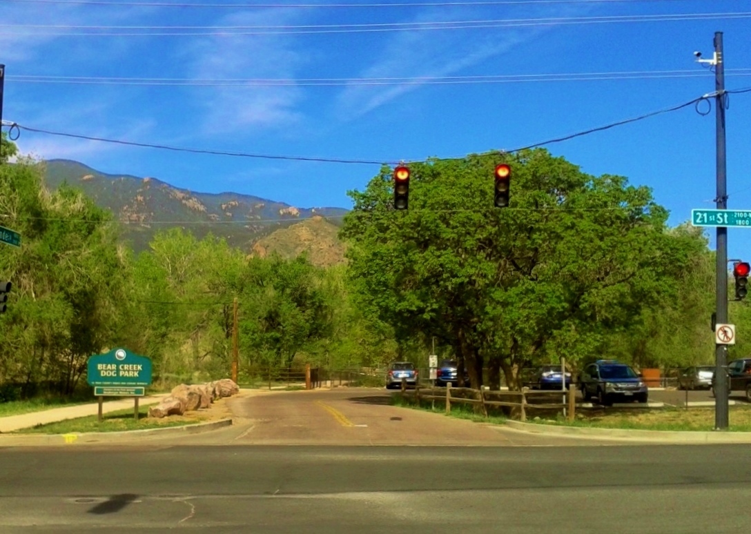


Bear Creek Regional Park and Nature Center
Park · 3.7 mi
Park in Colorado Springs, Colorado


8 more on the map.
Restaurants and cafes43

Crystal Park Cantina
Restaurant · Mexican · 0.9 mi
178 Crystal Park Road, Manitou Springs
Tu-Su 11:00-21:00

Inclination Cafe
Cafe · American, Breakfast · 0.5 mi
124 Ruxton Avenue
Mo-Th 06:30-17:00; Fr-Sa 06:30-21:00; Su 07:00-17:00

Manitou Brewing Company
Bar and pub
725 Manitou Avenue, Manitou Springs
Mo-Th 14:00-20:00; Fr,Sa 12:00-21:00; Su 12:00-20:00
Mo's Diner
Restaurant · American, Breakfast · 1.1 mi
108 Manitou Avenue, Manitou Springs
Tu-Su 07:00-16:00
Red Dog Coffee
Cafe · Coffee Shop, American
739 Manitou Avenue, Manitou Springs
Mo-Th 07:00-18:00; Fr-Su 07:00-19:00

Sahara Cafe
Restaurant · Mediterranean
954 Manitou Avenue, Manitou Springs
Mo-Su 10:00-22:00
31 more on the map.
History
General William Jackson Palmer and Dr. William Abraham Bell founded Manitou Springs in 1872, intending the town to be a "scenic health resort". Bell's home, Briarhurst Manor, is open to the public as a fine dining restaurant, which is listed on the National Register of Historic places. In 1876, the town was incorporated. "Manitou Springs has been the quintessential tourist town since the 1870s, when visitors discovered the healing waters the Ute Indians had been drinking for years. Many of the town's mineral springs still function today and the water is free."
From the History section of Manitou Springs, Colorado on Wikipedia, under CC BY-SA 4.0.
Where to stay24
Holiday Inn Express & Suites - Manitou Springs
Motel and hotel · 1.1 mi
114 Manitou Avenue, Manitou Springs
Agate Hill B&B Cottages
Motel and hotel · 0.4 mi
103 Cave Avenue, Manitou Springs
Churches and places of worship4
First Congregational Church
Church · National Register of Historic Places
Our Lady of Perpetual Help Catholic Church
Church · Roman Catholic · 0.6 mi
218 Ruxton Avenue, Manitou Springs
Community Congregational Church, United Church of Christ
Church
103 Pawnee Avenue, Manitou Springs
Shopping41
Gas and EV charging2
Schools, colleges and libraries37
Academy For Advanced And Creative Learning
School · 4.1 mi
2510 North Chestnut Street, Colorado Springs
Bristol Elementary School
School · 4.3 mi
890 North Walnut Street, Colorado Springs
Buena Vista Elementary School
School · 4.2 mi
924 W Pikes Peak Ave, Colorado Springs
Canon Elementary School
School · 5.4 mi
1201 West Cheyenne Road, Colorado Springs
Cheyenne Mountain Junior High School
School · 5.3 mi
1200 West Cheyenne Road, Colorado Springs
Chipeta Elementary School
School · 4.1 mi
2340 Ramsgate Terrace, Colorado Springs
Colorado Early Colleges Colorado Springs
School · 5.0 mi
4405 North Chestnut St Suite D, Colorado Springs
Colorado International Language Academy
School · 5.9 mi
303 Austin Bluffs Parkway, Colorado Springs
Healthcare1
Map of Manitou Springs
217 places. The map loads OpenStreetMap tiles when you open it.
Climate by month
Monthly table
| Month | High | Low | Rain | Snow |
|---|---|---|---|---|
| Jan | 39°F | 13°F | 0.7 in | 12.5 in |
| Feb | 39°F | 14°F | 1.0 in | 13.6 in |
| Mar | 45°F | 20°F | 1.9 in | 26.2 in |
| Apr | 50°F | 26°F | 3.1 in | 32.3 in |
| May | 59°F | 33°F | 2.5 in | 9.6 in |
| Jun | 70°F | 42°F | 2.1 in | 0.4 in |
| Jul | 74°F | 46°F | 3.9 in | 0.0 in |
| Aug | 72°F | 45°F | 3.9 in | 0.0 in |
| Sep | 66°F | 39°F | 1.9 in | 1.8 in |
| Oct | 56°F | 30°F | 1.2 in | 10.4 in |
| Nov | 46°F | 20°F | 0.8 in | 12.6 in |
| Dec | 39°F | 13°F | 0.8 in | 14.1 in |
U.S. Climate Normals 1991-2020 for Ruxton Park (3 mi away), NOAA NCEI.
People and cost of living
American Community Survey 5-year estimates, 2020-2024, U.S. Census Bureau. Estimates have margins of error, larger for small towns.
Disaster history
El Paso County has had 14 federal disaster declarations since 2000, most often for fires.
- 2023-08-25: Severe Storms, Flooding, And Tornadoes (Flood)
- 2020-03-28: Covid-19 Pandemic (Biological)
- 2020-03-13: Covid-19 (Biological)
- 2015-07-16: Severe Storms, Tornadoes, Flooding, Landslides, And Mudslides (Flood)
- 2013-09-14: Severe Storms, Flooding, Landslides, And Mudslides (Flood)
- 2013-09-12: Severe Storms, Flooding, Landslides, And Mudslides (Flood)
OpenFEMA disaster declarations summaries.
Getting there and nearby towns
United States Air Force Academy Airfield (AFF) is the nearest airport with scheduled flights listed in OpenStreetMap, 9 miles away.
- Cascade-Chipita Park 7 mi northwest, about 12 min by car
- Colorado Springs 8 mi east, about 13 min by car
- Stratmoor 9 mi southeast, about 15 min by car
- Air Force Academy 10 mi north, about 16 min by car
- Cimarron Hills 11 mi east, about 18 min by car
- Woodland Park 12 mi northwest, about 20 min by car
- Security-Widefield 13 mi southeast, about 21 min by car
- Gleneagle 13 mi north, about 22 min by car
- Fort Carson 15 mi southeast, about 24 min by car
- Monument 15 mi north, about 25 min by car
Drive times are estimates from straight-line distance, not routes.
Local news
Headlines from INDB, the NEMICO news database.
Reviews, tips and questions
Loading what members have shared...
Sources and licences
- NCES EDGE (Public domain): public schools
- NOAA NCEI U.S. Climate Normals 1991-2020 (Public domain): climate by month
- OpenFEMA (Public domain): disaster declarations
- OpenStreetMap contributors (ODbL 1.0): places, airports, map data
- U.S. Census Bureau (Public domain): population, income, housing, education, commute
- Wikidata (CC0 1.0): elevation, founding date, time zone, website, landmarks and historic places
- Wikimedia Commons (see each image): photos
- Wikipedia (CC BY-SA 4.0): overview and history text
Photo credits
- Manitou Springs City Hall, Smallbones, Public domain
- Miramont (Manitou Springs, Colorado), Jeffrey Beall, CC BY-SA 3.0
- Manitou Cliff Dwelling2, Obiwan23 at English Wikipedia, Public domain
- Barker House Manitou, Smallbones, Public domain
- Rainbow Falls, Manitou Springs, CO, Ahodges7, CC BY-SA 3.0
- Glen Eyrie castle in, David Shankbone, CC BY 3.0
- Briarhurst Manor, ERoss99, CC BY-SA 3.0
- Manitou Springs Bridges, Jeffrey Beall, CC BY-SA 3.0
- City Hall of Colorado City, Jeffrey Beall, CC BY-SA 3.0
- Crystal Valley Cemetery, Jeffrey Beall, CC BY-SA 3.0
- Manitou Ave 700 block, Smallbones, Public domain
- First Congregational Church (Manitou Springs, Colorado), Jeffrey Beall, CC BY-SA 3.0
- 717 Manitou, Smallbones, Public domain
- Keithley Log Cabin Development District, ERoss99, CC BY-SA 3.0
- Stockbridge House Colorado Springs CO 1980, Dennis Graham, CC BY-SA 3.0
- Colorado City Business District, ERoss99, CC BY-SA 3.0
- Cliff House, Manitou Springs, CO, Suzie T from Raleigh, USA, CC BY 2.0
- Chambers Ranch 05, ERoss99, CC BY-SA 3.0
- Midland School, Jeffrey Beall, CC BY-SA 3.0
- Midland Terminal Railroad Roundhouse, Jeffrey Beall, CC BY-SA 3.0
- US Post Office-Manitou Springs Main, Jeffrey Beall, CC BY-SA 3.0
- The Spa, Manitou Springs, CaroleHenson, CC BY-SA 3.0
- Bridge Over Fountain Creek - Manitou Springs, CO, Patricia Gallardo, CC BY-SA 3.0
- Cave of the winds, Chris Lott from Fairbanks, USA, CC BY 2.0
- Bear Creek Cañon Park - Bear Creek, just off Bear Creek Road, CaroleHenson, CC BY-SA 3.0
- Bear Creek Regional Park - Bear Creek Dog Park 1, CaroleHenson, CC BY-SA 3.0


Page built October 30, 2026. Spotted a mistake? Tell us or suggest a place.