

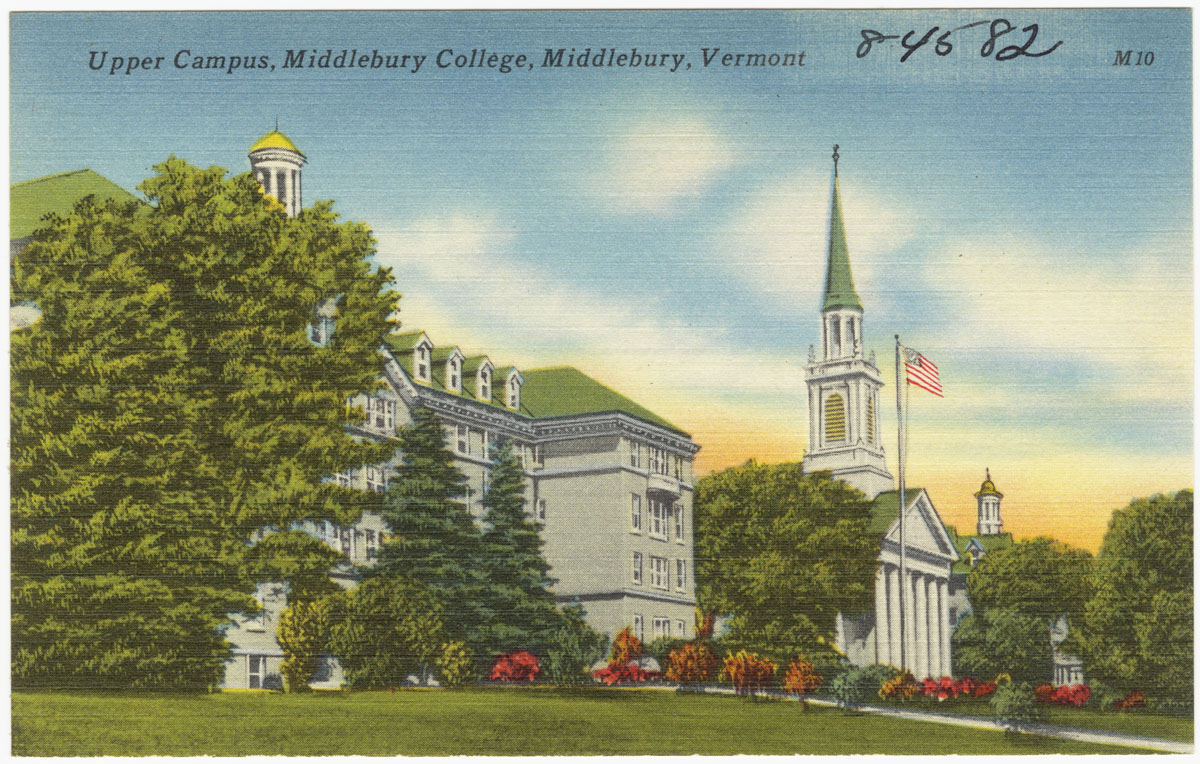


Middlebury, Vermont
Middlebury is a community of 7,220 people in Addison County, Vermont.
Why visit Middlebury
Townapedia lists 28 museums and landmarks, 15 parks and trails, 50 places to eat, 6 places to stay and 15 attractions in and around town.
Highlights include Halpin Covered Bridge, Pulp Mill Covered Bridge, Middlebury College Museum of Art and Bridge 26.
July is the warmest month, with average highs of 80°F; January lows average 9°F, and about 59 inches of snow fall in a normal year.
Weather in Middlebury
Forecast from the National Weather Service. Full forecast
About Middlebury
Middlebury is the main settlement in the town of Middlebury in Addison County, Vermont, United States, and a census-designated place (CDP). The population was 7,304 at the 2020 census, out of a total population of 9,152 in the town of Middlebury. Most of the village is listed on the National Register of Historic Places as the Middlebury Village Historic District.
From the Wikipedia article Middlebury (CDP), Vermont (this version), under CC BY-SA 4.0.
Things to do15

Halpin Covered Bridge
Bridge · National Register of Historic Places · 3.0 mi
Bridge in Middlebury, Vermont

Pulp Mill Covered Bridge
Bridge · National Register of Historic Places · 1.5 mi
Bridge in Middlebury, Vermont

Burnhams Maple Farm & Market
Farm and orchard · 1.2 mi
Maple Creemees, syrup, and gifts.
1124 U.S. Route 7 South, Middlebury
11:00-19:00


Kevin P. Mahaney '84 Center for the Arts
Cinema and theater · 0.9 mi
72 Porter Field Road, Middlebury
3 more on the map.
Museums and landmarks28

Middlebury College Museum of Art
Museum · 0.9 mi
72 Porter Field Road, Middlebury
Tu-Fr 10:00-17:00, Sa-Su 12:00-17:00, "closed for college holidays"

Bridge 26
Bridge · National Register of Historic Places · 4.9 mi
Historic bridge in Vermont, United States

Cornwall General Store
Monument and historic site · National Register of Historic Places · 4.1 mi
Building in Vermont, United States

Cornwall Town Hall
Monument and historic site · National Register of Historic Places · 4.1 mi
Rathaus in Vermont, United States of America

Cotton Free Library
Monument and historic site · National Register of Historic Places · 4.9 mi
Public library in Weybridge, Vermont

Emma Willard House
Monument and historic site · National Register of Historic Places · 0.9 mi
Historic house at 131 South Main Street in Middlebury, Vermont, United States

Fenn Farm
Monument and historic site · National Register of Historic Places · 3.3 mi
Multifamily residential in Vermont, United States of America

First Congregational Church of Cornwall Parsonage
Monument and historic site · National Register of Historic Places · 4.2 mi
Building in Vermont, United States
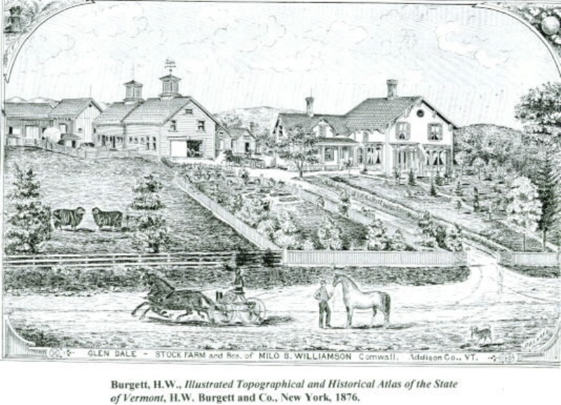
Glen Dale Farm
Monument and historic site · National Register of Historic Places · 2.6 mi
Human settlement in Cornwall, Vermont, United States of America

Middlebury Gorge Concrete Arch Bridge
Monument and historic site · National Register of Historic Places · 4.4 mi
Building in Vermont, United States

Old Stone Blacksmith Shop
Monument and historic site · National Register of Historic Places · 3.2 mi
Building in Vermont, United States


Shard Villa
Monument and historic site · National Register of Historic Places · 4.7 mi
Historic house in Vermont, United States
16 more on the map.
Parks, trails and playgrounds15

Champlain-Adirondak
Park · 3.1 mi
Biosphere reserve in United States Of America | designated in 1986



Memorial Sports Center
Sports field and stadium · 0.4 mi
296 Buttolph Drive, Middlebury
3 more on the map.
Restaurants and cafes50

7 South Sandwich Company
Restaurant · Sandwich · 1.5 mi
1396 U.S. Route 7 South, Middlebury
Mo-Sa 07:00-15:00
Fire & Ice
Restaurant · Steak House · 0.9 mi
26 Seymour Street, Middlebury
Mo-Fr 16:00-20:00, Sa-Su 12:00-20:00
Grapevine Grille
Restaurant · Sandwich · 0.7 mi
610 US Route 7 South, Middlebury
Mo-We 11:00-17:00; Th-Sa 11:00-19:00; Su 12:00-17:00

Haymaker Bun Company
Cafe · Coffee Shop, Bakery · 0.6 mi
7 Bakery Lane, Middlebury
Mo-Fr 07:30-14:00; Sa-Su 08:00-14:00
Juice Amour
Restaurant · Juice, Salad · 0.7 mi
16 Merchant's Row, Middlebury
Mo-Fr 08:00-17:00; Sa 09:00-17:00; Su 10:00-16:00
Marquis Southwest Cafe
Restaurant · Tacos, Tex-Mex, Burrito · 0.7 mi
65 Main Street, Middlebury
We 17:00-20:30; Th-Sa 12:00-20:30; Su 12:00-18:30
Mister Up's Restaurant & Pub
Restaurant · Grill · 0.6 mi
25 Bakery Lane, Middlebury
Fr, Sa 11:30-22:00; Tu-Th 11:30-21:00
38 more on the map.
History
The village of Middlebury grew as one of Addison County's early industrial centers, due to the presence of a significant waterfall on Otter Creek. The area around the falls developed as the center of industry, with mills lining the river in the Frog Hollow area (Mill Street), where the 1840 Stone Mill is one of the only survivors of that past. It also became a major stop on north–south stagecoach routes, running between Burlington and Rutland. The town green is located directly on this historic route (now United States Route 7), and features important examples of civic and religious architecture. The local Congregational Church, built 1806–09, is the oldest in the county, and is a fine example of Federal period architecture. Also impressive are the Middlebury Inn, built 1826 and restyled later in the 19th and early 20th centuries. Middlebury College was founded in 1800, and its campus is located just southwest of the village center. Another important educational milestone was the 1814 founding by Emma Willard of a private school for women, located in her house on South Main Street. Much of the village was listed on the National Register of Historic Places in 1976, with a significant enlargement in 1980.
From the History section of Middlebury (CDP), Vermont on Wikipedia, under CC BY-SA 4.0.
Where to stay6
Middlebury Sweets Motel
Motel and hotel · 1.4 mi
1395 U.S. Route 7 South, Middlebury
Churches and places of worship11
Brooksville Advent Church
Church · National Register of Historic Places · 4.0 mi
Wesleyan Methodist Church
Church · National Register of Historic Places · 4.9 mi
Memorial Baptist Church - (American Baptist)
Church · Baptist · 0.5 mi
97 South Pleasant Street, Middlebury
Saint Mary's Church
Church · Roman Catholic · 0.9 mi
292 College Street, Middlebury
United Methodist Church
Church · Methodist · 0.8 mi
43 North Pleasant Street, Middlebury
Shopping21
Gas and EV charging6
Schools, colleges and libraries18
Healthcare6
Map of Middlebury
176 places. The map loads OpenStreetMap tiles when you open it.
Climate by month
Monthly table
| Month | High | Low | Rain | Snow |
|---|---|---|---|---|
| Jan | 27°F | 9°F | 2.5 in | 13.3 in |
| Feb | 30°F | 10°F | 2.1 in | 13.3 in |
| Mar | 40°F | 20°F | 2.4 in | 11.9 in |
| Apr | 54°F | 33°F | 3.4 in | 2.6 in |
| May | 67°F | 45°F | 3.4 in | 0.0 in |
| Jun | 76°F | 54°F | 4.2 in | 0.0 in |
| Jul | 80°F | 60°F | 4.1 in | 0.0 in |
| Aug | 79°F | 57°F | 3.5 in | 0.0 in |
| Sep | 71°F | 49°F | 3.2 in | 0.0 in |
| Oct | 57°F | 38°F | 4.0 in | 0.3 in |
| Nov | 44°F | 28°F | 2.9 in | 3.8 in |
| Dec | 33°F | 18°F | 3.0 in | 13.4 in |
U.S. Climate Normals 1991-2020 for Cornwall Hcn (4 mi away), NOAA NCEI.
People and cost of living
American Community Survey 5-year estimates, 2020-2024, U.S. Census Bureau. Estimates have margins of error, larger for small towns.
Disaster history
Addison County has had 22 federal disaster declarations since 2000, most often for severe storms.
- 2024-08-20: Severe Storm, Flooding, Landslides, And Mudslides (Severe Storm)
- 2024-08-08: Tropical Depression Debby (Tropical Storm)
- 2023-10-06: Severe Storms And Flooding (Flood)
- 2023-07-14: Severe Storms, Flooding, Landslides, And Mudslides (Flood)
- 2023-07-10: Flooding (Flood)
- 2021-08-22: Tropical Storm Henri (Hurricane)
OpenFEMA disaster declarations summaries.
Getting there and nearby towns
Patrick Leahy Burlington International Airport (BTV) is the nearest airport with scheduled flights listed in OpenStreetMap, 32 miles away.
- Bristol 10 mi north, about 15 min by car
- Brandon 14 mi south, about 23 min by car
- Port Henry 15 mi west, about 25 min by car
- Ticonderoga 17 mi southwest, about 28 min by car
- Mineville 19 mi west, about 31 min by car
- Castleton 28 mi south, about 45 min by car
- Rutland 29 mi south, about 47 min by car
- Fair Haven 29 mi south, about 47 min by car
- South Burlington 30 mi north, about 48 min by car
- Burlington 34 mi north, about 54 min by car
Drive times are estimates from straight-line distance, not routes.
Local news
Headlines from INDB, the NEMICO news database.
Reviews, tips and questions
Loading what members have shared...
Sources and licences
- NCES EDGE (Public domain): public schools
- NOAA NCEI U.S. Climate Normals 1991-2020 (Public domain): climate by month
- OpenFEMA (Public domain): disaster declarations
- OpenStreetMap contributors (ODbL 1.0): places, airports, map data
- U.S. Census Bureau (Public domain): population, income, housing, education, commute
- Wikidata (CC0 1.0): elevation, founding date, time zone, website, landmarks and historic places
- Wikimedia Commons (see each image): photos
- Wikipedia (CC BY-SA 4.0): overview and history text
Photo credits
- Middlebury Village Historic District, Greenmountainboy, CC BY-SA 3.0
- Upper campus, Middlebury College, Middlebury, Vermont (2381079605), Boston Public Library, CC BY 2.0
- Lower Campus, Middlebury College, Middlebury, Vermont (2381911746), Boston Public Library, CC BY 2.0
- Mead Memorial Chapel, Middlebury College, Middlebury, Vermont (2381912960), Boston Public Library, CC BY 2.0
- Catholic church, Middlebury, Vermont (2381077251), Boston Public Library, CC BY 2.0
- Mead Memorial Chapel and Gifford Hall, Middlebury College, Middlebury, Vermont (2381076069), Boston Public Library, CC BY 2.0
- Old Chapel, Middlebury College, Middlebury, Vermont (2381909756), Boston Public Library, CC BY 2.0
- Battell South and Battell North, Middlebury College, Middlebury, Vermont (2381079217), Boston Public Library, CC BY 2.0
- Main Street and Congregational Church, Middlebury, Vermont (2381077619), Boston Public Library, CC BY 2.0
- Hepburn Hall, Middlebury College, Middlebury, Vermont (2381909366), Boston Public Library, CC BY 2.0
- Le Chateau, Middlebury College French School, Middlebury Vermont (2381911366), Boston Public Library, CC BY 2.0
- Memorial Field House, Middlebury College, Middlebury, Vermont (2381910942), Boston Public Library, CC BY 2.0
- Branbury Beach, Middlebury, Vermont (2381913334), Boston Public Library, CC BY 2.0
- Emma Hart Willard memorial and Congregational Church, Middlebury, Vermont, Kenneth C. Zirkel, CC BY-SA 4.0
- Emma Hart Willard memorial, Middlebury, Vermont, Kenneth C. Zirkel, CC BY-SA 4.0
- Middlebury Inn, Middlebury, Vermont, Kenneth C. Zirkel, CC BY-SA 4.0
- Civil War memorial, Middlebury, Vermont view, Kenneth C. Zirkel, CC BY-SA 4.0
- National Bank of Middlebury, Vermont, Kenneth C. Zirkel, CC BY-SA 4.0
- Congregational Church, Middlebury, Vermont, Kenneth C. Zirkel, CC BY-SA 4.0
- HalpinBridge, Steven Bergeron Srbergeron ( talk ), CC BY 3.0
- McCardellBicentennialHall, PenelopeIsMe, CC BY-SA 3.0
- Pulpmillbridge EB 20150613, Niranjan Arminius, CC BY-SA 4.0
- Cornwall, Vermont Town Hall, Greenmountainboy, CC BY-SA 3.0
- Bridge 26 Weybridge - New Haven Vermont, Ron Payne, CC BY-SA 3.0
- MiddleburyVT FennFarm, Magicpiano, CC BY-SA 3.0
- Brooksville Advent Church New Haven Vermont, Ron Payne, CC BY-SA 3.0
- Middlebury Gorge Concrete Arch Bridge from the south, NRavenel, CC BY-SA 3.0
- Waybury Inn from the southwest, NRavenel, CC BY-SA 3.0
- Glen Dale, Packard, Public domain
- CornwallVT FirstCongregationalChurchParsonage, Magicpiano, CC BY-SA 3.0
- Cornwall, Vermont Blacksmith Shop, Greenmountainboy, CC BY-SA 3.0
- Cornwall, Vermont general store, Greenmountainboy, CC BY-SA 3.0
- University of Vermont Morgan Horse Farm 2012-10-18 20-19-37, Greenmountainboy, CC BY-SA 3.0
- Weybridge Town Hall, Jonathan Leo Connor, CC BY-SA 3.0
- SalisburyVT ShardVilla, Magicpiano, CC BY-SA 4.0
- TheHeights, Unknown author Unknown author, Public domain
- Cotton Free Library, Jonathan L. Connor, CC BY-SA 3.0
- EmmaWillardHouse, PenelopeIsMe, CC BY-SA 3.0
- Addison County Court House, Jonathan Connor, CC0
- Otter Creek winter, Rania al-Bahara, CC BY-SA 4.0


Page built October 30, 2026. Spotted a mistake? Tell us or suggest a place.