


Middletown, Connecticut
Middletown is a city of 47,958 people in Connecticut, founded in 1651.
Why visit Middletown
Townapedia lists 91 museums and landmarks, 87 parks and trails, 207 places to eat, 10 places to stay and 45 attractions in and around town.
Highlights include Middletown–Portland railroad bridge, Powder Ridge Ski Area, Arrawanna Bridge and Broad Street Historic District.
July is the warmest month, with average highs of 84°F; January lows average 19°F.
Weather in Middletown
Forecast from the National Weather Service. Full forecast
About Middletown
Middletown is a city in Middlesex County, Connecticut, United States, located along the Connecticut River, in the central part of the state, 16 miles (25.8 km) south of Hartford. Middletown is the largest city in the Lower Connecticut River Valley Planning Region. In 1650, it was incorporated by English settlers as a town under its original Native American name, Mattabeseck, after the local Wangunk village of the same name. They were among many tribes along the Atlantic coast who spoke Algonquian languages.
From the Wikipedia article Middletown, Connecticut (this version), under CC BY-SA 4.0.
Things to do45

Middletown–Portland railroad bridge
Bridge · 1.3 mi
Rail bridge in Connecticut, US

Powder Ridge Ski Area
Ski area · 5.3 mi
Ski area located in Middlefield, Connecticut

33 more on the map.
Museums and landmarks91

Arrawanna Bridge
Monument and historic site · National Register of Historic Places · 1.1 mi
Bridge in United States of America

Broad Street Historic District
Monument and historic site · National Register of Historic Places · 0.8 mi
Historic district in Connecticut, United States

Connecticut Valley Hospital
Monument and historic site · National Register of Historic Places · 1.4 mi
Hospital in Connecticut, United States

Highland Historic District
Monument and historic site · National Register of Historic Places · 4.4 mi
Human settlement in Connecticut, United States of America
Indian Hill Avenue Historic District
Monument and historic site · National Register of Historic Places · 3.8 mi
Historic district in Connecticut, United States

Metro South Historic District
Monument and historic site · National Register of Historic Places · 0.8 mi
Historic district in Middletown, Connecticut, United States
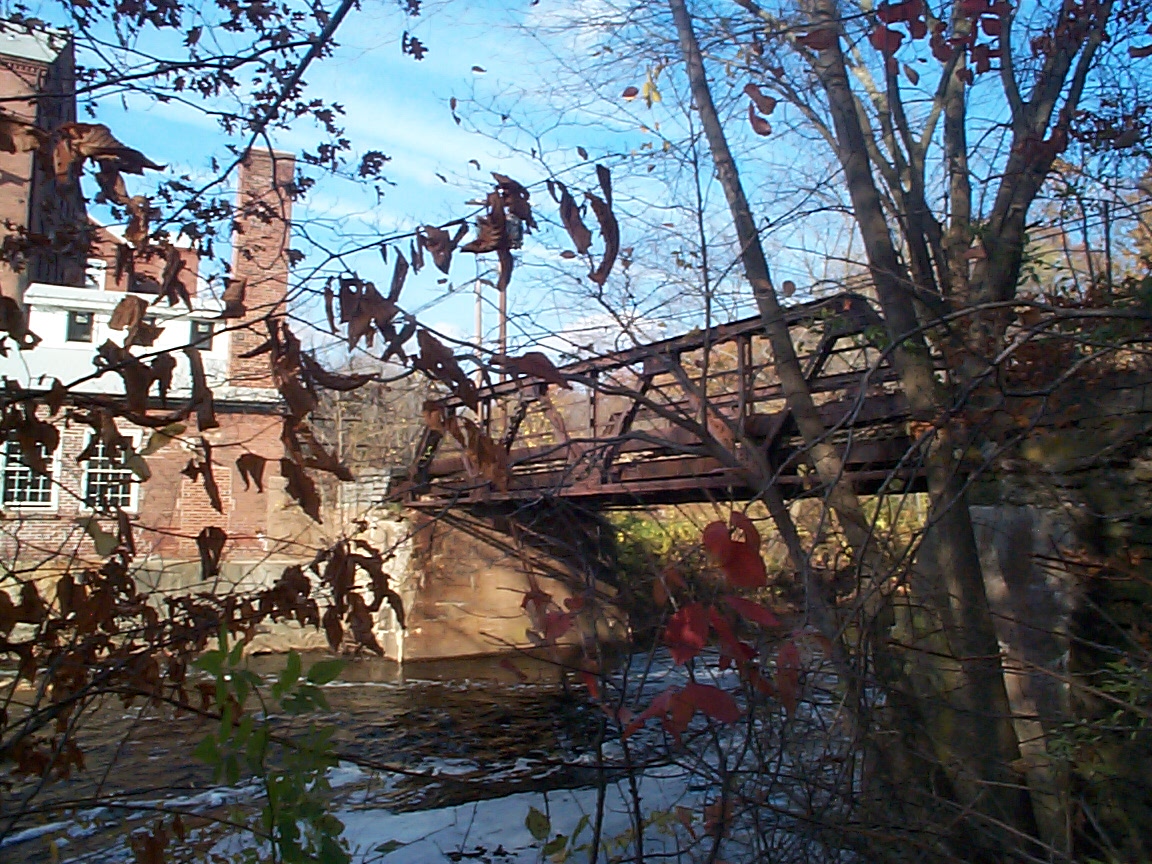
Starr Mill Road Bridge
Monument and historic site · National Register of Historic Places · 1.0 mi
Bridge in United States of America

Washington Street Historic District
Monument and historic site · National Register of Historic Places · 0.9 mi
Historic district in Middletown, Connecticut, U.S.
Captain Benjamin Williams House
Monument and historic site · National Register of Historic Places · 1.1 mi
Historic house in Connecticut, United States


Captain Enoch Lord House
Monument and historic site · National Register of Historic Places · 4.5 mi
Historic house in Connecticut, United States
Church of the Holy Trinity and Rectory
Monument and historic site · National Register of Historic Places · 1.0 mi
Church building in Connecticut, United States of America
Coite-Hubbard House
Monument and historic site · National Register of Historic Places · 0.6 mi
Historic house in Connecticut, United States
79 more on the map.
Parks, trails and playgrounds87

Smith Park
Park · 3.3 mi
Park in Connecticut, United States of America, United States of America


75 more on the map.
Restaurants and cafes207

Fortune Wok
Restaurant · Chinese · 1.4 mi
844 Washington Street, Middletown
Tu-Sa 11:00-21:00; Su 12:00-21:00
Japanica II
Restaurant · Japanese · 1.4 mi
852 Washington Street, Middletown
Mo-Th 11:30-22:00; Fr-Sa 11:30-23:00; Su 12:30-22:00
Pizzeria DaVinci
Restaurant · Pizza · 2.4 mi
149 Main Street, Rockfall;Middlefield
Su-Th 15:00-21:00, Fr-Sa 11:00-21:00

Texas Roadhouse
Restaurant · Steak House · 4.0 mi
55 Shunpike Road, Cromwell
Mo-Th 15:00-22:00; Fr 15:00-23:00; Sa 11:30-23:00; Su 11:30-22:00
Tibetan Himalyan
Restaurant · Tibetan · 1.1 mi
574 Main Street, Middletown
Mo-Th 11:30-15:00,17:00-21:00; Fr-Sa 11:30-15:00,17:00-21:30; Su off
Fuego Mexican Grill
Restaurant · Mexican · 3.9 mi
Former Ninety Nine Restaurant and Pub
36 Shunpike Road, Cromwell
Red Fox Amore Restaurant
Restaurant · Italian, Mediterranean · 2.9 mi
Former Red Dog Saloon
222 Meriden Road, Middlefield

Rich Farm Ice Cream
Ice cream · 2.1 mi
1 Lorraine Terrace, Middlefield
Mo-Sa 12:00-20:00; Su 12:00-18:00
195 more on the map.
History
The land on the western bank of the Connecticut River where Middletown now lies was home to a village of the Wangunk, a tribe of Algonquian-speaking Native Americans. The village was named Mattabesset (also spelled Mattabesett, Mattabesec, Mattabeseck, and Mattabesek); the area they inhabited—now Middletown and the surrounding area—was named after it. When the primarily English European settlers arrived in the region the Mattabesset were a part of the Wangunk, a large tribe in the Connecticut Valley, at the time under a sachem named Sowheag.
Plans for the colonial settlement were drawn up by the General Court in 1646; the first migrants came from nearby Connecticut colonies in 1650. On September 11, 1651, the General Court of Connecticut established the town of "Mattabesett". A couple of years later in November 1653, the settlement was renamed as Middletown. This name was chosen because the site was approximately halfway between Windsor and Saybrook on the Great River. Life was not easy for these early colonial Puritans; clearing the land and building houses, and tending farms in the rocky soil of New England was a labor-intensive ordeal. They had a strict society; offenses legally punishable by death in the Connecticut colonies included "witchcraft, blasphemy, cursing or smiting of parents, and incorrigible stubbornness of children."
From the History section of Middletown, Connecticut on Wikipedia, under CC BY-SA 4.0.
Where to stay10
Passport Inn & Suites
Motel and hotel · 1.8 mi
1310 South Main Street, Middletown
Churches and places of worship54
Saint Mary of Czestochowa Catholic Church
Church · Roman Catholic · 0.5 mi
79 South Main Street, Middletown
Saint Sebastian Catholic Church
Church · Roman Catholic · 0.9 mi
155 Washington Street, Middletown
First Congregational Church of Portland
Church · United Church Of Christ · 3.4 mi
554 Main Street, Portland
Middletown Portland Seventh-day Adventist Church
Church · Seventh Day Adventist · 2.1 mi
13 Waverly Avenue, Portland
Shopping40
Gas and EV charging31
Schools, colleges and libraries61
Healthcare23
The Beit Paley Center for Mental Health Services
Clinic and pharmacy · 0.8 mi
1;9 Macdonough Place, Middletown
Map of Middletown
250 places. The map loads OpenStreetMap tiles when you open it.
Climate by month
Monthly table
| Month | High | Low | Rain |
|---|---|---|---|
| Jan | 37°F | 19°F | 3.0 in |
| Feb | 39°F | 20°F | 2.9 in |
| Mar | 48°F | 28°F | 4.0 in |
| Apr | 60°F | 38°F | 4.1 in |
| May | 70°F | 48°F | 3.5 in |
| Jun | 79°F | 57°F | 4.0 in |
| Jul | 84°F | 62°F | 3.4 in |
| Aug | 82°F | 61°F | 3.5 in |
| Sep | 75°F | 54°F | 4.3 in |
| Oct | 64°F | 42°F | 4.5 in |
| Nov | 52°F | 32°F | 3.4 in |
| Dec | 42°F | 24°F | 4.1 in |
U.S. Climate Normals 1991-2020 for Meriden Markham Muni Ap (9 mi away), NOAA NCEI.
People and cost of living
American Community Survey 5-year estimates, 2020-2024, U.S. Census Bureau. Estimates have margins of error, larger for small towns.
Disaster history
The county has had 20 federal disaster declarations since 2000, most often for hurricanes.
- 2021-10-30: Remnants Of Hurricane Ida (Hurricane)
- 2021-08-22: Hurricane Henri (Hurricane)
- 2021-01-12: Tropical Storm Isaias (Hurricane)
- 2020-08-06: Tropical Storm Isaias (Hurricane)
- 2020-03-28: Covid-19 Pandemic (Biological)
- 2020-03-13: Covid-19 (Biological)
OpenFEMA disaster declarations summaries.
Getting there and nearby towns
Hartford–Brainard Airport (HFD) is the nearest airport with scheduled flights listed in OpenStreetMap, 13 miles away.
- Portland 3 mi northeast, about 4 min by car
- Durham 6 mi south, about 9 min by car
- Higganum 6 mi southeast, about 10 min by car
- Meriden 7 mi west, about 12 min by car
- Kensington 8 mi northwest, about 13 min by car
- Lake Pocotopaug 8 mi east, about 13 min by car
- East Hampton 9 mi east, about 15 min by car
- Newington 10 mi north, about 17 min by car
- New Britain 11 mi northwest, about 18 min by car
- Wethersfield 11 mi north, about 17 min by car
Drive times are estimates from straight-line distance, not routes.
Local news
Headlines from INDB, the NEMICO news database.
Reviews, tips and questions
Loading what members have shared...
Sources and licences
- NCES EDGE (Public domain): public schools
- NOAA NCEI U.S. Climate Normals 1991-2020 (Public domain): climate by month
- OpenFEMA (Public domain): disaster declarations
- OpenStreetMap contributors (ODbL 1.0): places, airports, map data
- U.S. Census Bureau (Public domain): population, income, housing, education, commute
- Wikidata (CC0 1.0): elevation, founding date, time zone, website, landmarks and historic places
- Wikimedia Commons (see each image): photos
- Wikipedia (CC BY-SA 4.0): overview and history text
Photo credits
- Middletown CT river skyline, Bflood, CC BY 3.0
- Wesleyan University - houses on Washington St. near Rt. 3 01, Joe Mabel, CC BY-SA 3.0
- Arrawanna Bridge on Coginchaug Middletown CT, Philosprey, CC BY-SA 3.0
- HIGHLAND HISTORIC DISTRICT, MIDDLETOWN, MIDDLESEX COUNTY, CT, JERRYE & ROY KLOTZ.M.D., CC BY-SA 4.0
- Middletown, CT - former Middlesex Theater 03, Joe Mabel, CC BY-SA 3.0
- PortlandCT IndianHillAvenueHD 1, Magicpiano, CC BY-SA 4.0
- StarrMill05, Mwackers at English Wikipedia, Public domain
- CVH09, Mwackers at en.wikipedia, Public domain
- WorthingtonRidgeHistDist1, Chrissypan, Public domain
- MiddlefieldCT DavidLymanIIHouse, Magicpiano, CC BY-SA 3.0
- Middletown CT Alms House (1814), Steadyjohn, CC BY 3.0
- Wesleyan University - Psi U 02, Joe Mabel, CC BY-SA 3.0
- CT Valley Hospital Cemetery-Middletown, TowersGolde, CC BY-SA 4.0
- EastHamptonCT MiddleHaddamSchool, Magicpiano, CC BY-SA 4.0
- DurhamCT ThomasLymanHouse, Magicpiano, CC BY-SA 3.0
- PortlandCT RuthCallanderHouse, Jerry Dougherty, CC BY 2.5
- Olde House in Winter, Theserazo, CC BY-SA 3.0
- The Plumb House, Agamanor, CC BY-SA 4.0
- Wadsworth Mansion Front Elevation, Unknown author, Public domain
- MiddletownCT TownFarmsInn, Magicpiano, CC BY-SA 4.0
- CAPTAIN ENOCH LORD HOUSE, OLD LYME, NEW LONDON COUNTY, Jerrye & Roy Klotz, MD, CC BY-SA 4.0
- OliverKnowlesHouseDurhamCT, Jerry Dougherty, CC BY 2.5
- PortlandCT MarlboroughStreetHD 1, Magicpiano, CC BY-SA 4.0
- WOODROW WILSON HIGH SCHOOL, MIDDLETOWN, MIDDLESEX COUNTY, CT, JERRYE & ROY KLOTZ, M.D., CC BY-SA 4.0


Page built October 30, 2026. Spotted a mistake? Tell us or suggest a place.