


Montvale, New Jersey
Montvale is a borough of 8,901 people in Bergen County, New Jersey, founded in August 31, 1894.
Why visit Montvale
Townapedia lists 45 museums and landmarks, 8 parks and trails, 40 places to eat and 3 places to stay in and around town.
Highlights include Abram Ackerman House, Achenbach House, Capital Park and Dexter Park.
Weather in Montvale
Forecast from the National Weather Service. Full forecast
About Montvale
Montvale is a borough in northern Bergen County, in the U.S. state of New Jersey, bordering the state of New York. The borough is part of the New York City metropolitan area. As of the 2020 United States census, the borough's population was 8,436, an increase of 592 (+7.5%) from the 2010 census count of 7,844, which in turn reflected an increase of 810 (+11.5%) from the 7,034 counted in the 2000 census.
From the Wikipedia article Montvale, New Jersey (this version), under CC BY-SA 4.0.
Museums and landmarks45

Abram Ackerman House
Monument and historic site · National Register of Historic Places · 3.0 mi
United States historic place

Achenbach House
Monument and historic site · National Register of Historic Places · 2.2 mi
House in Saddle River, New Jersey

Ackerman House
Monument and historic site · National Register of Historic Places · 2.7 mi
House in Saddle River, New Jersey
Ackerman-Dater House
Monument and historic site · National Register of Historic Places · 3.9 mi
Single-family detached home in Saddle River, New Jersey
Ackerman-Smith House
Monument and historic site · National Register of Historic Places · 2.3 mi
House in Saddle River, New Jersey
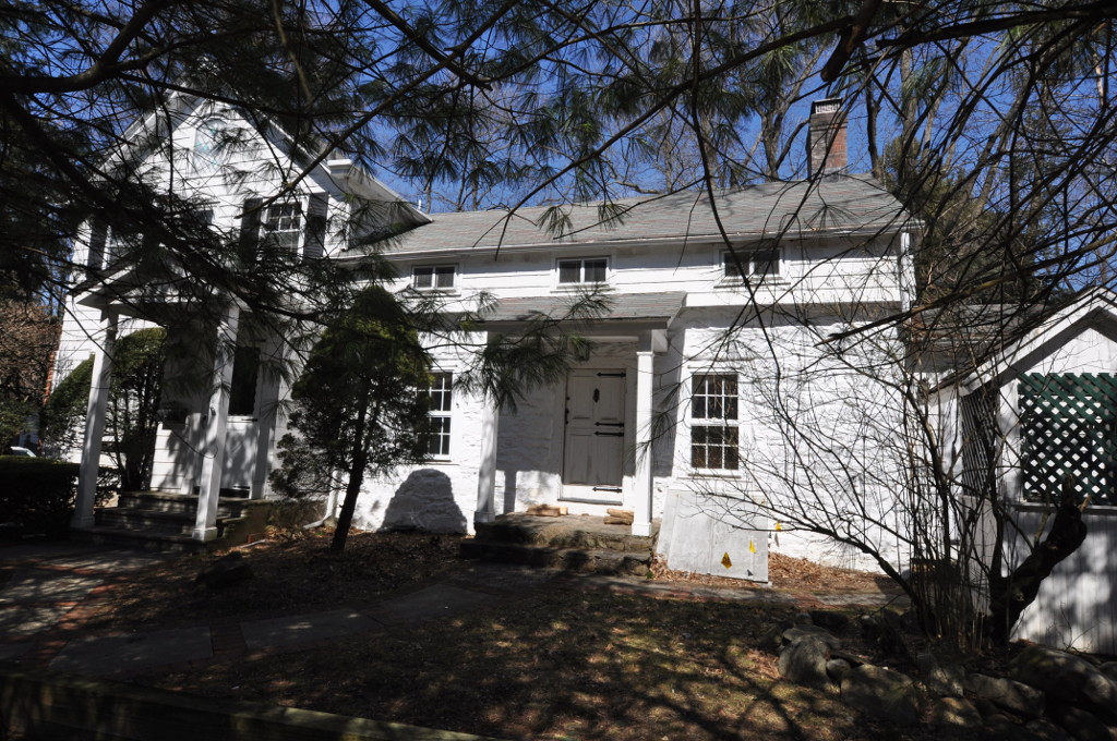
Albert Smith House
Monument and historic site · National Register of Historic Places · 3.8 mi
Historic house in New Jersey, United States
Alonzo Foringer House and Studio
Monument and historic site · National Register of Historic Places · 3.4 mi
House in Saddle River, New Jersey

Andries Thomas Van Buskirk House
Monument and historic site · National Register of Historic Places · 3.4 mi
House in Saddle River, New Jersey

B. C. Wandell House
Monument and historic site · National Register of Historic Places · 3.0 mi
Historic house in Saddle River, New Jersey
Blauvelt-Demarest House
Monument and historic site · National Register of Historic Places · 3.3 mi
Hillsdale, New Jersey, listed on the NRHP in Bergen County
Dr. E. G. Roy House
Monument and historic site · National Register of Historic Places · 3.0 mi
Historic house in New Jersey, United States


Dr. John Christie Ware Bungalow
Monument and historic site · National Register of Historic Places · 2.8 mi
Historic house in Saddle River, New Jersey
33 more on the map.
Parks, trails and playgrounds8


Restaurants and cafes40

Defiant Brewing Co
Bar and pub · 1.3 mi
6 Dexter Plaza, Pearl River
We 14:00-22:00; Th,Fr 14:00-24:00; Sa 12:00-24:00; Su 12:00-22:00



28 more on the map.
Where to stay3

History
Montvale was incorporated as a borough on August 31, 1894, from portions of Orvil Township and Washington Township. The borough was formed during the "Boroughitis" phenomenon then sweeping through Bergen County, in which 26 boroughs were formed in the county in 1894 alone. On February 15, 1896, Montvale acquired part of Orvil Township. In 1906, Montvale added further land from Orvil and Washington townships, and in 1912, Montvale added territory from Upper Saddle River. On May 20, 1959, portions of Montvale were passed to River Vale, and on December 9 and 14, 1965, territories were exchanged between Montvale and Upper Saddle River. The borough's name is derived from its topography.
As of 2026, the borough is a member of Local Leaders for Responsible Planning in order to address the borough's Mount Laurel doctrine-based housing obligations.
From the History section of Montvale, New Jersey on Wikipedia, under CC BY-SA 4.0.
Churches and places of worship14
Evangelical Lutheran Church of Saddle River and Ramapough Building
Church · National Register of Historic Places · 3.1 mi
New North Reformed Low Dutch Church
Church · National Register of Historic Places · 2.3 mi
St. Paul's Episcopal Church
Church · National Register of Historic Places · 3.8 mi
Saint Margaret of Antioch Catholic Church
Church · Roman Catholic · 1.1 mi
115 West Central Avenue, Pearl River
Shopping8
Gas and EV charging6
Schools, colleges and libraries54
Benjamin Franklin Middle School
School · 5.4 mi
335 North Van Dien Ave, Ridgewood
Edith A. Bogert Elementary School
School · 2.8 mi
391 W Saddle River Rd, Upper Saddle River
Healthcare6
VMG - Primary & Walk-In Care, Kinderkamack
Clinic and pharmacy · 1.2 mi
141 North Kinderkamack Road, Montvale
Map of Montvale
184 places. The map loads OpenStreetMap tiles when you open it.
People and cost of living
American Community Survey 5-year estimates, 2020-2024, U.S. Census Bureau. Estimates have margins of error, larger for small towns.
Disaster history
Bergen County has had 21 federal disaster declarations since 2000, most often for hurricanes.
- 2021-09-05: Remnants Of Hurricane Ida (Hurricane)
- 2021-09-02: Remnants Of Hurricane Ida (Hurricane)
- 2020-12-11: Tropical Storm Isaias (Hurricane)
- 2020-03-25: Covid-19 Pandemic (Biological)
- 2020-03-13: Covid-19 (Biological)
- 2018-06-08: Severe Winter Storm And Snowstorm (Severe Storm)
OpenFEMA disaster declarations summaries.
Getting there and nearby towns
Teterboro Airport (TEB) is the nearest airport with scheduled flights listed in OpenStreetMap, 14 miles away.
- Pearl River 2 mi east, about 3 min by car
- Chestnut Ridge 2 mi north, about 3 min by car
- Nanuet 3 mi northeast, about 5 min by car
- Hillsdale 3 mi south, about 5 min by car
- Monsey 4 mi north, about 7 min by car
- Spring Valley 4 mi north, about 7 min by car
- Airmont 4 mi northwest, about 7 min by car
- Westwood 5 mi south, about 7 min by car
- Ho-Ho-Kus 5 mi southwest, about 7 min by car
- Allendale 5 mi west, about 8 min by car
Drive times are estimates from straight-line distance, not routes.
Local news
Headlines from INDB, the NEMICO news database.
Reviews, tips and questions
Loading what members have shared...
Sources and licences
- NCES EDGE (Public domain): public schools
- OpenFEMA (Public domain): disaster declarations
- OpenStreetMap contributors (ODbL 1.0): places, airports, map data
- U.S. Census Bureau (Public domain): population, income, housing, education, commute
- Wikidata (CC0 1.0): elevation, founding date, time zone, website, landmarks and historic places
- Wikimedia Commons (see each image): photos
- Wikipedia (CC BY-SA 4.0): overview and history text
Photo credits
- A&P Headquarters, GRUBBXDN, CC BY-SA 3.0
- 2020-11-10 07 10 29 View east during a foggy morning along Bergen County Route 94 (West Grand Avenue) at Split Rock Lane on the border of Park Ridge and Montvale in Bergen County, New Jersey, Famartin, CC BY-SA 4.0
- 2020-07-11 18 52 14 View north along New Jersey State Route 444 (Garden State Parkway) at Exit 172 (Montvale, Park Ridge) in Montvale, Bergen County, New Jersey, Famartin, CC BY-SA 4.0
- 2018-07-21 13 24 37 View south along New Jersey State Route 444 (Garden State Parkway) entering Montvale, Bergen County, New Jersey from Chestnut Ridge, Ramapo, Rockland County, New York, Famartin, CC BY-SA 4.0
- 2018-07-22 17 23 37 View south along Bergen County Route 503 (Kinderkamack Road) at Magnolia Avenue in Montvale, Bergen County, New Jersey, Famartin, CC BY-SA 4.0
- 2020-07-16 08 36 19 View south along New Jersey State Route 444 (Garden State Parkway) at the Montvale Service Area in Montvale, Bergen County, New Jersey, Famartin, CC BY-SA 4.0
- Old style Dairy Queen, Montvale, NJ, Jan. 2025, Mr. Matté (if there is an issue with this image, contact me using this image's Commons talk page , my Commons user talk page , or my English Wikipedia user talk page ; I'll know about it a lot faster), CC BY-SA 4.0
- Courtyard Marriott Montvale - panoramio, qwesy qwesy, CC BY 3.0
- Courtyard in Montvale - panoramio, qwesy qwesy, CC BY 3.0
- St. Joseph Regional High School, Montvale, NJ, Jan. 2025, Mr. Matté (if there is an issue with this image, contact me using this image's Commons talk page , my Commons user talk page , or my English Wikipedia user talk page ; I'll know about it a lot faster), CC BY-SA 4.0
- 2018-07-21 13 00 42 View north along New Jersey State Route 444 (Garden State Parkway) at the entrance to the Montvale Service Area in Montvale, Bergen County, New Jersey, Famartin, CC BY-SA 4.0
- 2020-07-11 18 48 44 View north along New Jersey State Route 444 (Garden State Parkway) at the Montvale Service Area in Montvale, Bergen County, New Jersey, Famartin, CC BY-SA 4.0
- 2018-07-22 17 16 52 View north along Bergen County Route 503 (Kinderkamack Road) at Railroad Avenue and Wortendyke Avenue in Montvale, Bergen County, New Jersey, Famartin, CC BY-SA 4.0
- CR 503 nb split in Montvale, NJ, Oct. 2024, Mr. Matté (if there is an issue with this image, contact me using this image's Commons talk page , my Commons user talk page , or my English Wikipedia user talk page ; I'll know about it a lot faster), CC BY-SA 4.0
- Bergen CR 73 approaching NY state line, Montvale, NJ, Jan. 2025, Mr. Matté (if there is an issue with this image, contact me using this image's Commons talk page , my Commons user talk page , or my English Wikipedia user talk page ; I'll know about it a lot faster), CC BY-SA 4.0
- Eckerson House and CR 73 nb, Montvale, NJ, Jan. 2025, Mr. Matté (if there is an issue with this image, contact me using this image's Commons talk page , my Commons user talk page , or my English Wikipedia user talk page ; I'll know about it a lot faster), CC BY-SA 4.0
- 280 Chestnut Ridge Road, Montvale, NJ - Eckerson House, Zeete, CC BY-SA 4.0
- Chestnut Ridge Road, Montvale, NJ - Eckerson House, historical information, Zeete, CC BY-SA 4.0
- Bergen CR 73 at NY state line, Montvale, NJ, Jan. 2025, Mr. Matté (if there is an issue with this image, contact me using this image's Commons talk page , my Commons user talk page , or my English Wikipedia user talk page ; I'll know about it a lot faster), CC BY-SA 4.0
- GARRET K. OSBORN HOUSE AND BARN, SADDLE RIVER, BERGEN COUNTY, NJ, JERRYE & ROY KLOTZ MD, CC BY-SA 4.0
- WESTERVELT-LYDECKER HOUSE, WOODCLIFF LAKE, BERGEN COUNTY, JERRYE & ROY KLOTZ MD, CC BY-SA 4.0
- ST. PAUL'S EPISCOPAL CHURCH, Spring Valley, New York, JERRYE AND ROY KLOTZ, M.D., CC BY-SA 4.0
- FREDERICK WORTENDYKE HOUSE, WOODCLIFF LAKE, BERGEN COUNTY, JERRYE & ROY KLOTZ M.D., CC BY-SA 4.0
- HOPPER HOUSE, UPPER SADDLE RIVER, BERGEN COUNTY, NJ, JERRYE & ROY KLOTZ M.D., CC BY-SA 4.0
- ACKERMAN HOUSE, SADDLE RIVER, BERGEN COUNTY, NJ, JERRYE AND ROY KLOTZ M.D., CC BY-SA 4.0
- The Old Stone Church, Upper Saddle River, NJ - south view, Zeete, CC BY-SA 4.0
- WaldwickNJ AlbertSmithHouse, Magicpiano, CC BY-SA 4.0
- Tea House, Texwipe Corporation Headquarters, Upper Saddle River, NJ, Zeete, CC BY-SA 4.0
- HOLDRUM-VAN HOUTEN HOUSE, MONTVALE, BERGEN COUNTY, JERRYE & ROY KLOTZ, M.D., CC BY-SA 4.0
- SaddleRiverNJ AchenbachHouseRemnant, Magicpiano, CC BY-SA 4.0
- JOHN G. ACKERSON HOUSE, PARK RIDGE, BERGEN COUNTY, NJ, JERRYE & ROY KLOTZ, M.D., CC BY-SA 4.0
- DR. JOHN CHRISTIE WARE BUNGALOW, SADDLE RIVER, BERGEN COUNTY, NJ, JERRYE & ROY KLOTZ M.D., CC BY-SA 4.0
- JOE JEFFERSON CLUBHOUSE, SADDLE RIVER, BERGEN COUNTY, NJ, JERRYE & ROY KLOTZ M.D., CC BY-SA 4.0
- GarretAugustusAckermanHouse, Unknown author Unknown author, Public domain
- Michael Salyer Stone House, Orangetown, NY, Daniel Case, CC BY-SA 3.0
- EVANGELICAL LUTHERAN CHURCH OF SADDLE RIVER, BERGEN COUNTY, NJ, JERRYE & ROY KLOTZ, MD, CC BY-SA 4.0
- ANDRIES THOMAS VAN BUSKIRK HOUSE, SADDLE RIVER, BERGEN COUNTY, NJ, JERRYE & ROY KLOTZ M.D., CC BY-SA 4.0
- O'BLENIS HOUSE, SADDLE RIVER, BERGEN COUNTY, NJ, JERRYE & ROY KLOTZ M.D., CC BY-SA 4.0
- BC. WANDELL HOUSE - THE CEDARS, SADDLE RIVER, BERGEN COUNTY, NJ, JERRYE & ROY KLOTZ M.D., CC BY-SA 4.0
- ParkRidgeNJ FrederickWortendykeHouse, Magicpiano, CC BY-SA 4.0


Page built October 30, 2026. Spotted a mistake? Tell us or suggest a place.