


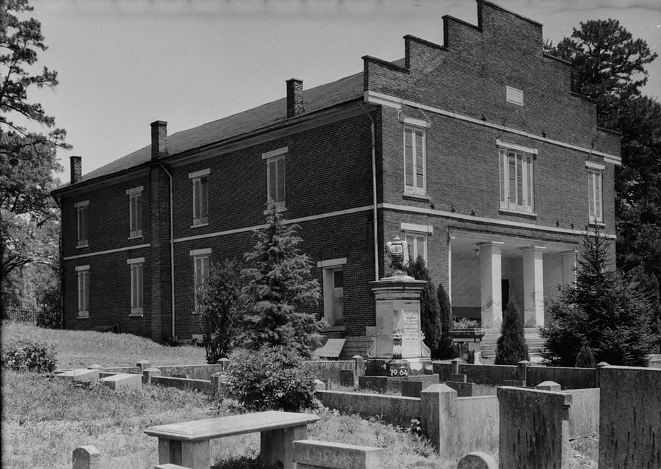


Mount Pleasant, Tennessee
Mount Pleasant is a city of 4,837 people in Maury County, Tennessee, founded in 1824.
Why visit Mount Pleasant
Townapedia lists 8 museums and landmarks, 3 parks and trails, 2 places to eat and 3 attractions in and around town.
Highlights include Ginger Hill, Institute Hill, Rattle and Snap and Clifton Place.
July is the warmest month, with average highs of 90°F; January lows average 27°F.
Weather in Mount Pleasant
Forecast from the National Weather Service. Full forecast
About Mount Pleasant
Mount Pleasant is a city in Maury County, Tennessee, United States. Mount Pleasant was the birthplace of 19th-century writer and humorist Samuel R. Watkins and formerly titled "The Phosphate Capital of the World." The population was 4,561 at the 2010 census, and 4,784 in 2020.
From the Wikipedia article Mount Pleasant, Tennessee (this version), under CC BY-SA 4.0.
Things to do3

Museums and landmarks8

Rattle and Snap
Monument and historic site · National Register of Historic Places · 1.4 mi
Human settlement in United States of America

Clifton Place
Monument and historic site · National Register of Historic Places · 4.0 mi
Mansion in Columbia, Tennessee
Dr. Samuel Mayes House
Monument and historic site · National Register of Historic Places · 3.3 mi
Historic house in Columbia, Tennessee, USA
Hamilton Place
Monument and historic site · National Register of Historic Places · 1.9 mi
Historic house in Tennessee, United States

Pine Hill
Monument and historic site · National Register of Historic Places · 3.7 mi
Mansion in Maury County, Tennessee


Walnut Grove
Monument and historic site · National Register of Historic Places · 1.7 mi
Historic house on a Southern plantation in Mount Pleasant, Maury County, Tennessee, USA
William Watkins House
Monument and historic site · National Register of Historic Places · 1.2 mi
House in Maury County, Tennessee

Parks, trails and playgrounds3

Restaurants and cafes2


History
Settlement of Mount Pleasant began in the early 19th century, and increased following the construction of the Military Road connecting Nashville and Madisonville, Louisiana, in 1817. By the time Mount Pleasant incorporated as a city in 1824, it was home to a store, tavern, and several churches.
In 1895, brown phosphate rock was discovered in Mount Pleasant, leading to a mining boom, and giving the city its nickname. Within a few years, ten phosphate mining companies were operating in Mount Pleasant, producing over 25,000 tons per year. The city's population grew from 466 in 1890 to 2,007 in 1900. Phosphate mining remained a major part of the city's economy into the latter half of the 20th century.
From the History section of Mount Pleasant, Tennessee on Wikipedia, under CC BY-SA 4.0.
Churches and places of worship7
St. John's Episcopal Church
Church · National Register of Historic Places · 2.6 mi
Zion Presbyterian Church
Church · National Register of Historic Places · 3.7 mi
Shopping1
Gas and EV charging2
Schools, colleges and libraries8
Mount Pleasant Branch Public Library
Library · 2.1 mi
200 Hay Long Avenue, Mt Pleasant
Mt. Pleasant Middle Visual Perform. Arts
School · 1.6 mi
410 Gray Ln, Mt. Pleasant
Map of Mount Pleasant
34 places. The map loads OpenStreetMap tiles when you open it.
Climate by month
Monthly table
| Month | High | Low | Rain |
|---|---|---|---|
| Jan | 47°F | 27°F | 5.2 in |
| Feb | 52°F | 31°F | 5.1 in |
| Mar | 61°F | 38°F | 6.0 in |
| Apr | 72°F | 47°F | 5.4 in |
| May | 80°F | 58°F | 6.3 in |
| Jun | 88°F | 67°F | 5.4 in |
| Jul | 90°F | 69°F | 4.8 in |
| Aug | 90°F | 66°F | 4.0 in |
| Sep | 84°F | 59°F | 5.3 in |
| Oct | 72°F | 47°F | 3.9 in |
| Nov | 61°F | 36°F | 4.3 in |
| Dec | 51°F | 30°F | 6.5 in |
U.S. Climate Normals 1991-2020 for Mt Pleasant 1N (1 mi away), NOAA NCEI.
People and cost of living
American Community Survey 5-year estimates, 2020-2024, U.S. Census Bureau. Estimates have margins of error, larger for small towns.
Disaster history
Maury County has had 15 federal disaster declarations since 2000, most often for severe storms.
- 2026-02-06: Severe Winter Storm (Winter Storm)
- 2026-01-24: Severe Winter Storm (Winter Storm)
- 2025-04-02: Severe Storms, Straight-Line Winds, Tornadoes, And Flooding (Severe Storm)
- 2024-06-17: Severe Storms, Tornadoes, And Flooding (Severe Storm)
- 2023-03-08: Severe Winter Storm (Winter Storm)
- 2021-05-08: Severe Storms, Tornadoes, And Flooding (Tornado)
OpenFEMA disaster declarations summaries.
Getting there and nearby towns
Maury County Airport (MRC) is the nearest airport with scheduled flights listed in OpenStreetMap, 0 miles away.
- Columbia 9 mi northeast, about 15 min by car
- Spring Hill 20 mi northeast, about 32 min by car
- Hohenwald 21 mi west, about 34 min by car
- Cornersville 22 mi southeast, about 36 min by car
- Lawrenceburg 23 mi southwest, about 36 min by car
- Lewisburg 23 mi east, about 37 min by car
- Centerville 24 mi northwest, about 38 min by car
- Bon Aqua Junction 27 mi north, about 43 min by car
- Fairview 30 mi north, about 48 min by car
- Franklin 31 mi northeast, about 50 min by car
Drive times are estimates from straight-line distance, not routes.
Local news
Headlines from INDB, the NEMICO news database.
Reviews, tips and questions
Loading what members have shared...
Sources and licences
- NCES EDGE (Public domain): public schools
- NOAA NCEI U.S. Climate Normals 1991-2020 (Public domain): climate by month
- OpenFEMA (Public domain): disaster declarations
- OpenStreetMap contributors (ODbL 1.0): places, airports, map data
- U.S. Census Bureau (Public domain): population, income, housing, education, commute
- Wikidata (CC0 1.0): elevation, founding date, time zone, website, landmarks and historic places
- Wikimedia Commons (see each image): photos
- Wikipedia (CC BY-SA 4.0): overview and history text
Photo credits
- Mount-Pleasant-Main-tn2, Brian Stansberry, CC BY 4.0
- Rattle and Snap, Columbia (Maury County, Tennessee), National Park Service photographer, Public domain
- Zion Church (Presbyterian), State Route 1, Columbia vicinity (Maury County, Tennessee), . Jeter Eason, Deputy District Officer, Photographer, Public domain
- St. John's Church Columbia TN, Hal Jespersen, Public domain
- PineHill1, Andrew F. Thornburg, CC BY-SA 4.0
- Walnut Grove, Skye Marthaler, CC BY-SA 4.0
Page built October 30, 2026. Spotted a mistake? Tell us or suggest a place.