


Franklin, Tennessee
Franklin is a city of 87,133 people in Williamson County, Tennessee, founded in 1799.
Why visit Franklin
Townapedia lists 83 museums and landmarks, 31 parks and trails, 263 places to eat, 35 places to stay and 15 attractions in and around town.
Highlights include AMC DINE-IN Thoroughbred 20, Franklin Theatre, McLemore House and Carter House.
July is the warmest month, with average highs of 91°F; January lows average 29°F.
Weather in Franklin
Forecast from the National Weather Service. Full forecast
About Franklin
Franklin is a city in and the county seat of Williamson County, Tennessee, United States. About 21 miles (34 km) south of Nashville, it is one of the principal cities of the Nashville metropolitan area and Middle Tennessee. As of 2020, its population was 83,454. It is the seventh-most populous city in Tennessee.
From the Wikipedia article Franklin, Tennessee (this version), under CC BY-SA 4.0.
Things to do15

Studio Tenn Theatre Company
Cinema and theater · 1.4 mi
230 Franklin Road, Franklin
Mo-Fr 09:00-17:00; Sa 10:00-15:00

3 more on the map.
Museums and landmarks83

McLemore House
Museum · National Register of Historic Places · 1.7 mi
Historic house museum in Tennessee, U.S.
446 11th Avenue North, Franklin
Sa 10:00-14:00

Fort Granger
Monument and historic site · National Register of Historic Places · 0.9 mi
Fort in Tennessee
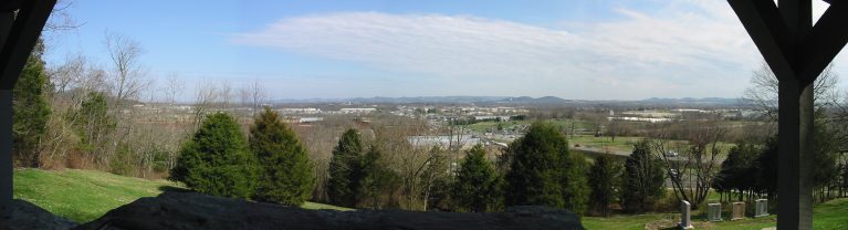
Winstead Hill
Monument and historic site · National Register of Historic Places · 2.6 mi
Landform in Tennessee, USA

Adams Street Historic District
Monument and historic site · National Register of Historic Places · 1.0 mi
Historic district in Franklin, Tennessee, USA
Alexander Smith House
Monument and historic site · National Register of Historic Places · 6.6 mi
House in Brentwood, Tennessee
Alpheus Truett House
Monument and historic site · National Register of Historic Places · 1.3 mi
House in Franklin, Tennessee
Andrew C. Vaughn House
Monument and historic site · National Register of Historic Places · 0.6 mi
House in Franklin, Tennessee
Andrew Crockett House
Monument and historic site · National Register of Historic Places · 6.1 mi
Historic house in Tennessee, United States
Beverly Toon House
Monument and historic site · National Register of Historic Places · 4.6 mi
Historic house in Tennessee, United States


Boyd-Wilson Farm
Monument and historic site · National Register of Historic Places · 6.5 mi
Historic district in Franklin, Tennessee, United States
Carnton
Monument and historic site · National Register of Historic Places · 0.8 mi
Historic plantation house and museum in Franklin in Williamson County, Tennessee
71 more on the map.
Parks, trails and playgrounds31

Pinkerton Park
Park · 0.7 mi
Park in Tennessee, United States of America
Murfreesburo Road, Franklin
Owl's Hill Nature Center
Park · 7.4 mi
Park in Williamson County, United States of America

Ladd Park Canoe Access
Park · 3.3 mi
Located at Milemarker 95.7 on Harpeth River
5001 Ryecroft St, Franklin

The Highlands at Ladd Park Private Playground
Playground · 3.6 mi
Truman Road West, Franklin
19 more on the map.
Restaurants and cafes263

Baskin-Robbins
Ice cream · Ice Cream · 4.2 mi
9100 Carothers Parkway, Franklin
Mo-Sa 05:00-21:00; Su 06:00-21:00

Honest Coffee Roasters
Cafe · Coffee Shop, Juice · 1.3 mi
230 Franklin Road, Franklin
Mo-Su 07:00-18:00

Hot Hattie B's Chicken
Restaurant · Chicken · 1.3 mi
230 Franklin Road, Franklin
Su-Th 10:00-21:00; Fr-Sa 10:00-22:00
Ichiddo Ramen
Restaurant · Asian, Japanese · 4.1 mi
1709 Galleria Boulevard
Su 11:00-21:00; Fr 11:00-15:00, 16:30-22:00; Mo-Th 11:00-15:00,...
Mojo's Tacos
Restaurant · Tex-Mex, Tacos, Mexican · 1.4 mi
230 Franklin Road, Franklin
Mo-Fr 10:30-21:00; Sa 09:00-21:00; Su 09:00-20:00
The Fainting Goat
Cafe · Coffee Shop · 1.2 mi
1143 Columbia Avenue, Franklin
Mo-Sa 06:00-18:00; Su 07:00-18:00

The Rutledge Franklin
Diner · American · 3.9 mi
105 International Drive, Franklin
Mo-Th 11:00-23:00, Fr 11:00-24:00; Sa 10:00-24:00; Su 10:00-22:00
The Well
Cafe · Coffee Shop · 3.3 mi
711 Cool Springs Boulevard, Franklin
Mo-Fr 06:00-17:00; Sa,Su 07:00-17:00
Jeni's Splendid Ice Creams
Ice cream · 1.4 mi
230 Franklin Road, Franklin
Su-Th 12:00-23:00; Fr-Sa 12:00-00:00
Stroud's Barbeque
Restaurant · Barbecue · 2.8 mi
1010 Fulton Greer Lane, Franklin
Tu-Fr 08:00-19:00; Sa 08:00-18:00
251 more on the map.
Where to stay35
The Harpeth Franklin Downtown, Curio Collection by Hilton
Motel and hotel · 1.2 mi
130 2nd Avenue North, Franklin
Hampton Inn & Suites Franklin Berry Farms
Motel and hotel · 3.7 mi
7101 Berry Farms Crossing, Franklin
Hampton Inn & Suites Nashville/Franklin (Cool Springs)
Motel and hotel · 3.4 mi
7141 South Springs Drive, Franklin
Churches and places of worship52
Owen Chapel Church of Christ
Church · National Register of Historic Places · 6.2 mi
St. Paul's Episcopal Church
Church · National Register of Historic Places · 1.3 mi
Trinity Methodist Church
Church · National Register of Historic Places · 5.6 mi
Franklin Church of Christ
Church · Church Of Christ · 1.6 mi
324 Franklin Road, Franklin
Shopping62
Gas and EV charging25
Schools, colleges and libraries44
Franklin County Public Library
Library · 1.3 mi
1314;105 Columbia Avenue;Columbia Ave;South Porter Street, Franklin
Healthcare20
North Franklin Internal Medicine & Pediatrics And Walk-In Clinic
Clinic and pharmacy · 1.9 mi
Map of Franklin
250 places. The map loads OpenStreetMap tiles when you open it.
Climate by month
Monthly table
| Month | High | Low | Rain | Snow |
|---|---|---|---|---|
| Jan | 49°F | 29°F | 4.2 in | 0.9 in |
| Feb | 53°F | 31°F | 4.8 in | 0.3 in |
| Mar | 62°F | 38°F | 5.2 in | 0.4 in |
| Apr | 72°F | 46°F | 5.2 in | 0.0 in |
| May | 80°F | 55°F | 5.4 in | 0.0 in |
| Jun | 87°F | 64°F | 4.4 in | 0.0 in |
| Jul | 91°F | 68°F | 4.6 in | 0.0 in |
| Aug | 90°F | 67°F | 3.6 in | 0.0 in |
| Sep | 85°F | 60°F | 4.0 in | 0.0 in |
| Oct | 74°F | 47°F | 3.5 in | 0.0 in |
| Nov | 62°F | 37°F | 3.8 in | 0.0 in |
| Dec | 52°F | 32°F | 5.2 in | 0.1 in |
U.S. Climate Normals 1991-2020 for Franklin Sewage Plt (2 mi away), NOAA NCEI.
People and cost of living
American Community Survey 5-year estimates, 2020-2024, U.S. Census Bureau. Estimates have margins of error, larger for small towns.
Disaster history
Williamson County has had 10 federal disaster declarations since 2000, most often for severe storms.
- 2026-02-06: Severe Winter Storm (Winter Storm)
- 2026-01-24: Severe Winter Storm (Winter Storm)
- 2025-04-02: Severe Storms, Straight-Line Winds, Tornadoes, And Flooding (Severe Storm)
- 2021-05-08: Severe Storms, Tornadoes, And Flooding (Tornado)
- 2020-04-02: Covid-19 Pandemic (Biological)
- 2020-03-13: Covid-19 (Biological)
OpenFEMA disaster declarations summaries.
Getting there and nearby towns
Nashville International Airport (BNA) is the nearest airport with scheduled flights listed in OpenStreetMap, 17 miles away.
- Brentwood 7 mi northeast, about 12 min by car
- Thompson's Station 8 mi southwest, about 12 min by car
- Nolensville 11 mi east, about 17 min by car
- Spring Hill 12 mi south, about 20 min by car
- Fairview 16 mi west, about 26 min by car
- Nashville-Davidson 18 mi north, about 29 min by car
- Columbia 23 mi southwest, about 36 min by car
- Murfreesboro 24 mi east, about 39 min by car
- Dickson 31 mi west, about 49 min by car
- Clarksville 53 mi northwest, about 1 h 30 min by car
Drive times are estimates from straight-line distance, not routes.
Local news
Headlines from INDB, the NEMICO news database.
Reviews, tips and questions
Loading what members have shared...
Sources and licences
- NCES EDGE (Public domain): public schools
- NOAA NCEI U.S. Climate Normals 1991-2020 (Public domain): climate by month
- OpenFEMA (Public domain): disaster declarations
- OpenStreetMap contributors (ODbL 1.0): places, airports, map data
- U.S. Census Bureau (Public domain): population, income, housing, education, commute
- Wikidata (CC0 1.0): elevation, founding date, time zone, website, landmarks and historic places
- Wikimedia Commons (see each image): photos
- Wikipedia (CC BY-SA 4.0): overview and history text
Photo credits
- 4th ave main street historic franklin tennessee 2010, Ichabod, CC BY-SA 3.0
- Willow Plunge Historical Marker, Franklin, Tennessee, Eagledj, CC BY-SA 4.0
- Mellow Mushroom @ Franklin, one of the best restaurants around Nashville - panoramio, Aaron Zhu, CC BY-SA 3.0
- Historical Presbyterian Church @ Franklin - panoramio, Aaron Zhu, CC BY-SA 3.0
- Sweet Ce Ce @ Franklin, TN - panoramio, Aaron Zhu, CC BY-SA 3.0
- Greetings from Franklin, Tennessee - Large Letter Postcard (14464733845), Steve Shook from Moscow, Idaho, USA, CC BY 2.0
- Franklin City Cemetery, Sarah Harrison00, CC BY-SA 3.0
- Winstead Hill near Franklin Tennessee, Srmiller50, CC BY-SA 4.0
- Franklin Interurban Historical Marker, Eagledj, CC BY-SA 4.0
- Winstead Hill Franklin TN, J. Williams, Public domain
- FT. GRANGER, JERRYE & ROY KLOTZ MD, CC BY-SA 3.0
- John Herbert House, Skye Marthaler, CC BY-SA 3.0
- Robert Hodge House, rossograph, CC BY-SA 4.0
- William Boyd House, rossograph, CC BY-SA 4.0
- McGavock-Gaines House-Franklin, TN, rossograph, CC BY-SA 4.0
- Douglas-Reams House-Franklin, TN, rossograph, CC BY-SA 4.0
- Nicholas Tate Perkins House, Skye Marthaler, CC BY-SA 3.0
- HARRISON HOUSE, JERRYE & ROY KLOTZ MD, CC BY-SA 3.0
- Henry P. Gray House, Skye Marthaler, CC BY-SA 3.0
- Knights of Pythias Pavilion, Skye Marthaler, CC BY-SA 3.0
- Franklin Hardeman House, rossograph, CC BY-SA 4.0
- Thomas L. Critz House, rossograph, CC BY-SA 4.0
- Dr. Hezekiah Oden House-Franklin, TN, rossograph, CC BY-SA 4.0
- Boyd-Wilson Farm, Skye Marthaler, CC BY-SA 3.0
- Meeting-of-the-Waters, Skye Marthaler, CC BY-SA 3.0
- James P. Johnson, Mthunter58, CC BY-SA 4.0
- Nashville Temple, Antipus, CC BY-SA 3.0
- Lotz House, Skye Marthaler, CC BY-SA 3.0
- Italian sub 1, Tim Rodenberg, CC BY 2.0
- Pozole good eats, Antheasadira, CC BY-SA 4.0
- Pilgrimage Fest Planning, Shannon McGee, CC BY-SA 2.0
- Alpheus Truett House, Skye Marthaler, CC BY-SA 3.0
- Henry H. Mayberry House, Skye Marthaler, CC BY-SA 3.0
- Rest Haven Cemetery, Sarah Harrison00, CC BY-SA 3.0
- Maney-Sidway House, Skye Marthaler, CC BY-SA 3.0
- McLemore House, Skye Marthaler, CC BY-SA 3.0
- Craig-Beasley House, Skye Marthaler, CC BY-SA 3.0
- THE PARK AT HARLINSDALE FARM - panoramio (7), Paula Tejo, CC BY 3.0
- THE PARK AT HARLINSDALE FARM - panoramio, Paula Tejo, CC BY 3.0
- THE PARK AT HARLINSDALE FARM - panoramio (10), Paula Tejo, CC BY 3.0


Page built October 30, 2026. Spotted a mistake? Tell us or suggest a place.