


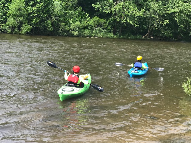
Munroe Falls, Ohio
Munroe Falls is a city of 5,000 people in Summit County, Ohio, founded in 1838.
Why visit Munroe Falls
Townapedia lists 4 museums and landmarks, 22 parks and trails, 19 places to eat and 1 attraction in and around town.
Highlights include Francis D. Alling House, Kent Jail and Adell Durbin Park.
July is the warmest month, with average highs of 82°F; January lows average 18°F.
Weather in Munroe Falls
Forecast from the National Weather Service. Full forecast
About Munroe Falls
Munroe Falls is a city in east-central Summit County, Ohio, United States, along the Cuyahoga River. The population was 5,044 at the 2020 census. It is a suburb of Akron and is part of the Akron metropolitan area.
From the Wikipedia article Munroe Falls, Ohio (this version), under CC BY-SA 4.0.
Things to do1

Museums and landmarks4

Francis D. Alling House
Monument and historic site · National Register of Historic Places · 2.7 mi
Historic house in Ohio, United States

Kent Jail
Monument and historic site · National Register of Historic Places · 3.6 mi
Prison in Ohio, United States of America


Oakwood Cemetery Chapel
Monument and historic site · National Register of Historic Places · 2.7 mi
Historic chapel in Cuyahoga Falls, Summit County, Ohio

Parks, trails and playgrounds22


10 more on the map.
Restaurants and cafes19

Angelina's Pizza House
Restaurant · Pizza · 1.3 mi
3451 Darrow Road, Stow
Tu-Sa 16:00-22:00


Lemongrass Grill Thai Restaurant and Bar
Restaurant · Thai
20 North Main Street, Munroe Falls


7 more on the map.
History
Like much of the Connecticut Western Reserve, the area that makes up present-day Munroe Falls was previously inhabited by various tribes of American Indians. When the Western Reserve began being surveyed in 1796, what is now Munroe Falls was mostly in the southern part of the survey township Town 3, Range 10 (later to be Stow Township), then a part of Washington County before being placed in the new Jefferson County the following year. In 1800, it was made part of Trumbull County, which followed the boundaries of the Western Reserve, and in 1808, the area was made part of Portage County.
The first settlers in present-day Munroe Falls, a group of around 40 people including Francis Kelsey and William Stow, came in 1809. William Stow built a log house to serve as his residence at what is now the northwest corner of Ohio State Route 91 and Munroe Falls Avenue. Kelsey built a sawmill on the south side of the Cuyahoga River and a gristmill was built on the north side. The initial name of the new village was Kelsey's Mills (also Kelsey Mills). The first school in Munroe Falls was built in 1816. In 1817 a wooden dam was built to provide power for both mills and the name of the village was changed to Florence.
From the History section of Munroe Falls, Ohio on Wikipedia, under CC BY-SA 4.0.
Churches and places of worship7
First Congregational Church of Cuyahoga Falls
Church · National Register of Historic Places · 2.6 mi
St. Eugene's Catholic Church
Church · Catholic · 1.1 mi
1821 Munroe Falls Avenue, Cuyahoga Falls
Stow-Falls Baptist Church
Church · Baptist · 1.3 mi
1601 Munroe Falls Avenue, Cuyahoga Falls
The Church of Jesus Christ of Latter-day Saints
Church · Mormon · 1.5 mi
106 East Howe Road, Tallmadge
Shopping6
Gas and EV charging4
Schools, colleges and libraries47
Cuyahoga Falls City School District Virtual Learning Option
School · 2.7 mi
431 Stow Ave, Cuyahoga Falls
Healthcare1
Map of Munroe Falls
111 places. The map loads OpenStreetMap tiles when you open it.
Climate by month
Monthly table
| Month | High | Low | Rain |
|---|---|---|---|
| Jan | 33°F | 18°F | 3.1 in |
| Feb | 36°F | 19°F | 2.5 in |
| Mar | 46°F | 25°F | 3.2 in |
| Apr | 60°F | 37°F | 3.7 in |
| May | 70°F | 47°F | 4.1 in |
| Jun | 78°F | 56°F | 4.1 in |
| Jul | 82°F | 60°F | 4.2 in |
| Aug | 81°F | 59°F | 3.5 in |
| Sep | 74°F | 52°F | 3.8 in |
| Oct | 61°F | 41°F | 3.3 in |
| Nov | 49°F | 32°F | 3.0 in |
| Dec | 38°F | 24°F | 3.1 in |
U.S. Climate Normals 1991-2020 for Stow 4 Se (1 mi away), NOAA NCEI.
People and cost of living
American Community Survey 5-year estimates, 2020-2024, U.S. Census Bureau. Estimates have margins of error, larger for small towns.
Disaster history
Summit County has had 10 federal disaster declarations since 2000, most often for severe storms.
- 2020-03-31: Covid-19 Pandemic (Biological)
- 2020-03-13: Covid-19 (Biological)
- 2012-06-30: Severe Storms (Severe Storm)
- 2008-10-24: Severe Wind Storm Associated With Tropical Depression Ike (Severe Storm)
- 2005-09-13: Hurricane Katrina Evacuation (Hurricane)
- 2004-09-19: Severe Storms And Flooding (Severe Storm)
OpenFEMA disaster declarations summaries.
Getting there and nearby towns
Akron Fulton International Airport (AKC) is the nearest airport with scheduled flights listed in OpenStreetMap, 7 miles away.
- Silver Lake 2 mi northwest, about 2 min by car
- Tallmadge 2 mi south, about 4 min by car
- Stow 3 mi north, about 4 min by car
- Kent 4 mi east, about 6 min by car
- Brimfield 5 mi southeast, about 9 min by car
- Akron 6 mi southwest, about 10 min by car
- Mogadore 6 mi south, about 10 min by car
- Cuyahoga Falls 7 mi northwest, about 11 min by car
- Hudson 7 mi north, about 11 min by car
- Streetsboro 8 mi northeast, about 13 min by car
Drive times are estimates from straight-line distance, not routes.
Local news
Headlines from INDB, the NEMICO news database.
Reviews, tips and questions
Loading what members have shared...
Sources and licences
- NCES EDGE (Public domain): public schools
- NOAA NCEI U.S. Climate Normals 1991-2020 (Public domain): climate by month
- OpenFEMA (Public domain): disaster declarations
- OpenStreetMap contributors (ODbL 1.0): places, airports, map data
- U.S. Census Bureau (Public domain): population, income, housing, education, commute
- Wikidata (CC0 1.0): elevation, founding date, time zone, website, landmarks and historic places
- Wikimedia Commons (see each image): photos
- Wikipedia (CC BY-SA 4.0): overview and history text
Photo credits
- City Hall of Munroe Falls 01, Munroe Falls photographer, CC BY-SA 3.0
- FRANCIS D. ALLING HOUSE, TALLMADGE, SUMMIT COUNTY, Jerrye & Roy Klotz, MD, CC BY-SA 4.0
- Oakwood Cemetery Chapel, Cuyahoga Falls, Nyttend, Public domain
- Old Kent Jail, JonRidinger, CC BY 3.0
- First Congregational Church of Cuyahoga Falls, Nyttend, Public domain
- Kayakers in the Cuyahoga, NPS, Public domain
- Cornelius Guise House, Nyttend, Public domain

Page built October 30, 2026. Spotted a mistake? Tell us or suggest a place.