


Murray, Kentucky
Murray is a city of 18,080 people in Calloway County, Kentucky, founded in 1822.
Why visit Murray
Townapedia lists 7 museums and landmarks, 10 parks and trails, 66 places to eat, 8 places to stay and 4 attractions in and around town.
Highlights include Cheri Theatres, First Christian Church, Calloway County Courthouse and CFSB Center.
July is the warmest month, with average highs of 89°F; January lows average 27°F.
Weather in Murray
Forecast from the National Weather Service. Full forecast
About Murray
Murray is a home rule-class city in Calloway County, Kentucky, United States. It is the seat of Calloway County and the 19th-largest city in Kentucky. The city's population was 17,307 during the 2020 U.S. census, and its micropolitan area's population is 37,191. Murray is a college town and is the home of Murray State University.
From the Wikipedia article Murray, Kentucky (this version), under CC BY-SA 4.0.
Things to do4

Museums and landmarks7
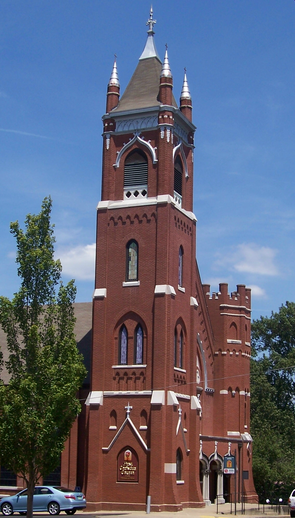
First Christian Church
Monument and historic site · National Register of Historic Places · 1.1 mi
Historic church in Murray, Kentucky, United States

Calloway County Courthouse
Monument and historic site · National Register of Historic Places · 1.1 mi
County courthouse in Murray, United States of America
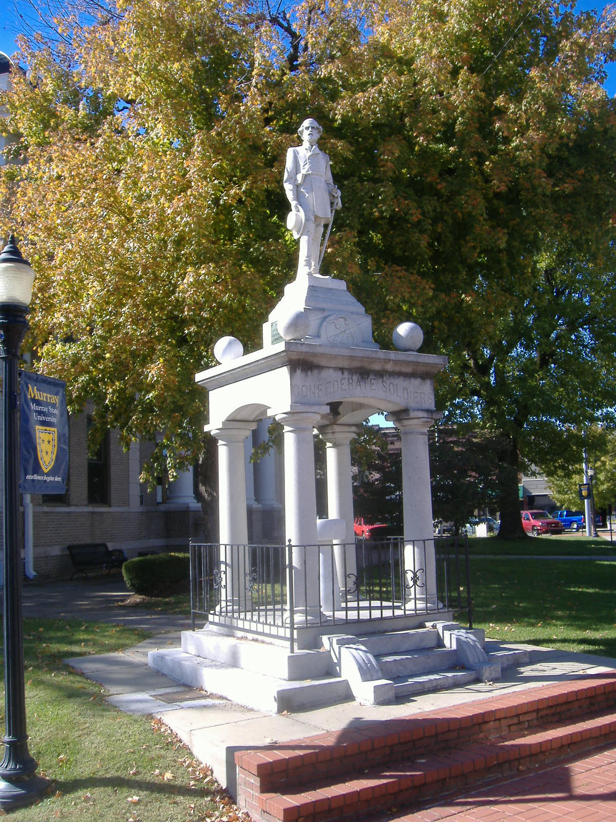


Confederate Monument in Murray
Monument and historic site · National Register of Historic Places · 1.0 mi
Sculpture in Kentucky, United States of America

Edwin S. Diuguid House
Monument and historic site · National Register of Historic Places · 1.0 mi
Single-family detached home in Murray, United States of America

Parks, trails and playgrounds10



Central Park
Park · 0.9 mi
Swimming, Baseball, Skate Board Park, Amphitheater, Playhouse Theater, kids play ground areas and picnic areas.
Restaurants and cafes66



The Burrito Shack
Restaurant · Mexican
214 North 15th Street, Murray
Mo-Sa 11:00-21:00
Mister B's Pizza & Wings
Restaurant · Pizza, Wings, Salad · 0.8 mi
807 Wal-Mart Drive, Murray
Shogun Japanese Steak & Sushi
Restaurant · Japanese, Sushi · 0.8 mi
706 North 12th Street, Murray
54 more on the map.
Where to stay8
Holiday Inn Express & Suites
Motel and hotel · 1.5 mi
1504 North 12th Street, Murray
Quality Inn Murray University Area
Motel and hotel · 1.2 mi
1210 North 12th Street
Churches and places of worship18
First Baptist Church
Church · National Register of Historic Places · 1.2 mi
Shopping13
Gas and EV charging12
Schools, colleges and libraries23
Healthcare8
Map of Murray
169 places. The map loads OpenStreetMap tiles when you open it.
Climate by month
Monthly table
| Month | High | Low | Rain | Snow |
|---|---|---|---|---|
| Jan | 46°F | 27°F | 4.2 in | 2.3 in |
| Feb | 50°F | 31°F | 5.2 in | 1.8 in |
| Mar | 61°F | 38°F | 5.5 in | 1.0 in |
| Apr | 71°F | 48°F | 5.6 in | 0.1 in |
| May | 79°F | 57°F | 5.8 in | 0.0 in |
| Jun | 86°F | 65°F | 5.3 in | 0.0 in |
| Jul | 89°F | 69°F | 4.7 in | 0.0 in |
| Aug | 89°F | 67°F | 3.6 in | 0.0 in |
| Sep | 83°F | 60°F | 3.9 in | 0.0 in |
| Oct | 71°F | 48°F | 4.1 in | 0.1 in |
| Nov | 58°F | 38°F | 4.6 in | 0.1 in |
| Dec | 48°F | 31°F | 5.5 in | 1.1 in |
U.S. Climate Normals 1991-2020 for Murray (1 mi away), NOAA NCEI.
People and cost of living
American Community Survey 5-year estimates, 2020-2024, U.S. Census Bureau. Estimates have margins of error, larger for small towns.
Disaster history
Calloway County has had 17 federal disaster declarations since 2000, most often for severe storms.
- 2026-01-24: Severe Winter Storm (Winter Storm)
- 2025-04-24: Severe Storms, Straight-Line Winds, Tornadoes, Flooding, Landslides, And Mudslides (Severe Storm)
- 2025-04-03: Severe Storms, Straight-Line Winds, Tornadoes, And Flooding (Severe Storm)
- 2025-02-16: Severe Storms, Straight-Line Winds, Flooding, And Landslides (Severe Storm)
- 2024-07-23: Severe Storms, Straight-Line Winds, Tornadoes, Landslides, And Mudslides (Severe Storm)
- 2023-04-10: Severe Storms, Straight-Line Winds, Tornadoes, Flooding, Landslides, And Mudslides (Severe Storm)
OpenFEMA disaster declarations summaries.
Getting there and nearby towns
Kyle-Oakley Field (CEY) is the nearest airport with scheduled flights listed in OpenStreetMap, 4 miles away.
- Hardin 10 mi north, about 17 min by car
- Puryear 12 mi south, about 19 min by car
- Benton 16 mi north, about 26 min by car
- Sedalia 16 mi west, about 25 min by car
- Mayfield 20 mi northwest, about 32 min by car
- Paris 22 mi south, about 36 min by car
- Wingo 23 mi west, about 38 min by car
- Fort Campbell North 47 mi east, about 1 h 15 min by car
- Hopkinsville 49 mi east, about 1 h 15 min by car
- Clarksville 54 mi east, about 1 h 30 min by car
Drive times are estimates from straight-line distance, not routes.
Local news
Headlines from INDB, the NEMICO news database.
Reviews, tips and questions
Loading what members have shared...
Sources and licences
- NCES EDGE (Public domain): public schools
- NOAA NCEI U.S. Climate Normals 1991-2020 (Public domain): climate by month
- OpenFEMA (Public domain): disaster declarations
- OpenStreetMap contributors (ODbL 1.0): places, airports, map data
- U.S. Census Bureau (Public domain): population, income, housing, education, commute
- Wikidata (CC0 1.0): elevation, founding date, time zone, website, landmarks and historic places
- Wikimedia Commons (see each image): photos
- Wikipedia (CC BY-SA 4.0): overview and history text
Photo credits
- Murray, Kentucky from US Highway 641, Thelatchkeykid at English Wikipedia, Public domain
- Desegregation of Murray State College Kentucky Historical Marker, Simon Placr, CC BY-SA 4.0
- Reverse side of Desegregation of Murray State College historical marker, Simon Placr, CC BY-SA 4.0
- Karen Reynolds at Murray DQ, Hannah Bullard, CC BY-SA 4.0
- Greetings from Murray, Kentucky, Birthplace of Radio, Gateway to Kentucky Lake - Large Letter Postcard (13080201615), Steve Shook from Moscow, Idaho, USA, CC BY 2.0
- National Hotel in Murray, Nyttend, Public domain
- Clubhouse of the Murray Women's Club, Nyttend, Public domain
- Fourth on Courthouse Square in Murray, Nyttend, Public domain
- Murray post office 42071, Nyttend, Public domain
- First Baptist Church of Murray, Nyttend, Public domain
- Churchside, Thelatchkeykid at en.wikipedia, CC BY-SA 3.0
- MSU campus-074L (6059659766), Murray State, CC BY 2.0
- Courtsquarechouse, Thelatchkeykid at en.wikipedia, CC BY-SA 3.0
- Confederate Monument in Murray, C. Bedford Crenshaw, Attribution
- Shoetree MSU, Fritz Knobel, CC BY-SA 3.0
- Businesscollege MSU, Fritz Knobel, CC BY-SA 3.0
- ACS GT MAG 3 Spoke Hub and Wheel 93 mm, Joel Weinberger, CC BY-SA 4.0
- ACS GT MAG 3 Spoke Hub and Wheel, Joel Weinberger, CC BY-SA 4.0
- HartCollege MSU, Fritz Knobel, CC BY-SA 3.0
- RoyStewart MSU, Fritz Knobel, CC BY-SA 3.0
- CFSB MSU, Fritz Knobel, CC BY-SA 3.0
- Calloway County Public Library, Nyttend, Public domain
- Waldrop House, Nyttend, Public domain
- Edwin Diuguid House, Nyttend, Public domain
- Will Linn House, Nyttend, Public domain
- ISS020-E-52727 - View of Earth, Earth Science and Remote Sensing Unit , Lyndon B. Johnson Space Center, Public domain
- ISS066-E-179646 - View of Earth, Earth Science and Remote Sensing Unit , Lyndon B. Johnson Space Center, Public domain
- ISS066-E-179647 - View of Earth, Earth Science and Remote Sensing Unit , Lyndon B. Johnson Space Center, Public domain
- Micropterus punctulatus 129481915, Brandon Preston, CC BY 4.0


Page built October 30, 2026. Spotted a mistake? Tell us or suggest a place.