




Agua Prieta, Mexico
Agua Prieta is a town of 77,254 people in Sonora, Mexico, founded in 1899.
Why visit Agua Prieta
Townapedia lists 16 museums and landmarks, 7 parks and trails, 28 places to eat, 14 places to stay and 2 attractions in and around town.
Highlights include Double Adobe Site and Douglas Historic District.
Weather in Agua Prieta
Forecast from MET Norway (CC BY 4.0). Full forecast
About Agua Prieta
Agua Prieta (also known as "Bachicuy" in the native Ópata language, meaning 'Blackwater' in English) is a city in the northeastern corner of the Mexican state of Sonora. It stands on the Mexico–U.S. border, adjacent to the town of Douglas, Arizona. It serves as the municipal seat for the municipality of the same name, which covers an area of 3,631.65 km2 (1,402.2 sq mi). In the 2010 census, the city had a population of 79,138 people, making it the seventh-largest community in the state, with a literacy rate of 96.3%.
From the Wikipedia article Agua Prieta (this version), under CC BY-SA 4.0.
Travel tips from other travellers: Agua Prieta on Wikivoyage (CC BY-SA 4.0).
Things to do2

Museums and landmarks16

Double Adobe Site
Monument and historic site · National Register of Historic Places · 3.2 km
Archaeological site in Arizona, United States
Douglas Historic District
Monument and historic site · National Register of Historic Places · 2.8 km
Historic district in Douglas, Arizona
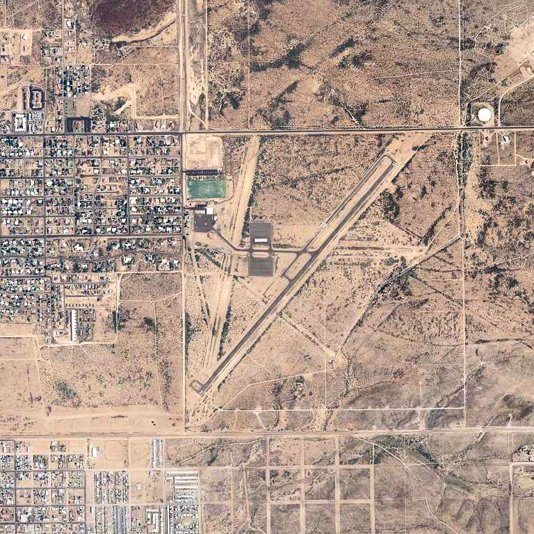
Douglas Municipal Airport
Monument and historic site · National Register of Historic Places · 4.1 km
Airport

Douglas Residential Historic District
Monument and historic site · National Register of Historic Places · 2.5 km
Historic district in Douglas, Arizona

Douglas Sonoran Historic District
Monument and historic site · National Register of Historic Places · 2.7 km
Historic district in Douglas, Arizona, United States

El Paso and Southwestern Railroad Passenger Depot
Monument and historic site · National Register of Historic Places · 3.3 km
Historic railway station in Douglas, Arizona, United States

El Paso and Southwestern Railroad YMCA
Monument and historic site · National Register of Historic Places · 2.8 km
Building in Arizona, United States

Gadsden Hotel
Monument and historic site · National Register of Historic Places · 2.8 km
United States historic place in Cochise County, Arizona

Grand Theatre
Cinema and theater · National Register of Historic Places · 3.0 km
Theater in Douglas, Arizona, United States


United States Post Office and Customs House–Douglas Main
Monument and historic site · National Register of Historic Places · 2.7 km
Custom house in Arizona, United States of America

4 more on the map.
Parks, trails and playgrounds7

Restaurants and cafes28


16 more on the map.
History
The city of Agua Prieta arose at the end of the 19th century as railroads were built between Douglas, Arizona, and Nacozari, Sonora, to transport minerals and goods. As a result, the first settlers of the city, then just a few blocks, were those employed by the U.S. mining company Phelps Dodge Corporation, which was based in Douglas, Arizona. One can say that the town was "founded" in 1899, but it was not until a "contract" was made in 1903 between officials and private citizens, to the name Camou, that area "pertaining" to those citizens was made a Commissary of the municipality of Fronteras. Agua Prieta did not become an independent seat of a municipality, with its current name and location, until August 28, 1916. Rodolfo L. Márquez was the new municipality's first president. It rose to the status of villa (town) on May 8, 1933, and it was "officially" placed in its current category of city relatively recently, on November 6, 1942.
From the History section of Agua Prieta on Wikipedia, under CC BY-SA 4.0.
Where to stay14
Casas YMCA de menores migrantes.
Motel and hotel · 0.7 km
2205 Calle 7, Agua Prieta
Churches and places of worship3
Shopping18
Plaza XPand
Shopping center · 0.9 km
Carretera Agua Prieta-Ascensión, Agua Prieta
Gas and EV charging8
Schools, colleges and libraries14
Healthcare16
Map of Agua Prieta
126 places. The map loads OpenStreetMap tiles when you open it.
Getting there and nearby towns
Cananea Airport (CNA) is the nearest airport with scheduled flights listed in OpenStreetMap, 60 km away.
- Pirtleville 5 km northwest, about 5 min by car
- Douglas 9 km north, about 9 min by car
- Naco 37 km west, about 37 min by car
- Bisbee 38 km west, about 38 min by car
- Naco 38 km west, about 38 min by car
- Sierra Vista Southeast 66 km west, about 1 h by car
- Tombstone 68 km northwest, about 1 h 15 min by car
- Sierra Vista 78 km west, about 1 h 15 min by car
- Whetstone 84 km northwest, about 1 h 30 min by car
- Huachuca City 83 km northwest, about 1 h 30 min by car
Drive times are estimates from straight-line distance, not routes.
Local news
Headlines from INDB.
Reviews, tips and questions
Loading what members have shared...
Sources and licences
- GeoNames (CC BY 4.0): population, coordinates, regions and time zone
- OpenStreetMap contributors (ODbL 1.0): places, airports, map data
- Wikidata (CC0 1.0): elevation, founding date, time zone, website, landmarks and historic places
- Wikimedia Commons (see each image): photos
- Wikipedia (CC BY-SA 4.0): overview and history text
Photo credits
- Agua Prieta, Sonora (23094305546), Comisión Mexicana de Filmaciones from México D. F., México, CC BY-SA 2.0
- Leggett building, Douglas AZ, Intoxyk8 (Charla Henney), CC BY-SA 3.0
- Douglas Municipal Airport-Arizona-2006-USGS, United States Geological Survey (USGS), Public domain
- El Paso and Southwestern Railroad Passenger Depot, Jeff Henley, CC BY-SA 3.0
- El Paso and Southwestern Railroad YMCA, Jeff Henley, CC BY-SA 3.0
- GadsdenHotel, The original uploader was Tillman at English Wikipedia ., CC BY 2.0
- Grand Theatre, Douglas, AZ, Jeff Henley, CC BY-SA 3.0
- Exterior of the Douglas, AZ post office., Intoxyk8 (Charla Henney), CC BY-SA 3.0
- Douglas Sonoran Historic District; H Ave. looking North, Jeff Henley, CC BY-SA 3.0
- 605 E. 10th St, Douglas, AZ, Charla Henney, CC BY-SA 3.0
- USDAgov (55486010435), USDAgov, Public domain
- Gadsden Hotel (40523879383), Chad Johnson from Lake Linden, MI, USA, CC BY 2.0
- Mixed train from Cananea and Nogales (9191431963), Clay Gilliland, CC BY-SA 2.0


Page built November 4, 2026. Spotted a mistake? Tell us or suggest a place.