


Azcapotzalco, Mexico
Azcapotzalco is a town of 414,711 people in Mexico City, Mexico, founded in 1928.
Why visit Azcapotzalco
Townapedia lists 72 museums and landmarks, 76 parks and trails, 155 places to eat, 10 places to stay and 25 attractions in and around town.
Highlights include Acuario Inbursa, Aztlán Parque Urbano, 49 ABC and Angel of Independence.
Weather in Azcapotzalco
Forecast from MET Norway (CC BY 4.0). Full forecast
About Azcapotzalco
Azcapotzalco (Classical Nahuatl: Āzcapōtzalco [aːskapoːˈt͡saɬko] ; Spanish pronunciation: [askapoˈtsalko] ; from āzcapōtzalli "anthill" + -co "place"; literally, "In the place of the anthills") is a borough (demarcación territorial) in Mexico City. Azcapotzalco is in the northwestern part of Mexico City.
From the Wikipedia article Azcapotzalco (this version), under CC BY-SA 4.0.
Travel tips from other travellers: Azcapotzalco on Wikivoyage (CC BY-SA 4.0).
Things to do25


Aztlán Parque Urbano
Monument and historic site · 8.0 km
Amusement park in Mexico City


La Feria Chapultepec Mágico
Monument and historic site · 8.0 km
Former amusement park in Mexico City, Mexico


Palace of Fine arts
Cinema and theater · 7.4 km
Cultural centre in Mexico City

Royal and Pontifical University of Mexico
School · 8.2 km
Historic university in Mexico City (1551–1865)
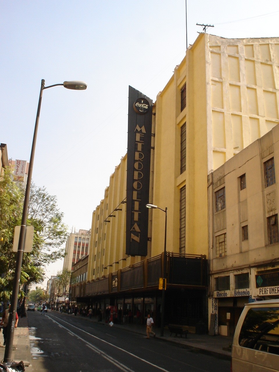
Teatro Metropólitan
Cinema and theater · 7.2 km
Music venue and theater in Mexico City, formerly a movie theater

Universidad de las Américas, Asociación Civil
School · 7.5 km
University in Mexico City (1985-)

13 more on the map.
Museums and landmarks72

49 ABC
Monument and historic site · 7.1 km
Anti-monument in Mexico City

Angel of Independence
Monument and historic site · 6.9 km
Monument in Mexico City

Antimonumento +72
Monument and historic site · 6.9 km
Anti-monument in Mexico City

Borda House
Monument and historic site · 7.8 km
Palace in Mexico City

Canadian totem
Monument and historic site · 7.7 km
Monument in Mexico City

Caricature Museum, Mexico City
Museum · 8.0 km
Building in Mexico City, Mexico


Casa del Poeta López Velarde
Museum · 8.1 km
Building in Coahuila y Tejas, Mexico

Centro Cultural de España
Museum · 8.0 km
Cultural center of Spain in Mexico

Chapultepec aqueduct
Monument and historic site · 7.4 km
Monument in Mexico City, Mexico


Complejo Cultural Los Pinos
Museum · 8.0 km
Mexico City cultural complex
60 more on the map.
Parks, trails and playgrounds76



Azcapotzalco
Park · 2.8 km
Dentro de este parque se encuentran las siguientes canchas: fútbol sala, baloncesto, tenis, balonmano y voleibol; así como áreas de...
406 Boulevard de los Ferrocarriles, Azcapotzalco
Mo-Su 06:00-22:30

Parque Bicentenario
Park · 2.4 km
290 Avenida 5 de Mayo, Ciudad de México


Parque canino
Park · 3.2 km
13 Avenida Somex, Los Reyes Ixtacala
Tu-Su 06:00-18:00
64 more on the map.
Restaurants and cafes155

Corazón de México Cafe
Cafe · Bubble Tea, Coffee Shop, Crepe, Sandwich, Tea · 1.2 km
408 Calzada Azcapotzalco-La Villa
Mo-Fr 08:00-21:00; Sa-Su 10:00-20:00

Con Antojo Truck
Restaurant · Mexican · 3.8 km
11 Calle Mar Adriático, mexico
Mo-Su 09:00-22:00
La Rodante Pizzería
Restaurant · 2.9 km
129 Grecia
We-Su 14:00-21:00
La güera
Restaurant · Mexican · 3.9 km
Local de quesadillas, sopes, pambazos, pozole en fin de semana y demás deliciosos antojitos Mexicanos. ¡Con más de 35 años de tradición local!
Mo-Sa 19:00-23:30

Don Rafael Herencia Michoacana
Ice cream · 3.3 km
540 Avenida de los Maestros
Mo-Su 08:00-22:00
Dosanto Gourmet
Restaurant · 3.2 km
62 Calle Muitle
Mo-Fr 09:00-22:00; Sa-Su 09:00-19:30
143 more on the map.
History
The name is derived from Nahuatl and means "ant hill" with the municipality Aztec glyph depicting a red ant surrounded by corn. It comes from a legend that says that after the creation of the Fifth Sun, the god Quetzalcoatl was tasked with recreating man. To do this, he needed to enter the realm of the dead, Mictlan, to recover the bones of men from the Fourth Sun. Ants helped Quetzalcoatl to find the realm of the dead and bring the bones up as well as grains of corn. Another version of the legend relates to the discovery of corn by observing that ants had put grains underground and corn plants grew there.
The very early history of the area follows that of the rest of the Valley of Mexico. About 7,000 years ago, hunter/gatherers arrived to the valley attracted by the vegetation and large game such as mammoths. Fossilized mammoth, bison and other bones were found when Line 6 of the Metro was constructed. When the large game died out, the inhabitants of the valley turned to agriculture, forming permanent villages sometime between 5000 and 2000 BCE. Plants were domesticated — the most important of which were corn, squash, chili peppers, avocados and beans.
From the History section of Azcapotzalco on Wikipedia, under CC BY-SA 4.0.
Where to stay10
Hotel Villa del Parque - Armas
Motel and hotel · 3.1 km
605 Calz. De Las Armas, Ciudad de México
Churches and places of worship52
Parroquia Cristo Rey de Reyes
Church · Roman Catholic · 3.9 km
S/N Avenida de los Barrios, Tlalnepantla de Baz
Parroquia de Ntra. Sra. de Guadalupe
Church · Roman Catholic · 3.6 km
11 Calle Ignacio López Rayón, Tlalnepantla de Baz
Shopping55
Gas and EV charging32
Schools, colleges and libraries111
Centro de Estudios Científicos y Tecnológicos No. 6 "Miguel Othón de Mendizábal"
School · 3.6 km
Ave. Jardín y Calle 4, México
Centro de Estudios Tecnológicos, Industriales y de Servicios No 33 "Carlos Maria de Bustamante"
School · 2.9 km
84 Avenida Hacienda de Narvarte, Azcapotzalco
Escuela de Enfermería Cruz Roja Mexicana Ciudad de México
School · 2.4 km
20 Avenida Manuel Salazar
Centro de Estudios Científicos y Tecnológicos No. 8
School · 1.2 km
618 Avenida de las Granjas, Ciudad De Mexico
Colegio de Ciencias y Humanidades Plantel Azcapotzalco
School · 2.4 km
2060 Aquiles Serdán, Ciudad de México
Escuela Superior de Ingeniería Mecánica y Eléctrica Azcapotzalco
School · 1.2 km
682 Avenida de las Granjas, Ciudad De Mexico
Healthcare49
Hospital Materno Infantil Dr. Nicolas M. Cedillo
Hospital · 2.2 km
Gustavo Garmendia esq. Víctor Hernández Col.Unidad Francisco Villa., Distrito Federal
Hospital Pediatrico Azcapotzalco
Hospital
731 Avenida Azcapotzalco, Distrito Federal
IMSS Hospital General de Zona 48 S. Pedro Xalpa
Hospital · 2.8 km
300 Calle El Pidio Cortez, Azcapotzalco
Map of Azcapotzalco
250 places. The map loads OpenStreetMap tiles when you open it.
Getting there and nearby towns
Mexico City International Airport (MEX) is the nearest airport with scheduled flights listed in OpenStreetMap, 14 km away.
- Naucalpan de Juárez 6 km west, about 6 min by car
- Tlalnepantla 6 km north, about 6 min by car
- Miguel Hidalgo 6 km south, about 6 min by car
- Cuauhtémoc 6 km southeast, about 6 min by car
- Mexico City 9 km southeast, about 9 min by car
- Iztacalco 14 km southeast, about 14 min by car
- Ecatepec de Morelos 19 km northeast, about 19 min by car
- Ciudad Nezahualcoyotl 20 km southeast, about 20 min by car
- Tlalpan 21 km south, about 21 min by car
- Xochimilco 27 km south, about 27 min by car
Drive times are estimates from straight-line distance, not routes.
Local news
Headlines from INDB.
Reviews, tips and questions
Loading what members have shared...
Sources and licences
- GeoNames (CC BY 4.0): population, coordinates, regions and time zone
- OpenStreetMap contributors (ODbL 1.0): places, airports, map data
- Wikidata (CC0 1.0): elevation, founding date, time zone, website, landmarks and historic places
- Wikimedia Commons (see each image): photos
- Wikipedia (CC BY-SA 4.0): overview and history text
Photo credits
- Avenida Azcapotzalco, ProtoplasmaKid, CC BY-SA 4.0
- Capilla de los Reyes (Azcapotzalco) 01, Dge, CC BY-SA 4.0
- Capilla de los Reyes (Azcapotzalco) 03, Dge, CC BY-SA 4.0
- Capilla Azcapotzalco los reyes, Cesar Saul Chaparro Ortega, CC BY-SA 3.0
- Capilla de Los Reyes, Los Reyes, Azcapotzalco, RicardoGGEE, CC BY-SA 4.0
- Parroquia de San Marcos, San Marcos, Azcapotzalco (2), RicardoGGEE, CC BY-SA 4.0
- Parroquia de San Marcos, San Marcos, Azcapotzalco (1), RicardoGGEE, CC BY-SA 4.0
- Azcapotzalco - Panorámica Plaza Cívica Fernando Montes de Oca, ProtoplasmaKid, CC BY-SA 4.0
- Capilla de San Marcos (Azcapotzalco) 06, Dge, CC BY-SA 4.0
- Capilla de San Marcos (Azcapotzalco) 03, Dge, CC BY-SA 4.0
- Capilla de San Marcos (Azcapotzalco) 05, Dge, CC BY-SA 4.0
- Capilla de San Marcos (Azcapotzalco) 01, Dge, CC BY-SA 4.0
- Azcapotzalco - Escultura de Tezozomoc, ProtoplasmaKid, CC BY-SA 4.0
- Estación de la línea 6 No. 3 Azcapotzalco, Hector Ezequiel, CC BY-SA 4.0
- Los Jarochos de Azcapotzalco, Wotancito, CC BY-SA 4.0
- Torniquetes Azcapotzalco, Rwffh, CC BY-SA 3.0
- Platform Metro Azcapotzalco, Rwffh, CC BY-SA 3.0
- Tour INJUVE Azcapotzalco Grupal 1 (3359415954), Eneas De Troya from Mexico City, México, CC BY 2.0
- Tour INJUVE Azcapotzalco Grupal 2 (3358582927), Eneas De Troya from Mexico City, México, CC BY 2.0
- Iglesia de los apóstoles Felipe y Santiago Azcapotzalco - 4, ProtoplasmaKid, CC BY-SA 3.0
- ParroquiaFelipeSantiago, Azcapotzalco, DF2, AlejandroPZ, CC BY-SA 3.0
- Acuario Inbursa entrance, Keizers, CC BY-SA 3.0
- Mexico City (2018) - 330, Another Believer, CC BY-SA 4.0
- La Feria Chapultepec Mágico, Dag Lindgren, Public domain
- Atardecer En Bellas Artes Vertical, Octavio Alonso Maya Castro, CC BY-SA 3.0
- Placa relativa a la Real y Pontificia Universidad de México, Patricia Alzuarte Díaz, CC BY-SA 3.0
- TEATRO METROPOLITAN EN EL D. F., No machine-readable author provided. JEDIKNIGHT1970 assumed (based on copyright claims)., CC BY-SA 2.5
- Antimonumento de la Guardería ABC 22, Luis Alvaz, CC BY-SA 4.0
- Angel de la independencia170409, Carlos Valenzuela, CC BY-SA 4.0
- Antimonumento por la masacre de migrantes en San Fernando, Tamaulipas 1 (cropped), EneasMx, CC BY-SA 4.0
- BordaHouseDF, Thelmadatter, CC BY-SA 3.0
- Totem Canadiense DSC 0441 (33954720623), Gobierno CDMX, CC0
- Colegio de Cristo Mexico City, Ymblanter, CC BY-SA 4.0
- Casa del Lago 2, Jesman 007, CC BY-SA 3.0
- Lvelarde, Anonymous Unknown author, Public domain
- CCEMEXFacade01, AlejandroLinaresGarcia, CC BY-SA 3.0
- Acueducto de Chapultepec, Martiktoluca, CC BY-SA 3.0
- Museo Júmex front, Keizers, CC BY-SA 3.0
- Los Pinos, Mexico 2018, Drkgk, CC BY-SA 4.0
- Homenaje a José José en Parque de la China - 1, ProtoplasmaKid, CC BY-SA 4.0
- Lago Tezozómoc, Adrián Cerón, CC BY-SA 4.0
- Alameda Central CDMX IMG 0731 (25892685445), Gobierno CDMX, CC0
- Dgzentradachapultepec, Nonbeach, CC BY-SA 3.0
- Monumento al Gral. Lázaro Cárdenas, Equipo 9mkt, CC BY-SA 3.0
- ClockTowerPolancoDF, Thelmadatter, Public domain
- Plaza Río de Janeiro Colonia Roma, Jake Galán, CC BY-SA 3.0
- Mexico city Insigne y Nacional Basílica de Santa María de Guadalupe 7, Arne Müseler, CC BY-SA 3.0 de
- TEMPLO DE SAN BERNARDO 1, Tonatiuh101, CC BY-SA 3.0
- Convento de San Francisco - Ciudad de México - 1, ProtoplasmaKid, CC BY-SA 3.0
- Catedral de Corpus Christi, Pastoral de la Comunicación, CC BY-SA 3.0
- FacadeLaEnseñanza1DF, Thelmadatter, Public domain
- Catedral Metropolitana de la Ciudad de México 1, ProtoplasmaKid, CC BY-SA 4.0
- Mexico City (2018) - 350, Another Believer, CC BY-SA 4.0
- Templo de Porta Coeli frente, Adán 1209, CC BY-SA 3.0
- Templo y Convento de Regina Coeli, México D.F., México, 2013-10-16, DD 08, Diego Delso, CC BY-SA 3.0
- Templo Expiatorio Nacional de San Felipe de Jesús - Mexico 2024, José Luiz, CC BY-SA 4.0
- Oficinas Generales del Colegio de Bachilleres, Apsu09, CC BY-SA 3.0
- Parque Bicentenario, D.f., Adrián Cerón, CC BY-SA 3.0
- ACMX16, Santix1988, CC BY-SA 3.0
- Gimnasio CECyT 6, E Zorro1000, CC0
- UDLAACDF, Thelmadatter, Public domain
- Mexico City (2018) - 431, Another Believer, CC BY-SA 4.0
- Vista aérea de la Ciudad de México desde el Parque Aztlán 02, ProtoplasmaKid, CC BY 4.0
- ESCUELA NACIONAL DE CIENCIAS BIOLOGICAS, No machine-readable author provided. JEDIKNIGHT1970 assumed (based on copyright claims)., CC BY-SA 2.5


Page built November 4, 2026. Spotted a mistake? Tell us or suggest a place.