


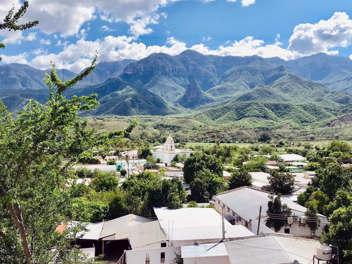


Chínipas de Almada, Mexico
Chínipas de Almada is a town of 1,934 people in Chihuahua, Mexico, founded in 1676.
Why visit Chínipas de Almada
Townapedia lists 3 museums and landmarks and 3 attractions in and around town.
Weather in Chínipas de Almada
Forecast from MET Norway (CC BY 4.0). Full forecast
About Chínipas de Almada
Chínipas de Almada is a town in the south-western portion of the Mexican state of Chihuahua, in the Sierra Madre Occidental. It serves as the municipal seat of the surrounding municipality of Chínipas.
From the Wikipedia article Chínipas de Almada (this version), under CC BY-SA 4.0.
Things to do3

Museums and landmarks3

Churches and places of worship1

History
Chínipas was founded as a mission town by the Jesuits Pedro Juan Castini and Julio Pascual on 31 December 1626. They were both killed, and the mission destroyed, during a Native war against the Spaniards, on 1 February 1632. The mission was rebuilt, slightly downstream, in 1676.
Gold was found locally in 1798, which led to the town's rapid expansion with European settlers in the late 19th century. Well known local family names include Piero, Sarracino the Santinis from Italy, Balderrama from Spain, the Schultzes from Germany, the Russos from Sicily, the O'Leary's from Ireland (now spelled Alire), the Bridge's from England (now spelled Breach) and the Willis' from England (now spelled Villis). The largest mine was called the Palmarejo and was British-owned. The equipment was manufactured in England, shipped to Guaymas on the Sonora coast, transported by mule or donkey to San Bernardo, Sonora and then over the mountains on people's backs.
From the History section of Chínipas de Almada on Wikipedia, under CC BY-SA 4.0.
Map of Chínipas de Almada
7 places. The map loads OpenStreetMap tiles when you open it.
Getting there and nearby towns
Aereopuerto de Alamos (XAL) is the nearest airport with scheduled flights listed in OpenStreetMap, 57 km away.
- Milpillas 24 km southwest, about 24 min by car
- Témoris 29 km southeast, about 29 min by car
- San Bernardo 30 km west, about 30 min by car
- Los Tanques 41 km southwest, about 41 min by car
- Cerocahui 49 km east, about 49 min by car
- Álamos 57 km southwest, about 57 min by car
- El Mocúzarit (Conicárit) 59 km west, about 59 min by car
- Uruachi 61 km northeast, about 1 h by car
- San Rafael 65 km east, about 1 h by car
- Urique 65 km east, about 1 h by car
Drive times are estimates from straight-line distance, not routes.
Local news
Headlines from INDB.
Reviews, tips and questions
Loading what members have shared...
Sources and licences
- GeoNames (CC BY 4.0): population, coordinates, regions and time zone
- OpenStreetMap contributors (ODbL 1.0): places, airports, map data
- Wikidata (CC0 1.0): elevation, founding date, time zone, website
- Wikimedia Commons (see each image): photos
- Wikipedia (CC BY-SA 4.0): overview and history text
Photo credits
- Calle en Chínipas de Almada, MikSed, CC BY 4.0
- Vistas a Chínipas de Almada, MikSed, CC BY 4.0
- Stella nombre Chínipas, Chihuahua, MikSed, CC BY 4.0
Page built November 4, 2026. Spotted a mistake? Tell us or suggest a place.