


Nuevo Laredo, Mexico
Nuevo Laredo is a town of 416,055 people in Tamaulipas, Mexico, founded in 1775.
Why visit Nuevo Laredo
Townapedia lists 16 museums and landmarks, 14 parks and trails, 34 places to eat, 4 places to stay and 8 attractions in and around town.
Highlights include Gateway to the Americas International Bridge, Juárez–Lincoln International Bridge, Barrio Azteca Historic District and Fort McIntosh.
Weather in Nuevo Laredo
Forecast from MET Norway (CC BY 4.0). Full forecast
About Nuevo Laredo
Nuevo Laredo (Spanish pronunciation: [ˈnweβo laˈɾeðo]) is a city in the Municipality of Nuevo Laredo in the Mexican state of Tamaulipas. The city lies on the banks of the Rio Grande, across from Laredo, Texas, United States. The 2010 census population of the city was 373,725. Nuevo Laredo is part of the Laredo-Nuevo Laredo Metropolitan Area with a population of 636,516.
From the Wikipedia article Nuevo Laredo (this version), under CC BY-SA 4.0.
Travel tips from other travellers: Nuevo Laredo on Wikivoyage (CC BY-SA 4.0).
Things to do8

Gateway to the Americas International Bridge
Bridge · 2.7 km
Toll bridge

Juárez–Lincoln International Bridge
Bridge · 3.0 km
International bridge connecting Laredo, Texas, and Laredo, Tamaulipas, on the US–Mexico border

Texas Mexican Railway International Bridge
Bridge · 2.5 km
Bridge in Nuevo Laredo, Tamaulipas

Museums and landmarks16

Barrio Azteca Historic District
Monument and historic site · National Register of Historic Places · 3.4 km
Historic district in Laredo, Webb County, Texas

Fort McIntosh
Monument and historic site · National Register of Historic Places · 3.2 km
Historic district in Laredo, Webb County, Texas
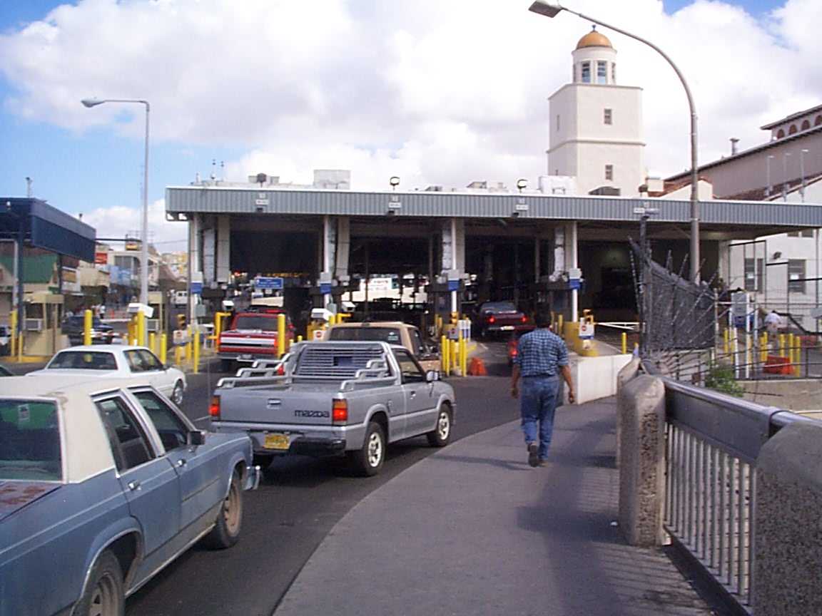
Laredo Convent Avenue Port of Entry
Monument and historic site · National Register of Historic Places · 2.9 km
Building in Laredo, Webb County, Texas

Laredo United States Post Office, Court House and Custom House
Monument and historic site · National Register of Historic Places · 3.5 km
Building in Laredo, Webb County, Texas

San Agustin de Laredo Historic District
Monument and historic site · National Register of Historic Places · 3.1 km
Historic district in Laredo, Webb County, Texas

Webb County Courthouse
Monument and historic site · National Register of Historic Places · 3.6 km
Building in Laredo, Webb County, Texas


4 more on the map.
Parks, trails and playgrounds14


Parque la Junta
Park · 2.5 km
Baseball field in Nuevo Laredo, Tamaulipas, Mexico


2 more on the map.
Restaurants and cafes34

El Papalote Taco & Grill
Restaurant · Mexican · 1.0 km
3102 Avenida Reforma
Mo-Fr 11:45-22:45; Sa-Su 08:00-22:45

Tango-Tango
Restaurant · Argentinian, Pizza, Empanada · 1.4 km
3609 Avenida Reforma
Tu-Sa 08:00-1:00; Su 09:00-23:00
Domino's Pizza Centro Nuevo Laredo
Restaurant · Pizza · 1.4 km
TeaBora
Cafe · Teahouse · 1.4 km
3464 Prolongación Vicente Guerrero
Mo-Fr 07:00-20:30; Sa 09:00-20:30

22 more on the map.
Where to stay4
Churches and places of worship6
Shopping11
Gas and EV charging9
Schools, colleges and libraries21
Healthcare16
Map of Nuevo Laredo
139 places. The map loads OpenStreetMap tiles when you open it.
Getting there and nearby towns
Quetzalcóatl International Airport (NLD) is the nearest airport with scheduled flights listed in OpenStreetMap, 6 km away.
- Laredo 10 km north, about 10 min by car
- El Campanario y Oradel 10 km west, about 10 min by car
- Rio Bravo 13 km south, about 13 min by car
- Los Altos 13 km east, about 13 min by car
- El Cenizo 16 km south, about 16 min by car
- Pueblo Nuevo 20 km east, about 20 min by car
- Ranchos Penitas West 24 km north, about 24 min by car
- Encinal 65 km north, about 1 h by car
- Zapata 69 km south, about 1 h 15 min by car
- Hebbronville 84 km east, about 1 h 30 min by car
Drive times are estimates from straight-line distance, not routes.
Local news
Headlines from INDB.
Reviews, tips and questions
Loading what members have shared...
Sources and licences
- GeoNames (CC BY 4.0): population, coordinates, regions and time zone
- OpenStreetMap contributors (ODbL 1.0): places, airports, map data
- Wikidata (CC0 1.0): elevation, founding date, time zone, website, landmarks and historic places
- Wikimedia Commons (see each image): photos
- Wikipedia (CC BY-SA 4.0): overview and history text
Photo credits
- Presidencia Municipal Edificio, AMAPO, CC BY 3.0
- Nuevo Laredo Tamaulipas, Kevin Dooley, CC BY 2.0
- Cunero Hospital de Especialidades Nuevo Laredo, Miguel Angel Omaña Rojas, CC0
- Pamela Viñals Nuevo Laredo, Miguel Angel Omaña Rojas, CC BY 4.0
- Plaza Zaragoza, Colonia Madero, Nuevo Laredo2, Miguel Angel Omaña Rojas, CC0
- Museo en el edificio antiguo de la estación de ferrocarril en Nuevo Laredo, Miguel Angel Omaña Rojas, CC BY 4.0
- Horacio Garza Garza presidente municipal Nuevo Laredo, Miguel Angel Omaña Rojas, CC BY 4.0
- Mexican street food in Nuevo Laredo, Miguel Angel Omaña Rojas, CC BY 4.0
- Children of Nuevo Laredo in street food stand, Miguel Angel Omaña Rojas, CC BY-SA 4.0
- Street food vendor lady Nuevo Laredo Mexico, Miguel Angel Omaña Rojas, CC BY-SA 4.0
- Parroquia Santo Niño, Nuevo Laredo, Tamaulipas, Catedrales e Iglesias/Cathedrals and Churches, CC BY 2.0
- GTAIBMC, AMAPO, CC BY 3.0
- Laredo br2, Wbaron, CC BY-SA 3.0
- Railway Bridge, AMAPO, CC BY 3.0
- ElAztecaSandstoneHouse, Jessevannaajar, CC BY-SA 3.0
- Laredo br1 port of entry, Wbaron, CC BY-SA 3.0
- Laredo Post Office and Courthouse, Laredo, Texas, Carol M. Highsmith, Public domain
- San Agustin Cathedral Tower, AMAPO, CC BY 2.5
- Webb County Courthouse 2007, AMAPO, CC BY-SA 3.0
- Rio Grande Republic Capitol, AMAPO, CC BY 2.5
- Vista nocturna del Parque La Junta, Gilgalindo81, CC BY-SA 4.0
- San Agustin Cathedral, AMAPO, CC BY 2.5
- Iglesia del Santo Niño, Pasquale jc97, CC BY-SA 4.0
- Parroquia del Santo Niño Torre, Copernico Contreras, CC BY-SA 3.0
- Iglesia santo Niño , ( parte frontal ), Pasquale jc97, CC BY-SA 4.0
- Parroquia del Santo Niño, Copernico Contreras, CC BY-SA 3.0
- Raul Cardenas Thomae, Miguel Angel Omaña Rojas, CC BY 4.0
- Imelda Sanmiguel Sanchez, Miguel Angel Omaña Rojas, CC0
- Mexican BBQ gas tank grill, Miguel Angel Omaña Rojas, CC0
- Campus ihs, Alejandro.trejo88, CC BY-SA 4.0


Page built November 4, 2026. Spotted a mistake? Tell us or suggest a place.