


Santa Catarina, Mexico
Santa Catarina is a town of 304,052 people in Nuevo León, Mexico.
Why visit Santa Catarina
Townapedia lists 11 museums and landmarks, 98 parks and trails, 105 places to eat, 12 places to stay and 35 attractions in and around town.
Highlights include Auditorio Banamex, Mirador del Obispado, Faro del Comercio and Government Palace Museum.
Weather in Santa Catarina
Forecast from MET Norway (CC BY 4.0). Full forecast
About Santa Catarina
Santa Catarina is a city in the Mexican state of Nuevo León. It serves as the seat of the municipality of the same name and is part of the Monterrey Metropolitan area.
From the Wikipedia article Santa Catarina, Nuevo León (this version), under CC BY-SA 4.0.
Things to do35

Auditorio Banamex
Cinema and theater · 17.8 km
Amphitheater in Mexico
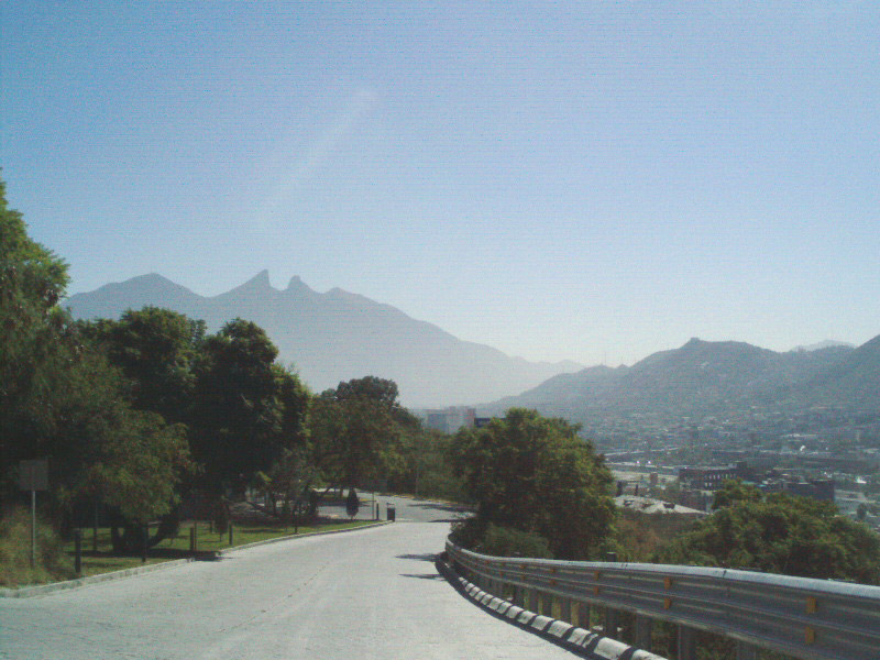
Mirador del Obispado
Monument and historic site · 11.2 km
Hill and lookout in Monterrey, Mexico

Monterrey Institute of Technology and Higher Education
School · 17.0 km
Private multi-campus university in Mexico

Monterrey Institute of Technology and Higher Education, Monterrey
School · 17.0 km
University campus


Universidad Autónoma Nuevo León
School · 16.0 km
Public university in the state Nuevo León in Mexico
Universidad de la vida, la casa de los famosos
School · 13.6 km
Institution of higher education in Monterrey, México
Universidad Metropolitana de Monterrey
School · 14.6 km
Mexican university


23 more on the map.
Museums and landmarks11

Faro del Comercio
Monument and historic site · 14.9 km
Monument in Mexico

Government Palace Museum
Museum · 14.9 km
State government building in Monterrey, Mexico

Museo de Arte Contemporáneo de Monterrey
Museum · 14.9 km
Museum of Contemporary Art in Monterrey, Mexico

Museum of Steel
Museum · 17.5 km
Museum in Monterrey, Nuevo León, Mexico

Palacio del Obispado
Museum · 11.6 km
History Museum in Nuevo Leon, MX


Parks, trails and playgrounds98



Jesus M Garza
Park · 4.2 km
Dddbfgnhmil.ftyhnfghmgj,uyfghgfn
Calle General Francisco Villa, San Pedro
24/7
Parque Hundido Polivalente
Park · 2.5 km
Calle 19 Ote Perimetral Norte, Santa Catarina
24/7
Plaza Colegio , Lopez Mateos
Park · 2.4 km
5 oriente Perimetral Norte, Santa Catarina
24/7
Plaza Colegio Lopez Mateios
Park · 2.4 km
5 oriente Perimetral Norte, Santa Catarina
24/7
86 more on the map.
Restaurants and cafes105


La Frambuesa by Carlls
Cafe · Coffee Shop, Crepe, Deli, Local, Pancake, Regional, Sandwich · 5.7 km
203 Calle Porfirio Díaz
Mo-Sa 06:30-13:00
Mood Coffee
Cafe · Breakfast, Coffee Shop, Crepe, Sandwich · 5.9 km
404 Avenida José Vasconcelos
Mo-Su 08:00-21:00

Sabino’s Bar New Generation
Bar and pub · Grill, Mexican, Regional, Steak House · 5.3 km
350 Avenida José Vasconcelos
Mo-Th 17:00-01:00; Fr-Sa 15:00-02:00
Taquería La Capital
Restaurant · Mexican, Breakfast, Diner, Fries · 8.3 km
1902 Avenida Aarón Sáenz Garza, Monterrey
Mo-Sa 18:00-23:45

BreAd Artisanal Bakers
Bakery · 7.6 km
545A Av. Humberto Lobo, San Pedro Garza García
Mo-Sa 07:00-22:00; Su 08:30-21:00
Casa Blasón
Cafe · Coffee Shop · 8.4 km
245 Calzada del Valle Alberto Santos, San Pedro Garza García
Mo-Sa 08:00-21:00; Su 08:00-14:30
Tim Hortons
Cafe · Coffee Shop · 2.1 km
Avenida Alfonso Reyes, Santa Catarina
Mo-Fr 07:00-21:00; Sa 08:00-21:00; Su 10:00-17:00

Helados Sultana
Ice cream · 8.6 km
217 Avenida José Vasconcelos, San Pedro Garza García
Mo-Su 09:00-21:00
Tortillas Españolas Tillos
Restaurant · Spanish · 6.1 km
613 Calle Hermenegildo Galeana, San Pedro Garza García
Mo-Su 09:00-21:00
93 more on the map.
History
The name of this city comes from the Catholic Saint Catherine of Alexandria.
The city of Santa Catarina was not "founded" in a traditional manner; at the beginning, it was only a resting point for travelers between Monterrey and Saltillo. The first recorded name was "Estancia de Santa Catarina" (Shelter of Santa Catarina).
During the French Invasion of Mexico in the second half of the 19th century, President Benito Juárez spent some days in Santa Catarina while traveling to Monterrey, and it was during this time that he elevated its status to a town (villa). The category of town was maintained until 1979 when the state government elevated its status to a city.
From the History section of Santa Catarina, Nuevo León on Wikipedia, under CC BY-SA 4.0.
Where to stay12
City Express Monterrey Santa Catarina
Motel and hotel · 4.2 km
1135 Carretera Saltillo-Monterrey, Santa Catarina
Hotel Hi! Santa Catarina
Motel and hotel · 2.1 km
338 Boulevard Licenciado Gustavo Díaz Ordaz, Santa Catarina
Krystal Urban Monterrey San Jerónimo
Motel and hotel · 8.2 km
1880 Boulevard Antonio L. Rodríguez, Monterrey
Wyndham Garden Monterrey Valle Real
Motel and hotel · 7.2 km
3062 Boulevard Antonio L. Rodríguez, Monterrey
Churches and places of worship32
Parroquia Cristo Resucitado
Church · Catholic · 2.8 km
223 Bahía de la Paz, Santa Catarina
Shopping69
Bricos
Hardware store · 1.9 km
6a. . Avenida 600, Privada Encinos, Zimix, Santa Catarina, Nuevo León
H-E-B
Grocery · 8.7 km
64349 Ave. Paseo de los Leones, Puerta de Hierro 8901 Col, Cumbres, Monterrey
Gas and EV charging47
Schools, colleges and libraries121
American School Foundation of Monterrey
School · 1.9 km
1500 Ave. Ignacio Morones Prieto
Escuela Secundaria nº 2 Jesús M. Montemayor
School · 5.6 km
703 Calle Licenciado Benito Juárez
Healthcare43
Farmacias del Ahorro
Clinic and pharmacy · 8.6 km
Avenida José Vasconcelos, San Pedro Garza García
Map of Santa Catarina
250 places. The map loads OpenStreetMap tiles when you open it.
Getting there and nearby towns
Del Norte International Airport (NTR) is the nearest airport with scheduled flights listed in OpenStreetMap, 30 km away.
- San Pedro Garza García 6 km east, about 6 min by car
- Mitras Poniente 12 km north, about 12 min by car
- Parque Industrial Ciudad Mitras 13 km north, about 13 min by car
- Valle de Lincoln 13 km north, about 13 min by car
- Los Parques 13 km north, about 13 min by car
- Monterrey 14 km east, about 14 min by car
- San Nicolás de los Garza 17 km northeast, about 17 min by car
- Guadalupe 20 km east, about 20 min by car
- Ciudad General Escobedo 20 km northeast, about 20 min by car
- Saltillo 59 km southwest, about 59 min by car
Drive times are estimates from straight-line distance, not routes.
Local news
Headlines from INDB.
Reviews, tips and questions
Loading what members have shared...
Sources and licences
- GeoNames (CC BY 4.0): population, coordinates, regions and time zone
- OpenStreetMap contributors (ODbL 1.0): places, airports, map data
- Wikidata (CC0 1.0): elevation, founding date, time zone, website, landmarks and historic places
- Wikimedia Commons (see each image): photos
- Wikipedia (CC BY-SA 4.0): overview and history text
Photo credits
- Puertamty, Unknown author, CC BY-SA 3.0
- Auditorio Banamex, Tavoman666, CC BY-SA 3.0
- ITESMMonterreyRectoria03, Thelmadatter, CC BY-SA 3.0
- Puente en Monterrey, Nuevo León, Rick González, CC BY 2.0
- Torre Rectoria UANL (2023), Davidmejoradas, CC BY-SA 4.0
- Farodelcomercio, Cvmontuy, CC BY-SA 3.0
- PALACIO DE GOB, LABNL Lab Cultural Ciudadano, CC BY-SA 2.0
- Fachada MARCO, Limbo@MX C, CC BY 2.5
- Antiguo Obispado o Museo Regional de Nuevo León, Brendablue77, CC BY-SA 3.0
- Parque Fundidora, Monterrey1, México en Fotos, CC BY-SA 2.0
- Montaña en el Parque la huasteca, Anaramirezz, CC BY-SA 4.0
- Basilica de Guadalupe Monterrey 17, Valdez Lopez, CC BY-SA 3.0
- Monterrey - Catedral de la Inmaculada Concepción - 4, This illustration was made by Peter Potrowl . Please credit this with : © Peter Potrowl in the immediate vicinity of the image. A link to my website sitemai.eu would be much appreciated but isn't..., CC BY-SA 4.0
- Monterrey - Antigua basilica de Guadalupe - 2, This illustration was made by Peter Potrowl . Please credit this with : © Peter Potrowl in the immediate vicinity of the image. A link to my website sitemai.eu would be much appreciated but isn't..., CC BY-SA 4.0
- Mirador Obispado 3, Unknown author, CC BY-SA 2.5
- Pabellón Sopladores del Museo del Acero en el Parque Fundidora, Rick González, CC BY 2.0


Page built November 4, 2026. Spotted a mistake? Tell us or suggest a place.