


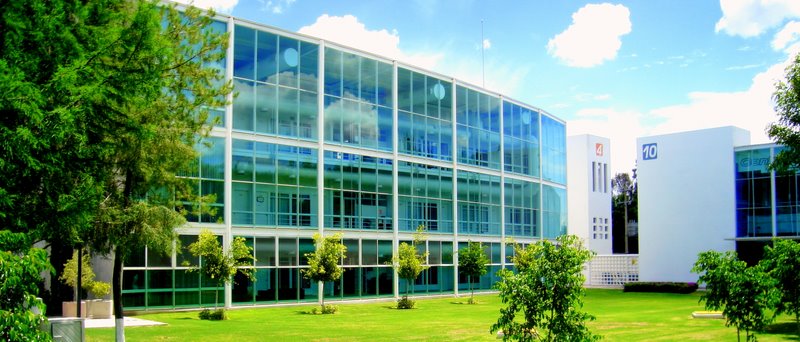


Santa Rosa Jáuregui, Mexico
Santa Rosa Jáuregui is a town of 18,508 people in Querétaro, Mexico.
Why visit Santa Rosa Jáuregui
Townapedia lists 13 museums and landmarks, 96 parks and trails, 164 places to eat, 24 places to stay and 12 attractions in and around town.
Highlights include Autonomous University of Queretaro, Teatro de la República, Zona Sujeta a Conservación Zona Occidental de Microcuencas and Zona Sujeta a Conservación Zona Occidental de Microcuencas.
Weather in Santa Rosa Jáuregui
Forecast from MET Norway (CC BY 4.0). Full forecast
About Santa Rosa Jáuregui
Santa Rosa Jáuregui is one of seven boroughs of the municipality Santiago de Querétaro. It has 16,966 inhabitants, and is located at 1950 meters above sea level. The borough is the largest of the municipality of Querétaro in terms of surface, covering its northern half, though it is the smallest in terms of population. There are fifty three rural and urban settlements, besides the borough of Santa Rosa.
From the Wikipedia article Santa Rosa Jáuregui (this version), under CC BY-SA 4.0.
Things to do12

Autonomous University of Queretaro
School · 17.2 km
University in Mexico

Teatro de la República
Cinema and theater · 17.4 km
Theatre in Querétaro, Mexico
Technological Institute of Querétaro
School · 17.1 km
Educational institution in Mexico
Monterrey Institute of Technology and Higher Education, Querétaro Campus
School · 15.0 km


Museums and landmarks13

Marquesina
Monument and historic site · 13.6 km
229 Playa Rincón, Santiago de Querétaro

1 more on the map.
Parks, trails and playgrounds96

Zona Sujeta a Conservación Zona Occidental de Microcuencas
Hiking and trails · 7.7 km
Zona Sujeta a Conservación Zona Occidental de Microcuencas
Hiking and trails · 8.4 km


Cerro de las Campanas
Park · 17.0 km
Hill and national park in Querétaro, Mexico

Zona Sujeta a Conservación Zona Occidental de Microcuencas
Hiking and trails · 9.8 km
Fuente Real Del Marqués
Park · 10.5 km
Avenida Real del Marqués, Santiago de Querétaro
24/7
Parque Monte Mayor
Park · 10.7 km
Avenida Real del Marqués, Santiago de Querétaro
24/7
84 more on the map.
Restaurants and cafes164

Davino Cortes Premium Querétaro
Restaurant · Steak House, Argentinian · 11.4 km
76230 Carr a S.L.P, Exhacienda de Alvarado km. 8.5, Av. 5 de febrero norte 0, Zona Industrial, Benito Juárez, Santiago de Querétaro, Qro.
Mo-Su 09:00-21:00
La Vinagreta Subs & Salads Querétaro
Restaurant · Salad, Sandwich · 5.7 km
3101 Calle Anillo Vial Fray Junípero Serra, Juriquilla
Mo-Su 10:00-21:00
Mr. Pampas Querétaro
Restaurant · Brazilian · 7.6 km
2 San Luis Potosí, Santiago de Querétaro
Mo-Su 12:00-00:00
Tacos El Pata
Restaurant · Mexican · 10.5 km
9200 Avenida 5 de Febrero, Santiago de Querétaro
Mo-Su,PH 00:00-04:00

La Vaka Juriquilla
Restaurant · 7.7 km
11940 San Luis Potosí – Santiago de Querétaro, Santiago de Querétaro
Tu-Su 13:00-22:00, Su 13:00-21:00
Resturante Emilia
Restaurant · Spanish, Pizza, Italian · 10.1 km
105-Int 3 Priv. de los Industriales, Santiago de Querétaro
Mo-Su 08:00-22:30

Alianza Do Brasil "UpTown Juriquilla"
Restaurant · Brazilian · 7.5 km
Calle Anillo Vial Fray Junípero Serra, Santiago de Querétaro
Mo-Su 12:00-22:00
El Santo Porrón de Jurica
Restaurant · Spanish · 10.4 km
9200 Avenida 5 de Febrero
Tu-Sa 13:30-00:00; Su 13:00-19:00
KHIOS Cocina Mediterránea
Restaurant · Greek · 8.0 km
11555 Paseo de la República, Santiago de Querétaro
Mo-Mo 13:00-01:00
152 more on the map.
History
The area is a perfect place for agricultural activities, and thus is home to four ancient haciendas, namely Juriquilla, La Solana, San Isidro and Santa María del Retablo.
The village of Santa Rosa has its origins in the 17th century, when the first settlers paid rent for fifty years to the owner of the Hacienda of La Solana in order to occupy a small tract of land.
On October 8, 1820, the regidor of Santa Rosa, Captain Antonio Ramón de Güemes, called elections to choose the 17 electors of the members of the first "Ayuntamiento", according to the Constitution of Cadiz. They were held on October 22, 1820, when the village had a population between seven and eight thousand people. On December 24, 1821 the second Ayuntamiento is elected, and on May 5, 1822, the mayor recognizes the independence of Mexico. The Constitutions of 1825, 1869 and 1879 recognize the settlement as a municipality.
In June 1871, the Ayuntamiento asks Ignacio Timoteo Fernández de Jáuregui, owner of the Hacienda of Juriquilla, to sell some land to the municipality, but instead he decided to donate. This enabled the proper foundation of the village, and engineer Mariano Reyes drew the plans of the streets and squares of the new settlement. Hence, in September of that year, the surname of Jáuregui is added to the name of Santa Rosa.
From the History section of Santa Rosa Jáuregui on Wikipedia, under CC BY-SA 4.0.
Where to stay24
Fairfield Inn & Suites Querétaro Juriquilla
Motel and hotel · 7.5 km
Paseo De La Republica Y Fray Junipero Serra, Santiago de Querétaro
Churches and places of worship16
Iglesia de la misericordia
Church · Catholic · 13.7 km
Playa Ángel, Santiago de Querétaro
Templo de Nuestra Señora de Guadalupe
Church · Catholic · 7.6 km
306 Calle Lirios, Santiago de Querétaro
Shopping95
Gas and EV charging35
Schools, colleges and libraries58
Centro de Investigación y de Estudios Avanzados Unidad Querétaro
School · 2.8 km
2000 Libramiento Norponiente, Juriquilla
Escuela Secundaria General Las Americas
School · 13.6 km
104 Playa Rincón, Santiago de Querétaro
Healthcare50
Farmacias Similares
Clinic and pharmacy · 7.2 km
67 Calle Camelinas, Santiago de Querétaro
Benavides
Clinic and pharmacy · 10.5 km
112 Calle Paseo de Jurica, Santiago de Querétaro
Farmacia Guadalajara
Clinic and pharmacy · 7.4 km
4 P.º del Mesón, Santiago de Querétaro
Map of Santa Rosa Jáuregui
250 places. The map loads OpenStreetMap tiles when you open it.
Getting there and nearby towns
Querétaro International Airport (QRO) is the nearest airport with scheduled flights listed in OpenStreetMap, 30 km away.
- Santiago de Querétaro 18 km south, about 18 min by car
- El Pueblito 22 km south, about 22 min by car
- San Miguel de Allende 36 km northwest, about 36 min by car
- Celaya 45 km southwest, about 45 min by car
- San Juan del Río 61 km southeast, about 1 h by car
- San Luis de la Paz 62 km north, about 1 h by car
- Tequisquiapan 63 km southeast, about 1 h by car
- Cadereyta de Montes 66 km east, about 1 h by car
- Salamanca 80 km west, about 1 h 15 min by car
- Guanajuato 90 km west, about 1 h 30 min by car
Drive times are estimates from straight-line distance, not routes.
Local news
Headlines from INDB.
Reviews, tips and questions
Loading what members have shared...
Sources and licences
- GeoNames (CC BY 4.0): population, coordinates, regions and time zone
- OpenStreetMap contributors (ODbL 1.0): places, airports, map data
- Wikidata (CC0 1.0): elevation, founding date, time zone, website, landmarks and historic places
- Wikimedia Commons (see each image): photos
- Wikipedia (CC BY-SA 4.0): overview and history text
Photo credits
- Teatro de la República, Querétaro - 1, Own work, CC BY-SA 4.0
- ExteriorCampusCentro, LuisQuerétaro, CC BY-SA 4.0
- ITESM Campus Queretaro, zmx80, CC BY-SA 2.0
- Capilla de Maximiliano, Ruiz, CC BY-SA 2.0
- Convento de la Cruz Querétaro, Adamcastforth, CC BY-SA 3.0
- Capilla de Maximiliano de Habsburgo, Cerro de las Campanas, Querétaro - Escaleras, Juan Carlos Fonseca Mata, CC BY-SA 4.0
- Catedral de Querétaro (México), Juan Carlos Fonseca Mata, CC BY-SA 4.0
- Parque1, Silnami, Public domain
- Jardines del parque bicentenario Queretaro - panoramio, ed_devilinside, CC BY-SA 3.0
- Pancho Villa, conjunto escultórico Parque Bicentenario, Mizael Contreras, CC BY-SA 4.0
- Cconjunto escultórico Parque Bicentenario, Mizael Contreras, CC BY-SA 4.0
- Rielera, conjunto escultórico Parque Bicentenario 01, Mizael Contreras, CC BY-SA 4.0
- Zapata, conjunto escultórico Parque Bicentenario, Mizael Contreras, CC BY-SA 4.0
- Expresso Bicentanario en Parque Queretaro Bicentenario - panoramio, ed_devilinside, CC BY-SA 3.0
- Laguna del parque bicentenario - panoramio, ed_devilinside, CC BY-SA 3.0
- Panoramica del parque bicentenario - panoramio, ed_devilinside, CC BY-SA 3.0
- Parque Bicentanario Queretaro, Vista desde la presa - panoramio, ed_devilinside, CC BY-SA 3.0
- Parque Bicentenario, vista desde la salida de la tirolesa - panoramio, ed_devilinside, CC BY-SA 3.0
- Parque Bicentenario Queretaro, vista desde bajada por libramiento - panoramio, ed_devilinside, CC BY-SA 3.0
- Manicurista, Carolina preciado g, CC BY-SA 4.0
- Unidades de biomecánica, neurodesarrollo y resonancia magnética (UNAM), Isacdaavid, CC BY-SA 4.0
- ENES Juriquilla UNAM en Querétaro, Sherpaverde09, CC BY 4.0
- Laboratorio Nacional de Visualización Científica Avanzada (UNAM), Isacdaavid, CC BY-SA 4.0
- Los Vigilantes II, escultura de Rubén Maya, Mizael Contreras, CC BY-SA 4.0
- Los Vigilantes I, escultura de Rubén Maya, Mizael Contreras, CC BY-SA 4.0
- Detalle de Los Vigilantes, escultura de Rubén Maya, Mizael Contreras, CC BY-SA 4.0
- Los Vigilantes III, escultura de Rubén Maya, Mizael Contreras, CC BY-SA 4.0
- Instituto de Ingeniería UNAM (Unidad Juriquilla), Isacdaavid, CC BY-SA 4.0
- Centro de Geociencias (UNAM), Isacdaavid, CC BY-SA 4.0
- Centro de Física Aplicada y Tecnología Avanzada (UNAM), Isacdaavid, CC BY-SA 4.0
- UNAM campus Juriquilla, Isacdaavid, CC BY-SA 4.0
- UNAM campus Juriquilla 2, Isacdaavid, CC BY-SA 4.0
- Reloj Centro de Física Aplicada y Tecnología Avanzada (CFATA UNAM), Isacdaavid, CC BY-SA 4.0
- Reloj Centro de Física Aplicada y Tecnología Avanzada (CFATA UNAM) 2, Isacdaavid, CC BY-SA 4.0
- ENTRADA FRACC. CUMBRES DEL LAGO - panoramio, jesusguillermo, CC BY-SA 3.0
- Laboratorio Internacional de Investigación sobre el Genoma Humano (UNAM), Isacdaavid, CC BY-SA 4.0
- Instituto de Neurobiología (UNAM) 2, Isacdaavid, CC BY-SA 4.0
- Instituto de Neurobiología (UNAM), Isacdaavid, CC BY-SA 4.0
- Instituto de Neurobiología UNAM Juriquilla, Agencia Informativa Conacyt, CC BY 4.0
- Centruroides limpidus 22911037, Juan Cruzado Cortés, CC BY-SA 4.0


Page built November 4, 2026. Spotted a mistake? Tell us or suggest a place.