


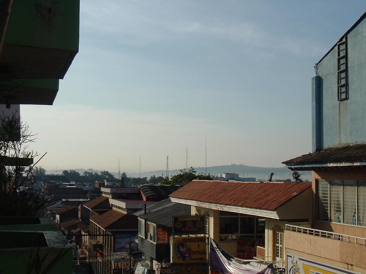


Uruapan, Mexico
Uruapan del Progreso
Uruapan is a town of 299,523 people in Michoacán, Mexico, founded in 1536.
Why visit Uruapan
Townapedia lists 14 museums and landmarks, 29 parks and trails, 38 places to eat, 9 places to stay and 4 attractions in and around town.
Highlights include Foro Cultural La Morada and Barranca del Cupatitzio National Park.
Weather in Uruapan
Forecast from MET Norway (CC BY 4.0). Full forecast
About Uruapan
Uruapan del Progreso, simply known as Uruapan (Spanish pronunciation: [uˈɾwa.pan]), is the second largest city in the Mexican state of Michoacán. It is located at the western edge of the Purépecha highlands, just to the east of the Tierra Caliente region. Since the colonial period, it has been an important city economically due to its location. The city was conquered by the Spanish in 1522, when the last Purépecha ruler fled the Pátzcuaro area to here.
From the Wikipedia article Uruapan (this version), under CC BY-SA 4.0.
Travel tips from other travellers: Uruapan on Wikivoyage (CC BY-SA 4.0).
Things to do4




Museums and landmarks14


2 more on the map.
Parks, trails and playgrounds29

Barranca del Cupatitzio National Park
Park · 0.9 km
National park in Michoacán, Mexico

17 more on the map.
Restaurants and cafes38


Cafe La Lucha
Cafe · Coffee Shop · 0.7 km
Calle García Ortiz, Centro, Uruapan
Mo-Su 09:00-21:00
La Burreria
Restaurant · Regional, Burger, Mexican · 1.1 km
Calle Miguel Treviño, Uruapan
Mo-Su 10:00-21:00

Helado Taiyaki Uruapan
Ice cream · 1.1 km
20 Avenida Latinoamericana, Uruapan
Mo-Su 10:00-18:00
el infierno
Restaurant · Taqueria · 2.0 km
Calle Paseo General Lázaro Cárdenas, uruapan
26 more on the map.
Where to stay9
Churches and places of worship18
Templo de San Miguel Arcangel
Church · Catholic · 1.1 km
62 Juan Delgado, Uruapan, Michoacán
Shopping21
Gas and EV charging3
Schools, colleges and libraries25
Universidad Interamericana para el Desarrollo Sede Uruapan
School · 1.8 km
1390 Carr. Uruapan - Pátzcuaro
Healthcare10
Map of Uruapan
171 places. The map loads OpenStreetMap tiles when you open it.
Getting there and nearby towns
Uruapan International Airport (UPN) is the nearest airport with scheduled flights listed in OpenStreetMap, 3 km away.
- Santa Rosa (Santa Bárbara) 4 km southeast, about 4 min by car
- Jucutácato 5 km southwest, about 5 min by car
- Caltzontzin 6 km east, about 6 min by car
- La Basilia 5 km north, about 5 min by car
- Toreo Bajo (El Toreo Bajo) 6 km northeast, about 6 min by car
- Arandín 7 km west, about 7 min by car
- Nuevo San Juan Parangaricutiro 8 km west, about 8 min by car
- El Arroyo Colorado 7 km south, about 7 min by car
- Cutzato (Cuisato) 10 km southwest, about 10 min by car
- Zamora de Hidalgo 67 km north, about 1 h by car
Drive times are estimates from straight-line distance, not routes.
Local news
Headlines from INDB.
Reviews, tips and questions
Loading what members have shared...
Sources and licences
- GeoNames (CC BY 4.0): population, coordinates, regions and time zone
- OpenStreetMap contributors (ODbL 1.0): places, airports, map data
- Wikidata (CC0 1.0): elevation, founding date, time zone, website, landmarks and historic places
- Wikimedia Commons (see each image): photos
- Wikipedia (CC BY-SA 4.0): overview and history text
Photo credits
- Fuente del parque Nacional Uruapan, Sachavir marcos angel carmona carcelez, CC BY 3.0
- San Francisco, Uruapan, Mich., Mexico - panoramio, juan_upn, CC BY 3.0
- Paisaje urbano de Uruapan, Ronquillo4Hire, CC BY-SA 3.0
- Vista de la ciudad de Uruapan, juan_upn, CC BY 3.0
- Portales de Uruapan. - panoramio, ArCaRa, CC BY 3.0
- InmaculadaConcepcionUruapan01, AlejandroLinaresGarcia, CC BY-SA 4.0
- InmaculadaConcepcionUruapan03, AlejandroLinaresGarcia, CC BY-SA 4.0
- InmaculadaConcepcionUruapan02, AlejandroLinaresGarcia, CC BY-SA 4.0
- GarciaOrtizStreetUruapan, AlejandroLinaresGarcia, CC BY-SA 4.0
- ParishUruapan, AlejandroLinaresGarcia, CC BY-SA 4.0
- ParishUruapan07, AlejandroLinaresGarcia, CC BY-SA 4.0
- ParishUruapan23, AlejandroLinaresGarcia, CC BY-SA 4.0
- ParishUruapan06, AlejandroLinaresGarcia, CC BY-SA 4.0
- ParishUruapan08, AlejandroLinaresGarcia, CC BY-SA 4.0
- ParishUruapan05, AlejandroLinaresGarcia, CC BY-SA 4.0
- StreetUruapan, AlejandroLinaresGarcia, CC BY-SA 4.0
- Presidencia Municipal de Uruapan, Michoacán., Keyomall, CC BY-SA 3.0
- Francisco Villa - panoramio, juan_upn, CC BY 3.0
- TianguisDomingoRamos2015 081, AlejandroLinaresGarcia, CC BY-SA 4.0
- Parroquia de San Francisco, cúpula, Cjuanpavon, CC BY-SA 3.0
- FabricaSanPedro38, AlejandroLinaresGarcia, CC BY-SA 4.0
- FabricaSanPedro50, AlejandroLinaresGarcia, CC BY-SA 4.0
- FabricaSanPedro01, AlejandroLinaresGarcia, CC BY-SA 4.0
- FabricaSanPedro51, AlejandroLinaresGarcia, CC BY-SA 4.0
- FabricaSanPedro37, AlejandroLinaresGarcia, CC BY-SA 4.0
- El Despacho 10, AlejandroLinaresGarcia, CC BY-SA 4.0
- BarrancadeCupatitzioPark28, AlejandroLinaresGarcia, CC BY-SA 4.0
- BarrancadeCupatitzioPark29, AlejandroLinaresGarcia, CC BY-SA 4.0
- BarrancadeCupatitzioPark23, AlejandroLinaresGarcia, CC BY-SA 4.0
- BarrancadeCupatitzioPark26, AlejandroLinaresGarcia, CC BY-SA 4.0
- BarrancadeCupatitzioPark24, AlejandroLinaresGarcia, CC BY-SA 4.0
- BarrancadeCupatitzioPark25, AlejandroLinaresGarcia, CC BY-SA 4.0
- BarrancadeCupatitzioPark27, AlejandroLinaresGarcia, CC BY-SA 4.0
- BarrancadeCupatitzioPark22, AlejandroLinaresGarcia, CC BY-SA 4.0
- BarrancadeCupatitzioPark30, AlejandroLinaresGarcia, CC BY-SA 4.0
- BarrancadeCupatitzioPark31, AlejandroLinaresGarcia, CC BY-SA 4.0
- BarrancadeCupatitzioPark11, AlejandroLinaresGarcia, CC BY-SA 4.0
- BarrancadeCupatitzioPark14, AlejandroLinaresGarcia, CC BY-SA 4.0
- BarrancadeCupatitzioPark21, AlejandroLinaresGarcia, CC BY-SA 4.0
- BarrancadeCupatitzioPark12, AlejandroLinaresGarcia, CC BY-SA 4.0


Page built November 4, 2026. Spotted a mistake? Tell us or suggest a place.