


New City, New York
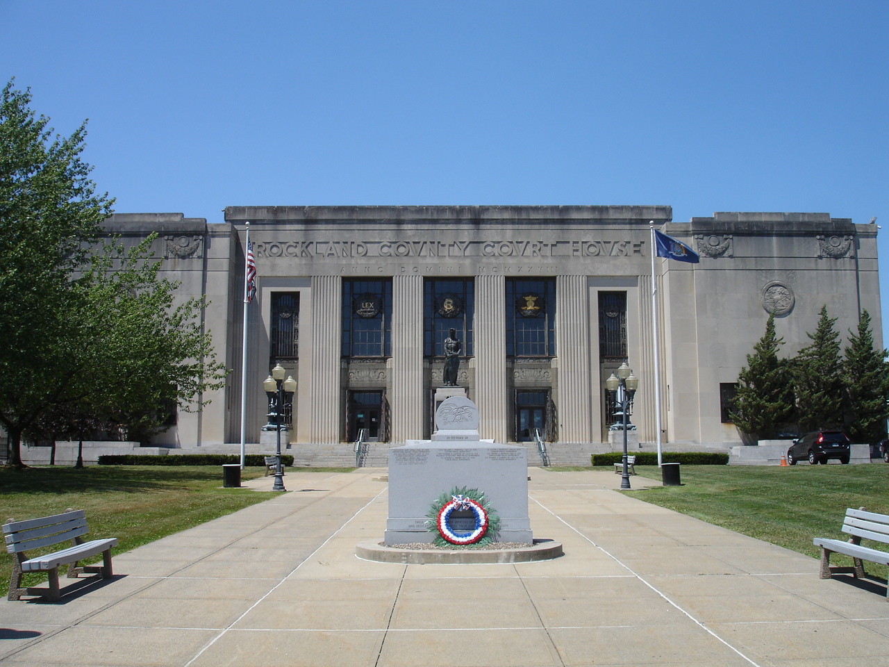
New City is a community of 34,458 people in Rockland County, New York.
Why visit New City
Townapedia lists 31 museums and landmarks, 24 parks and trails, 30 places to eat and 4 attractions in and around town.
Highlights include Yeshiva Zichron Yaakov, High Tor, Blauvelt House and Brookside.
July is the warmest month, with average highs of 83°F; January lows average 17°F, and about 40 inches of snow fall in a normal year.
Weather in New City
Forecast from the National Weather Service. Full forecast
About New City
New City is a hamlet and census-designated place in the town of Clarkstown in Rockland County, New York, United States, part of the New York metropolitan area. A suburb of New York City, the hamlet is located 18 miles (29 km) north of the city at its closest point, Riverdale, Bronx. Within Rockland County, New City is located north of Bardonia, northeast of Nanuet, east of New Square and New Hempstead, south of West Haverstraw and the village of Haverstraw, and west of Congers (across Lake DeForest). New City's population was 35,101 at the 2020 census, making it the 14th most populous CDP/hamlet in the state of New York.
From the Wikipedia article New City, New York (this version), under CC BY-SA 4.0.
Things to do4

Yeshiva Zichron Yaakov
School · 3.4 mi
All-male Jewish Orthodox high school located in New Hempstead, New York

Museums and landmarks31

Blauvelt House
Monument and historic site · National Register of Historic Places · 1.3 mi
Historic house in New York, United States

Brookside
Monument and historic site · National Register of Historic Places · 5.0 mi
Historic home located at Upper Nyack, Rockland County, New York

Contempora House
Monument and historic site · National Register of Historic Places · 2.5 mi
Historic house in New York, United States

Fowler Library Building
Monument and historic site · National Register of Historic Places · 3.4 mi
Historic building in New York, Haverstraw, United States

Fraser-Hoyer House
Monument and historic site · National Register of Historic Places · 4.1 mi
Historic home located at West Haverstraw in Rockland County, New York

H. R. Stevens House
Monument and historic site · National Register of Historic Places · 0.9 mi
Historic house in New York, United States
Henry M. Peck House
Monument and historic site · National Register of Historic Places · 4.1 mi
Haverstraw, New York, listed on the NRHP in Rockland County

Henry Varnum Poor House
Monument and historic site · National Register of Historic Places · 2.6 mi
Historic house in New York, United States

Houser-Conklin House
Monument and historic site · National Register of Historic Places · 4.1 mi
Historic house in New York, United States
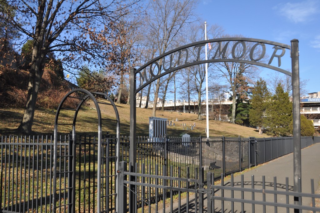
Mount Moor African-American Cemetery
Monument and historic site · National Register of Historic Places · 4.2 mi
Historic cemetery in Rockland County, New York, US

MV Commander
Monument and historic site · National Register of Historic Places · 4.6 mi
Historic motor vessel


North Main Street School
Monument and historic site · National Register of Historic Places · 3.5 mi
School building in New York, United States of America
19 more on the map.
Parks, trails and playgrounds24


Hook Mountain State Park
Hiking and trails · 3.4 mi

Kevin Landau Memorial Park
Park · 0.4 mi
Memorial park set up in the middle of town to honor former firefighter Kevin Landau, who was killed in a tragic accident on service....
Congers Road, New City
12 more on the map.
Restaurants and cafes30

China Garden
Restaurant · Chinese · 3.0 mi
15 State Highway 303 South, Clarkstown
Su-Mo, We-Th 11:00-21:30; Fr-Sa 11:00-22:00
Kobe Sushi
Restaurant · Sushi · 0.8 mi
195 South Main Street, New City
Tu-Th 11:30-22:00; Fr 11:30-23:00; Sa 13:00-23:00; Su 13:00-22:00
New City Pizzeria
Restaurant · Italian Pizza · 0.9 mi
218 South Main Street
Su-Mo 11:00-21:00; Tu-Sa 11:00-22:00
The Little Diner
Restaurant · Diner · 0.4 mi
49 South Main Street, New City
Tu-Sa 07:00-15:00; Su 08:00-15:00

Harbors Cafe
Cafe · American · 3.1 mi
1000 Round Pointe Drive, Haverstraw
Tu-Fr 09:00-20:00, Sa 08:30-20:00, Su 08:30-18:00

Mount Ivy All American Diner
Diner · American · 3.4 mi
1669 Route 202, Pomona
Mo-Su 07:00-22:00

Valley Pizzeria
Restaurant · Pizza, Italian · 3.3 mi
4 Lake Ridge Plaza, Valley Cottage
Mo-Sa 10:00-22:00; Su 11:00-21:00
18 more on the map.
History
Before the Revolutionary War, the land that would later become known as New City was inhabited mostly by Lenni Lenape American Indians. The Dutch were the first Europeans to settle in the area. Orange County was established in 1683 as one of the first 12 counties in Province of New York, which included present day Rockland County. In 1780, Major John André and Josh Hett Smith stopped at Coe's Tavern, located on what is now the corner of New Hempstead Road and Route 45.
New City was formed in 1798, when Rockland County was incorporated as a separate county from the south-easternmost portion of Orange County. With the formation of a new county, there were needs for a new county seat. The central location of New City was a convenient location for a county seat, since travel in 1798 was difficult, and the existing main towns in the county were not centrally located. At the time, the Squadron Cavalry of New York City had a summer encampment of what is now the busy streets of Squadron Boulevard and Cavalry Drive, hence how these streets were named. The community got its name because the founding fathers envisioned a "new" city when forming the new county seat.
From the History section of New City, New York on Wikipedia, under CC BY-SA 4.0.
Churches and places of worship24
Brick Church Complex
Church · National Register of Historic Places · 4.0 mi
First Methodist Episcopal Church of Nyack
Church · National Register of Historic Places · 5.1 mi
Ladentown United Methodist Church
Church · National Register of Historic Places · 4.6 mi
New Hempstead Presbyterian Church
Church · National Register of Historic Places · 2.2 mi
St. Paul's Episcopal Church
Church · National Register of Historic Places · 4.2 mi
Shopping13
Gas and EV charging10
Schools, colleges and libraries63
Haverstraw King's Daughters Public Library
Library · 3.5 mi
10 West Ramapo Road, Garnerville
Healthcare8
Map of New City
207 places. The map loads OpenStreetMap tiles when you open it.
Climate by month
Monthly table
| Month | High | Low | Rain | Snow |
|---|---|---|---|---|
| Jan | 36°F | 17°F | 3.7 in | 8.8 in |
| Feb | 39°F | 18°F | 3.1 in | 12.6 in |
| Mar | 47°F | 25°F | 4.1 in | 8.2 in |
| Apr | 60°F | 36°F | 3.9 in | 1.8 in |
| May | 70°F | 46°F | 3.9 in | 0.0 in |
| Jun | 78°F | 55°F | 5.0 in | 0.0 in |
| Jul | 83°F | 61°F | 4.3 in | 0.0 in |
| Aug | 81°F | 59°F | 4.3 in | 0.0 in |
| Sep | 74°F | 52°F | 4.8 in | 0.0 in |
| Oct | 62°F | 41°F | 4.6 in | 0.0 in |
| Nov | 51°F | 32°F | 4.2 in | 0.5 in |
| Dec | 41°F | 23°F | 4.4 in | 7.6 in |
U.S. Climate Normals 1991-2020 for Yorktown Hts 1W Hcn (13 mi away), NOAA NCEI.
People and cost of living
American Community Survey 5-year estimates, 2020-2024, U.S. Census Bureau. Estimates have margins of error, larger for small towns.
Disaster history
Rockland County has had 20 federal disaster declarations since 2000, most often for hurricanes.
- 2023-07-22: Severe Storms And Flooding (Severe Storm)
- 2021-09-05: Remnants Of Hurricane Ida (Hurricane)
- 2021-09-02: Remnants Of Hurricane Ida (Hurricane)
- 2021-08-22: Hurricane Henri (Hurricane)
- 2020-10-02: Tropical Storm Isaias (Hurricane)
- 2020-03-20: Covid-19 Pandemic (Biological)
OpenFEMA disaster declarations summaries.
Getting there and nearby towns
Westchester County Airport (HPN) is the nearest airport with scheduled flights listed in OpenStreetMap, 16 miles away.
- Haverstraw 3 mi northeast, about 5 min by car
- Nanuet 4 mi south, about 7 min by car
- Monsey 5 mi southwest, about 9 min by car
- Chestnut Ridge 6 mi southwest, about 9 min by car
- Airmont 7 mi southwest, about 11 min by car
- Ramsey 10 mi southwest, about 17 min by car
- Hillsdale 10 mi south, about 17 min by car
- Westwood 11 mi south, about 18 min by car
- Dobbs Ferry 12 mi southeast, about 19 min by car
- Waldwick 12 mi southwest, about 19 min by car
Drive times are estimates from straight-line distance, not routes.
Local news
Headlines from INDB, the NEMICO news database.
Reviews, tips and questions
Loading what members have shared...
Sources and licences
- NCES EDGE (Public domain): public schools
- NOAA NCEI U.S. Climate Normals 1991-2020 (Public domain): climate by month
- OpenFEMA (Public domain): disaster declarations
- OpenStreetMap contributors (ODbL 1.0): places, airports, map data
- U.S. Census Bureau (Public domain): population, income, housing, education, commute
- Wikidata (CC0 1.0): elevation, founding date, time zone, website, landmarks and historic places
- Wikimedia Commons (see each image): photos
- Wikipedia (CC BY-SA 4.0): overview and history text
Photo credits
- RocklandCountyCourthouse, KForce, CC BY-SA 3.0
- First Methodist Episcopal Church of Nyack 4, David Rivera, CC BY-SA 3.0
- New Hempstead Presbyterian Church, New City, NY, Daniel Case, CC BY-SA 3.0
- ST. PAUL'S EPISCOPAL CHURCH, Spring Valley, New York, JERRYE AND ROY KLOTZ, M.D., CC BY-SA 4.0
- Shadowcliff Shadowcliff, also known as the Fellowship of Reconciliation Headquarters, is a historic home located at Upper Nyack, Rockland County, New York, Jimstu8, CC BY-SA 3.0
- Brick Church, Jimstu8, CC BY-SA 3.0
- LADENTOWN UNITED METHODIST CHURCH, ROCKLAND COUNTY NY, JERRYE & ROY KLOTZ. M.D., CC BY-SA 4.0
- HENRY VARNUM POOR HOUSE, NEW CITY, ROCKLAND COUNTY, NY, JERRYE & ROY KLOTZ, M.D., CC BY-SA 4.0
- North Main Street School, Spring Valley, NY, Daniel Case, CC BY-SA 3.0
- WestNyackNY TerneurHuttonHouse, User:Magicpiano, CC BY-SA 4.0
- VAN HOUTEN'S LANDING HISTORIC DISTRICT, ROCKLAND COUNTY NY, JERRYE & ROY KLOTZ, M.D., CC BY-SA 4.0
- SEAMAN-KNAPP HOUSE, POMONA, ROCKLAND COUNTY MY, JERRYE & ROY KLOTZ, M.D., CC BY-SA 4.0
- HR Stevens House, New City, NY, Daniel Case, CC BY-SA 3.0
- The Homestead, Haverstraw, NY, Daniel Case, CC BY-SA 3.0
- Upper Nyack Firehouse, David Rivera, CC BY-SA 3.0
- Brookside-Lochbourn, Izzy406, CC BY-SA 3.0
- Haverstraw, NY, post office, Daniel Case, CC BY-SA 3.0
- New York - Palisades Interstate Parkway - 20180904201335, Kapitangrant, CC BY-SA 4.0
- CONTEMPORA HOUSE, NEW CITY, ROCKLAND COUNTY NY, JERRYE & ROY KLOTZ, M.D., CC BY-SA 4.0
- Jacob Blauvelt House, Alexisrael, CC BY-SA 3.0
- PETER DEPEW HOUSE, NEW CITY, ROCKLAND COUNTY NY, JERRYE & ROY KLOTZ, M.D., CC BY-SA 4.0
- WestNyackNY MountMoorCemetery 01, User:Magicpiano, CC BY-SA 4.0
- HOUSER-CONKLIN HOUSE, MONSEY, ROCKLAND COUNTY, NY, JERRYE & ROY KLOTZ. M.D., CC BY-SA 4.0
- Haverstraw King's Daughters Public Library, Daniel Case, CC BY-SA 3.0
- Spring Valley, NY, post office, Daniel Case, CC BY-SA 3.0
- MV Commander July 2018, Godsfriendchuck, CC BY-SA 4.0
- 9.6.07PalisadesCenterMallFoodCourtbyLuigiNovi, Nightscream at English Wikipedia, CC BY-SA 2.5


Page built October 30, 2026. Spotted a mistake? Tell us or suggest a place.