


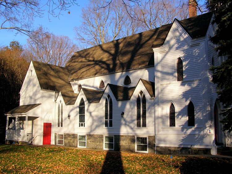


New Hartford Center, Connecticut
New Hartford Center is a community of 1,373 people in Connecticut.
Why visit New Hartford Center
Townapedia lists 11 museums and landmarks, 5 parks and trails, 6 places to eat and 3 attractions in and around town.
Highlights include Breezy Hill, Holcomb Hill, American Legion Forest CCC Shelter and Barkhamsted Center Historic District.
July is the warmest month, with average highs of 84°F; January lows average 14°F, and about 51 inches of snow fall in a normal year.
Weather in New Hartford Center
Forecast from the National Weather Service. Full forecast
About New Hartford Center
New Hartford Center is a census-designated place (CDP) in Litchfield County, Connecticut, United States. It comprises the village of New Hartford, the adjacent Pine Meadow Historic District, and some surrounding forest land, all within the town of New Hartford. As of the 2020 census, New Hartford Center had a population of 1,284.
From the Wikipedia article New Hartford Center, Connecticut (this version), under CC BY-SA 4.0.
Things to do3

Museums and landmarks11
American Legion Forest CCC Shelter
Monument and historic site · National Register of Historic Places · 3.7 mi
United States historic place

Barkhamsted Center Historic District
Monument and historic site · National Register of Historic Places · 3.4 mi
Historic district in Barkhamsted, Connecticut

Barkhamsted Lighthouse
Monument and historic site · National Register of Historic Places · 3.6 mi
Archaeological site in Connecticut, United States

Canton Center Historic District
Monument and historic site · National Register of Historic Places · 3.3 mi
Historic district in Connecticut, USA

Esperanza
Monument and historic site · National Register of Historic Places · 2.3 mi
Historic house in Connecticut, United States
Peoples Forest Museum
Monument and historic site · National Register of Historic Places · 3.3 mi
Forestry museum in Barkhamsted, USA
Philip Chapin House
Monument and historic site · National Register of Historic Places · 0.5 mi
Historic house in Connecticut, United States
Pine Meadow Historic District
Monument and historic site · National Register of Historic Places · 0.5 mi
Historic district in Connecticut, United States
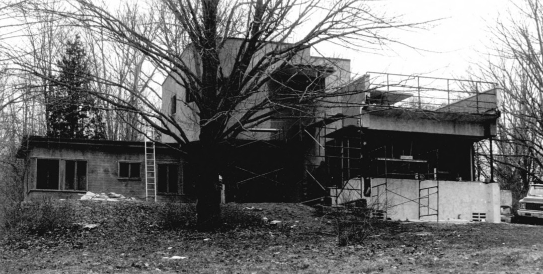


Sun Terrace
Monument and historic site · National Register of Historic Places · 2.8 mi
Historic house on Stub Hollow Road in New Hartford, Connecticut

Parks, trails and playgrounds5


Ski Sundown
Sports field and stadium · 1.6 mi
Ski area in New Hartford, Connecticut
126 Ratlum Road, New Hartford

The Village
Hiking and trails · 1.3 mi
Private, Open To Public With Fee
104 Goose Green Road, Barkhamsted
Restaurants and cafes6

Brewery Legitimus
Bar and pub · 0.9 mi
283 Main Street, New Hartford
Mo-We off; Th,Fr 16:00-21:00; Sa 12:00-21:00; Su 12:00-17:00


Dunkin'
Fast food · Donut, Coffee Shop · 0.4 mi
507 Main Street, New Hartford
Mo-Sa 04:30-20:00; Su 06:00-20:00
Churches and places of worship1
Immaculate Conception Catholic Church
Church · Roman Catholic · 0.4 mi
3 Church Street North, New Hartford
Shopping2
Schools, colleges and libraries14
Map of New Hartford Center
42 places. The map loads OpenStreetMap tiles when you open it.
Climate by month
Monthly table
| Month | High | Low | Rain | Snow |
|---|---|---|---|---|
| Jan | 34°F | 14°F | 3.6 in | 13.5 in |
| Feb | 37°F | 15°F | 3.2 in | 15.1 in |
| Mar | 46°F | 24°F | 4.2 in | 9.6 in |
| Apr | 59°F | 35°F | 4.0 in | 0.8 in |
| May | 70°F | 45°F | 4.0 in | 0.0 in |
| Jun | 79°F | 55°F | 4.8 in | 0.0 in |
| Jul | 84°F | 60°F | 4.5 in | 0.0 in |
| Aug | 82°F | 58°F | 4.3 in | 0.0 in |
| Sep | 75°F | 51°F | 4.8 in | 0.0 in |
| Oct | 63°F | 40°F | 5.2 in | 0.4 in |
| Nov | 50°F | 30°F | 3.9 in | 2.0 in |
| Dec | 39°F | 21°F | 4.6 in | 10.0 in |
U.S. Climate Normals 1991-2020 for Barkhamsted (3 mi away), NOAA NCEI.
People and cost of living
American Community Survey 5-year estimates, 2020-2024, U.S. Census Bureau. Estimates have margins of error, larger for small towns.
Disaster history
The county has had 23 federal disaster declarations since 2000, most often for hurricanes.
- 2024-09-20: Severe Storm, Flooding, Landslides, And Mudslides (Severe Storm)
- 2024-08-21: Severe Storms, Flooding, Landslides, And Mudslides (Severe Storm)
- 2021-10-30: Remnants Of Hurricane Ida (Hurricane)
- 2021-08-22: Hurricane Henri (Hurricane)
- 2021-01-12: Tropical Storm Isaias (Hurricane)
- 2020-08-06: Tropical Storm Isaias (Hurricane)
OpenFEMA disaster declarations summaries.
Getting there and nearby towns
Bradley International Airport (BDL) is the nearest airport with scheduled flights listed in OpenStreetMap, 16 miles away.
- Canton Valley 5 mi southeast, about 8 min by car
- Torrington 9 mi west, about 14 min by car
- West Hartford 14 mi southeast, about 22 min by car
- Bristol 14 mi south, about 22 min by car
- Hartford 17 mi southeast, about 27 min by car
- New Britain 17 mi southeast, about 27 min by car
- Windsor Locks 17 mi east, about 27 min by car
- Newington 18 mi southeast, about 29 min by car
- Wethersfield 20 mi southeast, about 32 min by car
- East Hartford 21 mi southeast, about 33 min by car
Drive times are estimates from straight-line distance, not routes.
Local news
Headlines from INDB, the NEMICO news database.
Reviews, tips and questions
Loading what members have shared...
Sources and licences
- NCES EDGE (Public domain): public schools
- NOAA NCEI U.S. Climate Normals 1991-2020 (Public domain): climate by month
- OpenFEMA (Public domain): disaster declarations
- OpenStreetMap contributors (ODbL 1.0): places, airports, map data
- U.S. Census Bureau (Public domain): population, income, housing, education, commute
- Wikidata (CC0 1.0): elevation, founding date, time zone, website, landmarks and historic places
- Wikimedia Commons (see each image): photos
- Wikipedia (CC BY-SA 4.0): overview and history text
Photo credits
- Town Hall, New Hartford CT, John Phelan, CC BY-SA 4.0
- AmericanLegionStateForest CCCShelter, Magicpiano, CC BY-SA 4.0
- StJohnsChurchNewHartfordCT, Jerry Dougherty, CC BY 2.5
- PeoplesStateForest Museum, Magicpiano, CC BY-SA 3.0
- ESPERANZA, NEW HARTFORD, LITCHFIELD COUNTY, CT, JERRYE & ROY KLOTZ, M.D., CC BY-SA 4.0
- 259 Cherry Brook Road (1789) Canton CT, Sphilbrick, CC BY-SA 3.0
- Barkhamsted 1821 Schoolhouse, Jerry Dougherty, CC BY 2.5
- SunTerrace NewHartford, Dana Elza, Public domain
- Pine Meadow, CT, CTsignhunt, CC0
- New Hartford, circa 1897, Philadelphia, Reading and New England Railroad, Public domain
- Dunkin Donuts, New Hartford CT, John Phelan, CC BY-SA 4.0
- 4 Bridge St, New Hartford CT, John Phelan, CC BY-SA 4.0
- New Hartford House, New Hartford, CT, pedrik, CC BY 2.0
- NewHartfordCT PineMeadowHD 3, Magicpiano, CC BY-SA 3.0
- NewHartfordCT PineMeadowHD 4, Magicpiano, CC BY-SA 3.0
- NewHartfordCT PineMeadowHD 1, Magicpiano, CC BY-SA 3.0
- NewHartfordCT PineMeadowHD 2, Magicpiano, CC BY-SA 3.0
- Licia and Mason Beekley Community Library, New Hartford CT, John Phelan, CC BY 4.0
- Pine Meadow Cemetery, Pine Meadow CT, John Phelan, CC BY 4.0
- NewHartfordCT PhilipChapinHouse, Magicpiano, CC BY-SA 3.0
- St Johns Episcopal Church, Pine Meadow CT, John Phelan, CC BY-SA 4.0
- Chapin Park, Pine Meadow CT, John Phelan, CC BY-SA 4.0
- Post Office, Pine Meadow CT, John Phelan, CC BY-SA 4.0
- New Hartford, CT, CTsignhunt, CC0
- CT Route 219 bridge over the East Branch Farmington River, New Hartford CT, John Phelan, CC BY 4.0
- Barkhamsted banner, Morrowlong, CC BY-SA 3.0
- LakeMcdonoughFromTunxisTrail, Morrowlong, CC BY-SA 3.0
- Puddletown Adventures, New Hartford CT, John Phelan, CC BY 4.0
- Kara Lawson at South Carolina game, Sphilbrick, CC BY-SA 4.0
- ISS067-E-253365 - View of Earth, Earth Science and Remote Sensing Unit , Lyndon B. Johnson Space Center, Public domain
- ISS044-E-7754 - View of Earth, Earth Science and Remote Sensing Unit , Lyndon B. Johnson Space Center, Public domain
- ISS044-E-7753 - View of Earth, Earth Science and Remote Sensing Unit , Lyndon B. Johnson Space Center, Public domain
- ISS044-E-7752 - View of Earth, Earth Science and Remote Sensing Unit , Lyndon B. Johnson Space Center, Public domain
- ISS044-E-7751 - View of Earth, Earth Science and Remote Sensing Unit , Lyndon B. Johnson Space Center, Public domain


Page built October 30, 2026. Spotted a mistake? Tell us or suggest a place.