


Bristol, Connecticut
Bristol is a city of 61,462 people in Connecticut, founded in 1785.
Why visit Bristol
Townapedia lists 60 museums and landmarks, 50 parks and trails, 80 places to eat, 3 places to stay and 21 attractions in and around town.
Highlights include Ingraham House, Campground Hill, American Clock and Watch Museum and East Plymouth Historic District.
July is the warmest month, with average highs of 84°F; January lows average 17°F, and about 39 inches of snow fall in a normal year.
Weather in Bristol
Forecast from the National Weather Service. Full forecast
About Bristol
Bristol is a suburban city located in Hartford County, Connecticut, United States. The city is part of the Naugatuck Valley Planning Region. As of the 2020 census, the population of the city was 60,833.
From the Wikipedia article Bristol, Connecticut (this version), under CC BY-SA 4.0.
Things to do21


9 more on the map.
Museums and landmarks60


East Plymouth Historic District
Monument and historic site · National Register of Historic Places · 3.0 mi
Plymouth, CT, listed on the NRHP in Connecticut

Endee Manor Historic District
Monument and historic site · National Register of Historic Places · 0.9 mi
Historic district in Connecticut, United States
Hart's Corner Historic District
Monument and historic site · National Register of Historic Places · 3.8 mi
Historic district in Connecticut, United States

Lake Compounce Carousel
Monument and historic site · National Register of Historic Places · 3.1 mi
Carousel in Southington, Connecticut, United States
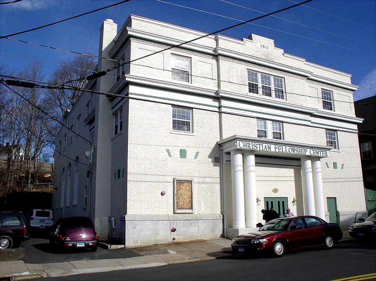
Main Street Historic District
Monument and historic site · National Register of Historic Places · 0.6 mi
Historic area in Bristol, Connecticut, United States
South End Historic District
Monument and historic site · National Register of Historic Places · 1.1 mi
Oldest residential areas of Bristol, Connecticut

Beleden House
Monument and historic site · National Register of Historic Places · 0.4 mi
Historic house in Connecticut, United States

Bristol Girls' Club
Monument and historic site · National Register of Historic Places · 1.0 mi
Clubhouse in Bristol, United States of America

Brown Tavern
Monument and historic site · National Register of Historic Places · 6.2 mi
Historic tavern in Connecticut, United States

Charles H. Norton House
Monument and historic site · National Register of Historic Places · 3.3 mi
Plainville, Connecticut


Clara T. O'Connell School
Monument and historic site · National Register of Historic Places · 1.0 mi
Historic school building at 122 Park Street in Bristol, Connecticut
48 more on the map.
Parks, trails and playgrounds50
Rockwell Park
Park · National Register of Historic Places · 1.2 mi
Park in Bristol, Hartford County, United States of America



38 more on the map.
Restaurants and cafes80

Saint’s
Diner · American · 4.2 mi
Restaurant and Catering
1248 Queen Street, Southington
Mo,We-Sa 06:00-20:00; Tu,Su 06:00-14:00

Cravings an American Eatery
Restaurant · Sandwich, Salad, Cake, Ice Cream, American · 2.1 mi
1158 Farmington Avenue, Bristol
Mo-Sa 07:00-20:00; Su 08:00-16:00
Golden Mango
Restaurant · Japanese, Thai · 3.9 mi
2 Spring Lane, Farmington
Mo-Th 11:00-21:30, Fr-Sa 11:00-22:30, Su 12:00-21:30
Main Street Pint & Plate
Diner · American · 0.7 mi
182 Main Street, Bristol
Mo-Tu closed, We-Th 16:00-22:00, Fr 16:00-23:00, Sa 15:00-23:00,...

Starbucks
Cafe · Coffee Shop · 1.1 mi
641 Farmington Avenue, Bristol
Th 08:00-24:00,05:00-20:30, Mo-We,Fr 08:00-18:00,05:00-20:30,...

Roma Pizza and Deli
Restaurant · 2.8 mi
95 Forestville Avenue, Plainville
Mo-Fr,Su 11:00-22:00, Sa 11:00-23:00
Aroma Joe's
Cafe · Coffee Shop · 2.3 mi
1235 Farmington Avenue, Bristol
Mo-Su 05:00-21:00
Golden City Restaurant
Restaurant · Chinese · 4.1 mi
311 Main Street, Terryville
Mo-Th 11:00-22:00, Fr,Sa 11:00-23:00, Su 12:00-22:00
68 more on the map.
History
The area that includes present-day Bristol was originally inhabited by the Tunxis Native American tribe, one of the Eastern Algonquian-speaking peoples that shared the lower Connecticut River Valley.
Originally, Bristol was within the boundaries of Farmington, Connecticut, which was incorporated in the Connecticut Colony in 1645. This deed was confirmed by another deed in 1650. The first actual settler of Bristol was Daniel Brownson, who built a house near West Street, but did not stay in the area very long. The first permanent settler was Ebenezer Barnes, who the next year built a home on King Street. Also in 1728, Nehemiah Manross arrived from Lebanon, Connecticut, and built a house north of Barnes Street, on the west side of King Street. The following year the first settlement arrived in what became East Bristol when Nathaniel Messenger of Hartford and Benjamin Buck of Southington bought land and built houses along King Street.
From the History section of Bristol, Connecticut on Wikipedia, under CC BY-SA 4.0.
Where to stay3
Churches and places of worship48
Congregational Church of Plainville
Church · National Register of Historic Places · 3.5 mi
Our Lady of Mercy Roman Catholic Church
Church · Roman Catholic · 3.8 mi
94;96 Broad Street, Plainville
Redeemer African Methodist Episcopal Zion Church
Church · African Methodist Episcopal Zion · 4.0 mi
110 Whiting Street, Plainville
Saint Gregory the Great Roman Catholic Church
Church · Roman Catholic · 2.0 mi
235 Maltby Street, Bristol
Shopping19
Gas and EV charging17
Schools, colleges and libraries52
Healthcare13
Community Health Center - Bristol
Clinic and pharmacy · 0.4 mi
395 North Main Street, Bristol
Map of Bristol
250 places. The map loads OpenStreetMap tiles when you open it.
Climate by month
Monthly table
| Month | High | Low | Rain | Snow |
|---|---|---|---|---|
| Jan | 36°F | 17°F | 3.6 in | 11.1 in |
| Feb | 39°F | 18°F | 3.4 in | 11.8 in |
| Mar | 47°F | 26°F | 4.2 in | 5.5 in |
| Apr | 60°F | 36°F | 4.3 in | 0.5 in |
| May | 70°F | 47°F | 4.2 in | 0.0 in |
| Jun | 78°F | 57°F | 4.8 in | 0.0 in |
| Jul | 84°F | 62°F | 4.4 in | 0.0 in |
| Aug | 82°F | 60°F | 5.1 in | 0.0 in |
| Sep | 75°F | 52°F | 5.0 in | 0.0 in |
| Oct | 63°F | 41°F | 5.7 in | 0.6 in |
| Nov | 52°F | 32°F | 3.9 in | 0.8 in |
| Dec | 41°F | 24°F | 4.8 in | 8.3 in |
U.S. Climate Normals 1991-2020 for Burlington (8 mi away), NOAA NCEI.
People and cost of living
American Community Survey 5-year estimates, 2020-2024, U.S. Census Bureau. Estimates have margins of error, larger for small towns.
Disaster history
The county has had 21 federal disaster declarations since 2000, most often for hurricanes.
- 2024-10-24: Hawthorne Fire (Fire)
- 2021-08-22: Hurricane Henri (Hurricane)
- 2021-01-12: Tropical Storm Isaias (Hurricane)
- 2020-08-06: Tropical Storm Isaias (Hurricane)
- 2020-03-28: Covid-19 Pandemic (Biological)
- 2020-03-13: Covid-19 (Biological)
OpenFEMA disaster declarations summaries.
Getting there and nearby towns
Hartford–Brainard Airport (HFD) is the nearest airport with scheduled flights listed in OpenStreetMap, 16 miles away.
- Terryville 3 mi west, about 6 min by car
- Plantsville 7 mi south, about 12 min by car
- Thomaston 7 mi west, about 12 min by car
- New Britain 8 mi east, about 13 min by car
- Waterbury 10 mi southwest, about 16 min by car
- Kensington 10 mi southeast, about 16 min by car
- Oakville 10 mi southwest, about 16 min by car
- Collinsville 10 mi north, about 15 min by car
- West Hartford 11 mi northeast, about 18 min by car
- Newington 11 mi east, about 17 min by car
Drive times are estimates from straight-line distance, not routes.
Local news
Headlines from INDB, the NEMICO news database.
Reviews, tips and questions
Loading what members have shared...
Sources and licences
- NCES EDGE (Public domain): public schools
- NOAA NCEI U.S. Climate Normals 1991-2020 (Public domain): climate by month
- OpenFEMA (Public domain): disaster declarations
- OpenStreetMap contributors (ODbL 1.0): places, airports, map data
- U.S. Census Bureau (Public domain): population, income, housing, education, commute
- Wikidata (CC0 1.0): elevation, founding date, time zone, website, landmarks and historic places
- Wikimedia Commons (see each image): photos
- Wikipedia (CC BY-SA 4.0): overview and history text
Photo credits
- St Joseph Church, Bristol CT, John Phelan, CC BY-SA 3.0
- RockwellParkBristolCT, Jerry Dougherty, CC BY 2.5
- EAST PLYMOUTH HISTORIC DISTRICT, LICHFIELD COUNTY, CT, JERRYE & ROY KLOTZ, M.D., CC BY-SA 4.0
- LakeCompounceCarousel, Martin Lewison, CC BY-SA 2.0
- BurlingtonCT HartsCornerHD 2, Magicpiano, CC BY-SA 4.0
- BristolCT SouthEndHD 3, Magicpiano, CC BY-SA 4.0
- FormerCarberryTheaterBristolCT, Jerry Dougherty, CC BY 2.5
- BristolCT EndeeManorHD 1, Magicpiano, CC BY-SA 4.0
- Jonathan Root House, Sphilbrick, CC BY-SA 3.0
- SouthingtonCT StephenGrannisHouse, David Ransom, Public domain
- BurwellHouseBristolCT, Jerry Dougherty, CC BY 2.5
- BeledenHouseBristolCT, Jerry Dougherty, CC BY 2.5
- SouthingtonCT IcabodBradleyHouse, Magicpiano, CC BY-SA 4.0
- GirlsClubBristolCT, Jerry Dougherty, CC BY 2.5
- West End Library, Farmington, Connecticut, Doug Kerr from Albany, NY, United States, CC BY-SA 2.0
- Poughkeepsie Trust Company, Daniel Case, CC BY-SA 3.0
- Gen. George Cowles House, August 31, 2008, Ragesoss, CC BY-SA 3.0
- BurlingtonCT TreadwellHouse2, Magicpiano, CC BY-SA 4.0
- Brown Tavern, Burlington, Connecticut, Doug Kerr from Albany, NY, United States, CC BY-SA 2.0
- TownGreenWolcottCT, Jerry Dougherty, CC BY 2.5
- Shade Swamp Shelter, TheCatalyst31, CC0
- Charles H. Norton House, Plainville (Hartford County, Connecticut), NPS photographer, Public domain
- FirstCongregationalChurchPlymouthCT, Jerry Dougherty, CC BY 2.5
- SouthingtonCT 590WestStreet, Magicpiano, CC BY-SA 4.0
- BristolCT ClarenceBinghamSchool, Magicpiano, CC BY-SA 4.0
- BristolCT ClaraTOConnellSchool, Doug Kerr, CC BY-SA 2.0


Page built October 30, 2026. Spotted a mistake? Tell us or suggest a place.