


Why visit Osogbo
Townapedia lists 3 museums and landmarks, 2 parks and trails, 3 places to eat, 4 places to stay and 2 attractions in and around town.
Highlights include Fountain University, Osun State University, Osun-Osogbo Grove and Uli Beier Museum.
Weather in Osogbo
Forecast from MET Norway (CC BY 4.0). Full forecast
About Osogbo
Osogbo (also known as Oṣogbo, and seldomly as Oshogbo) is a city in Nigeria. It became the capital city of Osun State in 1991. Osogbo city seats the Headquarters of both Osogbo Local Government Area (situated at Oke-Baale Area of the city) and Olorunda Local Government Area (situated at Igbonna Area of the city). It is some 88 kilometers by road northeast of Ibadan.
From the Wikipedia article Osogbo (this version), under CC BY-SA 4.0.
Travel tips from other travellers: Osogbo on Wikivoyage (CC BY-SA 4.0).
Things to do2

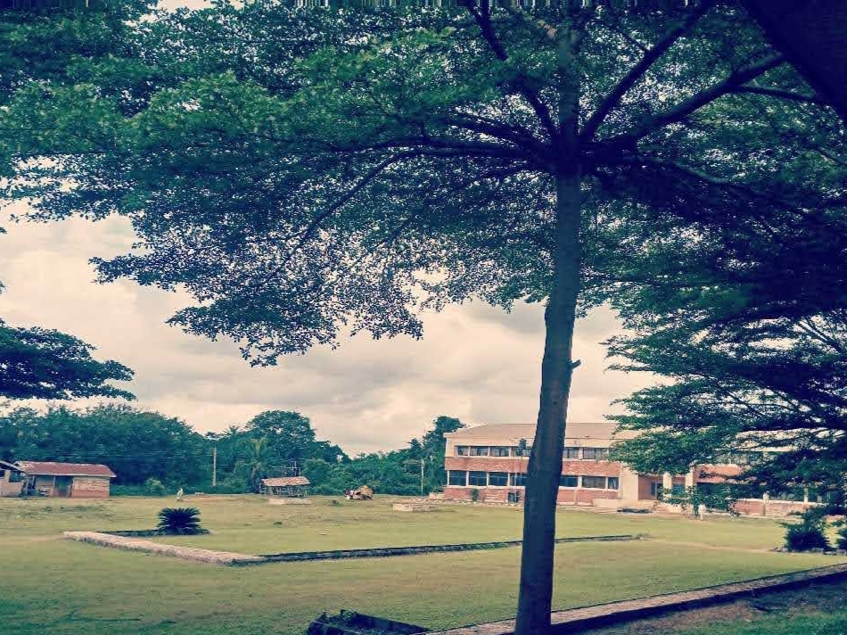
Osun State University
School · 5.0 km
Government-owned university in Osun State, Nigeria
Museums and landmarks3


Osun-Osogbo Grove
Monument and historic site · 1.9 km
Sacred forest along the bank of Osun river in Osogbo


Parks, trails and playgrounds2


Restaurants and cafes3


History
According to tradition, In Ipole Omu, seven rulers reigned before Olarooye in the following succession: Adefokanbale, Aikanya, Ogbogba, Saso, Luberin, Laege (also known as Adetuturinrin; father to both Lajomo and Larooye), Lajomo and Olarooye.
During the reign of Oba Olarooye at Ipole Omu, life became very unbearable because of incessant dry seasons. The then Ipole people became much dejected, worried and uncomfortable over the losses involving their farms, domestic animals and human beings. The Oba Olarooye was worried and disheartened by the situation at Ipole Omu. He wanted emergency solutions to inevitable and uncountable losses. This was the time he ordered the chief hunter at Ipole-in the person of Timehin-and his co-hunters to go on expedition and look for greener pastures. Timehin and the other hunters courageously took up the challenge and moved out in search of a better place for settlement. This expedition discovered River Osun.
Yoruba tradition claims many people fleeing the Fulani Invasion settled at Osogbo following the fall of old Oyo. As a result, Osogbo increased in population largely due to migration from other Yoruba towns.
From the History section of Osogbo on Wikipedia, under CC BY-SA 4.0.
Where to stay4
Alabama Luxury Hotel
Motel and hotel · 5.2 km
4-6 Alama Street, Koju Foam area, Osogbo, Osun State, Nigeria
Churches and places of worship8
Dream Centre, Life Oasis Ministry
Church · Pentecostal · 4.2 km
Gbongan - Osogbo Road, Osogbo
Four Square Gospel Church
Church · Protestant · 2.1 km
QH48+3V9 Jimmy Art Street, Oshogbo
Shopping9
Gas and EV charging9
Schools, colleges and libraries7
Healthcare8
Map of Osogbo
55 places. The map loads OpenStreetMap tiles when you open it.
Getting there and nearby towns
Ilorin International Airport (ILR) is the nearest airport with scheduled flights listed in OpenStreetMap, 75 km away.
- Ilobu 11 km northwest, about 11 min by car
- Ede 14 km west, about 14 min by car
- Ikirun 20 km northeast, about 20 min by car
- Ilesa 26 km southeast, about 26 min by car
- Inisa 26 km west, about 26 min by car
- Ejigbo 31 km northwest, about 31 min by car
- Ijebu-Jesa 30 km east, about 30 min by car
- Ile-Ife 32 km south, about 32 min by car
- Ilorin 81 km north, about 1 h 15 min by car
- Ibadan 84 km southwest, about 1 h 30 min by car
Drive times are estimates from straight-line distance, not routes.
Local news
Headlines from INDB.
Reviews, tips and questions
Loading what members have shared...
Sources and licences
- GeoNames (CC BY 4.0): population, coordinates, regions and time zone
- OpenStreetMap contributors (ODbL 1.0): places, airports, map data
- Wikidata (CC0 1.0): elevation, founding date, time zone, website, landmarks and historic places
- Wikimedia Commons (see each image): photos
- Wikipedia (CC BY-SA 4.0): overview and history text
Photo credits
- Osogbo, El-Shaddaites, CC BY-SA 4.0
- Susan Wenger House, Osogbo, Osun State, Nigeria 01, ExploreWithTunde, CC BY-SA 4.0
- The entrance of Olosun Ancient building in Osogbo, Kingaustin07, CC BY-SA 4.0
- Mandalla Freedom Park Osogbo 3, Profgkay, CC BY-SA 4.0
- Mandalla Freedom Park Osogbo 6, Profgkay, CC BY-SA 4.0
- Buildings on Fountain University, Openworks, CC BY-SA 4.0
- Osun State University, 8th8ense, CC BY-SA 4.0
- Osun Osogbo forest, river and sacred groove 08, Oloyedejuwonlo, CC BY-SA 4.0
- Osun Oshogbo Festival Gathering, Comradeayobami, CC BY-SA 4.0
- Osun Oshogbo Festival 2026 (16), GKLihouenou, CC BY-SA 4.0
- Osun Oshogbo Festival faces, Comradeayobami, CC BY-SA 4.0
- Yeye Osa Osun Oshogbo Festival, Comradeayobami, CC BY-SA 4.0
- Obirin rere Larooye of Osun Oshogo land, Comradeayobami, CC BY-SA 4.0
- Aare Ona Kakanfo, Comradeayobami, CC BY-SA 4.0
- Staffs of honour, Comradeayobami, CC BY-SA 4.0
- Agare the African Magic, Comradeayobami, CC BY-SA 4.0
- Side view of the Ancient buildings of iya osun, Kingaustin07, CC BY-SA 4.0
- Front view of ìyá olosun building, Kingaustin07, CC BY-SA 4.0
- Jollof rice and turkey, Olohunkemi Bushiro, CC0
- Oshogbo Osun State, Debo Adebayo, CC BY-SA 4.0
- Osun Groove 18, Profgkay, CC BY-SA 4.0
- Osun Groove 15, Profgkay, CC BY-SA 4.0
- Osun Groove 5, Profgkay, CC BY-SA 4.0
- Osun Groove 9, Profgkay, CC BY-SA 4.0
- Osun Groove 10, Profgkay, CC BY-SA 4.0
- Osun Groove 8, Profgkay, CC BY-SA 4.0
- Osun Groove 2, Profgkay, CC BY-SA 4.0
- Osun Groove 6, Profgkay, CC BY-SA 4.0
- Osun Groove 14, Profgkay, CC BY-SA 4.0
- Osun Groove 13, Profgkay, CC BY-SA 4.0
- Osun Groove 3, Profgkay, CC BY-SA 4.0
- Osun Groove 19, Profgkay, CC BY-SA 4.0
- Osun Groove 4, Profgkay, CC BY-SA 4.0
- Osun Groove 7, Profgkay, CC BY-SA 4.0
- Osun Groove 12, Profgkay, CC BY-SA 4.0
- Osun Groove 11, Profgkay, CC BY-SA 4.0
- Osun Groove 16, Profgkay, CC BY-SA 4.0
- Osun Groove 1, Profgkay, CC BY-SA 4.0
- Osun Groove 17, Profgkay, CC BY-SA 4.0
- Osun Oshogbo Festival 2026 (12), GKLihouenou, CC BY-SA 4.0


Page built November 3, 2026. Spotted a mistake? Tell us or suggest a place.