
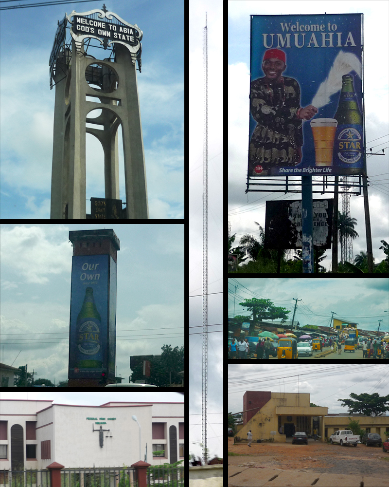


Umuahia, Nigeria
Umuahia is a regional capital of 370,000 people in Abia State, Nigeria.
Why visit Umuahia
Townapedia lists 1 museum or landmark and 1 park or trail in and around town.
Highlights include National War Museum, Umuahia.
Weather in Umuahia
Forecast from MET Norway (CC BY 4.0). Full forecast
About Umuahia
Umuahia (, pronounced [ʊmʊaːhiaː]) is the capital city of Abia State in southeastern Nigeria. Umuahia is located along the rail road that lies between Port Harcourt to its south, and Enugu city to its north. Umuahia has a population of 359,230 according to the 2006 Nigerian census.
From the Wikipedia article Umuahia (this version), under CC BY-SA 4.0.
Travel tips from other travellers: Umuahia on Wikivoyage (CC BY-SA 4.0).
Museums and landmarks1


Parks, trails and playgrounds1

Shopping1

Abia Mall
Shopping center · 1.9 km
Its a mall located in the city of Umuahia in Abia state, Nigeria
Uwalaka St
Mo-Sa 08:00-21:00, Su 09:00-21:00
Schools, colleges and libraries2

Britarch Schools
School · Assemblies Of God · 2.2 km
plot 327/335 Amuzukwu Layout, umuahia
History
According to popular legend, the name Umuahia derives from the Igbo word AmaAhia or "Ama Ahia", which means "market place or market center", respectively. The British, who arrived the region and annexed it sometime around the mid-to late 19th century, upon learning the name, mistakenly pronounced and spelled it as "Umuahia". Other legends exist regarding the origin of Umuahia, but the foregoing version seems most probable by consensus. In precolonial times, it served as one of the central marketplaces in the region for commerce. Given its serenity and proximity to other towns, such as Ohafia, Abiriba, Ihechiowa, Arochukwu, Obowo, Ngwa, Okigwi, Uzuakoli, Bende, Nnewi, Akwa Akpa (Old Calabar), and Kalabari, merchants of produce, pottery, crafts, textile, traditional medicine, palm wine, and tools travelled from afar, to trade at the busy market center, with many roads leading to it.
From the History section of Umuahia on Wikipedia, under CC BY-SA 4.0.
Healthcare2
Map of Umuahia
7 places. The map loads OpenStreetMap tiles when you open it.
Getting there and nearby towns
Sam Mbakwe International Airport (QOW) is the nearest airport with scheduled flights listed in OpenStreetMap, 34 km away.
- Bende 16 km east, about 16 min by car
- Okigwe 37 km northwest, about 37 min by car
- Ohafia-Ifigh 37 km east, about 37 min by car
- Iho 44 km west, about 44 min by car
- Ikot Ekpene 45 km southeast, about 45 min by car
- Aba 49 km south, about 49 min by car
- Amaigbo 48 km northeast, about 48 min by car
- Nkwerre 50 km northwest, about 50 min by car
- Owerri 51 km west, about 51 min by car
- Uyo 72 km southeast, about 1 h 15 min by car
Drive times are estimates from straight-line distance, not routes.
Local news
Headlines from INDB.
Reviews, tips and questions
Loading what members have shared...
Sources and licences
- GeoNames (CC BY 4.0): population, coordinates, regions and time zone
- OpenStreetMap contributors (ODbL 1.0): places, airports, map data
- Wikidata (CC0 1.0): elevation, founding date, time zone, website, landmarks and historic places
- Wikimedia Commons (see each image): photos
- Wikipedia (CC BY-SA 4.0): overview and history text
Photo credits
- Umuahia montage, Ukabia, CC BY-SA 3.0
- National War Museum Umuahia Nigeria, APATA , Dolapo Moses, CC BY-SA 4.0
- NAF 102 - One of the War Planes used during the Biafran War in Nigeria, David, CC BY-SA 4.0
- Statute of Michael Okpara, Emmanuel Eluwa, CC BY-SA 4.0
- Torpedo NNS Nigeria, APATA , Dolapo Moses, CC BY-SA 4.0
- Glittering model, Abayom-Ola Kehinde Ayodele, CC BY-SA 4.0
Page built November 3, 2026. Spotted a mistake? Tell us or suggest a place.