


O'Fallon, Illinois
O'Fallon is a city of 32,262 people in St. Clair County, Illinois, founded in 1854.
Why visit O'Fallon
Townapedia lists 5 museums and landmarks, 20 parks and trails, 71 places to eat, 14 places to stay and 1 attraction in and around town.
Highlights include O'Fallon 15 Cinema, Scott Field Historic District and Tiedemann House.
July is the warmest month, with average highs of 90°F; January lows average 24°F.
Weather in O'Fallon
Forecast from the National Weather Service. Full forecast
About O'Fallon
O'Fallon is a city in St. Clair County, Illinois, United States. The 2020 census listed the population at 32,289. The city is the second largest city in the Metro East region and Southern Illinois. It sits 5 miles (8.0 km) from Scott Air Force Base and 18 miles (29 km) from Downtown St.
From the Wikipedia article O'Fallon, Illinois (this version), under CC BY-SA 4.0.
Things to do1

Museums and landmarks5
Scott Field Historic District
Monument and historic site · National Register of Historic Places · 5.1 mi
Historic district in Illinois, United States

Tiedemann House
Monument and historic site · National Register of Historic Places · 0.5 mi
House in O'Fallon, Illinois

Parks, trails and playgrounds20




8 more on the map.
Restaurants and cafes71



Dogwood Social House
Restaurant · 1.9 mi
1206 Central Park Drive
Tu-Th 15:00-00:00; Fr 15:00-01:30; Sa 11:00-01:30; Su 11:00-00:00

54th Street Grill and Bar
Restaurant · American, Bar And Grill · 1.9 mi
3140 Greenmount Crossing Drive, O'Fallon
Golden Corral
Restaurant · American, Buffet · 1.9 mi
3360 Greenmount Crossing Road;Greenmount Crossing Rd
59 more on the map.
History
Founded in 1854, O'Fallon's namesake comes from Colonel John O'Fallon who was a wealthy gentleman from St. Louis. In downtown O'Fallon, a Baltimore and Ohio Railroad railroad depot was built, which helped put O'Fallon on the map. City lots were platted and sold at a public auction on May 18, 1854. A post office was established the following year and the city began attracting German settlers looking for fertile farming land. On January 27, 1874, O'Fallon was incorporated as a village. On March 14, 1905, the citizens voted for a change to the city form of government. Since its founding, O'Fallon has gained population every decennial census year except 1930, when the census showed a net loss of six residents.
The city center is approximately two miles east of the intersection of Interstate 64 and U.S. Route 50. Suburban growth in O'Fallon expanded considerably during the 1980s and following the expansion of Interstate 64 in the 1990s. Subdivisions include Thornbury Hill, Nolin Creek Estates, Fairwood Hills, Deer Creek, Forest Hills, and Fairwood East. O'Fallon Township High School's main campus at 600 South Smiley Street has undergone numerous additions over the past decades to ease overcrowding, including the creation of the separate 9th Grade Milburn Campus.
From the History section of O'Fallon, Illinois on Wikipedia, under CC BY-SA 4.0.
Where to stay14
Churches and places of worship20
Holy Trinity Catholic Church
Church · Roman Catholic · 3.3 mi
505 Fountains Parkway, Fairview Heights
Central Christian Church
Church · Protestant · 1.2 mi
1420 Illini Drive, O'Fallon
O'Fallon Assembly of God Church
Church · Assemblies Of God · 1.5 mi
1400 N Greenmount Rd, O'Fallon
Faith Family Church
Place of worship · 3.4 mi
704 North Greenmount Road, Belleville
Shopping20
Gas and EV charging9
Schools, colleges and libraries38
Healthcare6
Map of O'Fallon
204 places. The map loads OpenStreetMap tiles when you open it.
Climate by month
Monthly table
| Month | High | Low | Rain | Snow |
|---|---|---|---|---|
| Jan | 43°F | 24°F | 2.6 in | 3.4 in |
| Feb | 49°F | 28°F | 2.2 in | 3.3 in |
| Mar | 59°F | 36°F | 3.4 in | 1.0 in |
| Apr | 71°F | 46°F | 4.9 in | 0.0 in |
| May | 79°F | 56°F | 5.0 in | 0.0 in |
| Jun | 87°F | 64°F | 4.6 in | 0.0 in |
| Jul | 90°F | 68°F | 4.0 in | 0.0 in |
| Aug | 89°F | 65°F | 3.9 in | 0.0 in |
| Sep | 83°F | 57°F | 3.4 in | 0.0 in |
| Oct | 73°F | 47°F | 3.1 in | 0.0 in |
| Nov | 58°F | 37°F | 3.6 in | 0.6 in |
| Dec | 46°F | 28°F | 2.6 in | 2.9 in |
U.S. Climate Normals 1991-2020 for Belleville Siu Rsch (7 mi away), NOAA NCEI.
People and cost of living
American Community Survey 5-year estimates, 2020-2024, U.S. Census Bureau. Estimates have margins of error, larger for small towns.
Disaster history
St. Clair County has had 9 federal disaster declarations since 2000, most often for floods.
- 2024-09-20: Severe Storms, Tornadoes, Straight-Line Winds, And Floodng (Flood)
- 2022-10-14: Severe Storm And Flooding (Flood)
- 2020-03-26: Covid-19 Pandemic (Biological)
- 2020-03-13: Covid-19 (Biological)
- 2019-09-19: Severe Storms And Flooding (Flood)
- 2008-06-24: Severe Storms And Flooding (Severe Storm)
OpenFEMA disaster declarations summaries.
Getting there and nearby towns
MidAmerica St. Louis Airport (BLV) is the nearest airport with scheduled flights listed in OpenStreetMap, 6 miles away.
- Fairview Heights 5 mi west, about 8 min by car
- Belleville 7 mi southwest, about 11 min by car
- Collinsville 7 mi northwest, about 12 min by car
- East St. Louis 12 mi west, about 19 min by car
- Glen Carbon 12 mi north, about 19 min by car
- Cahokia Heights 13 mi west, about 21 min by car
- Edwardsville 14 mi north, about 22 min by car
- Granite City 14 mi northwest, about 23 min by car
- Highland 17 mi northeast, about 27 min by car
- St. Louis 18 mi west, about 29 min by car
Drive times are estimates from straight-line distance, not routes.
Local news
Headlines from INDB, the NEMICO news database.
Reviews, tips and questions
Loading what members have shared...
Sources and licences
- NCES EDGE (Public domain): public schools
- NOAA NCEI U.S. Climate Normals 1991-2020 (Public domain): climate by month
- OpenFEMA (Public domain): disaster declarations
- OpenStreetMap contributors (ODbL 1.0): places, airports, map data
- U.S. Census Bureau (Public domain): population, income, housing, education, commute
- Wikidata (CC0 1.0): elevation, founding date, time zone, website, landmarks and historic places
- Wikimedia Commons (see each image): photos
- Wikipedia (CC BY-SA 4.0): overview and history text
Photo credits
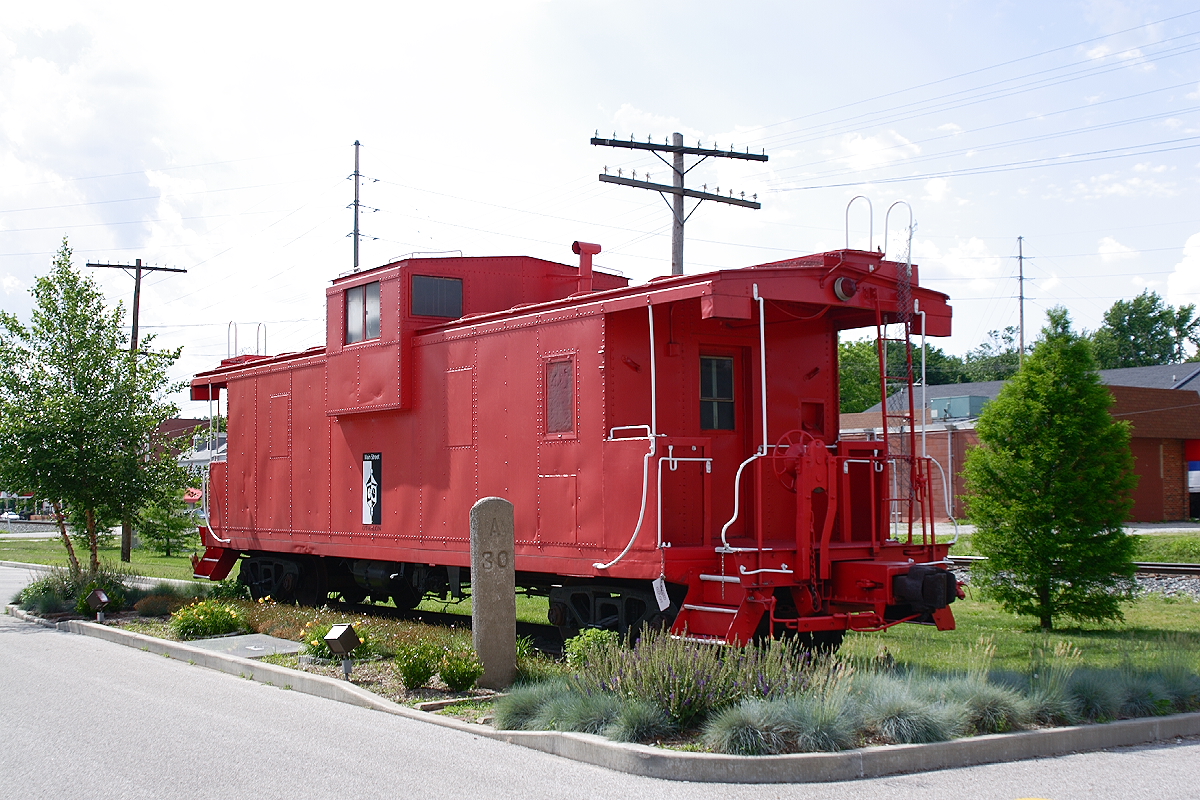
- Caboose, Robert Lawton, CC BY-SA 2.5
- The Tiedemann house at 212 W. Washington in O'Fallon, Illinois, ErnstTiedemann, CC BY-SA 4.0
- Scott Field - 1930, United States Army Air Corps, Public domain
- ISS012-E-11706 - View of Missouri, Earth Science and Remote Sensing Unit , Lyndon B. Johnson Space Center, Public domain
- ISS065-E-300058 - View of Earth, Earth Science and Remote Sensing Unit , Lyndon B. Johnson Space Center, Public domain
- ISS007-E-8001 - View of Missouri, Earth Science and Remote Sensing Unit , Lyndon B. Johnson Space Center, Public domain
- ISS007-E-8000 - View of Missouri, Earth Science and Remote Sensing Unit , Lyndon B. Johnson Space Center, Public domain

Page built October 30, 2026. Spotted a mistake? Tell us or suggest a place.