


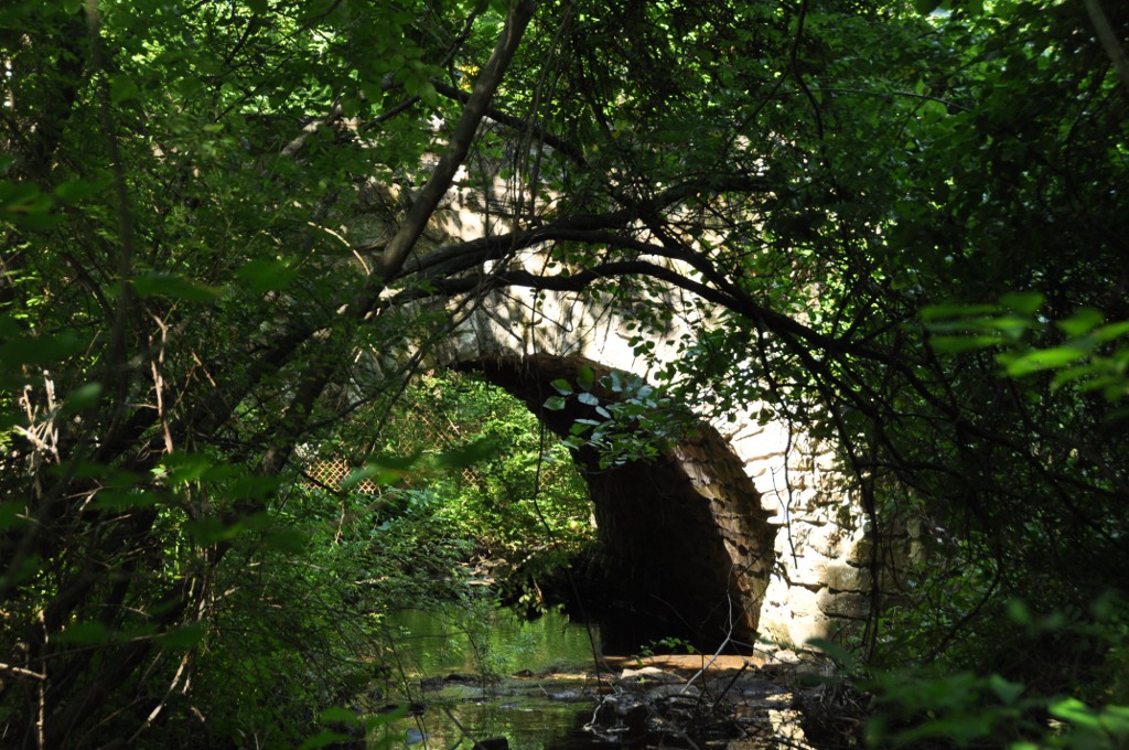

Why visit Oxoboxo River
Townapedia lists 9 museums and landmarks, 14 parks and trails, 6 places to eat and 9 attractions in and around town.
Highlights include Samson Occom Bridge, Mohegan-Pequot Bridge, Capt. Mark Stoddard Farmstead and Fort Shantok.
July is the warmest month, with average highs of 84°F; January lows average 21°F, and about 28 inches of snow fall in a normal year.
Weather in Oxoboxo River
Forecast from the National Weather Service. Full forecast
About Oxoboxo River
Oxoboxo River () is a census-designated place (CDP) in the town of Montville in New London County, Connecticut, United States. The population was 2,938 at the 2000 census, 3,165 at the 2010 census, and 2,955 at the 2020 census. The statistical area encompasses the town center of Montville, as well as the adjacent villages of Palmertown and Uncasville. The name of the statistical area is from the river of the same name running through the CDP.
From the Wikipedia article Oxoboxo River, Connecticut (this version), under CC BY-SA 4.0.
Things to do9
Samson Occom Bridge
Bridge · National Register of Historic Places · 3.2 mi
Bridge in United States of America

Mohegan-Pequot Bridge
Bridge · 3.7 mi
Bridge in United States of America

Museums and landmarks9

Capt. Mark Stoddard Farmstead
Monument and historic site · National Register of Historic Places · 3.7 mi
Building in Connecticut, United States
Fort Shantok
Monument and historic site · National Register of Historic Places · 3.4 mi
Archaeological site in Connecticut, United States

Gales Ferry
Monument and historic site · National Register of Historic Places · 2.1 mi
Census-designated place in New London County, Connecticut, United States of America
Gales Ferry Historic District No. 2
Monument and historic site · National Register of Historic Places · 2.4 mi
Historic district in Gales Ferry, Connecticut, United States

Perkins-Bill House
Monument and historic site · National Register of Historic Places · 3.7 mi
Historic house in Connecticut, United States
Quaker Hill Historic District
Monument and historic site · National Register of Historic Places · 3.0 mi
District in Waterford, Connecticut

Raymond-Bradford Homestead
Monument and historic site · National Register of Historic Places · 3.2 mi
Building in Connecticut, United States


Uncasville School
Monument and historic site · National Register of Historic Places · 1.1 mi

Gales Ferry Historic District No. 1
Monument and historic site · 2.1 mi
Parks, trails and playgrounds14

Lyman Allen Lot
Hiking and trails · 2.0 mi
Existing Preserved Open Space; Municipal, Open To Public Without Fee
Minson Tract
Hiking and trails · 2.1 mi
Open space. No marked trails. Small parking area. Boundary from A2 matched to GPS.
White Oak Preserve
Hiking and trails · 1.8 mi
Owned by Waterford Land Trust. Natural wooded area, open to the public.

Montville American Little League Complex
Park · 1.5 mi
Municipal, Members Or Owners Only; Existing Preserved Open Space
568 Old Colchester Road, Montville
Gales Ferry Launching Ramp
Hiking and trails · 2.0 mi
Municipal, Open To Public Without Fee; Existing Preserved Open Space

2 more on the map.
Restaurants and cafes6

Uncasville Diner
Restaurant · American, Breakfast, Lunch, Dinner · 1.1 mi
884 Norwich-New London Turnpike, Uncasville;Montville


Dunkin'
Fast food · Donut, Coffee Shop · 1.1 mi
568 Norwich-New London Turnpike, Uncasville
05:00-19:00
Churches and places of worship4
Apostolic Lighthouse United Pentecostal Church
Church · Pentecostal · 1.1 mi
270 Norwich-New London Turnpike, Montville
Saint John the Evangelist Catholic Church
Church · Roman Catholic · 1.0 mi
22 Maple Avenue, Uncasville
Shopping2
Gas and EV charging3
Schools, colleges and libraries19
Map of Oxoboxo River
66 places. The map loads OpenStreetMap tiles when you open it.
Climate by month
Monthly table
| Month | High | Low | Rain | Snow |
|---|---|---|---|---|
| Jan | 38°F | 21°F | 3.9 in | 9.0 in |
| Feb | 40°F | 23°F | 3.8 in | 7.1 in |
| Mar | 48°F | 29°F | 5.1 in | 5.0 in |
| Apr | 59°F | 39°F | 4.7 in | 0.8 in |
| May | 70°F | 49°F | 3.6 in | 0.0 in |
| Jun | 78°F | 58°F | 4.3 in | 0.0 in |
| Jul | 84°F | 65°F | 3.6 in | 0.0 in |
| Aug | 83°F | 63°F | 4.4 in | 0.0 in |
| Sep | 76°F | 55°F | 4.8 in | 0.0 in |
| Oct | 64°F | 44°F | 4.9 in | 0.0 in |
| Nov | 53°F | 34°F | 4.2 in | 0.3 in |
| Dec | 43°F | 27°F | 5.0 in | 5.6 in |
U.S. Climate Normals 1991-2020 for Norwich Public Utility Plt (6 mi away), NOAA NCEI.
People and cost of living
American Community Survey 5-year estimates, 2020-2024, U.S. Census Bureau. Estimates have margins of error, larger for small towns.
Disaster history
The county has had 24 federal disaster declarations since 2000, most often for severe storms.
- 2024-01-13: Severe Storms, Flooding, And A Potential Dam Breach (Severe Storm)
- 2021-10-30: Remnants Of Hurricane Ida (Hurricane)
- 2021-08-22: Hurricane Henri (Hurricane)
- 2021-01-12: Tropical Storm Isaias (Hurricane)
- 2020-08-06: Tropical Storm Isaias (Hurricane)
- 2020-03-28: Covid-19 Pandemic (Biological)
OpenFEMA disaster declarations summaries.
Getting there and nearby towns
Groton-New London Airport (GON) is the nearest airport with scheduled flights listed in OpenStreetMap, 9 miles away.
- Gales Ferry 3 mi southeast, about 4 min by car
- Conning Towers-Nautilus Park 5 mi southeast, about 8 min by car
- Norwich 7 mi north, about 12 min by car
- New London 8 mi south, about 13 min by car
- Long Hill 8 mi southeast, about 12 min by car
- Old Mystic 8 mi southeast, about 14 min by car
- Groton 9 mi south, about 14 min by car
- Niantic 10 mi southwest, about 16 min by car
- Poquonock Bridge 10 mi southeast, about 15 min by car
- Noank 10 mi southeast, about 16 min by car
Drive times are estimates from straight-line distance, not routes.
Local news
Headlines from INDB, the NEMICO news database.
Reviews, tips and questions
Loading what members have shared...
Sources and licences
- NCES EDGE (Public domain): public schools
- NOAA NCEI U.S. Climate Normals 1991-2020 (Public domain): climate by month
- OpenFEMA (Public domain): disaster declarations
- OpenStreetMap contributors (ODbL 1.0): places, airports, map data
- U.S. Census Bureau (Public domain): population, income, housing, education, commute
- Wikidata (CC0 1.0): elevation, founding date, time zone, website, landmarks and historic places
- Wikimedia Commons (see each image): photos
- Wikipedia (CC BY-SA 4.0): overview and history text
Photo credits
- CPT. MARK STODDARD FARMSTEAD, NEW LONDON COUNTY, CT, JERRYE & ROY KLOTZ, M.D., CC BY-SA 4.0
- Old Gales Ferry Schoolhouse, Ledyard, Connecticut, Jerry Dougherty, CC BY 2.5
- MoheganRes FortShantokGlade, User:Magicpiano, CC BY-SA 4.0
- PERKINS-BILL HOUSE, NEW LONDON COUNTY, Jerrye & Roy Klotz, MD, CC BY-SA 4.0
- MontvilleCT Bridge1860, User:Magicpiano, CC BY-SA 4.0
- Red Lion Tavern - Quaker Hill Historic District - New London County CT, CLK Hatcher, CC BY-SA 2.0
- Gales Ferry station postcard, Unknown author Unknown author, Public domain
- Raymond-Bradford Homestead - New London County CT, CLK Hatcher, CC BY-SA 2.0
- Uncasville School, CLK Hatcher, CC BY-SA 2.0
- Mohegan Pequot Bridge from Stoddards Wharf State Park, December 2018, Pi.1415926535, CC BY-SA 3.0
Page built October 30, 2026. Spotted a mistake? Tell us or suggest a place.