


Poquonock Bridge, Connecticut
Poquonock Bridge is a community of 1,105 people in Connecticut.
Why visit Poquonock Bridge
Townapedia lists 17 museums and landmarks, 36 parks and trails, 6 places to eat and 8 attractions in and around town.
Highlights include Avery Point Light, Morgan Point Light, Noank Historic District and Branford House.
July is the warmest month, with average highs of 81°F; January lows average 24°F, and about 24 inches of snow fall in a normal year.
Weather in Poquonock Bridge
Forecast from the National Weather Service. Full forecast
About Poquonock Bridge
Poquonock Bridge is a census-designated place (CDP) and village in the town of Groton in New London County, Connecticut, United States. The population was 1,686 at the 2020 census.
From the Wikipedia article Poquonock Bridge, Connecticut (this version), under CC BY-SA 4.0.
Things to do8

Avery Point Light
Lighthouse · National Register of Historic Places · 3.0 mi
Lighthouse in Connecticut, United States

Morgan Point Light
Lighthouse · 1.8 mi
Lighthouse in Connecticut, United States built 1868

Mystic River Railroad Bridge
Bridge · 2.4 mi
Bridge in United States of America

Mystic Seaport Light
Lighthouse · 2.9 mi
Lighthouse in Connecticut, United States

North Dumpling Light
Lighthouse · 3.3 mi
Lighthouse in New York, United States


Museums and landmarks17
Noank Historic District
Monument and historic site · National Register of Historic Places · 1.5 mi
Historic district in Connecticut, United States

Branford House
Monument and historic site · National Register of Historic Places · 3.0 mi
Historic house in Connecticut, United States

Charles W. Morgan
Monument and historic site · National Register of Historic Places · 3.1 mi
American whaling ship built in 1841

Edward Yeomans House
Monument and historic site · National Register of Historic Places · 0.6 mi
Historic house in Connecticut, United States

Emma C. Berry
Monument and historic site · National Register of Historic Places · 2.9 mi
Oldest Surviving Commercial Vessels

Jabez Smith House
Monument and historic site · National Register of Historic Places · 1.5 mi
Historic house in Connecticut, United States
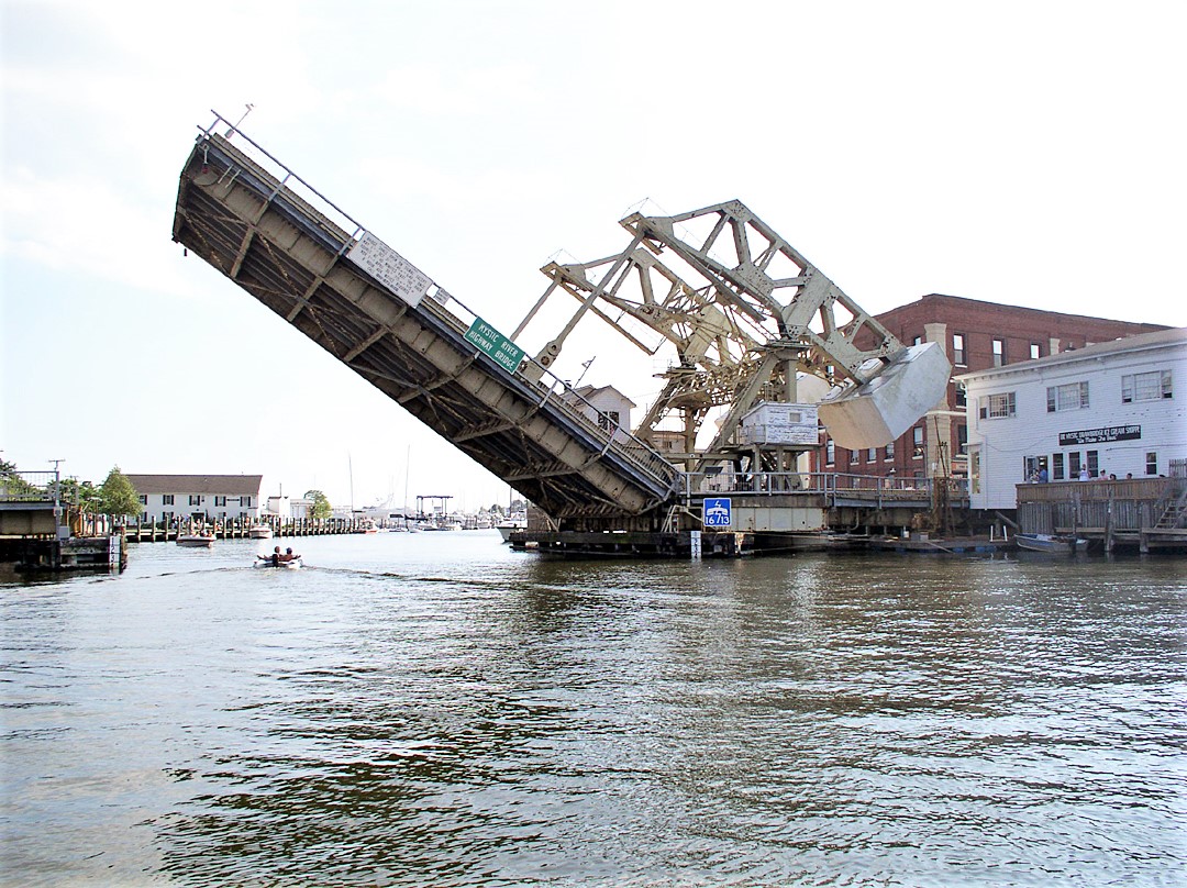
Mystic Bridge Historic District
Monument and historic site · National Register of Historic Places · 2.9 mi
Historic district in Mystic, Connecticut

Mystic River Historic District
Monument and historic site · National Register of Historic Places · 2.3 mi
Historic district in Connecticut, United States

Pequot Fort
Monument and historic site · National Register of Historic Places · 2.6 mi
United States historic place

Rossie Velvet Mill Historic District
Monument and historic site · National Register of Historic Places · 2.9 mi
Historic district in Connecticut, United States


Sabino
Monument and historic site · National Register of Historic Places · 2.9 mi
Wooden, coal-fired steamboat built in 1908
L. A. Dunton
Monument and historic site · National Register of Historic Places · 2.9 mi
5 more on the map.
Parks, trails and playgrounds36

Tanglewood Park
Park · 0.7 mi
Municipal, Open To Public Without Fee
65 Seneca Drive, Groton
sunrise-sunset
Bel-Aire Playground
Park · 1.4 mi
Municipal, Open To Public Without Fee
sunrise-sunset
Spicer House/Park
Park · 1.3 mi
Municipal, Open To Public Without Fee
sunrise-sunset

Raheem Ali Carter Memorial Park
Park · 0.6 mi
Municipal, Open To Public Without Fee
105 Midway Oval, Groton
24 more on the map.
Restaurants and cafes6

Ford's Black & Blue
Restaurant · Seafood, American, Burger, Fish And Chips · 1.3 mi
65 Marsh Road, Groton
Th-Mo 12:00-21:00
The Fisherman Restaurant at Long Point
Restaurant · Seafood · 1.2 mi
937 Groton Long Point Road, Groton
Su-Th 11:30-21:00; Fr-Sa 11:30-21:30
Carson's
Restaurant · Slushy, Candy, Ice Cream, Breakfast · 1.5 mi
39 Main Street, Groton


Churches and places of worship5
Saint Mary, Mother of the Redeemer Catholic Church
Church · Roman Catholic · 0.4 mi
69 Groton Long Point Road, Groton
Bishop Seabury Episcopal Church
Church · Episcopal · 1.5 mi
256 North Road, Groton
Christ United Methodist Church
Church · Methodist · 1.5 mi
200 Hazelnut Hill Road, Groton
Saint Andrew Presbyterian Church
Church · Presbyterian · 0.7 mi
310 Fort Hill Road, Groton
Shopping1
Gas and EV charging2
Schools, colleges and libraries26
C.B. Jennings International Elementary Magnet
School · 5.0 mi
50 Mercer Street, New London
Map of Poquonock Bridge
101 places. The map loads OpenStreetMap tiles when you open it.
Climate by month
Monthly table
| Month | High | Low | Rain | Snow |
|---|---|---|---|---|
| Jan | 39°F | 24°F | 3.9 in | 5.8 in |
| Feb | 41°F | 25°F | 3.4 in | 8.3 in |
| Mar | 47°F | 32°F | 4.9 in | 3.9 in |
| Apr | 57°F | 41°F | 4.4 in | 0.8 in |
| May | 66°F | 50°F | 3.7 in | 0.0 in |
| Jun | 75°F | 59°F | 3.9 in | 0.0 in |
| Jul | 81°F | 66°F | 3.4 in | 0.0 in |
| Aug | 80°F | 65°F | 4.2 in | 0.0 in |
| Sep | 74°F | 58°F | 4.3 in | 0.0 in |
| Oct | 63°F | 47°F | 4.4 in | 0.0 in |
| Nov | 53°F | 38°F | 3.8 in | 0.5 in |
| Dec | 44°F | 30°F | 4.6 in | 5.2 in |
U.S. Climate Normals 1991-2020 for Groton Hcn (2 mi away), NOAA NCEI.
People and cost of living
American Community Survey 5-year estimates, 2020-2024, U.S. Census Bureau. Estimates have margins of error, larger for small towns.
Disaster history
The county has had 24 federal disaster declarations since 2000, most often for severe storms.
- 2024-01-13: Severe Storms, Flooding, And A Potential Dam Breach (Severe Storm)
- 2021-10-30: Remnants Of Hurricane Ida (Hurricane)
- 2021-08-22: Hurricane Henri (Hurricane)
- 2021-01-12: Tropical Storm Isaias (Hurricane)
- 2020-08-06: Tropical Storm Isaias (Hurricane)
- 2020-03-28: Covid-19 Pandemic (Biological)
OpenFEMA disaster declarations summaries.
Getting there and nearby towns
Groton-New London Airport (GON) is the nearest airport with scheduled flights listed in OpenStreetMap, 2 miles away.
- New London 4 mi west, about 7 min by car
- Gales Ferry 7 mi northwest, about 11 min by car
- Westerly 11 mi east, about 18 min by car
- Norwich 15 mi north, about 24 min by car
- Old Saybrook Center 18 mi west, about 29 min by car
- Willimantic 28 mi north, about 45 min by car
- Storrs 35 mi north, about 56 min by car
- Middletown 36 mi northwest, about 59 min by car
- Newport 37 mi east, about 59 min by car
- Warwick 40 mi northeast, about 1 h by car
Drive times are estimates from straight-line distance, not routes.
Local news
Headlines from INDB, the NEMICO news database.
Reviews, tips and questions
Loading what members have shared...
Sources and licences
- NCES EDGE (Public domain): public schools
- NOAA NCEI U.S. Climate Normals 1991-2020 (Public domain): climate by month
- OpenFEMA (Public domain): disaster declarations
- OpenStreetMap contributors (ODbL 1.0): places, airports, map data
- U.S. Census Bureau (Public domain): population, income, housing, education, commute
- Wikidata (CC0 1.0): elevation, founding date, time zone, website, landmarks and historic places
- Wikimedia Commons (see each image): photos
- Wikipedia (CC BY-SA 4.0): overview and history text
Photo credits
- Groton Town Hall, Poquonock Bridge CT, John Phelan, CC BY-SA 4.0
- Noank Baptist Church, Jerry Dougherty, CC BY 2.5
- Jabez Smith House, Groton, CT, Pi.1415926535, CC BY-SA 3.0
- MysticTown, Monsieur dl mon talk - mon contribs, Public domain
- Branford House, UConn Avery Point, Groton, CT, Pi.1415926535, CC BY-SA 3.0
- Avery Point Lighthouse, June 2014, Pi.1415926535, CC BY-SA 3.0
- EmmaberrymysticCTUSA, Staib, CC BY 3.0
- Sabino Mystic Oct 2020, Godsfriendchuck, CC BY-SA 4.0
- PEQUOT FORT, NEW LONDON COUNTY, Jerrye & Roy Klotz, MD, CC BY-SA 4.0
- Mystic River Bridge, Rhvanwinkle ( talk ), CC BY 3.0
- Frohsinn Hall, 54 Greenmanville Avenue, Mystic, Beyond My Ken, CC BY-SA 4.0
- EDWARD YEOMANS HOUSE; NEW LONDON COUNTY, Jerrye & Roy Klotz, MD, CC BY-SA 4.0
- Mystic Seaport Lighthouse, Ad Meskens, CC BY-SA 3.0
- Big boat, Joethon, Public domain
- Morgan Point Lighthouse, Rhvanwinkle ( talk ), CC BY-SA 3.0
- Mystic River Railroad Bridge, Juliancolton, Public domain

Page built October 30, 2026. Spotted a mistake? Tell us or suggest a place.