


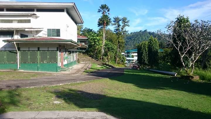
Bislig, Philippines
Bislig is a town of 99,872 people in Caraga, Philippines, founded in 1921.
Why visit Bislig
Townapedia lists 10 museums and landmarks, 5 parks and trails, 16 places to eat, 17 places to stay and 4 attractions in and around town.
Highlights include Tinuy-an Falls.
Weather in Bislig
Forecast from MET Norway (CC BY 4.0). Full forecast
About Bislig
Bislig, officially the City of Bislig (Cebuano: Dakbayan sa Bislig; Filipino: Lungsod ng Bislig), is a component city in the province of Surigao del Sur, Philippines. According to the 2024 census, it has a population of 99,872 people.
From the Wikipedia article Bislig (this version), under CC BY-SA 4.0.
Travel tips from other travellers: Bislig on Wikivoyage (CC BY-SA 4.0).
Things to do4



Museums and landmarks10


Parks, trails and playgrounds5



Restaurants and cafes16

Zam's Food and Fudge
Restaurant · Burger · 5.3 km
Espiritu Street, Bislig City
Mo-Sa 09:00-19:00, Su off



4 more on the map.
History
The first inhabitants of Bislig were believed to have come from the Agusan Valley in the hinterlands of Mindanao beyond the Magdiwata Mountains. These people used spears, bows and arrows and lived a semi-nomadic life and were called Manobos.
They were ruled during the later part of the seventeenth century by a native leader called "Bagani", meaning a formidable leader. They were very brave, tough and war-like. They also introduced edible crops such as rice, corn and rootcrops to the area.
At the turn of the century, Spanish colonizers and missionaries imposed the rule of Spain and brought with them Tagalogs, Ilonggos, and Cebuanos from the north as members of their expeditionary forces.
From the History section of Bislig on Wikipedia, under CC BY-SA 4.0.
Where to stay17
Churches and places of worship18
Bislig City Mosque
Place of worship · Sunni · 5.2 km
R. B. Castillo Street, Bislig City
Santo Tomas de Villanueva Parish Church
Church · Roman Catholic
Montero Street, Bislig City
St. Vincent de Paul Parish Church
Church · Roman Catholic · 5.8 km
Andres Soriano Avenue, Bislig
Shopping6
Gas and EV charging7
Schools, colleges and libraries89
Mangagoy Central Elementary School
School · 5.4 km
Andres Soriano Avenue, Bislig City
Mangagoy East Elementary School
School · 5.5 km
Andres Soriano Avenue, Bislig City
Mangagoy Hilltop Elementary School
School · 5.5 km
Andres Soriano Avenue, Bislig City
Mangagoy North Elementary School
School · 5.4 km
Andres Soriano Avenue, Bislig City
Mangagoy South Elementary School
School · 5.5 km
Andres Soriano Avenue, Bislig City
Southern Technological Institute of the Philippines
School · 5.2 km
Andres Soriano Avenue, Bislig
Healthcare10
Bislig Medical Specialists and Wound Care Clinic
Clinic and pharmacy · 5.5 km
Espiritu Street, Bislig City
Bislig Premier Birthing Home
Clinic and pharmacy · 5.5 km
Espiritu Street, Bislig City
Map of Bislig
182 places. The map loads OpenStreetMap tiles when you open it.
Getting there and nearby towns
Bislig Airport (BPH) is the nearest airport with scheduled flights listed in OpenStreetMap, 2 km away.
- Tidman 10 km north, about 10 min by car
- Bigaan 12 km north, about 12 min by car
- Veruela 43 km west, about 43 min by car
- San Francisco 54 km northwest, about 54 min by car
- Prosperidad 61 km northwest, about 1 h by car
- Compostela 65 km southwest, about 1 h by car
- Montevista 68 km southwest, about 1 h 15 min by car
- Nabunturan 78 km southwest, about 1 h 15 min by car
- Bayugan 85 km northwest, about 1 h 30 min by car
- New Corella 88 km southwest, about 1 h 30 min by car
Drive times are estimates from straight-line distance, not routes.
Local news
Headlines from INDB.
Reviews, tips and questions
Loading what members have shared...
Sources and licences
- GeoNames (CC BY 4.0): population, coordinates, regions and time zone
- OpenStreetMap contributors (ODbL 1.0): places, airports, map data
- Wikidata (CC0 1.0): elevation, founding date, time zone, website, landmarks and historic places
- Wikimedia Commons (see each image): photos
- Wikipedia (CC BY-SA 4.0): overview and history text
Photo credits
- Bisligovp, HavenHost, CC BY-SA 3.0
- Espiritu Street, Mangagoy, Bislig, Mabisur jacobojimm, CC BY-SA 4.0
- Andres Soriano Ave, Bislig, Mabisur jacobojimm, CC BY-SA 4.0
- Tinuy-an Waterfalls of Bislig, Bro. Jeffrey Pioquinto, SJ, CC BY 2.0
- ISS038-E-921 - View of the Philippines, Earth Science and Remote Sensing Unit , Lyndon B. Johnson Space Center, Public domain
- DLSJBC Junior High, Jimmyjacobo, CC BY-SA 4.0
- Cash transfer in Asia, City Government of Bislig, Public domain

Page built November 7, 2026. Spotted a mistake? Tell us or suggest a place.