


Why visit Bued
Townapedia lists 5 museums and landmarks, 5 parks and trails, 41 places to eat and 19 places to stay in and around town.
Weather in Bued
Forecast from MET Norway (CC BY 4.0). Full forecast
Museums and landmarks5

Parks, trails and playgrounds5



Restaurants and cafes41

Badz & Pets Kaleskisan
Restaurant · Regional · 2.1 km
V. Montemayor Street, Alaminos

Island's Prime Steakhouse
Restaurant · Steak House, American · 2.3 km
Quezon Avenue

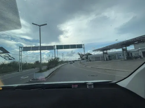


29 more on the map.
Where to stay19

Islandia hotel
Motel and hotel · 2.5 km
Horrible place..., internet in rooms not function, old, run down, room adv. with hot shower only cold etc.
Marcos Avenue
Monte Rio B&B
Motel and hotel · 2.1 km
A Business Man's Hotel
Hotel Monter Rio Quezon Avenue, Alaminos
Siento Islas Pension House
Motel and hotel · 1.9 km
Lucap-Magsaysay Road, Alaminos
7 more on the map.
Churches and places of worship16
Alaminos Cathedral
Church · Roman Catholic · 2.2 km
Quezon Avenue, Alaminos
Magsaysay Catholic Chapel
Church · Roman Catholic · 2.0 km
Cayucay Road, Alaminos
The Church of Jesus Christ of Latter-day Saints
Church · Mormon · 1.7 km
Lucap-Magsaysay Road, Magsaysay
Shopping13
Gas and EV charging9
Schools, colleges and libraries12
Healthcare22
Accumed Diagnostic Center
Clinic and pharmacy · 1.6 km
Lucap-Magsaysay Road, Ploblacion
Asuncion Internal Medicine
Clinic and pharmacy · 2.1 km
M. Rabago Street, Alaminos
JDA Medical & Lying In Clinic
Clinic and pharmacy · 1.8 km
Quezon Avenue, Alaminos
We Care Medical Clinic
Clinic and pharmacy · 1.6 km
Lucap-Magsaysay Road, Ploblacion
Map of Bued
142 places. The map loads OpenStreetMap tiles when you open it.
Getting there and nearby towns
San Fernando Airport (SFE) is the nearest airport with scheduled flights listed in OpenStreetMap, 58 km away.
- Alaminos 2 km west, about 2 min by car
- Mabini 12 km southwest, about 12 min by car
- Labrador 21 km southeast, about 21 min by car
- Lingayen 29 km southeast, about 29 min by car
- Binmaley 32 km southeast, about 32 min by car
- Dagupan 38 km east, about 38 min by car
- Calasiao 42 km southeast, about 42 min by car
- Mangaldan 44 km east, about 44 min by car
- Aringay 46 km northeast, about 46 min by car
- Santa Barbara 47 km east, about 47 min by car
Drive times are estimates from straight-line distance, not routes.
Local news
Headlines from INDB.
Reviews, tips and questions
Loading what members have shared...
Sources and licences
- GeoNames (CC BY 4.0): population, coordinates, regions and time zone
- Mapillary (see each image): photos
- OpenStreetMap contributors (ODbL 1.0): places, airports, map data
- Wikidata (CC0 1.0): elevation, founding date, time zone, website
- Wikimedia Commons (see each image): photos
Photo credits
- Bued, Alaminos, Pangasinan, Philippines - panoramio, randomtraveller, CC BY 3.0
- Alaminos Church in Pangasinan, Elmer B. Domingo, CC BY-SA 4.0
- Hundred Islands, Alaminos, Pangasinan - 13, BiancaBrazal, CC BY-SA 4.0
- Poblacion, Alaminos, Pangasinan, Philippines - panoramio, Sindre Helvik, CC BY 3.0
- Poblacion, Alaminos, Pangasinan, Philippines - panoramio (1), Sindre Helvik, CC BY 3.0
- Tanaytay, Alaminos, Pangasinan, Philippines - panoramio, Sindre Helvik, CC BY 3.0
- Poblacion, Alaminos, Pangasinan, Philippines - panoramio (2), Sindre Helvik, CC BY 3.0
- Alaminos City - panoramio, Sindre Helvik, CC BY 3.0
- Alaminos City - panoramio (1), Sindre Helvik, CC BY 3.0
- Sunrise Over Hundred Islands National Park, Philippines (181759684), yeowatzup, CC BY 2.0
- Sunrise Over Hundred Islands National Park, Philippines (181760825), yeowatzup, CC BY 2.0
- Sunrise, Hundred Islands National Park, Philippines (181760826), yeowatzup, CC BY 2.0
- Street-level photo, Prof_Pickell, CC BY-SA 4.0
- Street-level photo, Prof_Pickell, CC BY-SA 4.0


Page built November 7, 2026. Spotted a mistake? Tell us or suggest a place.