


Why visit Echague
Townapedia lists 5 museums and landmarks, 11 parks and trails, 59 places to eat and 14 places to stay in and around town.
Weather in Echague
Forecast from MET Norway (CC BY 4.0). Full forecast
About Echague
Echague, officially the Municipality of Echague, is a municipality in the province of Isabela, Philippines. According to the 2024 census, it has a population of 91,320 people.
From the Wikipedia article Echague (this version), under CC BY-SA 4.0.
Museums and landmarks5


Parks, trails and playgrounds11



Restaurants and cafes59

Timpla&Co. Cafe
Cafe · Coffee Shop · 3.2 km
Ballad St. Purok 7 Malitao, Echague
mo-fr 11am to 11pm




Charina's Grill Family KTV and Resto Bar
Restaurant · 12.2 km
Maharlika Highway, Santiago
47 more on the map.
Where to stay14

GraceHill Econo Suites
Motel and hotel · 13.8 km
238 Camacam Street
24/7
2 more on the map.
History
The town was founded in 1752 and ecclesiastically placed under the patronage of St. Joseph on May 12, 1753.
Prior to 1856, there were only two provinces in the Cagayan Valley Region: Cagayan and Nueva Vizcaya. The province of Cagayan at that time consisted of all towns from Tumauini to the north in Aparri and all other towns from Ilagan southward to Aritao comprised the Province of Nueva Vizcaya. In order to facilitate the work of the missionaries in the evangelization of the Cagayan Valley, a royal decree was issued on May 1, 1856, that created the Province of Isabela consisting of the towns of Gamu, Angadanan, Bindang (now Roxas) and Camarag (now Echague), Carig (now Santiago City) and Palanan. The new province was named in honor of Queen Isabela II of Spain.
Missionaries wanted to transfer the town from the banks of the Cagayan River to the Ganano River 10 kilometers away. The people rebelled because the soil was more fertile along the Cagayan River. But in 1776, they were forcibly transferred. Some 72 years later, the people returned to Camarag. On 1863, Camarag was renamed after Rafael de Echagüe y Bermingham, a former Spanish governor-general.
From the History section of Echague on Wikipedia, under CC BY-SA 4.0.
Churches and places of worship25
Cathedral of Saint James the Greater
Church · Iglesia Filipina Independiente · 14.2 km
JCSGO - Jesus Christ Saves Global Outreach
Church · Full Gospel - Non Sectarian · 12.9 km
231 Agustin Street, Santiago
Jehovah's Witness Kingdom Hall
Church · Jehovahs Witness
Saint Joseph Street, Echague
Lighthouse Bible Baptist Church - Santiago City, Isabela Congregation
Church · Baptist · 14.2 km
Roxas Street, Santiago
Shopping19
Gas and EV charging30
Schools, colleges and libraries219
Healthcare23
Cagayan Valley Sanitarium Hospital
Hospital · 11.7 km
Maharlika Highway, Santiago
Map of Echague
250 places. The map loads OpenStreetMap tiles when you open it.
Getting there and nearby towns
Cauayan Airport (CYZ) is the nearest airport with scheduled flights listed in OpenStreetMap, 26 km away.
- Alicia 9 km north, about 9 min by car
- Angadanan 9 km northeast, about 9 min by car
- Santiago 14 km west, about 14 min by car
- Ramon 17 km northwest, about 17 min by car
- Cordon 23 km west, about 23 min by car
- Gamu 42 km northeast, about 42 min by car
- Roxas 46 km north, about 46 min by car
- Quezon 49 km southwest, about 49 min by car
- Ilagan 54 km northeast, about 54 min by car
- Solano 57 km west, about 57 min by car
Drive times are estimates from straight-line distance, not routes.
Local news
Headlines from INDB.
Reviews, tips and questions
Loading what members have shared...
Sources and licences
- GeoNames (CC BY 4.0): population, coordinates, regions and time zone
- Mapillary (see each image): photos
- OpenStreetMap contributors (ODbL 1.0): places, airports, map data
- Wikidata (CC0 1.0): elevation, founding date, time zone, website, landmarks and historic places
- Wikimedia Commons (see each image): photos
- Wikipedia (CC BY-SA 4.0): overview and history text
Photo credits
- ISS035-E-20310 - View of Earth, Earth Science and Remote Sensing Unit , Lyndon B. Johnson Space Center, Public domain
- ISS035-E-20312 - View of Earth, Earth Science and Remote Sensing Unit , Lyndon B. Johnson Space Center, Public domain
- ISS035-E-20311 - View of Earth, Earth Science and Remote Sensing Unit , Lyndon B. Johnson Space Center, Public domain
- ISS035-E-20313 - View of Earth, Earth Science and Remote Sensing Unit , Lyndon B. Johnson Space Center, Public domain
- Road in the Province of Isabela, Garcia.arnel, CC BY-SA 4.0
- Walk with Me Dad, Garcia.arnel, CC BY-SA 4.0
- LOCKDOWN, Garcia.arnel, CC BY-SA 4.0
- Alicia, Isabela church inside (S. Ciencia) - Flickr, Shubert Ciencia from Nueva Ecija, Philippines, CC BY 2.0
- Alicia, Isabela church (S. Ciencia) - Flickr, Shubert Ciencia from Nueva Ecija, Philippines, CC BY 2.0
- Butterfly with Eye, Garcia.arnel, CC BY-SA 4.0
- THE OUR LADY OF ATOCHA PARICSH CHURCH, Garcia.arnel, CC BY-SA 4.0
- Our Lady of Atocha Parish Church, Garcia.arnel, CC BY-SA 4.0
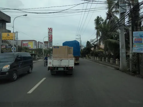
- Street-level photo, asdfasdf0986, CC BY-SA 4.0
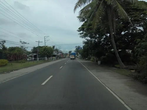
- Street-level photo, asdfasdf0986, CC BY-SA 4.0
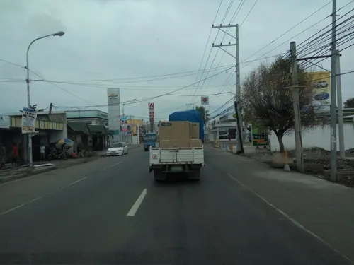
- Street-level photo, asdfasdf0986, CC BY-SA 4.0
- Street-level photo, asdfasdf0986, CC BY-SA 4.0
- Street-level photo, asdfasdf0986, CC BY-SA 4.0
- Street-level photo, asdfasdf0986, CC BY-SA 4.0
- Street-level photo, asdfasdf0986, CC BY-SA 4.0
- Street-level photo, asdfasdf0986, CC BY-SA 4.0
- Street-level photo, asdfasdf0986, CC BY-SA 4.0
- Street-level photo, asdfasdf0986, CC BY-SA 4.0
- Street-level photo, asdfasdf0986, CC BY-SA 4.0
- Street-level photo, asdfasdf0986, CC BY-SA 4.0
- Street-level photo, asdfasdf0986, CC BY-SA 4.0
- Street-level photo, asdfasdf0986, CC BY-SA 4.0


Page built November 7, 2026. Spotted a mistake? Tell us or suggest a place.