

Why visit Mainit
Townapedia lists 1 museum or landmark, 3 parks and trails, 5 places to eat and 2 attractions in and around town.
Highlights include Double Peak.
Weather in Mainit
Forecast from MET Norway (CC BY 4.0). Full forecast
About Mainit
Mainit, officially the Municipality of Mainit (Surigaonon: Lungsod nan Mainit; Cebuano: Lungsod sa Mainit; Tagalog: Bayan ng Mainit), is a municipality in the province of Surigao del Norte, Philippines. According to the 2024 census, it has a population of 29,205 people.
From the Wikipedia article Mainit (this version), under CC BY-SA 4.0.
Things to do2


Museums and landmarks1

Parks, trails and playgrounds3

Restaurants and cafes5




History
The first inhabitants of Mainit settled near Lake Mainit in what is now barangay San Isidro (formerly called "Daang Lungsod" or "Old Town"). It was believed that the constant harassment of pirates forced the original settlers to move to the present town site.
Mainit was established as a Barrio in 1904 under the Municipality of Placer. In 1906, it was transferred under the jurisdiction and reclassified as a Municipality of the Province of Agusan del Norte (owing to its proximity to the border of Surigao del Norte and Agusan del Norte). However, after six months, Mainit was returned to the Province of Surigao del Norte and its status was reverted to being a barangay of Placer. Mainit was finally reclassified into a separate municipality in Jan. 1, 1931 by virtue of Executive Order 290 dated December 27, 1930, signed by Governor-General Dwight F. Davis.
Two of Mainit's barangays were made into full-fledged municipalities: Tubod in 1958 and Alegria in 1968. Mainit currently has 21 Barangays.
Mainit got its name from the hot sulfuric spring which flows to the river the “Mapaso Hot Spring”. Mapaso literally is “hot”.
From the History section of Mainit on Wikipedia, under CC BY-SA 4.0.
Churches and places of worship7
Shopping1
Gas and EV charging2
Schools, colleges and libraries45
Hacienda National High School
School · 5.8 km
Ipil-San Francisco-Malimono-Mainit Road, Mainit
San Francisco Elementary School
School · 5.8 km
Ipil-San Francisco-Malimono-Mainit Road, Mainit
Surigao del Norte College of Agriculture & Technology
School · 3.8 km
Magpayang-Mainit Road
Healthcare1
Map of Mainit
67 places. The map loads OpenStreetMap tiles when you open it.
Getting there and nearby towns
Surigao Airport (SUG) is the nearest airport with scheduled flights listed in OpenStreetMap, 25 km away.
- San Francisco 4 km west, about 4 min by car
- Alegria 10 km southeast, about 10 min by car
- Kitcharao 10 km southeast, about 10 min by car
- Tubay 41 km south, about 41 min by car
- Cabadbaran 46 km south, about 46 min by car
- Buenavista 63 km south, about 1 h by car
- Butuan 65 km south, about 1 h by car
- Sibagat 82 km south, about 1 h 15 min by car
- Macrohon 88 km northwest, about 1 h 30 min by car
- Tandag 90 km southeast, about 1 h 30 min by car
Drive times are estimates from straight-line distance, not routes.
Local news
Headlines from INDB.
Reviews, tips and questions
Loading what members have shared...
Sources and licences
- GeoNames (CC BY 4.0): population, coordinates, regions and time zone
- Mapillary (see each image): photos
- OpenStreetMap contributors (ODbL 1.0): places, airports, map data
- Wikidata (CC0 1.0): elevation, founding date, time zone, website
- Wikimedia Commons (see each image): photos
- Wikipedia (CC BY-SA 4.0): overview and history text
Photo credits
- Lake Mainit Surigao del Norte sunset, Tim Dangerfield, CC BY-SA 3.0
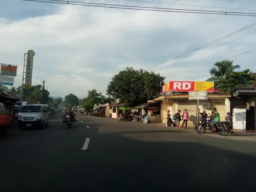
- Street-level photo, dp24ph, CC BY-SA 4.0
- Street-level photo, dp24ph, CC BY-SA 4.0
- Street-level photo, dp24ph, CC BY-SA 4.0
Page built November 7, 2026. Spotted a mistake? Tell us or suggest a place.