

Why visit Tubay
Townapedia lists 1 museum or landmark, 4 parks and trails, 9 places to eat, 5 places to stay and 3 attractions in and around town.
Weather in Tubay
Forecast from MET Norway (CC BY 4.0). Full forecast
About Tubay
Tubay, officially the Municipality of Tubay (Cebuano: Lungsod sa Tubay; Tagalog: Bayan ng Tubay), is a 1st Class municipality in the province of Agusan del Norte, Philippines. According to the 2024 census, it has a population of 26,463 people.
From the Wikipedia article Tubay (this version), under CC BY-SA 4.0.
Things to do3


Museums and landmarks1

Parks, trails and playgrounds4


Restaurants and cafes9





History
The town of Tubay is named after its legendary founder Datu Tabay, and lays claim to being the second Spanish Settlement in Agusan and was known as a pueblo as early as 1751. Formerly, the people settled in the wilderness of Ilihan, then transferred to sitio Malabog and later to Tubay-Tubay and Sabang near the mouth of the Jabonga River. However, the danger of constant inundation and Moro attacks convinced the succeeding leader of the place to move the pueblo to Daang Lungsod where the massive magkuno post of once spacious and strongly built church now stand. It was here where the settlement firmly took place.
By 1898, Tubay had developed into a prosperous town. However, following American occupation, officials determined that neighboring Cabadbaran was more suitable as the seat of government. As a result, in 1903, Tubay was reduced to the status of a barrio in favor of Cabadbaran. Despite this change, Tubay remained an active commercial center, largely due to the presence of Chinese merchants. Economic activity continued into the 1920s, when the navigable Jabonga River served as the main route for the transport of copra and hemp. However, the completion of the Tubay–Santiago–Cabadbaran road led to a decline in river-based trade, causing a gradual downturn in Tubay’s commercial prominence.
From the History section of Tubay on Wikipedia, under CC BY-SA 4.0.
Where to stay5
Cabadbaran Campus Guest House
Motel and hotel · 5.6 km
T. Curato Street, Cabadbaran
Churches and places of worship13
God's Tabernacle of Praise
Church · Nondenominational · 6.6 km
Scoutmaster F. Ojeda Avenue, Cabadbaran
Bible Baptist Church
Church · Baptist · 5.7 km
Scoutmaster F. Ojeda Avenue, Cabadbaran
Catheral of Our Lady of Presentation
Church · Iglesia Filipina Independiente · 5.0 km
Cabiltes Street, Cabadbaran
Virgen de la Candelaria Parish Church
Church · Roman Catholic · 5.0 km
Funcion Street
Shopping7
Gaisano Grand Cabadbaran
Shopping center · 6.0 km
Scoutmaster F. Ojeda Avenue, Cabadbaran
Gaisano City Cabadbaran
Shopping center · 7.1 km
Scoutmaster F. Ojeda Avenue, Cabadbaran
Gas and EV charging7
Schools, colleges and libraries45
North Cabadbaran Central Elementary School
School · 5.1 km
A. Curato Street, Cabadbaran
Alfonso B. Dagani Elementary School
School · 6.8 km
Scoutmaster F. Ojeda Avenue, Cabadbaran
Cabadbaran City National High School
School · 5.8 km
T. Curato Street, Cabadbaran
Comagascas Elementary School
School · 5.1 km
Surigao-Butuan National Highway, Cabadbaran
Healthcare6
Mercury Drug
Clinic and pharmacy · 5.8 km
Scoutmaster F. Ojeda Avenue, Cabadbaran
Map of Tubay
100 places. The map loads OpenStreetMap tiles when you open it.
Getting there and nearby towns
Bancasi Airport (BXU) is the nearest airport with scheduled flights listed in OpenStreetMap, 24 km away.
- Cabadbaran 5 km south, about 5 min by car
- Comagascas 5 km southeast, about 5 min by car
- Butuan 24 km south, about 24 min by car
- Buenavista 25 km southwest, about 25 min by car
- Bayugan 53 km southeast, about 53 min by car
- Gingoog 60 km southwest, about 1 h by car
- Tandag 75 km east, about 1 h 15 min by car
- Prosperidad 77 km southeast, about 1 h 15 min by car
- San Francisco 84 km southeast, about 1 h 30 min by car
- Mambajao 89 km west, about 1 h 30 min by car
Drive times are estimates from straight-line distance, not routes.
Local news
Headlines from INDB.
Reviews, tips and questions
Loading what members have shared...
Sources and licences
- GeoNames (CC BY 4.0): population, coordinates, regions and time zone
- Mapillary (see each image): photos
- OpenStreetMap contributors (ODbL 1.0): places, airports, map data
- Wikidata (CC0 1.0): elevation, founding date, time zone, website, landmarks and historic places
- Wikimedia Commons (see each image): photos
- Wikipedia (CC BY-SA 4.0): overview and history text
Photo credits
- Tubay, Agusan del Norte, Philippines, Paolobon140, CC BY-SA 4.0
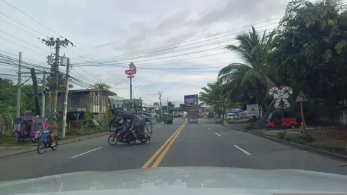
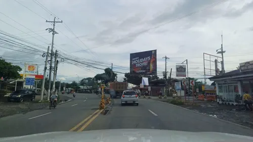
- Street-level photo, dp24ph, CC BY-SA 4.0
- Street-level photo, dp24ph, CC BY-SA 4.0
- Street-level photo, dp24ph, CC BY-SA 4.0
- Street-level photo, dp24ph, CC BY-SA 4.0
- Street-level photo, dp24ph, CC BY-SA 4.0
- Street-level photo, dp24ph, CC BY-SA 4.0
- Street-level photo, dp24ph, CC BY-SA 4.0
- Street-level photo, dp24ph, CC BY-SA 4.0
- Street-level photo, dp24ph, CC BY-SA 4.0
- Street-level photo, dp24ph, CC BY-SA 4.0
- Street-level photo, dp24ph, CC BY-SA 4.0
Page built November 7, 2026. Spotted a mistake? Tell us or suggest a place.