
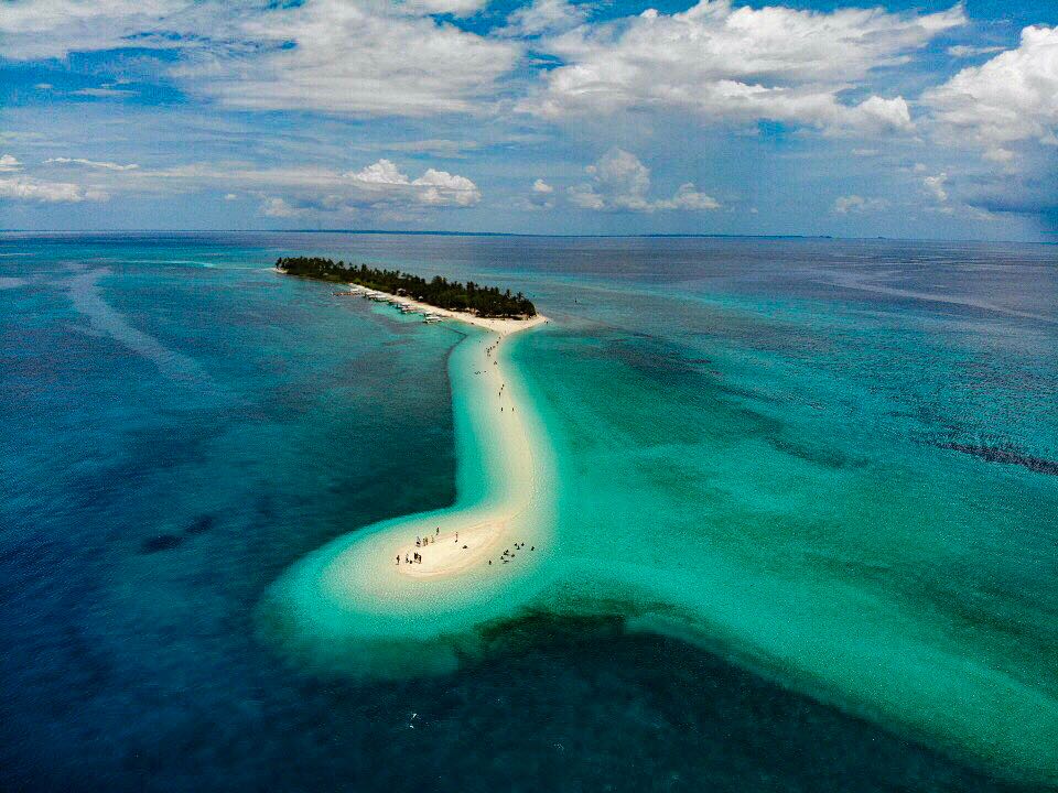


Palompon, Philippines
Palompon is a town of 12,087 people in Eastern Visayas, Philippines, founded in 1620.
Why visit Palompon
Townapedia lists 2 museums and landmarks, 9 parks and trails, 14 places to eat, 8 places to stay and 3 attractions in and around town.
Weather in Palompon
Forecast from MET Norway (CC BY 4.0). Full forecast
About Palompon
Palompon (IPA: [pɐ'lompɔn]), officially the Municipality of Palompon (Cebuano: Lungsod sa Palompon; Waray: Bungto han Palompon; Tagalog: Bayan ng Palompon), is a municipality in the province of Leyte, Philippines. According to the 2024 census, it has a population of 59,486 people.
From the Wikipedia article Palompon (this version), under CC BY-SA 4.0.
Travel tips from other travellers: Palompon on Wikivoyage (CC BY-SA 4.0).
Things to do3


Museums and landmarks2

Parks, trails and playgrounds9




Restaurants and cafes14




2 more on the map.
History
Along the strip of the fertile coast, the community was founded circa 1620 and originally named Hinablayan. Fish, sea shells, and other marine products abounded. People fished along the shore with arrows tied to vines. Its abundance attracted not only migrants but also Moro raiders from the south. Legend tells that local defenders used to hang the dead bodies of Moros on tree branches so that the place come to be known as Hinablayan (from the word sablay which means "to hang").
The legend continues that when the Spaniards came they saw floating at the bay a cluster (pong pong) of mangrove propagules locally known as "Tungki", they decided to change the name of Hinablayan to Paungpung, after the cluster of mangrove propagules to erase the bloody memory of the Moro raiders. Gradually the name evolved to Palompong as seen in the first Murillo-Velarde Map published in 1734, then to Palumpun, and its current spelling of Palompon sometime in 1700 or 1800. It is said that cluster later got stuck to the shoal until they grew up as trees, forming an islet which is Tabuk Island today.
From the History section of Palompon on Wikipedia, under CC BY-SA 4.0.
Where to stay8
Churches and places of worship7
Trinity Faith Baptist Church in the Philippines, International Ministry Inc.
Church · Southern Baptist
607 Washington Street, Palompon
Shopping2
Gas and EV charging3
Schools, colleges and libraries42
Healthcare8
Map of Palompon
98 places. The map loads OpenStreetMap tiles when you open it.
Getting there and nearby towns
Ormoc Airport (OMC) is the nearest airport with scheduled flights listed in OpenStreetMap, 20 km away.
- Isabel 15 km south, about 15 min by car
- Ormoc 25 km east, about 25 min by car
- Capoocan 39 km northeast, about 39 min by car
- Bogo 41 km west, about 41 min by car
- Carigara 42 km northeast, about 42 min by car
- Daanbantayan 46 km northwest, about 46 min by car
- Medellin 47 km west, about 47 min by car
- San Remigio 49 km west, about 49 min by car
- Barugo 49 km northeast, about 49 min by car
- Burauen 56 km east, about 56 min by car
Drive times are estimates from straight-line distance, not routes.
Local news
Headlines from INDB.
Reviews, tips and questions
Loading what members have shared...
Sources and licences
- GeoNames (CC BY 4.0): population, coordinates, regions and time zone
- OpenStreetMap contributors (ODbL 1.0): places, airports, map data
- Wikidata (CC0 1.0): elevation, founding date, time zone, website, landmarks and historic places
- Wikimedia Commons (see each image): photos
- Wikipedia (CC BY-SA 4.0): overview and history text
Photo credits
- Kalanggaman Island, Exec8, CC BY-SA 4.0
- A brave beautiful caterpillar, Darlene Baltes, CC BY-SA 4.0
Page built November 7, 2026. Spotted a mistake? Tell us or suggest a place.