


San Remigio, Philippines
San Remigio is a town of 3,806 people in Central Visayas, Philippines, founded in 1863.
Why visit San Remigio
Townapedia lists 3 museums and landmarks, 7 parks and trails, 26 places to eat, 13 places to stay and 5 attractions in and around town.
Weather in San Remigio
Forecast from MET Norway (CC BY 4.0). Full forecast
About San Remigio
San Remigio, officially called the Municipality of San Remigio (Cebuano: Lungsod sa San Remigio; Tagalog: Bayan ng San Remigio), is a municipality in the province of Cebu, Philippines. According to the 2024 census, it has a population of 67,850 people.
From the Wikipedia article San Remigio, Cebu (this version), under CC BY-SA 4.0.
Travel tips from other travellers: San Remigio on Wikivoyage (CC BY-SA 4.0).
Things to do5



Museums and landmarks3

Parks, trails and playgrounds7




Restaurants and cafes26


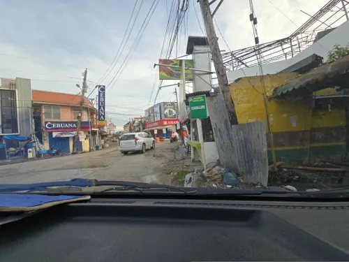
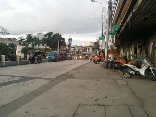


14 more on the map.
History
San Remigio was formerly known as Kanghagas, a kind of tree that grew in abundance in the area. When the Spanish conquistadores arrived, they identified a town site by clearing the kanghagas trees. At the time, Kanghagas was part of barangay Punta.
Initially, the chapel of ease (visita) of Kanghagas was under the jurisdiction of Bantayan. In 1850, the town of Bogo established a parish and took over civil governance of the three barrios of Kanghagas, Lambusan, and Victoria (formerly Maraat). Later, barangay Kanghagas was renamed Isabel after the Queen Isabela II of Spain, but was eventually changed in 1863 to its permanent name, San Remigio. The name San Remigio can be found in San Remigio, Florence, an Italian church from in the 1100s and later rebuilt in the 1300s. In 1864, San Remigio and other barrios established their own parish, San Juan Nepomuceno.
The town sustained extensive damage during the 2025 Cebu earthquake on September 30; 22 of the 72 deaths recorded came from San Remigio.
From the History section of San Remigio, Cebu on Wikipedia, under CC BY-SA 4.0.
Where to stay13
Churches and places of worship7
Kingdom Hall of Jehovah's Witnesses
Church · Jehovahs Witness · 1.4 km
Cebu North Road
Shopping5
Gas and EV charging4
Schools, colleges and libraries49
Dayhagon Elementary School
School · 4.0 km
Bogo – Curva – Medellin – Daanbantayan – Maya Road
Saint Louis Marillac College of Bogo - College Department
School · 7.8 km
Sor D. Rubio Street, Bogo
Healthcare15
Map of San Remigio
134 places. The map loads OpenStreetMap tiles when you open it.
Getting there and nearby towns
Ormoc Airport (OMC) is the nearest airport with scheduled flights listed in OpenStreetMap, 69 km away.
- Medellin 6 km northeast, about 6 min by car
- Bogo 8 km southeast, about 8 min by car
- Santa Fe 17 km northwest, about 17 min by car
- Daanbantayan 20 km northeast, about 20 min by car
- Bantayan 25 km west, about 25 min by car
- Palompon 49 km east, about 49 min by car
- Escalante 55 km southwest, about 55 min by car
- Sagay 58 km west, about 58 min by car
- Danao 63 km south, about 1 h by car
- Ormoc 74 km east, about 1 h 15 min by car
Drive times are estimates from straight-line distance, not routes.
Local news
Headlines from INDB.
Reviews, tips and questions
Loading what members have shared...
Sources and licences
- GeoNames (CC BY 4.0): population, coordinates, regions and time zone
- Mapillary (see each image): photos
- OpenStreetMap contributors (ODbL 1.0): places, airports, map data
- Wikidata (CC0 1.0): elevation, founding date, time zone, website
- Wikimedia Commons (see each image): photos
- Wikipedia (CC BY-SA 4.0): overview and history text
Photo credits
- Random street of San Remigio - panoramio, Daugilas, CC BY-SA 3.0
- ISS047-E-24065 - View of Earth, Earth Science and Remote Sensing Unit , Lyndon B. Johnson Space Center, Public domain
- ISS057-E-28318 - View of Earth, Earth Science and Remote Sensing Unit, NASA Johnson Space Center, Public domain
- A Group Of Kids Gathered Around Baddie Roma, Haus Of Baddie, CC BY 4.0
- Street-level photo, Jongkiko, CC BY-SA 4.0
- Street-level photo, Jongkiko, CC BY-SA 4.0
- Street-level photo, GOwin, CC BY-SA 4.0
Page built November 7, 2026. Spotted a mistake? Tell us or suggest a place.