


San Enrique, Philippines
San Enrique is a town of 2,620 people in Western Visayas, Philippines, founded in July 12, 1975.
Why visit San Enrique
Townapedia lists 7 museums and landmarks, 8 parks and trails, 51 places to eat, 4 places to stay and 3 attractions in and around town.
Highlights include Mount Ilajas, Lapuz Lapuz Cave and Bulabog Putian National Park.
Weather in San Enrique
Forecast from MET Norway (CC BY 4.0). Full forecast
About San Enrique
San Enrique, officially the Municipality of San Enrique (Hiligaynon: Banwa sang San Enrique, Tagalog: Bayan ng San Enrique), is a municipality in the province of Iloilo, Philippines. According to the 2024 census, it has a population of 37,381 people.
From the Wikipedia article San Enrique, Iloilo (this version), under CC BY-SA 4.0.
Things to do3

Museums and landmarks7

Lapuz Lapuz Cave
Monument and historic site · 4.8 km
Cave and archaeological site in the Philippines
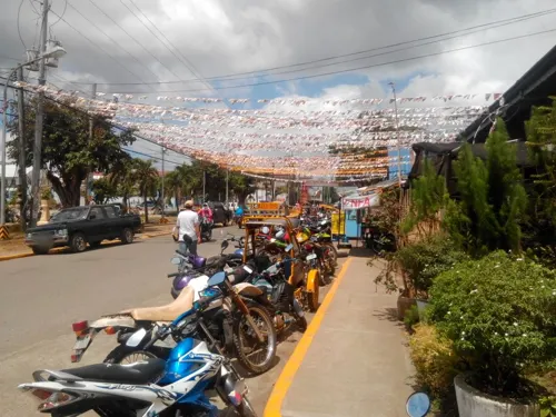
Perlas Monument
Monument and historic site · 4.1 km
F. Palmares Sr. Street, Passi
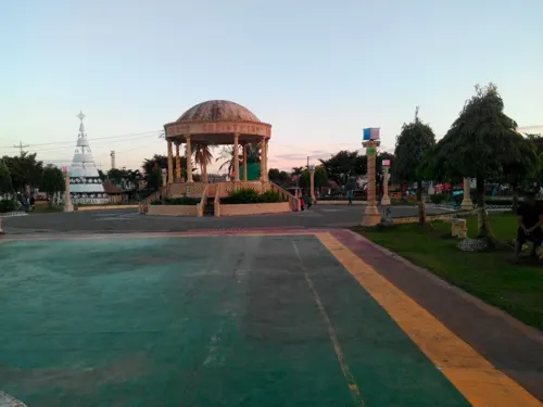
World War II Memorial
Monument and historic site · 4.3 km
Railway bridge where Japanese beheadead many Passinhon
Parks, trails and playgrounds8



Restaurants and cafes51


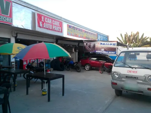



39 more on the map.
Where to stay4
Churches and places of worship22
Parish of Saint William Church
Church · Roman Catholic · 4.2 km
F. Palmares Sr. Street
Seventh Day Adventist Church
Church · Seventh Day Adventist · 4.7 km
Alfelor Street
Shopping18
Gas and EV charging8
Schools, colleges and libraries81
St. Therese Learnig Center
School · Roman Catholic
Palabrica Street, San Enrique, Iloilo
Iloilo State College of Fisheries - Dingle Campus
School · 7.7 km
Pototan-Tabugon Road
Healthcare14
Map of San Enrique
216 places. The map loads OpenStreetMap tiles when you open it.
Getting there and nearby towns
Iloilo International Airport (ILO) is the nearest airport with scheduled flights listed in OpenStreetMap, 32 km away.
- Passi 4 km north, about 4 min by car
- Pototan 14 km south, about 14 min by car
- Barotac Nuevo 20 km south, about 20 min by car
- Janiuay 21 km southwest, about 21 min by car
- Tapas 25 km northwest, about 25 min by car
- Santa Barbara 31 km southwest, about 31 min by car
- Enrique B. Magalona 41 km southeast, about 41 min by car
- Iloilo 43 km south, about 43 min by car
- Victorias 49 km southeast, about 49 min by car
- Talisay 50 km southeast, about 50 min by car
Drive times are estimates from straight-line distance, not routes.
Local news
Headlines from INDB.
Reviews, tips and questions
Loading what members have shared...
Sources and licences
- GeoNames (CC BY 4.0): population, coordinates, regions and time zone
- Mapillary (see each image): photos
- OpenStreetMap contributors (ODbL 1.0): places, airports, map data
- Wikidata (CC0 1.0): elevation, founding date, time zone, website, landmarks and historic places
- Wikimedia Commons (see each image): photos
- Wikipedia (CC BY-SA 4.0): overview and history text
Photo credits
- San Enrique Municipal Hall (2020), Akosirobep, CC BY-SA 4.0
- San Enrique, Iloilo 20230329 133026, BSrap, CC BY-SA 4.0
- San Enrique Town Hall (06-2022), BSrap, CC BY-SA 4.0
- Covered court San Enrique, Iloilo 04-2022, BSrap, CC BY-SA 4.0
- Covered court San Enrique, Iloilo 05-2022, BSrap, CC BY-SA 4.0
- San Enrique, Iloilo 20240127 173621, BSrap, CC BY 4.0
- Barangay Compo, San Enrique, Iloilo rice field 20230313 132533, BSrap, CC BY-SA 4.0
- Barangay Compo, San Enrique, Iloilo rice field 20230313 132537, BSrap, CC BY-SA 4.0
- San Enrique public market 20220620 171549, BSrap, CC BY-SA 4.0
- May 24, 2021 thunderstorm in San Enrique, Iloilo, PH, BSrap, CC BY-SA 4.0
- Thunderstorm in San Enrique, Iloilo, PH (May 31, 2021), BSrap, CC BY-SA 4.0
- Thunderstorm in San Enrique 20210824 140200, BSrap, CC BY-SA 4.0
- San Enrique Central School (SECS) 20240412 172916, BSrap, CC BY 4.0
- San Enrique Central School 20230213 131426, BSrap, CC BY-SA 4.0
- San Enrique Central School 20230213 131406, BSrap, CC BY-SA 4.0
- San Enrique Central School 20230213 130034, BSrap, CC BY-SA 4.0
- San Enrique, Iloilo rice fields 20261023 162650, Moraljaya67, CC BY-SA 4.0
- Barangay Compo, San Enrique, Iloilo rice field 20230313 132608, BSrap, CC BY-SA 4.0
- Brgy. Bantayan, San Enrique, Iloilo 20230424 123145, BSrap, CC BY-SA 4.0
- Brgy. Bantayan, San Enrique, Iloilo 20230424 123159, BSrap, CC BY-SA 4.0
- Brgy. Bantayan, San Enrique, Iloilo (April 2022), BSrap, CC BY-SA 4.0
- Jalaur River passes through San Enrique, Iloilo 20230107 142750, BSrap, CC BY-SA 4.0
- Jalaur River passing through San Enrique, Iloilo20230107 142750, BSrap, CC BY-SA 4.0
- Brgy. Bantayan, San Enrique, Iloilo (April 2022) sugar cane field, BSrap, CC BY-SA 4.0
- Bulabog entrance, BSrap, CC BY-SA 4.0
- Dueñas Church, Iloilo, Joelaldor, CC BY-SA 4.0
- Dingle Church, Iloilo, Joelaldor, CC BY-SA 4.0
- Passi Church, Iloilo, Joelaldor, CC BY-SA 4.0
- Common house gecko, butiki 20250208 214012, BSrap, CC BY-SA 4.0
- Jalaur River 20230313 131156, BSrap, CC BY-SA 4.0
- Jalaur River 20230313 131200, BSrap, CC BY-SA 4.0
- Dingle, Iloilo corn fields20250125 105334, BSrap, CC BY-SA 4.0
- Barotac Nuevo, Iloilo, highway 2 11-28-2022, BSrap, CC BY-SA 4.0
- Thunderstorm in Iloilo 20210831 141312, BSrap, CC BY-SA 4.0
- Jalaur River 05-2022 A, BSrap, CC BY-SA 4.0
- Jalaur River SE 20220321 161912, BSrap, CC BY-SA 4.0
- Jalaur River 05-2022 B, BSrap, CC BY-SA 4.0
- Welcome arc of Passi City, Iloilo 20240218 143125, BSrap, CC BY 4.0
- Jalaur River in Passi, Iloilo 05-2022, BSrap, CC BY-SA 4.0
- Passi City, Iloilo 20230320 111948, BSrap, CC BY-SA 4.0
- Street-level photo, oslec, CC BY-SA 4.0
- Street-level photo, oslec, CC BY-SA 4.0
- Street-level photo, oslec, CC BY-SA 4.0


Page built November 7, 2026. Spotted a mistake? Tell us or suggest a place.