


San Manuel, Philippines
San Manuel is a town of 9,865 people in Cagayan Valley, Philippines, founded in 1957.
Why visit San Manuel
Townapedia lists 2 museums and landmarks, 1 park or trail, 1 place to eat and 1 place to stay in and around town.
Weather in San Manuel
Forecast from MET Norway (CC BY 4.0). Full forecast
About San Manuel
San Manuel (formerly Callang), officially the Municipality of San Manuel (Ilocano: Ili ti San Manuel; Tagalog: Bayan ng San Manuel), is a municipality in the province of Isabela, Philippines. According to the 2024 census, it has a population of 34,740 people.
From the Wikipedia article San Manuel, Isabela (this version), under CC BY-SA 4.0.
Museums and landmarks2

Parks, trails and playgrounds1

Restaurants and cafes1

Where to stay1


History
In the early 1920s, the initial groups of settlers from Central Luzon came and founded communities in the area. At that time, Callang was a barrio of the municipality of Gamu. After gaining independence from Gamu in 1948, Roxas (formerly Barrio Vera) became a municipality. One of the barrios of this recently established municipality was Callang. Before 1957, Callang's leaders petitioned for the barrio to become a municipality because of the town's rapid progress. Congressman Delfin B. Albano's bill was approved by Congress. The area had 14,650 residents and earned ₱65,000 annually at the time.
In June 23, 1957, the barrios of Callang, Eden, Babanuang, Cabaritan, Santa Cruz, Malalinta, Mararigue, Calaocan, and Caraniogan of Roxas were separated to form Callang. The municipality was inaugurated on October 12, 1957 with the barangay of Callang as the government seat. In June 19, 1965, the town was renamed as San Manuel by virtue of Republic Act No. 4600. By virtue of Republic Act No. 5869, the barrios of Villanueva and Sandiat in the Municipality of Roxas were made part of San Manuel.
From the History section of San Manuel, Isabela on Wikipedia, under CC BY-SA 4.0.
Churches and places of worship6
The Church of Jesus Christ of Latter-day Saints
Church · Jehovahs Witness · 8.4 km
Tandang Sora Street
Gas and EV charging7
Schools, colleges and libraries69
Healthcare2
Map of San Manuel
89 places. The map loads OpenStreetMap tiles when you open it.
Getting there and nearby towns
Cauayan Airport (CYZ) is the nearest airport with scheduled flights listed in OpenStreetMap, 16 km away.
- Roxas 11 km north, about 11 min by car
- Gamu 21 km east, about 21 min by car
- Alicia 28 km south, about 28 min by car
- Ramon 29 km south, about 29 min by car
- Ilagan 30 km northeast, about 30 min by car
- Angadanan 32 km south, about 32 min by car
- Echague 36 km south, about 36 min by car
- Santiago 38 km south, about 38 min by car
- Cabagan 47 km north, about 47 min by car
- Tabuk 48 km northwest, about 48 min by car
Drive times are estimates from straight-line distance, not routes.
Local news
Headlines from INDB.
Reviews, tips and questions
Loading what members have shared...
Sources and licences
- GeoNames (CC BY 4.0): population, coordinates, regions and time zone
- Mapillary (see each image): photos
- OpenStreetMap contributors (ODbL 1.0): places, airports, map data
- Wikidata (CC0 1.0): elevation, founding date, time zone, website, landmarks and historic places
- Wikimedia Commons (see each image): photos
- Wikipedia (CC BY-SA 4.0): overview and history text
Photo credits
- Aurora, Isabela Public Market, Hariboneagle927, CC BY-SA 4.0
- ISS030-E-214069 - View of Earth, Earth Science and Remote Sensing Unit , Lyndon B. Johnson Space Center, Public domain
- ISS065-E-411514 - View of Earth, Earth Science and Remote Sensing Unit , Lyndon B. Johnson Space Center, Public domain
- ISS055-E-56206 - View of Earth, Earth Science and Remote Sensing Unit, NASA Johnson Space Center, Public domain
- ISS065-E-411513 - View of Earth, Earth Science and Remote Sensing Unit , Lyndon B. Johnson Space Center, Public domain
- ISS055-E-56207 - View of Earth, Earth Science and Remote Sensing Unit, NASA Johnson Space Center, Public domain
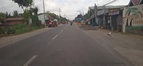
- Street-level photo, mdgabriel, CC BY-SA 4.0
Page built November 7, 2026. Spotted a mistake? Tell us or suggest a place.