


Santa Fe, Philippines
Santa Fe is a town of 2,405 people in Central Visayas, Philippines.
Why visit Santa Fe
Townapedia lists 6 museums and landmarks, 5 parks and trails, 51 places to eat and 50 places to stay in and around town.
Highlights include Balik-Laro.
Weather in Santa Fe
Forecast from MET Norway (CC BY 4.0). Full forecast
About Santa Fe
Santa Fe, officially the Municipality of Santa Fe (Cebuano: Lungsod sa Santa Fe; Tagalog: Bayan ng Santa Fe), is a municipality in the province of Cebu, Philippines. According to the 2024 census, it has a population of 34,834 people.
From the Wikipedia article Santa Fe, Cebu (this version), under CC BY-SA 4.0.
Museums and landmarks6

Parks, trails and playgrounds5


Restaurants and cafes51

Stumble Inn Bar & Restaurant
Restaurant
We_Do_all_Types_of_Local_&_International_Food_.._Cold_Beer_&_Drinks;burger;pizza;chicken;fish_and_chips;coffee_shop;italian;regional
Vincente Illut Street
08:00-22:00
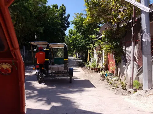


39 more on the map.
Where to stay50

Casa Andrea
Motel and hotel · 0.8 km
Santa Fe - Bantayan Road
Mo-Su 07:00-21:00
Piodena residence
Motel and hotel
067 F. Duarte Street
Su 09:00-18:00
38 more on the map.
Churches and places of worship8
Shopping13
Gas and EV charging3
Schools, colleges and libraries12
Healthcare3
Map of Santa Fe
151 places. The map loads OpenStreetMap tiles when you open it.
Getting there and nearby towns
Sicogon Airport (ICO) is the nearest airport with scheduled flights listed in OpenStreetMap, 69 km away.
- Bantayan 9 km west, about 9 min by car
- Medellin 17 km east, about 17 min by car
- Bogo 25 km southeast, about 25 min by car
- Daanbantayan 25 km northeast, about 25 min by car
- Escalante 48 km southwest, about 48 min by car
- Sagay 48 km southwest, about 48 min by car
- Cadiz 61 km west, about 1 h by car
- Palompon 64 km east, about 1 h by car
- Danao 74 km south, about 1 h 15 min by car
- Estancia 79 km northwest, about 1 h 15 min by car
Drive times are estimates from straight-line distance, not routes.
Local news
Headlines from INDB.
Reviews, tips and questions
Loading what members have shared...
Sources and licences
- GeoNames (CC BY 4.0): population, coordinates, regions and time zone
- Mapillary (see each image): photos
- OpenStreetMap contributors (ODbL 1.0): places, airports, map data
- Wikidata (CC0 1.0): elevation, founding date, time zone, website
- Wikimedia Commons (see each image): photos
- Wikipedia (CC BY-SA 4.0): overview and history text
Photo credits
- Ogtong beach area, Santa Fe, Unbuttered Parsnip, CC BY-SA 3.0
- Santa Fe Beach, Francisco M. Pajares, Jr., CC BY-SA 4.0
- Palm tree in Santa Fe, Bantayan island - panoramio, Daugilas, CC BY-SA 3.0
- Beach in Santa Fe, John Martin PERRY, CC BY-SA 3.0
- Beach in Santa Fe, Bantayan Island, SYKE Travel & Tours, CC BY-SA 4.0
- Santa Fe, Bantayan island - panoramio, Mats Sjödin, CC BY 3.0
- Santa Fe port - panoramio, Mats Sjödin, CC BY 3.0
- Ferry pier, Santa Fe, John Martin PERRY, CC BY-SA 3.0
- Bantayan island beach, Santa Fe, Cebu - panoramio, Mats Sjödin, CC BY 3.0
- Ferry from Hagnaya, Cebu to Santa Fe, Bantayan - panoramio, Robert Breivik, CC BY-SA 3.0
- Santa fe beach on Bantayan island - panoramio, Mats Sjödin, CC BY 3.0
- Boat beached in Santa Fe., John Martin PERRY, CC BY-SA 3.0
- Hilantagaan Island, Santa Fe seen from the south, Unbuttered Parsnip, CC BY-SA 4.0
- The Fountain of Love, SYKE Travel & Tours, CC BY-SA 4.0
- Cherry Blossom in Bantayan Island, SYKE Travel & Tours, CC BY-SA 4.0
- The Tiny House at SMAK's Hotel, SYKE Travel & Tours, CC BY-SA 4.0
- Beach scene at Marlin with Cebu on far horizon, Unbuttered parsnip, CC BY-SA 3.0
- Pinay - panoramio, Robert Breivik, CC BY-SA 3.0
- Marlins Beach Resort - panoramio (1), Rob McGregor, CC BY 3.0
- Marlins Beach Resort - panoramio, Rob McGregor, CC BY 3.0
- Bantayan island - panoramio, jackylim, CC BY-SA 3.0
- Beach Bantayan Island, SYKE Travel & Tours, CC BY-SA 4.0
- Beach in Bantayan Island, SYKE Travel & Tours, CC BY-SA 4.0
- St. Bernard resort - panoramio, Robert Breivik, CC BY-SA 3.0
- Bangka race - panoramio, Robert Breivik, CC BY-SA 3.0
- Anika Resort - panoramio (6), Rob McGregor, CC BY 3.0
- Anika Resort - panoramio (7), Rob McGregor, CC BY 3.0
- Anika Resort - panoramio (2), Rob McGregor, CC BY 3.0
- Anika Resort - panoramio (3), Rob McGregor, CC BY 3.0
- Anika Resort - panoramio (4), Rob McGregor, CC BY 3.0
- Anika Resort - panoramio, Rob McGregor, CC BY 3.0
- Anika Resort - panoramio (5), Rob McGregor, CC BY 3.0
- Bantayan island - panoramio (2), jackylim, CC BY-SA 3.0
- Tidal Erosion Pattern on Bantayan Island Limestone, MikelleBandin, CC BY-SA 4.0
- Pumpboat dock at barangay Baigad has seen better days 01, John Martin PERRY, CC BY-SA 4.0
- Pumpboat dock at barangay Baigad has seen better days 02, Unbuttered Parsnip, CC BY-SA 4.0
- Random beach of Bantayan island - panoramio, Daugilas, CC BY-SA 3.0
- Street-level photo, axe, CC BY-SA 4.0
- Street-level photo, axe, CC BY-SA 4.0
- Street-level photo, axe, CC BY-SA 4.0


Page built November 7, 2026. Spotted a mistake? Tell us or suggest a place.