
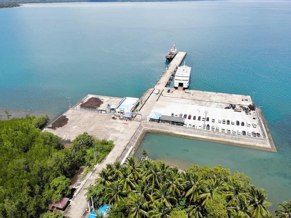
Sindangan, Philippines
Sindangan is a town of 5,718 people in Zamboanga Peninsula, Philippines, founded in December 22, 1936.
Why visit Sindangan
Townapedia lists 1 park or trail, 11 places to eat and 9 places to stay in and around town.
Weather in Sindangan
Forecast from MET Norway (CC BY 4.0). Full forecast
About Sindangan
Sindangan, officially the Municipality of Sindangan (Cebuano: Lungsod sa Sindangan; Subanen: Benwa Sindangan; Chavacano: Municipalidad de Sindangan; Tagalog: Bayan ng Sindangan), is a municipality in the province of Zamboanga del Norte, Philippines. According to the 2024 census, it has a population of 104,514 people.
From the Wikipedia article Sindangan (this version), under CC BY-SA 4.0.
Parks, trails and playgrounds1

Restaurants and cafes11





Where to stay9

Siayan Pension Guest House
Motel and hotel · 12.4 km
Sindangan - Siayan - Dumingag - Mahayag Road
Churches and places of worship12

Kingdom Hall of Jehovah's Witnesses
Church · Jehovahs Witness · 1.2 km
Dipolog-Sindangan-Liloy Road
Lokal ng Siare, Iglesia ni Cristo
Church · Iglesia Ni Cristo · 10.8 km
Dipolog-Sindangan-Liloy Road
Lokal ng Sindangan, Iglesia ni Cristo
Church · Iglesia Ni Cristo · 1.0 km
Dipolog-Sindangan-Liloy Road
Saint Isidore the Farmer Parish
Church · Roman Catholic · 12.5 km
Abundio B. Siasico Sr. Street, Siayan
History
This town sets back its origin during the pre-Spanish colonization of the Philippines. Subanon people or tribe was its first inhabitants. The Subanens, a nomadic tribe of Indo-Malayan stock, were the earliest known settlers who lived along river banks or "suba", from which word they received their present tribal identity as Subanen. They built houses and sanctuaries for their shelter and formed their own 'government' ruled by the Datu.
Over the years the Moros settled also in this place and preached Islam.
From the History section of Sindangan on Wikipedia, under CC BY-SA 4.0.
Shopping7
Gas and EV charging7
Schools, colleges and libraries82
Juan Bugarin Central School
School · 6.2 km
Dipolog-Sindangan-Liloy Road, Sindangan
Maras East Elementary School
School · 6.1 km
Dipolog-Sindangan-Liloy Road, Sindangan
Saint Joseph College of Sindangan - Basic Education
School
Dipolog-Sindangan-Liloy Road
Siayan National High School
School · 12.0 km
Sindangan - Siayan - Dumingag - Mahayag Road, Siayan
Sindangan National Agricultural School
School · 1.0 km
Dipolog-Sindangan-Liloy Road
Healthcare6
Map of Sindangan
135 places. The map loads OpenStreetMap tiles when you open it.
Getting there and nearby towns
Dipolog Airport (DPL) is the nearest airport with scheduled flights listed in OpenStreetMap, 55 km away.
- Disod 3 km northeast, about 3 min by car
- Mandih 4 km southeast, about 4 min by car
- Dipolog 52 km northeast, about 52 min by car
- Siay 62 km south, about 1 h by car
- Pagadian 67 km southeast, about 1 h by car
- Dapitan 66 km northeast, about 1 h by car
- Ipil 68 km southwest, about 1 h 15 min by car
- Labangan 70 km southeast, about 1 h 15 min by car
- Tangub 85 km east, about 1 h 30 min by car
- Tubod 90 km east, about 1 h 30 min by car
Drive times are estimates from straight-line distance, not routes.
Local news
Headlines from INDB.
Reviews, tips and questions
Loading what members have shared...
Sources and licences
- GeoNames (CC BY 4.0): population, coordinates, regions and time zone
- OpenStreetMap contributors (ODbL 1.0): places, airports, map data
- Wikidata (CC0 1.0): elevation, founding date, time zone, website
- Wikimedia Commons (see each image): photos
- Wikipedia (CC BY-SA 4.0): overview and history text
Photo credits
- Port of Sindangan Aerial View, Unknown author Unknown author, Public domain
Page built November 7, 2026. Spotted a mistake? Tell us or suggest a place.