

Sumpong, Philippines
Sumpong is a town of 7,399 people in Northern Mindanao, Philippines.
Why visit Sumpong
Townapedia lists 1 museum or landmark, 5 parks and trails, 105 places to eat, 18 places to stay and 3 attractions in and around town.
Weather in Sumpong
Forecast from MET Norway (CC BY 4.0). Full forecast
About Sumpong
Sumpong is an urban barangay of the City of Malaybalay in the Province of Bukidnon, Philippines. According to the 2015 census, Sumpong has a population of 9,302 people. It is bounded to the north by Kibalabag, to the east by Can-ayan, to the south by the Poblacion District, and to the west by Kalasungay.
From the Wikipedia article Sumpong, Malaybalay (this version), under CC BY-SA 4.0.
Things to do3



Museums and landmarks1

Parks, trails and playgrounds5


Restaurants and cafes105
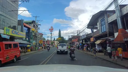
Cafe Esquinita
Restaurant · Asian, Coffee Shop, Seafood, Boodle Fight, Putos-Putos, Pinutos, Catering, Milktea · 1.2 km
Outdoor Apparels
Fortich Street, Malaybalay
Mo-Su 08:00-20:00

AHAVAH Milk Tea House
Cafe · Tea, Ramen · 1.3 km
Don Carlos Street
Mo-Fr 10:00-19:00; Sa 10:00-18:00

D' Saint Cakery
Bakery · 1.3 km
01-31 Bonifacio Drive
Mo-Su 06:00-21:00
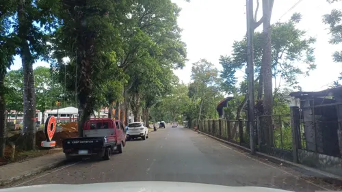

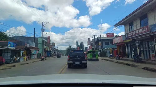

Benedict's Combo Meals and Refreshments
Restaurant · International, Filipino · 1.5 km
93 more on the map.
History
The area around the Migkayagan River (today known as Tagoloan River) is considered as a sacred place for the indigenous peoples' community because it was the birthplace of tribal laws and customs. It was mostly settled by the Higaunen (Higaonon) people, who called the area Sumpong. In the mid-19th century, the Spanish integrated the community under the pueblo of Oroquita del Interior, as a sitio of Malaybalay. At the start of the 20th century, then Governor Manolo Fortich, upon orders of the American colonial administration, relocated the community near Malaybalay. The people submitted to the directive, but they still called their new village Sumpong. It was organized into a barrio, with Datu Mandupila (Juan Luminton) as its first teniente del barrio. It was formally organized as a barangay in 1961.
From the History section of Sumpong, Malaybalay on Wikipedia, under CC BY-SA 4.0.
Where to stay18
Churches and places of worship21
Faithway Fundamental Baptist Church
Church · Baptist · 2.5 km
Fortich Street, Malaybalay
Shopping23
Gas and EV charging9
Schools, colleges and libraries22
Healthcare18
Malaybalay City Health Office
Clinic and pharmacy · 1.4 km
Armando Loop, Malaybalay
Malaybalay Polymedic General Hospital
Hospital · 2.2 km
Fortich Street, Malaybalay
Map of Sumpong
225 places. The map loads OpenStreetMap tiles when you open it.
Getting there and nearby towns
Maramag Airport (XMA) is the nearest airport with scheduled flights listed in OpenStreetMap, 46 km away.
- Malaybalay 1 km southeast, about 1 min by car
- Casisang 3 km south, about 3 min by car
- Manolo Fortich 36 km northwest, about 36 min by car
- Maramag 46 km south, about 46 min by car
- Quezon 48 km south, about 48 min by car
- Don Carlos 55 km south, about 55 min by car
- Tagoloan 58 km northwest, about 58 min by car
- Kalilangan 62 km southwest, about 1 h by car
- Villanueva 61 km northwest, about 1 h by car
- Cagayan de Oro 63 km northwest, about 1 h by car
Drive times are estimates from straight-line distance, not routes.
Local news
Headlines from INDB.
Reviews, tips and questions
Loading what members have shared...
Sources and licences
- GeoNames (CC BY 4.0): population, coordinates, regions and time zone
- Mapillary (see each image): photos
- OpenStreetMap contributors (ODbL 1.0): places, airports, map data
- Wikidata (CC0 1.0): elevation, founding date, time zone, website
- Wikimedia Commons (see each image): photos
- Wikipedia (CC BY-SA 4.0): overview and history text
Photo credits
- Bethel Baptist Hospital, Daweelmac, CC BY-SA 3.0
- Street-level photo, dp24ph, CC BY-SA 4.0
- Street-level photo, dp24ph, CC BY-SA 4.0
- Street-level photo, dp24ph, CC BY-SA 4.0
- Street-level photo, dp24ph, CC BY-SA 4.0
- Street-level photo, dp24ph, CC BY-SA 4.0
- Street-level photo, dp24ph, CC BY-SA 4.0
- Street-level photo, dp24ph, CC BY-SA 4.0
- Street-level photo, dp24ph, CC BY-SA 4.0
- Street-level photo, dp24ph, CC BY-SA 4.0
- Street-level photo, dp24ph, CC BY-SA 4.0
- Street-level photo, dp24ph, CC BY-SA 4.0
- Street-level photo, dp24ph, CC BY-SA 4.0
- Street-level photo, dp24ph, CC BY-SA 4.0
- Street-level photo, dp24ph, CC BY-SA 4.0
- Street-level photo, dp24ph, CC BY-SA 4.0
- Street-level photo, WBGCP, CC BY-SA 4.0
- Street-level photo, dp24ph, CC BY-SA 4.0
- Street-level photo, dp24ph, CC BY-SA 4.0
Page built November 7, 2026. Spotted a mistake? Tell us or suggest a place.