

Villareal, Philippines
Villareal is a town of 3,765 people in Eastern Visayas, Philippines.
Why visit Villareal
Townapedia lists 1 place to eat and 1 attraction in and around town.
Weather in Villareal
Forecast from MET Norway (CC BY 4.0). Full forecast
About Villareal
Villareal, officially the Municipality of Villareal (Waray: Bungto han Villareal; Tagalog: Bayan ng Villareal), is a municipality in the province of Samar, Philippines. According to the 2024 census, it has a population of 27,909 people.
From the Wikipedia article Villareal, Samar (this version), under CC BY-SA 4.0.
Things to do1

Restaurants and cafes1

Churches and places of worship3

Gas and EV charging2


History
What was called Umauas existed in 1768 as a pueblo and parish, however, often sharing the priest with Calbiga, where it became its visita by early 19th century. In 1863, it became a separate entity with its name being changed to Villareal.
Villareal was among the pueblos where the Dios-dios movement, forerunner of the Pulahanism and had been accused by the church authorities of subversion, had their followers. There were reports on their existence in the area by 1870s, at the time subversive activities in the Samar island were being investigated by the Spanish authorities, and 1880s. In the 1870s, four individuals were deported for their activities and secret alliance with Leon Petac, a member of the movement.
During the American occupation, the still-undivided Samar was reorganized, so as Villareal. In 1903, part of the then-dissolved municipality of Santa Rita (on the right bank of the Silanga River) was annexed into it (the rest was annexed into Calbayog and Basey); as the jurisdiction of barrio Iquiran was transferred to Zumarraga. In 1906, the re-establishment of Santa Rita resulted to Villareal and Basey losing their territories.
From the History section of Villareal, Samar on Wikipedia, under CC BY-SA 4.0.
Schools, colleges and libraries56
Map of Villareal
63 places. The map loads OpenStreetMap tiles when you open it.
Getting there and nearby towns
Daniel Z. Romualdez Airport (TAC) is the nearest airport with scheduled flights listed in OpenStreetMap, 39 km away.
- Catbalogan 24 km north, about 24 min by car
- Tacloban 37 km south, about 37 min by car
- Carigara 40 km southwest, about 40 min by car
- Palo 46 km south, about 46 min by car
- Tanauan 52 km south, about 52 min by car
- Borongan 55 km east, about 55 min by car
- Calbayog City 66 km northwest, about 1 h by car
- Burauen 66 km south, about 1 h by car
- Dulag 69 km south, about 1 h 15 min by car
- Ormoc 71 km southwest, about 1 h 15 min by car
Drive times are estimates from straight-line distance, not routes.
Local news
Headlines from INDB.
Reviews, tips and questions
Loading what members have shared...
Sources and licences
- GeoNames (CC BY 4.0): population, coordinates, regions and time zone
- Mapillary (see each image): photos
- OpenStreetMap contributors (ODbL 1.0): places, airports, map data
- Wikidata (CC0 1.0): elevation, founding date, time zone, website
- Wikimedia Commons (see each image): photos
- Wikipedia (CC BY-SA 4.0): overview and history text
Photo credits
- Villareal, Samar from air (Samar; 09-09-2022), Patrickroque01, CC BY-SA 4.0
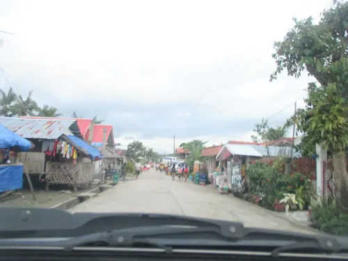
- Street-level photo, maning, CC BY-SA 4.0
Page built November 7, 2026. Spotted a mistake? Tell us or suggest a place.